There are over 20,000 Grade II* listed buildings in England. This page is a list of these buildings in the district of Nuneaton and Bedworth in Warwickshire.
Nuneaton and Bedworth
| Name | Location | Type | Completed [note 1] | Date designated | Grid ref.[note 2] Geo-coordinates |
Entry number [note 3] | Image |
|---|---|---|---|---|---|---|---|
| Chamberlaine's Almshouses | Bedworth, Nuneaton and Bedworth | Almshouse | 1715 | 10 September 1974 | SP3597587073 52°28′49″N 1°28′18″W / 52.480402°N 1.471722°W |
1035003 | |
| Church of All Saints | Bedworth, Nuneaton and Bedworth | Church | C14/C15 | 1 July 1949 | SP3592786919 52°28′44″N 1°28′21″W / 52.479021°N 1.472446°W |
1365052 | 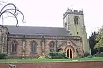 Church of All Saints |
| Church of St Giles | Exhall, Nuneaton and Bedworth | Church | 1988 | 1 July 1949 | SP3404785057 52°27′45″N 1°30′01″W / 52.462402°N 1.500315°W |
1186152 | .jpg.webp) Church of St Giles |
| Church of St James | Bulkington, Nuneaton and Bedworth | Church | 1988 | 1 July 1949 | SP3912086763 52°28′39″N 1°25′32″W / 52.4774°N 1.425453°W |
1365054 | 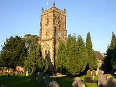 Church of St James |
| North Lodge, Arbury Hall | Nuneaton and Bedworth | Gate Lodge | Mid/Late 19th century | 6 December 1947 | SP3338590976 52°30′56″N 1°30′34″W / 52.515653°N 1.509467°W |
1034973 |  North Lodge, Arbury Hall |
| Park Farmhouse | Arbury Park, Nuneaton and Bedworth | Farmhouse | Late 15th century | 11 February 1988 | SP3303389804 52°30′18″N 1°30′53″W / 52.505138°N 1.51477°W |
1365048 |  Upload Photo |
| South Farmhouse | Arbury Park, Nuneaton and Bedworth | Farmhouse | 17th century | 6 December 1947 | SP3367088526 52°29′37″N 1°30′20″W / 52.493611°N 1.505514°W |
1034972 | Upload Photo |
| The Tea House at SP3395 8956 | Arbury Park, Nuneaton and Bedworth | House | C18/Early 19th century | 11 February 1988 | SP3394689553 52°30′10″N 1°30′05″W / 52.502826°N 1.501345°W |
1299615 | Upload Photo |
Notes
- ↑ The date given is the date used by Historic England as significant for the initial building or that of an important part in the structure's description.
- ↑ Sometimes known as OSGB36, the grid reference is based on the British national grid reference system used by the Ordnance Survey.
- ↑ The "List Entry Number" is a unique number assigned to each listed building and scheduled monument by Historic England.
External links
This article is issued from Wikipedia. The text is licensed under Creative Commons - Attribution - Sharealike. Additional terms may apply for the media files.