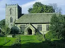
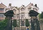
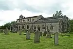
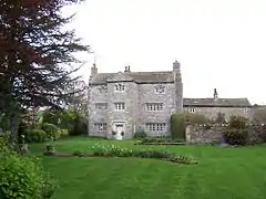
There are over 20,000 Grade II* listed buildings in England. This page is a list of these buildings in the district of Craven in North Yorkshire.

List of buildings

Name Location Type Completed [note 1]Date designated Grid ref.[note 2]
Geo-coordinates
Entry number [note 3]Image
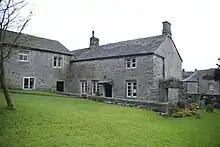
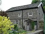
Airton Quaker Meeting House, archway and bench AirtonFriends Meeting House169420 February 1958SD9031359214
54°01′44″N 2°08′58″W / 54.02884°N 2.14947°W / 54.02884; -2.14947 (Airton Quaker Meeting House, archway and bench)
1132105
Airton Quaker Meeting House, archway and bench
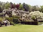
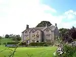
Parcevall Hall Skyreholme, AppletreewickHouse16th century10 September 1954SE0689161249
54°02′50″N 1°53′46″W / 54.047163°N 1.896249°W / 54.047163; -1.896249 (Parcevall Hall)
1157423
Henry Simpson's Barn Skyreholme, AppletreewickBarn173726 October 1995SE0695161288
54°02′51″N 1°53′43″W / 54.047513°N 1.895332°W / 54.047513; -1.895332 (Henry Simpson's Barn)
1249282
Upload Photo
High Hall AppletreewickHouse16th century10 September 1954SE0543860090
54°02′12″N 1°55′06″W / 54.036763°N 1.91846°W / 54.036763; -1.91846 (High Hall)
1131792
Upload Photo
Barn to north-west of Newton Hall Bank NewtonCow houseMid-17th century10 September 1954SD9090453146
53°58′27″N 2°08′25″W / 53.974299°N 2.140164°W / 53.974299; -2.140164 (Barn to north-west of Newton Hall)
1167635
Upload Photo
Newton Hall Bank NewtonHouseMid-17th century10 September 1954SD9092453108
53°58′26″N 2°08′23″W / 53.973957°N 2.139858°W / 53.973957; -2.139858 (Newton Hall)
1316866
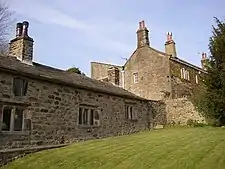
Newton Hall
Newton Hall
Beamsley Hospital (south range) BeamsleyAlmshouse159310 September 1954SE0823953030
53°58′24″N 1°52′33″W / 53.973274°N 1.875881°W / 53.973274; -1.875881 (Beamsley Hospital (south range))
1166620
Beamsley Hospital (south range)
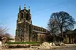
Church of St John the Baptist Low Bentham, BenthamChurch15th century20 February 1958SD6447369272
54°07′05″N 2°32′42″W / 54.118079°N 2.545007°W / 54.118079; -2.545007 (Church of St John the Baptist)
1157613
Church of St John the Baptist
Mewith Head Hall, wall to garden and gatepiers BenthamHouseEarly 18th century20 February 1958SD6984166903
54°05′50″N 2°27′46″W / 54.097133°N 2.462651°W / 54.097133; -2.462651 (Mewith Head Hall, wall to garden and gatepiers)
1132417
Mewith Head Hall, wall to garden and gatepiers
Bolton Abbey Hall Bolton AbbeyHouseMid-19th century10 September 1954SE0729254204
53°59′02″N 1°53′25″W / 53.98384°N 1.890291°W / 53.98384; -1.890291 (Bolton Abbey Hall)
1131774
Bolton Abbey Hall
Bolton Abbey Hall
The Great Tythe Barn Bolton AbbeyThreshing barn16th century10 September 1954SE0725353838
53°58′50″N 1°53′27″W / 53.980551°N 1.890895°W / 53.980551; -1.890895 (The Great Tythe Barn)
1131772
The Great Tythe Barn
The Old Rectory Bolton AbbeyHouseLate 17th century10 September 1954SE0738754140
53°59′00″N 1°53′20″W / 53.983263°N 1.888844°W / 53.983263; -1.888844 (The Old Rectory)
1131776
The Old Rectory
The Old Rectory
Church of St Michael and All Angels Hubberholme, BuckdenChurch12th century10 September 1954SD9261478268
54°12′00″N 2°06′53″W / 54.20011°N 2.114717°W / 54.20011; -2.114717 (Church of St Michael and All Angels)
1167280
Church of St Michael and All Angels
Church of All Saints and churchyard wall and railings Burton in LonsdaleChurch1868–7624 June 1988SD6511272139
54°08′38″N 2°32′08″W / 54.143889°N 2.535564°W / 54.143889; -2.535564 (Church of All Saints and churchyard wall and railings)
1132430
Church of All Saints and churchyard wall and railings
Trappes Hall CarletonHousec.168610 September 1954SD9713049741
53°56′38″N 2°02′43″W / 53.943769°N 2.045211°W / 53.943769; -2.045211 (Trappes Hall)
1166761
Trappes Hall
Trappes Hall
Ingleborough Hall Clapham cum NewbyCountry housec.181420 February 1958SD7468269343
54°07′10″N 2°23′20″W / 54.119324°N 2.388835°W / 54.119324; -2.388835 (Ingleborough Hall)
1132400
Upload Photo
Kilnsey Old Hall Kilnsey, Conistone with KilnseyHouse164810 September 1954SD9732467845
54°06′23″N 2°02′33″W / 54.106482°N 2.042422°W / 54.106482; -2.042422 (Kilnsey Old Hall)
1316821
Kilnsey Old Hall
Kilnsey Old Hall
Carr Head Hall CowlingCountry houseMid-18th century10 September 1954SD9750044277
53°53′41″N 2°02′22″W / 53.894662°N 2.039527°W / 53.894662; -2.039527 (Carr Head Hall)
1157455
Carr Head Hall
Carr Head Hall
Long Croft and attached barn CowlingFarmhouse and barnc.170023 October 1984SD9693643945
53°53′30″N 2°02′53″W / 53.891675°N 2.048106°W / 53.891675; -2.048106 (Long Croft and attached barn)
1131807
Upload Photo
Elslack Hall Farmhouse and Elslack Hall Cottage with garden wall adjoining to north ElslackFarmhouse198810 September 1954SD9285249225
53°56′21″N 2°06′37″W / 53.939089°N 2.110372°W / 53.939089; -2.110372 (Elslack Hall Farmhouse and Elslack Hall Cottage with garden wall adjoining to north)
1166963
Elslack Hall Farmhouse and Elslack Hall Cottage with garden wall adjoining to north
Manor House Embsay, Embsay with EastbyHousec.163510 September 1954SE0054253830
53°58′50″N 1°59′36″W / 53.980528°N 1.993224°W / 53.980528; -1.993224 (Manor House)
1157616
Manor House
Manor House
Eshton Hall EshtonHouse1825–2710 September 1954SD9377655994
54°00′00″N 2°05′47″W / 53.999939°N 2.096438°W / 53.999939; -2.096438 (Eshton Hall)
1167726
Eshton Hall
Eshton Hall
Brockabank Flasby with WinterburnFarmhouseLate 16th century10 September 1954SD9344656886
54°00′29″N 2°06′05″W / 54.007951°N 2.101492°W / 54.007951; -2.101492 (Brockabank)
1131652
Brockabank
Brockabank
Friars Head Flasby with WinterburnHousec.167010 September 1954SD9320757533
54°00′50″N 2°06′19″W / 54.013763°N 2.105153°W / 54.013763; -2.105153 (Friars Head)
1157656
Friars Head
Friars Head
Beck House GiggleswickHouseEarly 18th century20 February 1958SD8104463991
54°04′17″N 2°17′28″W / 54.071498°N 2.291167°W / 54.071498; -2.291167 (Beck House)
1317037
Beck House
Beck House
Giggleswick School Chapel GiggleswickChapel1897–190120 February 1958SD8072063927
54°04′15″N 2°17′46″W / 54.070911°N 2.296114°W / 54.070911; -2.296114 (Giggleswick School Chapel)
1131724
Ivy Fold GiggleswickHouseMid-17th century20 February 1958SD8110664071
54°04′20″N 2°17′25″W / 54.07222°N 2.290225°W / 54.07222; -2.290225 (Ivy Fold)
1131721
Upload Photo
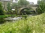
Settle Bridge GiggleswickRoad bridge17th century20 November 1987SD8165264094
54°04′21″N 2°16′55″W / 54.072446°N 2.281882°W / 54.072446; -2.281882 (Settle Bridge)
1317032
Settle Bridge
Settle Bridge
Grassington Hall GrassingtonHouseMedieval10 September 1954SE0020964058
54°04′21″N 1°59′54″W / 54.072453°N 1.998299°W / 54.072453; -1.998299 (Grassington Hall)
1132153
Upload Photo
Church of St. Peter HebdenChurch184125 January 1994SE0260062967
54°03′45″N 1°57′42″W / 54.062615°N 1.961762°W / 54.062615; -1.961762 (Church of St. Peter)
1203742
Church of St. Peter
Church of St. Peter
Arnford Farmhouse HellifieldFarmhousec.170020 February 1958SD8364256279
54°03′45″N 2°15′04″W / 54.062615°N 2.251048°W / 54.062615; -2.251048 (Arnford Farmhouse)
1317061
Upload Photo
Lodge Hall Horton in RibblesdaleFarmhouse168720 February 1958SD7800277963
54°11′49″N 2°20′19″W / 54.196947°N 2.338676°W / 54.196947; -2.338676 (Lodge Hall)
1289489
Lodge Hall
Lodge Hall
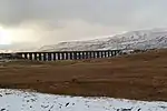
Batty Moss Railway Viaduct (Ribblehead Viaduct) IngletonRailway viaduct1870–7423 November 1988SD7594479471
54°12′37″N 2°22′13″W / 54.210407°N 2.370341°W / 54.210407; -2.370341 (Batty Moss Railway Viaduct (Ribblehead Viaduct))
1132228
Church of St Mary the Virgin IngletonChurch15th century20 February 1958SD6951273260
54°09′15″N 2°28′06″W / 54.154245°N 2.468325°W / 54.154245; -2.468325 (Church of St Mary the Virgin)
1252726
Church of St Mary the Virgin
Chapel at Scargill House, including linking passage, staircase and vestry Kettlewell with StarbottonSteps1958–6125 September 1998SD9779971067
54°08′08″N 2°02′07″W / 54.135442°N 2.035181°W / 54.135442; -2.035181 (Chapel at Scargill House, including linking passage, staircase and vestry)
1376604
Chapel at Scargill House, including linking passage, staircase and vestry
Church of St Mary KettlewellChurch182010 September 1954SD9714072255
54°08′46″N 2°02′43″W / 54.146115°N 2.045279°W / 54.146115; -2.045279 (Church of St Mary)
1173574
Church of St Mary
Church of St Mary
Fold Farmhouse KettlewellFarmhouseLate 15th century4 May 1989SD9719872248
54°08′46″N 2°02′40″W / 54.146053°N 2.044391°W / 54.146053; -2.044391 (Fold Farmhouse)
1173639
Upload Photo
Kildwick Hall with kitchen block to rear KildwickKitchen167310 September 1954SE0117446307
53°54′46″N 1°59′01″W / 53.912912°N 1.983614°W / 53.912912; -1.983614 (Kildwick Hall with kitchen block to rear)
1132170
Kildwick Hall with kitchen block to rear
Church of St Michael and All Angels LintonChurch12th century10 September 1954SE0050863229
54°03′54″N 1°59′37″W / 54.065003°N 1.993731°W / 54.065003; -1.993731 (Church of St Michael and All Angels)
1167172
Church of St Michael and All Angels
Fountaines Hospital LintonAlmshouse172110 September 1954SD9970962683
54°03′36″N 2°00′21″W / 54.060095°N 2.005938°W / 54.060095; -2.005938 (Fountaines Hospital)
1132124
Fountaines Hospital
Fountaines Hospital
Stone Gappe LothersdaleHouse172510 September 1954SD9679245751
53°54′28″N 2°03′01″W / 53.907906°N 2.050317°W / 53.907906; -2.050317 (Stone Gappe)
1167086
Church of St Peter Martons BothParish church12th century10 September 1954SD9080750690
53°57′08″N 2°08′30″W / 53.952223°N 2.141568°W / 53.952223; -2.141568 (Church of St Peter)
1167226
Church of St Peter
Church of St Peter
Gledstone Hall and forecourt walls, pavilions and gates Martons BothApartments1922–2631 October 1988SD8868551277
53°57′27″N 2°10′26″W / 53.957456°N 2.173925°W / 53.957456; -2.173925 (Gledstone Hall and forecourt walls, pavilions and gates)
1296985
Gledstone Hall and forecourt walls, pavilions and gates
Terraces at Gledstone Hall Martons BothGarden wall192331 October 1988SD8870351203
53°57′24″N 2°10′25″W / 53.956792°N 2.173647°W / 53.956792; -2.173647 (Terraces at Gledstone Hall)
1316750
Upload Photo
Ingthorpe Grange Martons BothHouse167210 September 1954SD8926552024
53°57′51″N 2°09′54″W / 53.964183°N 2.165112°W / 53.964183; -2.165112 (Ingthorpe Grange)
1296906
Ingthorpe Grange
Ingthorpe Grange
Old Gledstone Martons BothHousec.177010 September 1954SD8831350770
53°57′10″N 2°10′46″W / 53.952891°N 2.179574°W / 53.952891; -2.179574 (Old Gledstone)
1132251
Upload Photo
Friends Meeting House SettleFriends meeting house167813 September 1988SD8181963663
54°04′07″N 2°16′45″W / 54.068579°N 2.279304°W / 54.068579; -2.279304 (Friends Meeting House)
1166732
Friends Meeting House
Settle Bridge Bridge End, SettleRoad bridge17th century20 February 1958SD8165464091
54°04′21″N 2°16′55″W / 54.072419°N 2.281851°W / 54.072419; -2.281851 (Settle Bridge)
1316710
Settle Bridge
Settle Bridge
Christ Church SkiptonChurch1837–392 March 1978SD9882451338
53°57′29″N 2°01′10″W / 53.958129°N 2.01941°W / 53.958129; -2.01941 (Christ Church)
1131846
Christ Church
Christ Church
Devonshire Hotel SkiptonHotel18th century28 April 1952SD9907351571
53°57′37″N 2°00′56″W / 53.960224°N 2.015616°W / 53.960224; -2.015616 (Devonshire Hotel)
1157440
Devonshire Hotel
Devonshire Hotel
Swinden Hall SwindenFarmhousec.160020 February 1958SD8610754417
53°59′08″N 2°12′48″W / 53.985614°N 2.213356°W / 53.985614; -2.213356 (Swinden Hall)
1296668
Swinden Hall
Swinden Hall
Church of St Oswald Thornton in LonsdaleChurch15th century20 February 1958SD6857173618
54°09′27″N 2°28′58″W / 54.157405°N 2.482771°W / 54.157405; -2.482771 (Church of St Oswald)
1252730

See also

Notes

  1. The date given is the date used by Historic England as significant for the initial building or that of an important part in the structure's description.
  2. Sometimes known as OSGB36, the grid reference is based on the British national grid reference system used by the Ordnance Survey.
  3. The "List Entry Number" is a unique number assigned to each listed building and scheduled monument by Historic England.

Media related to Grade II* listed buildings in Craven District at Wikimedia Commons

This article is issued from Wikipedia. The text is licensed under Creative Commons - Attribution - Sharealike. Additional terms may apply for the media files.