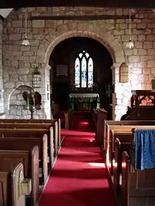
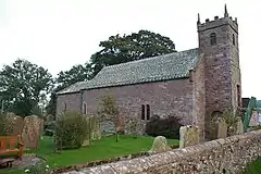
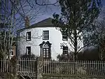
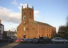
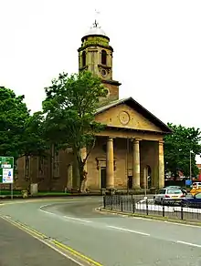
There are over 20,000 Grade II* listed buildings in England. This page is a list of these buildings in the district of Allerdale in Cumbria.

List of buildings

Name Location Type Completed [note 1]Date designated Grid ref.[note 2]
Geo-coordinates
Entry number [note 3]Image
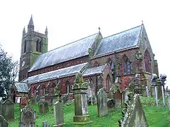
Church of St Kentigern AspatriaChurch1846–4811 April 1967NY1471041916
54°45′54″N 3°19′38″W / 54.764903°N 3.327095°W / 54.764903; -3.327095 (Church of St Kentigern)
1234861
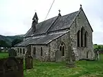
Church of St Bega BassenthwaiteChurch12th century3 March 1967NY2266228748
54°38′52″N 3°12′00″W / 54.647882°N 3.200038°W / 54.647882; -3.200038 (Church of St Bega)
1332957
Church of St Bega
Church of St Bega
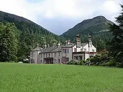
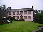
Mirehouse BassenthwaiteHouseLate 17th century3 March 1967NY2317828378
54°38′41″N 3°11′31″W / 54.644637°N 3.191946°W / 54.644637; -3.191946 (Mirehouse)
1326263
Table tomb south of chancel of Church of St Michael Isel, BlindcrakeTable tombLate 15th century5 September 1986NY1625433303
54°41′16″N 3°18′02″W / 54.687782°N 3.300624°W / 54.687782; -3.300624 (Table tomb south of chancel of Church of St Michael)
1312018
Upload Photo
Weary Hall Mealsgate, BoltonsFarmhouseMid-16th century11 April 1967NY2178141836
54°45′55″N 3°13′02″W / 54.765336°N 3.217205°W / 54.765336; -3.217205 (Weary Hall)
1137761
Upload Photo
Church of St Michael Bowness-on-SolwayChurch12th century11 April 1967NY2237662646
54°57′09″N 3°12′49″W / 54.952393°N 3.213563°W / 54.952393; -3.213563 (Church of St Michael)
1137007
Fingland Farmhouse and adjoining barn Fingland, BownessFarmhouseLate 17th century11 April 1967NY2547157119
54°54′12″N 3°09′50″W / 54.903209°N 3.163813°W / 54.903209; -3.163813 (Fingland Farmhouse and adjoining barn)
1327125
Upload Photo
Parsonage Farmhouse BrighamFarmhouse13th or 14th century3 March 1967NY0858430987
54°39′56″N 3°25′08″W / 54.66564°N 3.41884°W / 54.66564; -3.41884 (Parsonage Farmhouse)
1145197
Upload Photo
Hesket Hall Farmhouse Hesket Newmarket, CaldbeckFarmhouseMid- or late 17th century11 April 1967NY3397338646
54°44′18″N 3°01′37″W / 54.738428°N 3.027028°W / 54.738428; -3.027028 (Hesket Hall Farmhouse)
1144444
Hesket Hall Farmhouse
Castlegate House CockermouthDetached houseMid-18th century28 August 1951NY1234430839
54°39′54″N 3°21′38″W / 54.664979°N 3.360519°W / 54.664979; -3.360519 (Castlegate House)
1327097
Upload Photo
Church of All Saints CockermouthChurch1852–5428 August 1951NY1236430640
54°39′47″N 3°21′37″W / 54.663194°N 3.360149°W / 54.663194; -3.360149 (Church of All Saints)
1144744
Church of All Saints
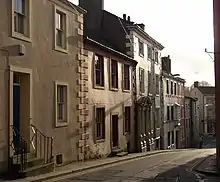
Cobbled forecourt to Nos 45 and 47, Kirkgate CockermouthHouseLate 18th century28 August 1951NY1243830584
54°39′46″N 3°21′32″W / 54.662704°N 3.358985°W / 54.662704; -3.358985 (Cobbled forecourt to Nos 45 and 47, Kirkgate)
1327064
Cobbled forecourt to Nos 45 and 47, Kirkgate
Norham House CockermouthHouse18th century18 December 1969NY1193830671
54°39′48″N 3°22′00″W / 54.663398°N 3.366761°W / 54.663398; -3.366761 (Norham House)
1144717
Upload Photo
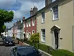
6 Castlegate CockermouthHouseLate 18th century28 August 1951NY1231330789
54°39′52″N 3°21′40″W / 54.664524°N 3.360984°W / 54.664524; -3.360984 (6 Castlegate)
1327096
6 Castlegate
6 Castlegate
5, 7 Castlegate CockermouthHouseMid-18th century28 August 1951NY1228930787
54°39′52″N 3°21′41″W / 54.664502°N 3.361356°W / 54.664502; -3.361356 (5, 7 Castlegate)
1373837
Upload Photo
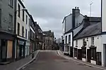
38, 40 and 42 Market Place CockermouthCross passage houseEarly–mid-16th century26 July 1974NY1225930745
54°39′51″N 3°21′43″W / 54.664119°N 3.361808°W / 54.664119; -3.361808 (38, 40 and 42 Market Place)
1327092
38, 40 and 42 Market Place
Crakeplace Hall Ullock, DeanFarmhouseMid-16th century3 March 1967NY0700424032
54°36′10″N 3°26′28″W / 54.602868°N 3.441116°W / 54.602868; -3.441116 (Crakeplace Hall)
1326884
Upload Photo
Church of St Mary GilcruxChurch18363 March 1967NY1173438176
54°43′51″N 3°22′20″W / 54.730788°N 3.372197°W / 54.730788; -3.372197 (Church of St Mary)
1275717
Church of St Mary
Church of St Mary
Mill Grove Abbeytown, Holme AbbeyFormer infirmaryBefore 14721 April 1967NY1774650693
54°50′39″N 3°16′57″W / 54.844264°N 3.282419°W / 54.844264; -3.282419 (Mill Grove)
1212550
Upload Photo
Aisle columns west of Ireby Old Church IrebyGate pier13th century3 January 1986NY2237239311
54°44′34″N 3°12′26″W / 54.742742°N 3.207347°W / 54.742742; -3.207347 (Aisle columns west of Ireby Old Church)
1146404
Upload Photo
Orthwaite Hall and adjoining barn Orthwaite, Ireby and UldaleFarmhouseLate 16th or early 17th century11 April 1967NY2527234183
54°41′50″N 3°09′40″W / 54.697109°N 3.160993°W / 54.697109; -3.160993 (Orthwaite Hall and adjoining barn)
1144419
Orthwaite Hall and adjoining barn
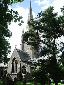
Church of St John KeswickChurch18382 October 1951NY2678823181
54°35′55″N 3°08′05″W / 54.59848°N 3.134718°W / 54.59848; -3.134718 (Church of St John)
1144666
Church of St John
Church of St John
Church of St Kentigern Great Crosthwaite, KeswickChurch14th century2 October 1951NY2574124285
54°36′30″N 3°09′04″W / 54.608246°N 3.1512°W / 54.608246; -3.1512 (Church of St Kentigern)
1327118
The Moot Hall KeswickMoot hall15712 October 1951NY2663223436
54°36′03″N 3°08′14″W / 54.600748°N 3.137196°W / 54.600748; -3.137196 (The Moot Hall)
1137345
Church of St Bride KirkbrideChurch12th century1 April 1967NY2296057329
54°54′17″N 3°12′11″W / 54.904715°N 3.203019°W / 54.904715; -3.203019 (Church of St Bride)
1144617
Church of St Bride
Church of St Bride
Lilac House KirkbrideHouse17th century6 January 2011NY2293656944
54°54′05″N 3°12′12″W / 54.901252°N 3.20329°W / 54.901252; -3.20329 (Lilac House)
1396397
Upload Photo
Allanby House Flimby, MaryportHouse173129 July 1950NY0239433468
54°41′12″N 3°30′56″W / 54.686766°N 3.515604°W / 54.686766; -3.515604 (Allanby House)
1137677
Upload Photo
Flimby Hall Flimby, MaryportHouse176629 July 1950NY0239633503
54°41′13″N 3°30′56″W / 54.687081°N 3.515585°W / 54.687081; -3.515585 (Flimby Hall)
1137687
Upload Photo
Netherhall MaryportCountry houseMid- and late Georgian29 July 1950NY0432536908
54°43′05″N 3°29′12″W / 54.71804°N 3.486792°W / 54.71804; -3.486792 (Netherhall)
1137621
Upload Photo
Dovecote south of Church of St Cuthbert Parsonby, PlumblandDovecote16th century13 August 1985NY1417939159
54°44′24″N 3°20′04″W / 54.740043°N 3.33453°W / 54.740043; -3.33453 (Dovecote south of Church of St Cuthbert)
1217363
Dovecote south of Church of St Cuthbert
Church of St Mary Churchtown, SeberghamChurchMedieval11 April 1967NY3640841853
54°46′03″N 2°59′24″W / 54.767558°N 2.989918°W / 54.767558; -2.989918 (Church of St Mary)
1327246
Church of St Mary
Church of St Mary
Sebergham Hall SeberghamHouseLate 17th century3 January 1986NY3636642442
54°46′22″N 2°59′27″W / 54.772844°N 2.9907°W / 54.772844; -2.9907 (Sebergham Hall)
1144392
Upload Photo
Warnell Hall SeberghamFarmhouseEarly or mid-16th century11 April 1967NY3505241339
54°45′46″N 3°00′39″W / 54.762765°N 3.010875°W / 54.762765; -3.010875 (Warnell Hall)
1311727
Warnell Hall
Warnell Hall
Courtyard range and gatehouse with barn adjoining, Warnell Hall SeberghamCourtyardEarly 16th century3 January 1986NY3506741323
54°45′45″N 3°00′38″W / 54.762624°N 3.010638°W / 54.762624; -3.010638 (Courtyard range and gatehouse with barn adjoining, Warnell Hall)
1144400
Upload Photo
Hewthwaite Hall SetmurthyFarmhouse15813 March 1967NY1523832836
54°41′00″N 3°18′58″W / 54.683416°N 3.316245°W / 54.683416; -3.316245 (Hewthwaite Hall)
1145129
Hewthwaite Hall
Hewthwaite Hall
Millbeck Hall and adjoining barn Millbeck, UnderskiddawFarmhouse15923 March 1967NY2559526082
54°37′28″N 3°09′14″W / 54.624371°N 3.153917°W / 54.624371; -3.153917 (Millbeck Hall and adjoining barn)
1121974
Upload Photo
Fiddleback West Woodside, WestwardFarmhouse170911 April 1967NY3073049170
54°49′57″N 3°04′48″W / 54.832547°N 3.079905°W / 54.832547; -3.079905 (Fiddleback)
1311657
Fiddleback
Fiddleback
Islekirk Hall WestwardHouseMid-16th century11 April 1967NY2594344526
54°47′24″N 3°09′12″W / 54.790137°N 3.153222°W / 54.790137; -3.153222 (Islekirk Hall)
1274096
Upload Photo
Jenkin's Cross WestwardFarmhouseEarly 19th century11 April 1967NY2894447915
54°49′16″N 3°06′27″W / 54.821021°N 3.107394°W / 54.821021; -3.107394 (Jenkin's Cross)
1238648
Jenkin's Cross
Jenkin's Cross
Meadow Bank Farmhouse West Curthwaite, WestwardFarmhouse166611 April 1967NY3238548926
54°49′50″N 3°03′15″W / 54.830582°N 3.054088°W / 54.830582; -3.054088 (Meadow Bank Farmhouse)
1144410
Upload Photo
Church of St Mary WigtonChurch17881 April 1967NY2559948273
54°49′26″N 3°09′34″W / 54.823751°N 3.159534°W / 54.823751; -3.159534 (Church of St Mary)
1144590
Church of St Mary
Church of St Mary
Byres to north of Schoose Farm House Schoose, WorkingtonCow houseEarly 19th century13 December 1985NY0146028044
54°38′16″N 3°31′42″W / 54.637857°N 3.528256°W / 54.637857; -3.528256 (Byres to north of Schoose Farm House)
1138196
Upload Photo
Church of St John and adjoining community hall WorkingtonChurch1822–236 June 1951NY0043228499
54°38′30″N 3°32′40″W / 54.641743°N 3.544332°W / 54.641743; -3.544332 (Church of St John and adjoining community hall)
1138257
Church of St John and adjoining community hall
Church of St Michael WorkingtonChurch12th century6 June 1951NX9973428956
54°38′45″N 3°33′19″W / 54.64571°N 3.5553°W / 54.64571; -3.5553 (Church of St Michael)
1144492
Granary east of Schoose Farmhouse Schoose, WorkingtonGranaryc. 180013 December 1985NY0150228002
54°38′15″N 3°31′39″W / 54.637488°N 3.527592°W / 54.637488; -3.527592 (Granary east of Schoose Farmhouse)
1144490
Upload Photo
Helena Thompson Museum and former stables WorkingtonHouseLate 18th century6 June 1951NY0087828563
54°38′33″N 3°32′15″W / 54.642406°N 3.537446°W / 54.642406; -3.537446 (Helena Thompson Museum and former stables)
1311987
Upload Photo
Schoose Farmhouse and adjoining barns Schoose, WorkingtonFarmhousec. 180013 December 1985NY0142828018
54°38′15″N 3°31′43″W / 54.637618°N 3.528743°W / 54.637618; -3.528743 (Schoose Farmhouse and adjoining barns)
1144489
Upload Photo
St Michael's House WorkingtonHouse15th century13 December 1985NX9980728963
54°38′45″N 3°33′15″W / 54.645787°N 3.554172°W / 54.645787; -3.554172 (St Michael's House)
1144478
Upload Photo
Windmill, adjoining barns, gatehouse and curtain wall Schoose, WorkingtonFarm buildingsc. 180013 December 1985NY0140427985
54°38′14″N 3°31′45″W / 54.637317°N 3.529104°W / 54.637317; -3.529104 (Windmill, adjoining barns, gatehouse and curtain wall)
1327213
Windmill, adjoining barns, gatehouse and curtain wall

Notes

  1. The date given is the date used by Historic England as significant for the initial building or that of an important part in the structure's description.
  2. Sometimes known as OSGB36, the grid reference is based on the British national grid reference system used by the Ordnance Survey.
  3. The "List Entry Number" is a unique number assigned to each listed building and scheduled monument by Historic England.
This article is issued from Wikipedia. The text is licensed under Creative Commons - Attribution - Sharealike. Additional terms may apply for the media files.