
Merseyside shown in England
There are over 20,000 Grade II* listed buildings in England. This page is a list of these buildings in the county of Merseyside.
Knowsley
| Name | Location | Type | Completed [note 1] | Date designated | Grid ref.[note 2] Geo-coordinates |
Entry number [note 3] | Image |
|---|---|---|---|---|---|---|---|
| Church of St Mary | Knowsley | Church | 1895 | 28 January 1971 | SJ4347495831 53°27′22″N 2°51′10″W / 53.456184°N 2.852735°W |
1253329 | |
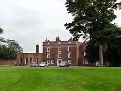
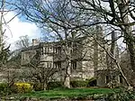
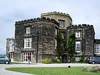
| Knowsley Hall | Knowsley | Country House | 15th century | 9 June 1952 | SJ4448193802 53°26′17″N 2°50′14″W / 53.438056°N 2.837213°W |
1253241 | |
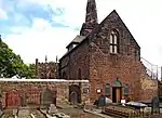
| Church of St Chad | Kirkby, Knowsley | Church | 1869 or later | 20 June 1975 | SJ4083798989 53°29′03″N 2°53′35″W / 53.484276°N 2.893038°W |
1356211 | |
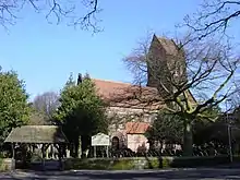
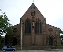
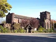
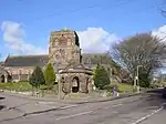
| Church of St Michael | Huyton, Knowsley | Church | 14th century | 6 June 1951 | SJ4426791130 53°24′50″N 2°50′24″W / 53.414018°N 2.83996°W |
1075535 |  Church of St Michael |


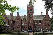
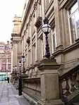
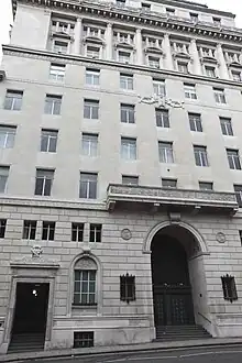
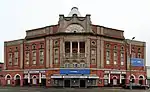
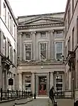
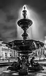
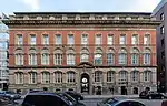
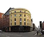
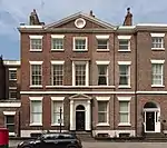
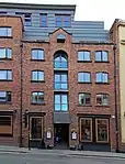
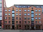
Liverpool
.JPG.webp)


.JPG.webp)

.JPG.webp)

.JPG.webp)


.jpg.webp)
.JPG.webp)


.JPG.webp)


.jpg.webp)


.JPG.webp)
.jpg.webp)


.JPG.webp)


.jpg.webp)
.jpg.webp)
.jpg.webp)


.jpg.webp)
.JPG.webp)

.jpg.webp)
.JPG.webp)

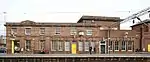
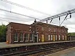
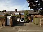
Sefton
.JPG.webp)
_p2.222_-_Ince_Blundell%252C_Lancashire.jpg.webp)


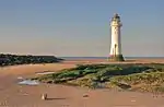
.jpg.webp)
.jpg.webp)

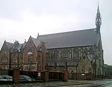
St. Helens
| Name | Location | Type | Completed [note 1] | Date designated | Grid ref.[note 2] Geo-coordinates |
Entry number [note 3] | Image |
|---|---|---|---|---|---|---|---|
| Birchley Hall | Billinge Chapel End, St. Helens | House | 1594 | 23 August 1966 | SJ5241999817 53°29′34″N 2°43′07″W / 53.492895°N 2.718643°W |
1343273 | |
| Church of St Aidan | Billinge Chapel End, St. Helens | Church | 1718 | 23 August 1966 | SD5332600697 53°30′03″N 2°42′18″W / 53.500886°N 2.705105°W |
1075923 | |
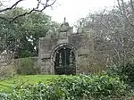
| Adjacent Ruins at Scholes House | Eccleston, St. Helens | Friary | Pre 1681 | 28 January 1971 | SJ4898593406 53°26′06″N 2°46′10″W / 53.434953°N 2.769355°W |
1261890 |  Upload Photo |
| Effigy Pedestal in Garden of Scholes House | Eccleston, St. Helens | Shrine | 28 May 1958 | SJ4896693372 53°26′05″N 2°46′11″W / 53.434645°N 2.769636°W |
1253239 | Upload Photo | |
| Scholes House | Eccleston, St. Helens | Farmhouse | 16th century | 28 May 1958 | SJ4897393395 53°26′05″N 2°46′10″W / 53.434853°N 2.769534°W |
1253238 | Upload Photo |
| Guildhall Farmhouse | Rainford, St. Helens | Farmhouse | 1629 | 24 March 1966 | SD5114400211 53°29′47″N 2°44′17″W / 53.496319°N 2.737921°W |
1075904 | Upload Photo |
| Manor Farmhouse | Rainhill, St. Helens | Farmhouse | 14th century | 28 May 1958 | SJ4998090120 53°24′20″N 2°45′14″W / 53.405514°N 2.753857°W |
1253349 | Upload Photo |
| Old Hall Farmhouse | Rainhill, St. Helens | Farmhouse | 19th century | 9 June 1952 | SJ4897690254 53°24′24″N 2°46′08″W / 53.406623°N 2.768979°W |
1253242 | Upload Photo |
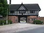
| Entrance Archway to Randall's Nursery | St. Helens | Arch | Early 19th century | 12 February 1981 | SJ5881895898 53°27′30″N 2°37′18″W / 53.458213°N 2.621685°W |
1198958 |  Entrance Archway to Randall's Nursery |
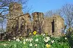
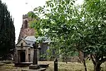
| Ruins of Windleshaw Abbey in Roman Catholic Cemetery (chapel of Saint Thomas of Canterbury) | St. Helens | Chantry Chapel | c. 1453 | 11 September 1951 | SJ4996296958 53°28′01″N 2°45′19″W / 53.466971°N 2.755217°W |
1199094 |  Ruins of Windleshaw Abbey in Roman Catholic Cemetery (chapel of Saint Thomas of Canterbury) |
| Statue of Queen Victoria | St. Helens | Statue | 1906 | 12 December 1984 | SJ5126195476 53°27′14″N 2°44′08″W / 53.453773°N 2.735421°W |
1075878 | |
| Tank House, Beside Canal at Crown Glass Works | St. Helens | Glass Works | 1883 | 23 August 1985 | SJ5121495014 53°26′59″N 2°44′10″W / 53.449616°N 2.736057°W |
1075879 |  Tank House, Beside Canal at Crown Glass Works |
| 159, 161 and 163 Crow Lane East | St. Helens | Cruck House | 16th century | 3 February 1966 | SJ5820095685 53°27′22″N 2°37′51″W / 53.456249°N 2.630963°W |
1343246 |  159, 161 and 163 Crow Lane East |
.jpg.webp)

.JPG.webp)
Wirral


See also
- Category:Grade II* listed buildings in Merseyside
Notes
- 1 2 3 4 5 The date given is the date used by Historic England as significant for the initial building or that of an important part in the structure's description.
- 1 2 3 4 5 Sometimes known as OSGB36, the grid reference is based on the British national grid reference system used by the Ordnance Survey.
- 1 2 3 4 5 The "List Entry Number" is a unique number assigned to each listed building and scheduled monument by Historic England.
References
External links
![]() Media related to Grade II* listed buildings in Merseyside at Wikimedia Commons
Media related to Grade II* listed buildings in Merseyside at Wikimedia Commons
This article is issued from Wikipedia. The text is licensed under Creative Commons - Attribution - Sharealike. Additional terms may apply for the media files.