Mendip district shown within Somerset

Mendip is a local government district in the English county of Somerset. The Mendip district covers a largely rural area of 285 square miles (738 km2)[1] ranging from the Mendip Hills through on to the Somerset Levels. It had a population of approximately 110,000 in 2014.[1][2] The administrative centre of the district is Shepton Mallet.

In the United Kingdom, the term listed building refers to a building or other structure officially designated as being of special architectural, historical or cultural significance; Grade II* structures are those considered to be "particularly significant buildings of more than local interest".[3] Listing was begun by a provision in the Town and Country Planning Act 1947. Once listed, severe restrictions are imposed on the modifications allowed to a building's structure or its fittings. In England, the authority for listing under the Planning (Listed Buildings and Conservation Areas) Act 1990 rests with Historic England, a non-departmental public body sponsored by the Department for Digital, Culture, Media and Sport; local authorities have a responsibility to regulate and enforce the planning regulations.[4]

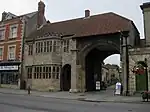
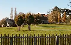
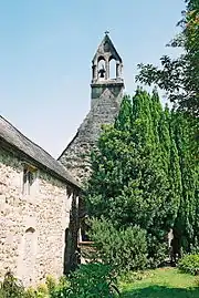
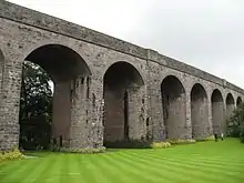
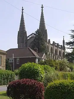
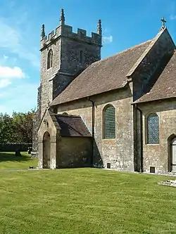
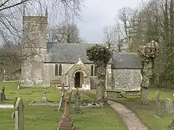
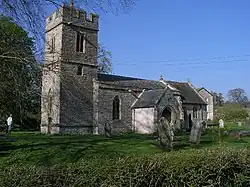
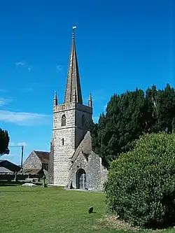
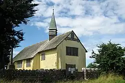
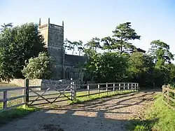
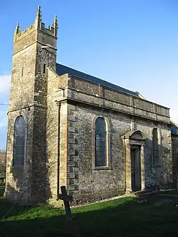
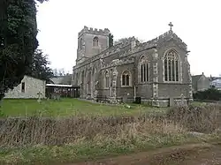
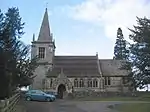
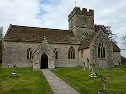
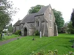
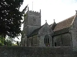
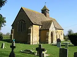
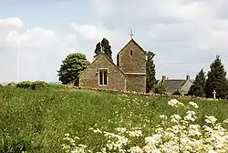
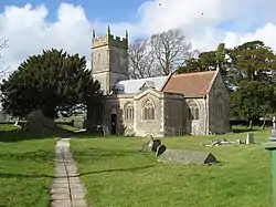
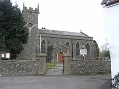
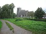
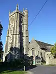
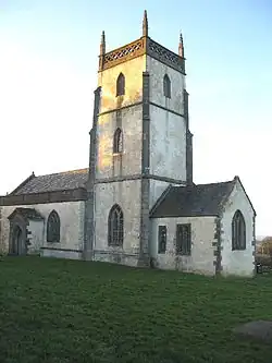
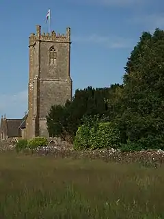
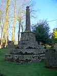
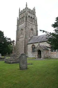
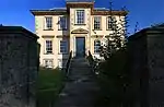
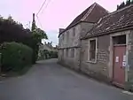
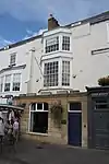
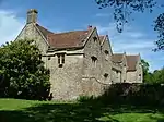
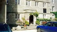
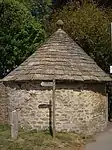
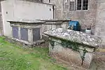
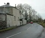
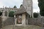
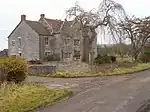
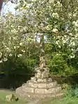
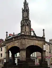
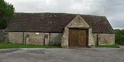
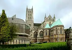
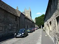
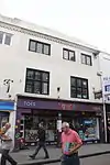
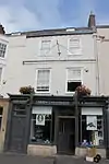
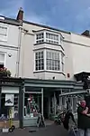
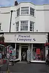
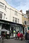
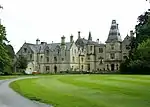
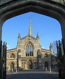
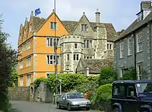
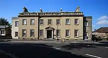
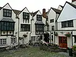
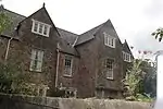
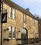
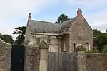
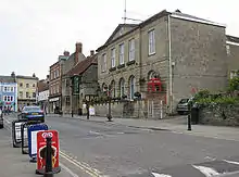
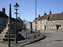
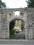
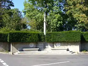
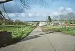
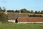
There are 209 Grade II* listed buildings in Mendip. The list includes a large number of churches, some of which are Norman. Several buildings are associated with the church, particularly the Anglican Glastonbury Abbey and Wells Cathedral along with the Benedictine Downside Abbey. Many of the rest of the buildings are urban or rural houses ranging in date from the 12th to 19th centuries. Trade in the area is represented by market crosses and the Anglo-Bavarian Brewery. Shepton Mallet Prison and a village lock-up are also included in the list. The oldest is the Church of St Mary, Laverton, while the most recent is Mells War Memorial by Sir Edwin Lutyens.
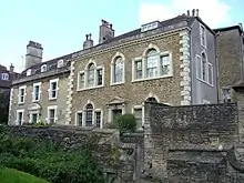
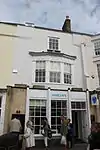
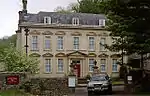
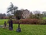
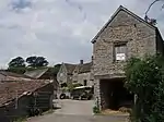
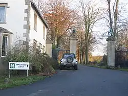
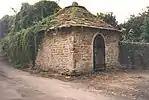
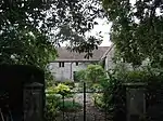
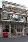
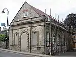
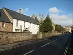
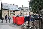
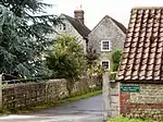
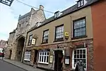
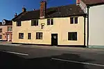
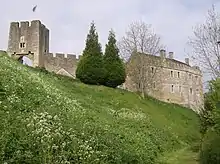
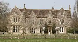
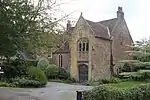
Buildings

Name Location Type Completed [note 1] Grid ref.[note 2]
Geo-coordinates
Entry number [note 3]ImageRef.
Abbey Gatehouse GlastonburyPorters lodgeMid 14th centuryST4989738881
51°08′49″N 2°43′04″W / 51.146986°N 2.717655°W / 51.146986; -2.717655 (Abbey Gatehouse)
1345446
[5]
Abbots Sharpham and Sharpham Park Farmhouse SharphamFarmhouse18th centuryST4669037428
51°08′01″N 2°45′48″W / 51.133632°N 2.763283°W / 51.133632; -2.763283 (Abbots Sharpham and Sharpham Park Farmhouse)
1345069
[6]
Alice Street Farmhouse WanstrowFarmhouseLate 17th centuryST7243542795
51°11′01″N 2°23′45″W / 51.183714°N 2.395763°W / 51.183714; -2.395763 (Alice Street Farmhouse)
1345299
Upload Photo
[7]
Almshouses and Chapel of St Mary Magdalene's Hospital GlastonburyAlmshousec.1310ST4988238661
51°08′42″N 2°43′04″W / 51.145007°N 2.717839°W / 51.145007; -2.717839 (Almshouses and Chapel of St Mary Magdalene's Hospital)
1057909
[8][9]
Anglo Trading Estate Shepton MalletBrewery1864ST6161443734
51°11′30″N 2°33′02″W / 51.19153°N 2.550677°W / 51.19153; -2.550677 (Anglo Trading Estate)
1296561
[10]
Argyle House FromeHouse1768–1769ST7765247895
51°13′47″N 2°19′17″W / 51.229801°N 2.321442°W / 51.229801; -2.321442 (Argyle House)
1057828
Argyle House
Argyle House
[11]
Babington House BabingtonCountry house17th centuryST7087350907
51°15′24″N 2°25′08″W / 51.256576°N 2.418772°W / 51.256576; -2.418772 (Babington House)
1177567
[12]
Barclays Bank WellsHousec. 1453ST5500645796
51°12′35″N 2°38′44″W / 51.209587°N 2.64549°W / 51.209587; -2.64549 (Barclays Bank)
1383011
Barclays Bank
Barclays Bank
[13]
Barn 35 metres to North-East of Nunney Castle NunneyBarnc. 1500ST7369745782
51°12′38″N 2°22′41″W / 51.210632°N 2.377928°W / 51.210632; -2.377928 (Barn 35 metres to North-East of Nunney Castle)
1058267
Barn 35 metres to North-East of Nunney Castle
[14]
Bellerica Farmhouse Witham FriaryFarmhouse16th centuryST7215839183
51°09′04″N 2°23′58″W / 51.151222°N 2.399445°W / 51.151222; -2.399445 (Bellerica Farmhouse)
1175208
Upload Photo
[15]
Berkley House BerkleyCountry houseMid 18th centuryST8113149380
51°14′36″N 2°16′18″W / 51.24328°N 2.271697°W / 51.24328; -2.271697 (Berkley House)
1058192
Upload Photo
[16]
Boathouse LullingtonBoat houseMid 18th centuryST7816151046
51°15′29″N 2°18′52″W / 51.258153°N 2.314346°W / 51.258153; -2.314346 (Boathouse)
1174399
Upload Photo
[17]
Bowlish House Shepton MalletHouse1732ST6125843959
51°11′37″N 2°33′21″W / 51.193529°N 2.555796°W / 51.193529; -2.555796 (Bowlish House)
1058419
Bowlish House
Bowlish House
[18]
Bradley House West BradleyCountry house16th or 17th centuryST5582836925
51°07′48″N 2°37′57″W / 51.129888°N 2.632631°W / 51.129888; -2.632631 (Bradley House)
1058794
Bradley House
Bradley House
[19]
Bridge Farmhouse ButleighFarmhouse14th centuryST5226033636
51°06′00″N 2°40′59″W / 51.100029°N 2.68318°W / 51.100029; -2.68318 (Bridge Farmhouse)
1175640
Upload Photo
[20]
Brookside Farm LullingtonFarmhouseMid 18th centuryST7757753446
51°16′47″N 2°19′22″W / 51.279711°N 2.322866°W / 51.279711; -2.322866 (Brookside Farm)
1295843
Upload Photo
[21]
Cathedral Green House WellsRow housePre 17th centuryST5503545822
51°12′35″N 2°38′42″W / 51.209823°N 2.645078°W / 51.209823; -2.645078 (Cathedral Green House)
1382892
Upload Photo
[22]
Charlton Viaduct Shepton MalletRailway viaduct1874ST6279843548
51°11′24″N 2°32′01″W / 51.189936°N 2.533716°W / 51.189936; -2.533716 (Charlton Viaduct)
1058414
[23]
Christ Church FromeChurch1817–1818ST7733547865
51°13′46″N 2°19′34″W / 51.229518°N 2.32598°W / 51.229518; -2.32598 (Christ Church)
1057853
[24]
Christ Church RodeChurch1824ST8062954153
51°17′10″N 2°16′45″W / 51.28618°N 2.279148°W / 51.28618; -2.279148 (Christ Church)
1058062
[25]
Church of All Saints DownheadChurch14th centuryST6917046189
51°12′51″N 2°26′34″W / 51.214064°N 2.442768°W / 51.214064; -2.442768 (Church of All Saints)
1174065
[26]
Church of All Saints Rodden, SelwoodChurch1640ST7988147719
51°13′42″N 2°17′22″W / 51.228301°N 2.28951°W / 51.228301; -2.28951 (Church of All Saints)
1058893
Upload Photo
[27]
Church of St Andrew HolcombeChurchLate Saxon or Early NormanST6688050734
51°15′17″N 2°28′34″W / 51.254802°N 2.475974°W / 51.254802; -2.475974 (Church of St Andrew)
1058677
[28]
Church of St Andrew West BradleyChurch19th centuryST5578636874
51°07′46″N 2°38′00″W / 51.129427°N 2.633224°W / 51.129427; -2.633224 (Church of St Andrew)
1058795
[29]
Church of St George WhatleyChurch14th centuryST7340247603
51°13′37″N 2°22′56″W / 51.226992°N 2.382286°W / 51.226992; -2.382286 (Church of St George)
1058258
[30]
Church of St Hugh Charterhouse, PriddyChurch1908ST5013155663
51°17′52″N 2°43′00″W / 51.297897°N 2.71665°W / 51.297897; -2.71665 (Church of St Hugh)
1307304
[31]
Church of St James Milton ClevedonChurchRebuilt 1790ST6645637788
51°08′18″N 2°28′51″W / 51.138372°N 2.480836°W / 51.138372; -2.480836 (Church of St James)
1059161
[32]
Church of St James the Less Foxcote, HemingtonChurchEarly 18th centuryST7155555570
51°17′55″N 2°24′34″W / 51.298539°N 2.409372°W / 51.298539; -2.409372 (Church of St James the Less)
1058709
[33]
Church of St John The Baptist ChilcomptonChurch19th centuryST6469752410
51°16′11″N 2°30′27″W / 51.26974°N 2.50742°W / 51.26974; -2.50742 (Church of St John The Baptist)
1345096
[34]
Church of St Katherine East Woodlands, SelwoodChurchc. 1712ST7898244151
51°11′46″N 2°18′08″W / 51.196186°N 2.302174°W / 51.196186; -2.302174 (Church of St Katherine)
1175821
[35]
Church of St Lawrence Westbury-sub-MendipChurch1887ST4996048704
51°14′07″N 2°43′05″W / 51.235313°N 2.718127°W / 51.235313; -2.718127 (Church of St Lawrence)
1178326
[36]
Church of St Leonard ButleighChurchMid 19th centuryST5200333922
51°06′09″N 2°41′13″W / 51.102579°N 2.686888°W / 51.102579; -2.686888 (Church of St Leonard)
1058773
[37]
Church of St Leonard Farleigh HungerfordChurch1443ST7999357423
51°18′56″N 2°17′18″W / 51.315561°N 2.288452°W / 51.315561; -2.288452 (Church of St Leonard)
1174661
[38]
Church of St Mary BerkleyChurch1751ST8111249404
51°14′37″N 2°16′19″W / 51.243495°N 2.27197°W / 51.243495; -2.27197 (Church of St Mary)
1295976
[39]
Church of St Mary Chesterblade, EvercreechChurch12th century51°10′09″N 2°29′10″W / 51.16903°N 2.486246°W / 51.16903; -2.486246 (Church of St Mary) 1222368
[40]
Church of St Mary Laverton, LullingtonChurch11th centuryST7781452997
51°16′32″N 2°19′10″W / 51.275683°N 2.31944°W / 51.275683; -2.31944 (Church of St Mary)
1366309
[41]
Church of St Mary WanstrowChurch15th centuryST7127541717
51°10′26″N 2°24′44″W / 51.173963°N 2.412273°W / 51.173963; -2.412273 (Church of St Mary)
1174955
[42]
Church of St Mary Cloford, WanstrowChurch15th centuryST7263443983
51°11′40″N 2°23′35″W / 51.194405°N 2.393007°W / 51.194405; -2.393007 (Church of St Mary)
1295509
[43]
Church of St Mary Lottisham, West BradleyChurch1876ST5703135060
51°06′48″N 2°36′55″W / 51.113211°N 2.615217°W / 51.113211; -2.615217 (Church of St Mary)
1058792
[44]
Church of St Mary and St John LamyattChurch13th centuryST6612636190
51°07′26″N 2°29′07″W / 51.123983°N 2.485401°W / 51.123983; -2.485401 (Church of St Mary and St John)
1344874
[45]
Church of St Mary Magdalene Upton NobleChurch12th centuryST7129339451
51°09′13″N 2°24′43″W / 51.153589°N 2.411834°W / 51.153589; -2.411834 (Church of St Mary Magdalene)
1174889
[46]
Church of St Mary The Virgin Ston EastonChurch11th centuryST6238153453
51°16′44″N 2°32′27″W / 51.27897°N 2.540726°W / 51.27897; -2.540726 (Church of St Mary The Virgin)
1295301
[47]
Church of St Michael DinderChurch14th centuryST5751644601
51°11′57″N 2°36′34″W / 51.199035°N 2.609418°W / 51.199035; -2.609418 (Church of St Michael)
1345121
[48]
Church of St Michael Stoke St MichaelChurchc. 1400ST6644446977
51°13′16″N 2°28′55″W / 51.220995°N 2.481868°W / 51.220995; -2.481868 (Church of St Michael)
1173964
[49]
Church of St Peter Lydford-on-FosseChurch1846ST5646331882
51°05′05″N 2°37′23″W / 51.084593°N 2.622946°W / 51.084593; -2.622946 (Church of St Peter)
1175052
[50]
Church of St Peter North WoottonChurch14th or 15th centuryST5637741808
51°10′26″N 2°37′31″W / 51.173836°N 2.625379°W / 51.173836; -2.625379 (Church of St Peter)
1175106
[51]
Church of St Philip and St James Norton St PhilipChurch14th centuryST7721755726
51°18′01″N 2°19′41″W / 51.300197°N 2.328174°W / 51.300197; -2.328174 (Church of St Philip and St James)
1345373
[52]
Church of St Thomas WellsChurch1856–1857ST5560346168
51°12′47″N 2°38′13″W / 51.212979°N 2.63699°W / 51.212979; -2.63699 (Church of St Thomas)
1383153
[53]
Church of St Thomas A Beckett PylleChurch1868ST6070638334
51°08′34″N 2°33′47″W / 51.142914°N 2.563078°W / 51.142914; -2.563078 (Church of St Thomas A Beckett)
1175680
[54]
Church of the Blessed Virgin Mary EmboroughChurch18th centuryST6144051358
51°15′36″N 2°33′14″W / 51.26007°N 2.55399°W / 51.26007; -2.55399 (Church of the Blessed Virgin Mary)
1177590
[55]
Church of the Holy Trinity BinegarChurchNormanST6153749454
51°14′35″N 2°33′09″W / 51.242956°N 2.552395°W / 51.242956; -2.552395 (Church of the Holy Trinity)
1058641
[56]
Church of the Holy Trinity FromeChurch1837ST7719648349
51°14′02″N 2°19′41″W / 51.233865°N 2.328002°W / 51.233865; -2.328002 (Church of the Holy Trinity)
1174175
[56]
Churchyard Cross East PennardCross15th centuryST5968637468
51°08′06″N 2°34′39″W / 51.135056°N 2.577561°W / 51.135056; -2.577561 (Churchyard Cross)
1345215
[57]
Churchyard Cross in Churchyard, Church of St Aldhelm DoultingCross15th centuryST6461443153
51°11′11″N 2°30′28″W / 51.1865°N 2.507692°W / 51.1865; -2.507692 (Churchyard Cross in Churchyard, Church of St Aldhelm)
1345192
Churchyard Cross in Churchyard, Church of St Aldhelm
[58]
Churchyard Cross in Churchyard, South of Church of St Bartholemew CranmoreCross14th centuryST6683043319
51°11′17″N 2°28′34″W / 51.188126°N 2.476002°W / 51.188126; -2.476002 (Churchyard Cross in Churchyard, South of Church of St Bartholemew)
1058529
Churchyard Cross in Churchyard, South of Church of St Bartholemew
[59]
Claver Morris House WellsHouse1699ST5520946114
51°12′45″N 2°38′33″W / 51.212462°N 2.642624°W / 51.212462; -2.642624 (Claver Morris House)
1383173
Claver Morris House
Claver Morris House
[60]
Congregational Chapel TrudoxhillChapel1699ST7492143784
51°11′34″N 2°21′37″W / 51.192722°N 2.360265°W / 51.192722; -2.360265 (Congregational Chapel)
1345311
Congregational Chapel
[61]
Conservative Club WellsHousec. 1453ST5501145798
51°12′35″N 2°38′44″W / 51.209605°N 2.645418°W / 51.209605; -2.645418 (Conservative Club)
1383013
Conservative Club
Conservative Club
[62]
Court Farmhouse WookeyFarmhouse18th centuryST5180445714
51°12′31″N 2°41′29″W / 51.208588°N 2.691313°W / 51.208588; -2.691313 (Court Farmhouse)
1058584
Upload Photo
[63]
Cranmore Hall, walling and gazebo, now part of All Hallows School CranmoreHouse17th centuryST6815843744
51°11′31″N 2°27′25″W / 51.192024°N 2.457038°W / 51.192024; -2.457038 (Cranmore Hall, walling and gazebo, now part of All Hallows School)
1058533
Upload Photo
[64]
De Salis House and De Salis Cottage WellsHouseLate 14th centuryST5521046150
51°12′46″N 2°38′33″W / 51.212786°N 2.642614°W / 51.212786; -2.642614 (De Salis House and De Salis Cottage)
1383171
De Salis House and De Salis Cottage
[65]
Ditcheat House or Ditcheat Manor DitcheatHouseEarly 17th centuryST6257336370
51°07′31″N 2°32′10″W / 51.12538°N 2.536186°W / 51.12538; -2.536186 (Ditcheat House or Ditcheat Manor)
1275484
Ditcheat House or Ditcheat Manor
[66]
Doulting Manor and stables (Previously listed as The Vicarage) DoultingHouseEarly 18th centuryST6457243158
51°11′12″N 2°30′30″W / 51.186543°N 2.508294°W / 51.186543; -2.508294 (Doulting Manor and stables (Previously listed as The Vicarage))
1221290
Upload Photo
[67]
Dovecote Norton St PhilipDovecote15th centuryST7713255925
51°18′07″N 2°19′46″W / 51.301983°N 2.329406°W / 51.301983; -2.329406 (Dovecote)
1174418
Dovecote
Dovecote
[68]
Downside School Stratton-on-the-FosseSchoolc. 1700ST6553150716
51°15′16″N 2°29′43″W / 51.25456°N 2.495302°W / 51.25456; -2.495302 (Downside School)
1295086
[69]
Dwelling at right angles to Rear of No 3; Wall and Gate Piers The Abbey The Grange BeckingtonHousec. 1620ST8004451716
51°15′51″N 2°17′15″W / 51.264247°N 2.2874°W / 51.264247; -2.2874 (Dwelling at right angles to Rear of No 3; Wall and Gate Piers The Abbey The Grange)
1345319
Upload Photo
[70]
Former Church of St Michael TrudoxhillChurchc. 1857ST7799240227
51°09′39″N 2°18′58″W / 51.160865°N 2.316101°W / 51.160865; -2.316101 (Former Church of St Michael)
1058275
[71]
Former St Michael's Roman Catholic Church Shepton MalletChurch1804ST6165343393
51°11′18″N 2°33′00″W / 51.188467°N 2.550083°W / 51.188467; -2.550083 (Former St Michael's Roman Catholic Church)
1345271
Former St Michael's Roman Catholic Church
[72]
Former Village Reading Room Witham FriaryDovecotec. 1300ST7445441081
51°10′06″N 2°22′00″W / 51.168396°N 2.366755°W / 51.168396; -2.366755 (Former Village Reading Room)
1175244
Upload Photo
[73]
Fountain House FromeHouse1818ST7710948279
51°14′00″N 2°19′45″W / 51.233232°N 2.329244°W / 51.233232; -2.329244 (Fountain House)
1057829
Upload Photo
[74]
Gazebo 20 m north of No 13 Bath Road BeckingtonGazebo18th centuryST8004651998
51°16′00″N 2°17′15″W / 51.266783°N 2.287387°W / 51.266783; -2.287387 (Gazebo 20 m north of No 13 Bath Road)
1345296
Gazebo 20 m north of No 13 Bath Road
[75]
Gazebo and attached stables, 10 m south west of No 1 (Rode Mill House) RodeGazeboLate 18th centuryST8026954294
51°17′15″N 2°17′04″W / 51.287436°N 2.284318°W / 51.287436; -2.284318 (Gazebo and attached stables, 10 m south west of No 1 (Rode Mill House))
1175487
Upload Photo
[76]
Glastonbury Abbey Precinct Wall from No.2 Silver Street to Abbey Gatehouse GlastonburyPrecinct wall15th centuryST4996338916
51°08′50″N 2°43′00″W / 51.147307°N 2.716717°W / 51.147307; -2.716717 (Glastonbury Abbey Precinct Wall from No.2 Silver Street to Abbey Gatehouse)
1392856
Glastonbury Abbey Precinct Wall from No.2 Silver Street to Abbey Gatehouse
[77]
Gloucester Lodge LullingtonLodgeEarly 19th centuryST7862651854
51°15′56″N 2°18′28″W / 51.265436°N 2.307731°W / 51.265436; -2.307731 (Gloucester Lodge)
1295783
[78]
Grey Gables PiltonHouse15th centuryST5935740834
51°09′55″N 2°34′58″W / 51.165298°N 2.582644°W / 51.165298; -2.582644 (Grey Gables)
1058805
Upload Photo
[79]
Grottoes, 350 metres south west of rear of The Chantry WhatleyGrottoc. 1830ST7193546603
51°13′05″N 2°24′12″W / 51.21793°N 2.403216°W / 51.21793; -2.403216 (Grottoes, 350 metres south west of rear of The Chantry)
1345304
Upload Photo
[80]
Group of 7 monuments in churchyard, adjacent to nave, Church of St Peter and St Paul KilmersdonGravestone1680ST6959952419
51°16′12″N 2°26′14″W / 51.270105°N 2.437157°W / 51.270105; -2.437157 (Group of 7 monuments in churchyard, adjacent to nave, Church of St Peter and St Paul)
1058693
Group of 7 monuments in churchyard, adjacent to nave, Church of St Peter and St Paul
[81]
Hapsford House Great ElmHouseEarly 19th centuryST7594649692
51°14′45″N 2°20′46″W / 51.245889°N 2.345996°W / 51.245889; -2.345996 (Hapsford House)
1174202
Hapsford House
Hapsford House
[82]
Hassage Manor Norton St PhilipHouseMid 17th centuryST7522255733
51°18′01″N 2°21′24″W / 51.300176°N 2.356789°W / 51.300176; -2.356789 (Hassage Manor)
1115353
Upload Photo
[83]
Her Majestys Prison and Perimeter Wall Shepton MalletBoundary wall1610ST6212643639
51°11′27″N 2°32′36″W / 51.19071°N 2.543341°W / 51.19071; -2.543341 (Her Majestys Prison and Perimeter Wall)
1058425
[84]
Higher Southtown Farmhouse West PennardFarmhouse16th centuryST5579337792
51°08′16″N 2°38′00″W / 51.137681°N 2.633237°W / 51.137681; -2.633237 (Higher Southtown Farmhouse)
1058800
Higher Southtown Farmhouse
[85]
Ivythorn Manor StreetClerical dwellingMedievalST4806534304
51°06′20″N 2°44′35″W / 51.105669°N 2.743182°W / 51.105669; -2.743182 (Ivythorn Manor)
1176171
Upload Photo
[86]
Jacoby Cottage GlastonburyHouseMedievalST5045539067
51°08′55″N 2°42′35″W / 51.148707°N 2.709704°W / 51.148707; -2.709704 (Jacoby Cottage)
1345431
Upload Photo
[87]
Kilmersdon Lodges, gate piers and gates KilmersdonLodgeEarly 19th centuryST7066152290
51°16′08″N 2°25′19″W / 51.269001°N 2.421924°W / 51.269001; -2.421924 (Kilmersdon Lodges, gate piers and gates)
1307411
[88]
Kings Head Hotel WellsInnLate 18th centuryST5485945710
51°12′32″N 2°38′51″W / 51.208802°N 2.647583°W / 51.208802; -2.647583 (Kings Head Hotel)
1382974
Kings Head Hotel
Kings Head Hotel
[89]
Langham House and attached stables RodeCountry house1792ST8045254238
51°17′13″N 2°16′54″W / 51.286938°N 2.281691°W / 51.286938; -2.281691 (Langham House and attached stables)
1345390
Langham House and attached stables
[90]
Lock-Up MellsLock up17th centuryST7261248983
51°14′22″N 2°23′37″W / 51.239363°N 2.393705°W / 51.239363; -2.393705 (Lock-Up)
1058320
Lock-Up
Lock-Up
[91]
Lottisham Manor West BradleyHouseLate 16th centuryST5748134331
51°06′24″N 2°36′31″W / 51.10669°N 2.608703°W / 51.10669; -2.608703 (Lottisham Manor)
1308193
Lottisham Manor
Lottisham Manor
[92]
Lych Gate, flanking walls and gates on north side of Church of St Peter and St Paul KilmersdonChurch1900ST6958552445
51°16′13″N 2°26′14″W / 51.270338°N 2.43736°W / 51.270338; -2.43736 (Lych Gate, flanking walls and gates on north side of Church of St Peter and St Paul)
1058695
Lych Gate, flanking walls and gates on north side of Church of St Peter and St Paul
[93]
Manor Cottages LullingtonHouse17th centuryST7783953166
51°16′38″N 2°19′09″W / 51.277203°N 2.319093°W / 51.277203; -2.319093 (Manor Cottages)
1366310
Manor Cottages
Manor Cottages
[94]
Manor Farmhouse EmboroughFarmhouseMedievalST6139651328
51°15′35″N 2°33′17″W / 51.259797°N 2.554617°W / 51.259797; -2.554617 (Manor Farmhouse)
1345124
Manor Farmhouse
Manor Farmhouse
[95]
Manor Farmhouse LullingtonFarmhouse17th centuryST7783753005
51°16′33″N 2°19′09″W / 51.275755°N 2.319111°W / 51.275755; -2.319111 (Manor Farmhouse)
1058171
Upload Photo
[96]
Manor Farmhouse SelwoodFarmhouseEarly 17th centuryST7769543947
51°11′39″N 2°19′14″W / 51.194303°N 2.32058°W / 51.194303; -2.32058 (Manor Farmhouse)
1176081
Upload Photo
[97]
Manor Farmhouse WanstrowHouse1633ST7104641695
51°10′26″N 2°24′56″W / 51.173754°N 2.415547°W / 51.173754; -2.415547 (Manor Farmhouse)
1174987
Upload Photo
[98]
Manor Farmhouse Coxbridge, West PennardFarmhouse17th centuryST5417236553
51°07′35″N 2°39′22″W / 51.126413°N 2.656247°W / 51.126413; -2.656247 (Manor Farmhouse)
1345050
Manor Farmhouse
Manor Farmhouse
[99]
Manor Farmhouse WhatleyFarmhousec. 1700ST7338647635
51°13′38″N 2°22′57″W / 51.227279°N 2.382518°W / 51.227279; -2.382518 (Manor Farmhouse)
1058259
Manor Farmhouse
Manor Farmhouse
[100]
Manor Farmhouse Manor House WanstrowHouse17th centuryST7104641695
51°10′26″N 2°24′56″W / 51.173754°N 2.415547°W / 51.173754; -2.415547 (Manor Farmhouse Manor House)
1058285
Upload Photo
[101]
Manor Farmhouse and attached dwelling Stratton-on-the-FosseFarmhouseEarly 18th centuryST6663051718
51°15′49″N 2°28′47″W / 51.263635°N 2.479648°W / 51.263635; -2.479648 (Manor Farmhouse and attached dwelling)
1178338
Upload Photo
[102]
Manor Farmhouse and forecourt wall Upper Milton, St Cuthbert OutFarmhouse19th centuryST5459547352
51°13′25″N 2°39′06″W / 51.223545°N 2.651571°W / 51.223545; -2.651571 (Manor Farmhouse and forecourt wall)
1058604
Manor Farmhouse and forecourt wall
[103]
Manor House PiltonHouse17th centuryST5954342178
51°10′39″N 2°34′48″W / 51.177396°N 2.580136°W / 51.177396; -2.580136 (Manor House)
1058822
Upload Photo
[104]
Manor House Stoke St MichaelManor housec. 1700ST6641946917
51°13′14″N 2°28′56″W / 51.220454°N 2.48222°W / 51.220454; -2.48222 (Manor House)
1345263
Manor House
Manor House
[105]
Manor House, gates and gate piers adjoining to west NunneyHousec. 1720ST7360245743
51°12′37″N 2°22′45″W / 51.210277°N 2.379285°W / 51.210277; -2.379285 (Manor House, gates and gate piers adjoining to west)
1174502
Upload Photo
[106]
Market Cross NunneyMarket crossc. 1100ST7374245763
51°12′38″N 2°22′38″W / 51.210463°N 2.377282°W / 51.210463; -2.377282 (Market Cross)
1058301
Market Cross
Market Cross
[107]
Market Cross Shepton MalletMarket crossc. 1500ST6189043651
51°11′27″N 2°32′48″W / 51.190803°N 2.546719°W / 51.190803; -2.546719 (Market Cross)
1058383
[108]
Marston House Marston BigotHousec. 1650ST7573045232
51°12′21″N 2°20′56″W / 51.205777°N 2.348787°W / 51.205777; -2.348787 (Marston House)
1174802
[109]
Mellifont Abbey, boundary walls and gate piers WookeyCountry house1753–1765ST5181845816
51°12′34″N 2°41′28″W / 51.209506°N 2.691127°W / 51.209506; -2.691127 (Mellifont Abbey, boundary walls and gate piers)
1180119
Upload Photo
[110]
Mells Village Hall MellsVillage hall14th centuryST7287449133
51°14′27″N 2°23′24″W / 51.240724°N 2.389964°W / 51.240724; -2.389964 (Mells Village Hall)
1058313
[111]
Melrose House FromeHousec. 1700ST7745048148
51°13′55″N 2°19′28″W / 51.232068°N 2.324351°W / 51.232068; -2.324351 (Melrose House)
1057747
Upload Photo
[112]
Mendip House and boundary walls to road Welshmill House and boundary walls to road FromeHousec. 1790ST7779348503
51°14′07″N 2°19′10″W / 51.235273°N 2.319461°W / 51.235273; -2.319461 (Mendip House and boundary walls to road Welshmill House and boundary walls to road)
1057740
Upload Photo
[113]
Merfield House RodeHousec. 1810ST7992353604
51°16′52″N 2°17′21″W / 51.281219°N 2.289241°W / 51.281219; -2.289241 (Merfield House)
1345393
Upload Photo
[114]
Monastery of St Gregory the Great, Downside Abbey with Petre Cloister Stratton-on-the-FosseAbbey1873ST6546850804
51°15′19″N 2°29′46″W / 51.255347°N 2.496213°W / 51.255347; -2.496213 (Monastery of St Gregory the Great, Downside Abbey with Petre Cloister)
1295178
[115]
Monmouth Chambers FromeHouseLate 17th centuryST7760948050
51°13′52″N 2°19′19″W / 51.231193°N 2.322068°W / 51.231193; -2.322068 (Monmouth Chambers)
1057818
Upload Photo
[116]
Newbury House ColefordCountry houseEarly 18th centuryST6994050522
51°15′11″N 2°25′56″W / 51.253066°N 2.432109°W / 51.253066; -2.432109 (Newbury House)
1175636
Newbury House
Newbury House
[117]
25 Keyford FromeHouse18th centuryST7766147426
51°13′32″N 2°19′17″W / 51.225584°N 2.321284°W / 51.225584; -2.321284 (25 Keyford)
1057796
Upload Photo
[118]
4, Cheap Street FromeHouseLate 16th centuryST7767848018
51°13′51″N 2°19′16″W / 51.230908°N 2.321078°W / 51.230908; -2.321078 (4, Cheap Street)
1057840
4, Cheap Street
4, Cheap Street
[119]
11, Cheap Street FromeHouse17th centuryST7770547980
51°13′50″N 2°19′14″W / 51.230567°N 2.320689°W / 51.230567; -2.320689 (11, Cheap Street)
1057842
Upload Photo
[120]
14–16, Willow Vale FromeHousec. 1720ST7798348148
51°13′56″N 2°19′00″W / 51.232088°N 2.316718°W / 51.232088; -2.316718 (14–16, Willow Vale)
1058465
Upload Photo
[121]
21, Wine Street FromeHousec. 1730–1750ST7739447945
51°13′49″N 2°19′31″W / 51.23024°N 2.325141°W / 51.23024; -2.325141 (21, Wine Street)
1058467
Upload Photo
[122]
13, Bridge Street FromeHouseEarly–mid 18th centuryST7779148259
51°13′59″N 2°19′10″W / 51.233079°N 2.319474°W / 51.233079; -2.319474 (13, Bridge Street)
1345465
Upload Photo
[123]
16 and 17, Stony Street FromeHousec. 1688ST7760248027
51°13′52″N 2°19′20″W / 51.230986°N 2.322167°W / 51.230986; -2.322167 (16 and 17, Stony Street)
1345534
Upload Photo
[124]
6, New Street MellsHousec. 1470ST7279549244
51°14′30″N 2°23′28″W / 51.241718°N 2.391104°W / 51.241718; -2.391104 (6, New Street)
1174360
6, New Street
6, New Street
[125]
9, New Street MellsHousec. 1470ST7278549206
51°14′29″N 2°23′28″W / 51.241376°N 2.391244°W / 51.241376; -2.391244 (9, New Street)
1174367
Upload Photo
[126]
4, New Street MellsHousec. 1470ST7277849254
51°14′31″N 2°23′29″W / 51.241808°N 2.391348°W / 51.241808; -2.391348 (4, New Street)
1295803
Upload Photo
[127]
6 And 8, High Street RodeHouse18th centuryST8029853779
51°16′58″N 2°17′02″W / 51.282806°N 2.283874°W / 51.282806; -2.283874 (6 And 8, High Street)
1058091
6 And 8, High Street
[128]
8, Market Place Shepton MalletHouseEarly to mid 17th centuryST6194343620
51°11′26″N 2°32′45″W / 51.190527°N 2.545958°W / 51.190527; -2.545958 (8, Market Place)
1058457
[129]
6, High Street WellsHouse16th centuryST5494845763
51°12′33″N 2°38′47″W / 51.209286°N 2.646316°W / 51.209286; -2.646316 (6, High Street)
1382951
6, High Street
6, High Street
[130]
8, High Street WellsHouse15th centuryST5494845753
51°12′33″N 2°38′47″W / 51.209196°N 2.646315°W / 51.209196; -2.646315 (8, High Street)
1382953
8, High Street
8, High Street
[131]
3, Market Place WellsHousec. 1453ST5499245781
51°12′34″N 2°38′44″W / 51.209451°N 2.645688°W / 51.209451; -2.645688 (3, Market Place)
1383006
3, Market Place
3, Market Place
[132]
5, Market Place WellsHousec. 1453ST5499745785
51°12′34″N 2°38′44″W / 51.209487°N 2.645617°W / 51.209487; -2.645617 (5, Market Place)
1383008
5, Market Place
5, Market Place
[133]
7, Market Place WellsHousec. 1453ST5499645798
51°12′35″N 2°38′44″W / 51.209604°N 2.645633°W / 51.209604; -2.645633 (7, Market Place)
1383009
7, Market Place
7, Market Place
[134]
13, Market Place WellsHousec. 1453ST5501845797
51°12′35″N 2°38′43″W / 51.209597°N 2.645318°W / 51.209597; -2.645318 (13, Market Place)
1383015
13, Market Place
13, Market Place
[135]
15, Market Place WellsHousec. 1453ST5502445800
51°12′35″N 2°38′43″W / 51.209624°N 2.645233°W / 51.209624; -2.645233 (15, Market Place)
1383017
15, Market Place
15, Market Place
[136]
17, Market Place WellsHousec. 1453ST5502745806
51°12′35″N 2°38′43″W / 51.209679°N 2.64519°W / 51.209679; -2.64519 (17, Market Place)
1383019
17, Market Place
17, Market Place
[137]
19, Market Place WellsHousec. 1453ST5503545805
51°12′35″N 2°38′42″W / 51.20967°N 2.645076°W / 51.20967; -2.645076 (19, Market Place)
1383020
19, Market Place
19, Market Place
[138]
21, Market Place WellsHousec. 1453ST5504145807
51°12′35″N 2°38′42″W / 51.209689°N 2.64499°W / 51.209689; -2.64499 (21, Market Place)
1383021
21, Market Place
21, Market Place
[139]
23, Market Place WellsHousec. 1453ST5504445817
51°12′35″N 2°38′42″W / 51.209779°N 2.644948°W / 51.209779; -2.644948 (23, Market Place)
1383022
23, Market Place
23, Market Place
[140]
25, Market Place WellsHousec. 1453ST5505145816
51°12′35″N 2°38′41″W / 51.20977°N 2.644848°W / 51.20977; -2.644848 (25, Market Place)
1383023
25, Market Place
25, Market Place
[141]
7, Sadler Street WellsHouse15th centuryST5495045778
51°12′34″N 2°38′47″W / 51.209421°N 2.646289°W / 51.209421; -2.646289 (7, Sadler Street)
1383081
7, Sadler Street
7, Sadler Street
[142]
12, Sadler Street WellsHousec. 1800ST5497545801
51°12′35″N 2°38′45″W / 51.20963°N 2.645934°W / 51.20963; -2.645934 (12, Sadler Street)
1383086
12, Sadler Street
12, Sadler Street
[143]
3 And 5, St Thomas Street WellsHouse14th centuryST5527946023
51°12′42″N 2°38′30″W / 51.21165°N 2.64161°W / 51.21165; -2.64161 (3 And 5, St Thomas Street)
1383128
3 And 5, St Thomas Street
[144]
23, The Liberty WellsHouse1819ST5521846067
51°12′43″N 2°38′33″W / 51.21204°N 2.642489°W / 51.21204; -2.642489 (23, The Liberty)
1383176
23, The Liberty
23, The Liberty
[145]
Norwood Park Farmhouse GlastonburyAbbots summer palace1480ST5255438982
51°08′53″N 2°40′47″W / 51.148121°N 2.679687°W / 51.148121; -2.679687 (Norwood Park Farmhouse)
1296421
Upload Photo
[146]
Old Bowlish House Shepton MalletHouse17th centuryST6124344015
51°11′39″N 2°33′22″W / 51.194032°N 2.556016°W / 51.194032; -2.556016 (Old Bowlish House)
1172927
Old Bowlish House
Old Bowlish House
[147]
Old Farmhouse West PennardFarmhouse15th centuryST5405138959
51°08′53″N 2°39′30″W / 51.148037°N 2.658284°W / 51.148037; -2.658284 (Old Farmhouse)
1175898
Upload Photo
[148]
Old Pump House GlastonburyHouse17th centuryST4989638679
51°08′43″N 2°43′04″W / 51.14517°N 2.717641°W / 51.14517; -2.717641 (Old Pump House)
1296477
Old Pump House
Old Pump House
[149]
Orangery and walled garden at rear of Ammerdown House KilmersdonOrangeryc. 1793ST7115252768
51°16′24″N 2°24′54″W / 51.273324°N 2.414925°W / 51.273324; -2.414925 (Orangery and walled garden at rear of Ammerdown House)
1345115
Upload Photo
[150]
Orchardlea House, forecourt walls and gates LullingtonHouse1856ST7771451286
51°15′37″N 2°19′15″W / 51.260294°N 2.320767°W / 51.260294; -2.320767 (Orchardlea House, forecourt walls and gates)
1058140
[151]
Outbuilding, about 30 m west of Higher Southtown Farmhouse West PennardHouseEarly 17th centuryST5576337803
51°08′16″N 2°38′01″W / 51.137778°N 2.633667°W / 51.137778; -2.633667 (Outbuilding, about 30 m west of Higher Southtown Farmhouse)
1175928
Upload Photo
[152]
Parish Church of St John the Baptist FromeChurch12th centuryST7770747909
51°13′48″N 2°19′14″W / 51.229929°N 2.320656°W / 51.229929; -2.320656 (Parish Church of St John the Baptist)
1345441
[153]
Park House MellsHouse18th centuryST7132248682
51°14′12″N 2°24′44″W / 51.236593°N 2.412159°W / 51.236593; -2.412159 (Park House)
1058296
Upload Photo
[154]
Park House Shepton MalletHousec. 1700ST6121944090
51°11′41″N 2°33′23″W / 51.194705°N 2.556368°W / 51.194705; -2.556368 (Park House)
1172922
Upload Photo
[155]
Polydor House WellsHouse16th centuryST5501946045
51°12′43″N 2°38′43″W / 51.211827°N 2.645335°W / 51.211827; -2.645335 (Polydor House)
1383163
Polydor House
Polydor House
[156]
Pylle Manor and attached walled garden at rear PylleHouse17th centuryST6076938264
51°08′32″N 2°33′44″W / 51.142289°N 2.56217°W / 51.142289; -2.56217 (Pylle Manor and attached walled garden at rear)
1058786
Pylle Manor and attached walled garden at rear
[157]
Retaining walls and associated garden features on south and east sides of Ammerdown House KilmersdonBoundary wall17th centuryST7118252677
51°16′21″N 2°24′52″W / 51.272507°N 2.414488°W / 51.272507; -2.414488 (Retaining walls and associated garden features on south and east sides of Ammerdown House)
1177422
Upload Photo
[158]
Ritchie Hall WellsSchool1884ST5504646078
51°12′44″N 2°38′42″W / 51.212126°N 2.644953°W / 51.212126; -2.644953 (Ritchie Hall)
1383166
Ritchie Hall
Ritchie Hall
[159]
Rockfield House and service buildings NunneyHousec. 1805ST7339145550
51°12′31″N 2°22′56″W / 51.208531°N 2.382291°W / 51.208531; -2.382291 (Rockfield House and service buildings)
1058309
Upload Photo
[160]
Rodden Manor SelwoodHouseLate 16th centuryST7961147573
51°13′37″N 2°17′36″W / 51.226979°N 2.293368°W / 51.226979; -2.293368 (Rodden Manor)
1058894
Upload Photo
[161]
Rode Mill House RodeHouseLate 18th centuryST8025654321
51°17′16″N 2°17′04″W / 51.287678°N 2.284506°W / 51.287678; -2.284506 (Rode Mill House)
1058061
Upload Photo
[162]
Southfield House RodeHouse17th centuryST8034153798
51°16′59″N 2°17′00″W / 51.282978°N 2.283258°W / 51.282978; -2.283258 (Southfield House)
1058092
Upload Photo
[163]
St Algars Farmhouse SelwoodFarmhouse14th centuryST7876841945
51°10′35″N 2°18′18″W / 51.176342°N 2.305106°W / 51.176342; -2.305106 (St Algars Farmhouse)
1058902
St Algars Farmhouse
St Algars Farmhouse
[164]
St Cuthbert's Lodge and attached walls and gate piers WellsHouseEarly 18th centuryST5467245787
51°12′34″N 2°39′01″W / 51.20948°N 2.65027°W / 51.20948; -2.65027 (St Cuthbert's Lodge and attached walls and gate piers)
1382940
St Cuthbert's Lodge and attached walls and gate piers
[165]
Stables to Ston Easton Park Ston EastonStablec. 1769ST6243354087
51°17′05″N 2°32′24″W / 51.284674°N 2.540048°W / 51.284674; -2.540048 (Stables to Ston Easton Park)
1295250
Upload Photo
[166]
Stables, about 40 metres west of Standerwick Court BeckingtonStable18th centuryST8156351106
51°15′32″N 2°15′56″W / 51.258814°N 2.265598°W / 51.258814; -2.265598 (Stables, about 40 metres west of Standerwick Court)
1173876
Upload Photo
[167]
Standerwick Court BeckingtonHouse18th centuryST8163451123
51°15′32″N 2°15′52″W / 51.258969°N 2.264581°W / 51.258969; -2.264581 (Standerwick Court)
1173869
Upload Photo
[168]
The Abbey Retreat House GlastonburyHouse1830ST5024238861
51°08′49″N 2°42′46″W / 51.146836°N 2.712721°W / 51.146836; -2.712721 (The Abbey Retreat House)
1167617
[169]
The Ancient Gate House Hotel WellsHotel1451ST5494945843
51°12′36″N 2°38′47″W / 51.210005°N 2.646312°W / 51.210005; -2.646312 (The Ancient Gate House Hotel)
1383093
The Ancient Gate House Hotel
[170]
The Castle BeckingtonHouseEarly 17th centuryST7999451502
51°15′44″N 2°17′17″W / 51.262321°N 2.288104°W / 51.262321; -2.288104 (The Castle)
1296202
[171]
The Cedars WellsHousec. 1758ST5514546123
51°12′45″N 2°38′37″W / 51.212538°N 2.643541°W / 51.212538; -2.643541 (The Cedars)
1383170
The Cedars
The Cedars
[172]
The Cedars and garden wall BeckingtonHouse17th centuryST8005651951
51°15′59″N 2°17′14″W / 51.266361°N 2.287241°W / 51.266361; -2.287241 (The Cedars and garden wall)
1173480
Upload Photo
[173]
The Chantry WhatleyHousec. 1826ST7199246965
51°13′16″N 2°24′09″W / 51.221187°N 2.402428°W / 51.221187; -2.402428 (The Chantry)
1058254
Upload Photo
[174]
The Chantry The Hermitage FromeHouseLate 17th centuryST7764947852
51°13′46″N 2°19′17″W / 51.229414°N 2.321483°W / 51.229414; -2.321483 (The Chantry The Hermitage)
1345487
Upload Photo
[175]
The Court House FromeHousec. 1700ST7775948017
51°13′51″N 2°19′12″W / 51.230902°N 2.319918°W / 51.230902; -2.319918 (The Court House)
1173467
Upload Photo
[176]
The Crown Hotel WellsHotelLate 16th centuryST5501045752
51°12′33″N 2°38′44″W / 51.209192°N 2.645427°W / 51.209192; -2.645427 (The Crown Hotel)
1383007
The Crown Hotel
The Crown Hotel
[177]
The Dean's Lodging WellsHouse1610ST5522446042
51°12′43″N 2°38′33″W / 51.211816°N 2.6424°W / 51.211816; -2.6424 (The Dean's Lodging)
1383178
The Dean's Lodging
The Dean's Lodging
[178]
The Falconry, Lodge Farm Norton St PhilipFarmhouse14th or 15th centuryST7967558020
51°19′15″N 2°17′35″W / 51.320918°N 2.293049°W / 51.320918; -2.293049 (The Falconry, Lodge Farm)
1345341
Upload Photo
[179]
The Iron Gates FromeHousec. 1696ST7774248010
51°13′51″N 2°19′13″W / 51.230838°N 2.320161°W / 51.230838; -2.320161 (The Iron Gates)
1345516
The Iron Gates
The Iron Gates
[180]
The Jolliffe Arms and Nos 235 and 236 KilmersdonHouseEarly 18th centuryST6957252404
51°16′12″N 2°26′15″W / 51.269968°N 2.437543°W / 51.269968; -2.437543 (The Jolliffe Arms and Nos 235 and 236)
1058660
The Jolliffe Arms and Nos 235 and 236
[181]
The Jolliffe Column and terraced base KilmersdonColumn1853ST7181152170
51°16′05″N 2°24′20″W / 51.26798°N 2.405431°W / 51.26798; -2.405431 (The Jolliffe Column and terraced base)
1058687
Upload Photo
[182]
The Manor House CroscombeHouse15th centuryST5892744312
51°11′48″N 2°35′21″W / 51.19654°N 2.589192°W / 51.19654; -2.589192 (The Manor House)
1058823
Upload Photo
[183]
The Manor House Upton NobleHousec. 1600ST7164239392
51°09′11″N 2°24′25″W / 51.153076°N 2.406839°W / 51.153076; -2.406839 (The Manor House)
1345277
Upload Photo
[184]
The Manor House and attached wall to rear PiltonAbbots summer palace1235–1252ST5880340755
51°09′52″N 2°35′26″W / 51.164548°N 2.590558°W / 51.164548; -2.590558 (The Manor House and attached wall to rear)
1175218
The Manor House and attached wall to rear
[185]
The Manor House, forecourt wall with piers and steps KilmersdonHouse1674ST6943252260
51°16′07″N 2°26′22″W / 51.268666°N 2.439537°W / 51.268666; -2.439537 (The Manor House, forecourt wall with piers and steps)
1345103
Upload Photo
[186]
The Market Cross WellsMarket crossc. 1797ST5499445763
51°12′33″N 2°38′44″W / 51.209289°N 2.645657°W / 51.209289; -2.645657 (The Market Cross)
1383027
The Market Cross
The Market Cross
[187]
The Music School and attached walls WellsHouse13th centuryST5511045946
51°12′39″N 2°38′38″W / 51.210944°N 2.64402°W / 51.210944; -2.64402 (The Music School and attached walls)
1382905
[188]
The Old Almshouse WellsAlmshouse1436ST5460945703
51°12′31″N 2°39′04″W / 51.208719°N 2.651161°W / 51.208719; -2.651161 (The Old Almshouse)
1382942
The Old Almshouse
The Old Almshouse
[189]
The Old Chapel CroscombeHouseLate 14th centuryST5906144462
51°11′52″N 2°35′14″W / 51.197898°N 2.587292°W / 51.197898; -2.587292 (The Old Chapel)
1174728
Upload Photo
[190]
The Old Manse BeckingtonHouse17th centuryST8008051919
51°15′58″N 2°17′13″W / 51.266074°N 2.286895°W / 51.266074; -2.286895 (The Old Manse)
1345333
Upload Photo
[191]
The Old Parsonage Walton, SomersetClerical dwelling15th centuryST4611236288
51°07′24″N 2°46′17″W / 51.123327°N 2.771372°W / 51.123327; -2.771372 (The Old Parsonage)
1058723
Upload Photo
[192]
The Old Vicarage FromeVicarage1744ST7780847871
51°13′47″N 2°19′09″W / 51.229591°N 2.319207°W / 51.229591; -2.319207 (The Old Vicarage)
1345519
Upload Photo
[193]
The Priest House and adjoining range, Farleigh Hungerford Castle Farleigh HungerfordFarmhouse17th centuryST8014357629
51°19′03″N 2°17′11″W / 51.317418°N 2.286312°W / 51.317418; -2.286312 (The Priest House and adjoining range, Farleigh Hungerford Castle)
1058118
[194]
The Priory (also known as The Abbey) DitcheatHouse1473ST6235436143
51°07′24″N 2°32′21″W / 51.123325°N 2.539292°W / 51.123325; -2.539292 (The Priory (also known as The Abbey))
1275470
[195]
The Rib WellsHouseMid 15th centuryST5522645940
51°12′39″N 2°38′32″W / 51.210899°N 2.642359°W / 51.210899; -2.642359 (The Rib)
1383106
The Rib
The Rib
[196]
The Talbot Inn MellsInnc. 1470ST7275549207
51°14′29″N 2°23′30″W / 51.241384°N 2.391674°W / 51.241384; -2.391674 (The Talbot Inn)
1058314
The Talbot Inn
The Talbot Inn
[197]
Thomas Jolliffe Monument in churchyard, about 50 metres south east of Church of St Peter and St Paul KilmersdonGravestone1918ST6964652412
51°16′12″N 2°26′11″W / 51.270044°N 2.436483°W / 51.270044; -2.436483 (Thomas Jolliffe Monument in churchyard, about 50 metres south east of Church of St Peter and St Paul)
1177784
Thomas Jolliffe Monument in churchyard, about 50 metres south east of Church of St Peter and St Paul
[198]
Tower House WellsHouseEarly 14th centuryST5518845983
51°12′41″N 2°38′34″W / 51.211283°N 2.642908°W / 51.211283; -2.642908 (Tower House)
1383103
Tower House
Tower House
[199]
Town Hall, including wall with steps to street GlastonburyWall1818ST4991538873
51°08′49″N 2°43′03″W / 51.146916°N 2.717397°W / 51.146916; -2.717397 (Town Hall, including wall with steps to street)
1057904
[200]
Unidentified Monument in churchyard about 4 metres south of south chapel Church of St Leonard Rodney StokeChest tomb15th centuryST4823449840
51°14′43″N 2°44′35″W / 51.245372°N 2.743011°W / 51.245372; -2.743011 (Unidentified Monument in churchyard about 4 metres south of south chapel Church of St Leonard)
1058593
Upload Photo
[201]
Village Cross adjacent to entrance of and in churchyard, Church of St Mary MeareCross15th centuryST4553141662
51°10′18″N 2°46′50″W / 51.171591°N 2.780488°W / 51.171591; -2.780488 (Village Cross adjacent to entrance of and in churchyard, Church of St Mary)
1058751
Upload Photo
[202]
Village Cross adjacent to The Bull Terrier CroscombeCross14th centuryST5904044346
51°11′49″N 2°35′15″W / 51.196854°N 2.587579°W / 51.196854; -2.587579 (Village Cross adjacent to The Bull Terrier)
1058863
Village Cross adjacent to The Bull Terrier
[203]
Village Cross to west of Church of St Peter EvercreechCross15th centuryST6490038683
51°08′47″N 2°30′11″W / 51.146326°N 2.503163°W / 51.146326; -2.503163 (Village Cross to west of Church of St Peter)
1059174
Village Cross to west of Church of St Peter
[204]
Wall around grounds of Glastonbury Abbey and Abbey Retreat House, including the gate way on Chilkwell Street GlastonburyBoundary wall19th centuryST5033238759
51°08′45″N 2°42′41″W / 51.145927°N 2.71142°W / 51.145927; -2.71142 (Wall around grounds of Glastonbury Abbey and Abbey Retreat House, including the gate way on Chilkwell Street)
1345438
Wall around grounds of Glastonbury Abbey and Abbey Retreat House, including the gate way on Chilkwell Street
[205]
Walling enclosing garden of Doulting Manor including gateway with piers, and gazebo DoultingBoundary wall19th centuryST6451143095
51°11′10″N 2°30′33″W / 51.185973°N 2.50916°W / 51.185973; -2.50916 (Walling enclosing garden of Doulting Manor including gateway with piers, and gazebo)
1058519
Upload Photo
[206]
War Memorial MellsWar memorialc. 1920ST7291649151
51°14′27″N 2°23′22″W / 51.240888°N 2.389364°W / 51.240888; -2.389364 (War Memorial)
1058315
[207]
West Compton House, forecourt wall and piers on roadside West Compton, PiltonFarmhouse17th centuryST5939742245
51°10′41″N 2°34′56″W / 51.177988°N 2.582232°W / 51.177988; -2.582232 (West Compton House, forecourt wall and piers on roadside)
1345021
Upload Photo
[208]
West Lodge FromeHouse1778–1780ST7725747954
51°13′49″N 2°19′38″W / 51.230315°N 2.327103°W / 51.230315; -2.327103 (West Lodge)
1296444
Upload Photo
[209]
Westholme House PiltonHouseMid to late 18th centuryST5776141425
51°10′14″N 2°36′20″W / 51.170496°N 2.605538°W / 51.170496; -2.605538 (Westholme House)
1345043
Upload Photo
[210]
Whitchurch Farmhouse Ston EastonFarmhousec. 1140ST6344053553
51°16′48″N 2°31′32″W / 51.279938°N 2.525554°W / 51.279938; -2.525554 (Whitchurch Farmhouse)
1345104
Whitchurch Farmhouse
[211]
Wick Farmhouse Norton St PhilipFarmhouse17th centuryST7873857214
51°18′49″N 2°18′23″W / 51.313636°N 2.306447°W / 51.313636; -2.306447 (Wick Farmhouse)
1058113
Wick Farmhouse
Wick Farmhouse
[212]
Wiltshires Barton FromeHouseEarly 18th centuryST7725848247
51°13′59″N 2°19′38″W / 51.23295°N 2.327108°W / 51.23295; -2.327108 (Wiltshires Barton)
1295877
Upload Photo
[213]

See also

Notes

  1. The date given is the date used by Historic England as significant for the initial building or that of an important part in the structure's description.
  2. Sometimes known as OSGB36, the grid reference is based on the British national grid reference system used by the Ordnance Survey.
  3. The "List Entry Number" is a unique number assigned to each listed building and scheduled monument by Historic England.

References

  1. 1 2 "A Portrait of Mendip". Mendip District Council. Retrieved 21 October 2017.
  2. "Community Profile Mendip District". Somerset Intelligence. Retrieved 2 January 2018.
  3. "Listed Buildings". Historic England. Retrieved 23 August 2017.
  4. "Planning (Listed Buildings and Conservation Areas) Act 1990 (c. 9)". Ministry of Justice. Archived from the original on 18 April 2010. Retrieved 17 December 2007.
  5. Historic England. "Abbey Gatehouse, Including The Porters' Lodge (1345446)". National Heritage List for England.
  6. Historic England. "Abbots Sharpham Sharpham Park Farmhouse (1345069)". National Heritage List for England.
  7. Historic England. "Alice Street Farmhouse (1345299)". National Heritage List for England.
  8. Historic England. "Almshouses And Chapel Of St Mary Magdalene's Hospital (1057909)". National Heritage List for England.
  9. Historic England. "Part of the Hospital of St Mary Magdalene, Magdalene Street (1020789)". National Heritage List for England.
  10. Historic England. "Anglo Trading Estate (1296561)". National Heritage List for England.
  11. Historic England. "Argyle House (1057828)". National Heritage List for England.
  12. Historic England. "Babington House (1177567)". National Heritage List for England.
  13. Historic England. "Barclays Bank (1383011)". National Heritage List for England.
  14. Historic England. "Barn 35 Metres To North-East Of Nunney Castle (1058267)". National Heritage List for England.
  15. Historic England. "Bellerica Farmhouse (1175208)". National Heritage List for England.
  16. Historic England. "Berkley House (1058192)". National Heritage List for England.
  17. Historic England. "Boathouse (1174399)". National Heritage List for England.
  18. Historic England. "Bowlish House (1058419)". National Heritage List for England.
  19. Historic England. "Bradley House (1058794)". National Heritage List for England.
  20. Historic England. "Bridge Farmhouse (1175640)". National Heritage List for England.
  21. Historic England. "Brookside Farm (1295843)". National Heritage List for England.
  22. Historic England. "Cathedral Green House (1382892)". National Heritage List for England.
  23. Historic England. "Charlton Viaduct (1058414)". National Heritage List for England.
  24. Historic England. "Christ Church (1057853)". National Heritage List for England.
  25. Historic England. "Christ Church (1058062)". National Heritage List for England.
  26. Historic England. "Church of All Saints (1174065)". National Heritage List for England.
  27. Historic England. "Church of All Saints (1058893)". National Heritage List for England.
  28. Historic England. "Church of St Andrew (1058677)". National Heritage List for England.
  29. Historic England. "Church of St Andrew (1058795)". National Heritage List for England.
  30. Historic England. "Church of St George (1058258)". National Heritage List for England.
  31. Historic England. "Church of St Hugh (1307304)". National Heritage List for England.
  32. Historic England. "Church of St James (1059161)". National Heritage List for England.
  33. Historic England. "Church of St James The Less (1058709)". National Heritage List for England.
  34. Historic England. "Church of St John The Baptist (1345096)". National Heritage List for England.
  35. Historic England. "Church of St Katherine (1175821)". National Heritage List for England.
  36. Historic England. "Church of St Lawrence (1178326)". National Heritage List for England.
  37. Historic England. "Church of St Leonard (1058773)". National Heritage List for England.
  38. Historic England. "Church of St Leonard (1174661)". National Heritage List for England.
  39. Historic England. "Church of St Mary (1295976)". National Heritage List for England.
  40. Historic England. "Church of St Mary (1222368)". National Heritage List for England.
  41. Historic England. "Church of St Mary (1366309)". National Heritage List for England.
  42. Historic England. "Church of St Mary (1174955)". National Heritage List for England.
  43. Historic England. "Church of St Mary (1295509)". National Heritage List for England.
  44. Historic England. "Church of St Mary (1058792)". National Heritage List for England.
  45. Historic England. "Church of St Mary and St John (1344874)". National Heritage List for England.
  46. Historic England. "Church of St Mary Magdalene (1174889)". National Heritage List for England.
  47. Historic England. "Church of St Mary The Virgin (1295301)". National Heritage List for England.
  48. Historic England. "Church of St Michael (1345121)". National Heritage List for England.
  49. Historic England. "Church of St Michael (1173964)". National Heritage List for England.
  50. Historic England. "Church of St Peter (1175052)". National Heritage List for England.
  51. Historic England. "Church of St Peter (1175106)". National Heritage List for England.
  52. Historic England. "Church of St Philip and St James (1345373)". National Heritage List for England.
  53. Historic England. "Church of St Thomas (1383153)". National Heritage List for England.
  54. Historic England. "Church of St Thomas A Beckett (1175680)". National Heritage List for England.
  55. Historic England. "Church of the Blessed Virgin Mary (1177590)". National Heritage List for England.
  56. 1 2 Historic England. "Church of the Holy Trinity (1058641)". National Heritage List for England.
  57. Historic England. "Churchyard Cross (1345215)". National Heritage List for England.
  58. Historic England. "Churchyard Cross in Churchyard, Church of St Aldhelm (1345192)". National Heritage List for England.
  59. Historic England. "Churchyard Cross in Churchyard, South of Church of St Bartholemew (1058529)". National Heritage List for England.
  60. Historic England. "Claver Morris House (1383173)". National Heritage List for England.
  61. Historic England. "Congregational Chapel (1345311)". National Heritage List for England.
  62. Historic England. "Conservative Club (1383013)". National Heritage List for England.
  63. Historic England. "Court Farmhouse (1058584)". National Heritage List for England.
  64. Historic England. "Cranmore Hall, walling and gazebo, now part of All Hallows School (1058533)". National Heritage List for England.
  65. Historic England. "De Salis House and De Salis Cottage (1383171)". National Heritage List for England.
  66. Historic England. "Ditcheat House or Ditcheat Manor (1275484)". National Heritage List for England.
  67. Historic England. "Doulting Manor and stables (Previously listed as The Vicarage) (1221290)". National Heritage List for England.
  68. Historic England. "Dovecote (1174418)". National Heritage List for England.
  69. Historic England. "Downside School (1295086)". National Heritage List for England.
  70. Historic England. "Dwelling at right angles to Rear of No 3; Wall and Gate Piers The Abbey The Grange (1345319)". National Heritage List for England.
  71. Historic England. "Former Church of St Michael (1058275)". National Heritage List for England.
  72. Historic England. "Former St Michael's Roman Catholic Church (1345271)". National Heritage List for England.
  73. Historic England. "Former Village Reading Room (1175244)". National Heritage List for England.
  74. Historic England. "Fountain House (1057829)". National Heritage List for England.
  75. Historic England. "Gazebo 20 metres to North of No 13 Bath Road (1345296)". National Heritage List for England.
  76. Historic England. "Gazebo and attached stables, 10 metres south west of No 1 (Rode Mill House) (1175487)". National Heritage List for England.
  77. Historic England. "Glastonbury Abbey Precinct Wall from No.2 Silver Street to Abbey Gatehouse (1392856)". National Heritage List for England.
  78. Historic England. "Gloucester Lodge (1295783)". National Heritage List for England.
  79. Historic England. "Grey Gables (1058805)". National Heritage List for England.
  80. Historic England. "Grottoes, 350 metres south west of rear of The Chantry (1345304)". National Heritage List for England.
  81. Historic England. "Group of 7 monuments in churchyard, adjacent to nave, Church of St Peter and St Paul (1058693)". National Heritage List for England.
  82. Historic England. "Hapsford House (1174202)". National Heritage List for England.
  83. Historic England. "Hassage Manor (1115353)". National Heritage List for England.
  84. Historic England. "Her Majestys Prison and Perimeter Wall (1058425)". National Heritage List for England.
  85. Historic England. "Higher Southtown Farmhouse (1058800)". National Heritage List for England.
  86. Historic England. "Ivythorn Manor (1176171)". National Heritage List for England.
  87. Historic England. "Jacoby Cottage (1345431)". National Heritage List for England.
  88. Historic England. "Kilmersdon Lodges, gate piers and gates (1307411)". National Heritage List for England.
  89. Historic England. "Kings Head Hotel (1382974)". National Heritage List for England.
  90. Historic England. "Langham House and attached stables (1345390)". National Heritage List for England.
  91. Historic England. "Lock-Up (1058320)". National Heritage List for England.
  92. Historic England. "Lottisham Manor (1308193)". National Heritage List for England.
  93. Historic England. "Lych Gate, flanking walls and gates on north side of Church of St Peter and St Paul (1058695)". National Heritage List for England.
  94. Historic England. "Manor Cottages (1366310)". National Heritage List for England.
  95. Historic England. "Manor Farmhouse (1345124)". National Heritage List for England.
  96. Historic England. "Manor Farmhouse (1058171)". National Heritage List for England.
  97. Historic England. "Manor Farmhouse (1176081)". National Heritage List for England.
  98. Historic England. "Manor Farmhouse (1174987)". National Heritage List for England.
  99. Historic England. "Manor Farmhouse (1345050)". National Heritage List for England.
  100. Historic England. "Manor Farmhouse (1058259)". National Heritage List for England.
  101. Historic England. "Manor Farmhouse (1058285)". National Heritage List for England.
  102. Historic England. "Manor Farmhouse and attached dwelling (1178338)". National Heritage List for England.
  103. Historic England. "Manor Farmhouse and forecourt wall (1058604)". National Heritage List for England.
  104. Historic England. "Manor House (1058822)". National Heritage List for England.
  105. Historic England. "Manor House (1345263)". National Heritage List for England.
  106. Historic England. "Manor House, gates and gate piers adjoining to west (1174502)". National Heritage List for England.
  107. Historic England. "Market Cross (1058301)". National Heritage List for England.
  108. Historic England. "Market Cross (1058383)". National Heritage List for England.
  109. Historic England. "Marston House (1174802)". National Heritage List for England.
  110. Historic England. "Mellifont Abbey, boundary walls and gate piers (1180119)". National Heritage List for England.
  111. Historic England. "Mells Village Hall (1058313)". National Heritage List for England.
  112. Historic England. "Melrose House (1057747)". National Heritage List for England.
  113. Historic England. "Mendip House and boundary walls to road Welshmill House and boundary walls to road (1057747)". National Heritage List for England.
  114. Historic England. "Merfield House (1057747)". National Heritage List for England.
  115. Historic England. "Monastery of St Gregory the Great, Downside Abbey with Petre Cloister (1295178)". National Heritage List for England.
  116. Historic England. "Monmouth Chambers (1057818)". National Heritage List for England.
  117. Historic England. "Newbury House (1175636)". National Heritage List for England.
  118. Historic England. "25 Keyford (1057796)". National Heritage List for England.
  119. Historic England. "4, Cheap Street (1057840)". National Heritage List for England.
  120. Historic England. "11, Cheap Street (1057842)". National Heritage List for England.
  121. Historic England. "14–16, Willow Vale (1058465)". National Heritage List for England.
  122. Historic England. "21, Wine Street (1058467)". National Heritage List for England.
  123. Historic England. "13, Bridge Street (1345465)". National Heritage List for England.
  124. Historic England. "16 and 17, Stony Street (1345534)". National Heritage List for England.
  125. Historic England. "6, New Street (1174360)". National Heritage List for England.
  126. Historic England. "9, New Street (1174367)". National Heritage List for England.
  127. Historic England. "4, New Street (1295803)". National Heritage List for England.
  128. Historic England. "6 And 8, High Street (1058091)". National Heritage List for England.
  129. Historic England. "8, Market Place (1058457)". National Heritage List for England.
  130. Historic England. "6, High Street (1382951)". National Heritage List for England.
  131. Historic England. "8, High Street (1382953)". National Heritage List for England.
  132. Historic England. "3, Market Place (1383006)". National Heritage List for England.
  133. Historic England. "5, Market Place (1383008)". National Heritage List for England.
  134. Historic England. "7, Market Place (1383009)". National Heritage List for England.
  135. Historic England. "13, Market Place (1383015)". National Heritage List for England.
  136. Historic England. "15, Market Place (1383017)". National Heritage List for England.
  137. Historic England. "17, Market Place (1383019)". National Heritage List for England.
  138. Historic England. "19, Market Place (1383019)". National Heritage List for England.
  139. Historic England. "21, Market Place (1383021)". National Heritage List for England.
  140. Historic England. "23, Market Place (1383022)". National Heritage List for England.
  141. Historic England. "25, Market Place (1383023)". National Heritage List for England.
  142. Historic England. "7, Sadler Street (1383081)". National Heritage List for England.
  143. Historic England. "12, Sadler Street (1383086)". National Heritage List for England.
  144. Historic England. "3 And 5, St Thomas Street (1383128)". National Heritage List for England.
  145. Historic England. "23, The Liberty (1383176)". National Heritage List for England.
  146. Historic England. "Norwood Park Farmhouse (1296421)". National Heritage List for England.
  147. Historic England. "Old Bowlish House (1172927)". National Heritage List for England.
  148. Historic England. "Old Farmhouse (1175898)". National Heritage List for England.
  149. Historic England. "Old Pump House (1296477)". National Heritage List for England.
  150. Historic England. "Orangery and walled garden at rear of Ammerdown House (1345115)". National Heritage List for England.
  151. Historic England. "Orchardlea House, forecourt walls and gates (1058140)". National Heritage List for England.
  152. Historic England. "Outbuilding, about 30 m west of Higher Southtown Farmhouse (1175928)". National Heritage List for England.
  153. Historic England. "Parish Church of St John the Baptist (1345441)". National Heritage List for England.
  154. Historic England. "Park House (1058296)". National Heritage List for England.
  155. Historic England. "Park House (1172922)". National Heritage List for England.
  156. Historic England. "Polydor House (1383163)". National Heritage List for England.
  157. Historic England. "Pylle Manor and attached walled garden at rear (1058786)". National Heritage List for England.
  158. Historic England. "Retaining walls and associated garden features on south and east sides of Ammerdown House (1177422)". National Heritage List for England.
  159. Historic England. "Ritchie Hall (1383166)". National Heritage List for England.
  160. Historic England. "Rockfield House and service buildings (1058309)". National Heritage List for England.
  161. Historic England. "Rodden Manor (1058894)". National Heritage List for England.
  162. Historic England. "Rode Mill House (1058061)". National Heritage List for England.
  163. Historic England. "Southfield House (1058092)". National Heritage List for England.
  164. Historic England. "St Algars Farmhouse (1058902)". National Heritage List for England.
  165. Historic England. "St Cuthbert's Lodge and attached walls and gate piers (1382940)". National Heritage List for England.
  166. Historic England. "Stables to Ston Easton Park (1295250)". National Heritage List for England.
  167. Historic England. "Stables, about 40 metres west of Standerwick Court (1173876)". National Heritage List for England.
  168. Historic England. "Standerwick Court (1173869)". National Heritage List for England.
  169. Historic England. "The Abbey Retreat House (1167617)". National Heritage List for England.
  170. Historic England. "The Ancient Gate House Hotel (1383093)". National Heritage List for England.
  171. Historic England. "The Castle (1296202)". National Heritage List for England.
  172. Historic England. "The Cedars (1383170)". National Heritage List for England.
  173. Historic England. "The Cedars and garden wall (1173480)". National Heritage List for England.
  174. Historic England. "The Chantry (1058254)". National Heritage List for England.
  175. Historic England. "The Chantry The Hermitage (1345487)". National Heritage List for England.
  176. Historic England. "The Court House (1173467)". National Heritage List for England.
  177. Historic England. "The Crown Hotel (1383007)". National Heritage List for England.
  178. Historic England. "The Dean's Lodging (1383178)". National Heritage List for England.
  179. Historic England. "The Falconry, Lodge Farm (1345341)". National Heritage List for England.
  180. Historic England. "The Iron Gates (1345516)". National Heritage List for England.
  181. Historic England. "The Jolliffe Arms and Nos 235 and 236 (1058660)". National Heritage List for England.
  182. Historic England. "The Jolliffe Column and terraced base (1058687)". National Heritage List for England.
  183. Historic England. "The Manor House (1058823)". National Heritage List for England.
  184. Historic England. "The Manor House (1345277)". National Heritage List for England.
  185. Historic England. "The Manor House and attached wall to rear (1175218)". National Heritage List for England.
  186. Historic England. "The Manor House, forecourt wall with piers and steps (1345103)". National Heritage List for England.
  187. Historic England. "The Market Cross (1383027)". National Heritage List for England.
  188. Historic England. "The Music School and attached walls (1382905)". National Heritage List for England.
  189. Historic England. "The Old Almshouse (1382942)". National Heritage List for England.
  190. Historic England. "The Old Chapel (1174728)". National Heritage List for England.
  191. Historic England. "The Old Manse (1345333)". National Heritage List for England.
  192. Historic England. "The Old Parsonage (1058723)". National Heritage List for England.
  193. Historic England. "The Old Vicarage (1345519)". National Heritage List for England.
  194. Historic England. "The Priest House and adjoining range, Farleigh Hungerford Castle (1058118)". National Heritage List for England.
  195. Historic England. "The Priory (also known as The Abbey) (1275470)". National Heritage List for England.
  196. Historic England. "The Rib (1383106)". National Heritage List for England.
  197. Historic England. "The Talbot Inn (1058314)". National Heritage List for England.
  198. Historic England. "Thomas Jolliffe Monument in churchyard, about 50 metres south east of Church of St Peter and St Paul (1177784)". National Heritage List for England.
  199. Historic England. "Tower House (1383103)". National Heritage List for England.
  200. Historic England. "Town Hall, including wall with steps to street (1057904)". National Heritage List for England.
  201. Historic England. "Unidentified Monument in churchyard about 4 metres south of south chapel Church of St Leonard (1058593)". National Heritage List for England.
  202. Historic England. "Village Cross adjacent to entrance of and in churchyard, Church of St Mary (1058751)". National Heritage List for England.
  203. Historic England. "Village Cross adjacent to The Bull Terrier (1058863)". National Heritage List for England.
  204. Historic England. "Village Cross to west of Church of St Peter (1058863)". National Heritage List for England.
  205. Historic England. "Wall around grounds of Glastonbury Abbey and Abbey Retreat House, including the gate way on Chilkwell Street (1345438)". National Heritage List for England.
  206. Historic England. "Walling enclosing garden of Doulting Manor including gateway with piers, and gazebo (1058519)". National Heritage List for England.
  207. Historic England. "War Memorial (1058315)". National Heritage List for England.
  208. Historic England. "West Compton House, forecourt wall and piers on roadside (1345021)". National Heritage List for England.
  209. Historic England. "West Lodge (1296444)". National Heritage List for England.
  210. Historic England. "Westholme House (1345043)". National Heritage List for England.
  211. Historic England. "Whitchurch Farmhouse (1345104)". National Heritage List for England.
  212. Historic England. "Wick Farmhouse (1058113)". National Heritage List for England.
  213. Historic England. "Wiltshires Barton (1295877)". National Heritage List for England.
This article is issued from Wikipedia. The text is licensed under Creative Commons - Attribution - Sharealike. Additional terms may apply for the media files.