There are over 20,000 Grade II* listed buildings in England. This page is a list of these buildings in the Aylesbury Vale in Buckinghamshire.
List of buildings
| Name | Location | Type | Completed [note 1] | Date designated | Grid ref.[note 2] Geo-coordinates |
Entry number [note 3] | Image |
|---|---|---|---|---|---|---|---|
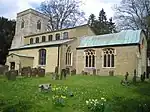
| Church of St Mary | Addington | Church | 14th century | 13 July 1966 | SP7426128492 51°57′00″N 0°55′15″W / 51.949974°N 0.920904°W |
1214530 | 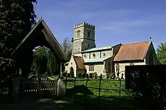 Church of St Mary |
| Church of St James | Aston Abbotts | Church | Late 15th–early 16th century | 18 October 1966 | SP8473920239 51°52′27″N 0°46′14″W / 51.874294°N 0.770512°W |
1116023 | 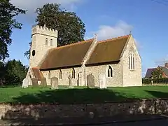 Church of St James |
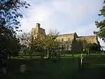
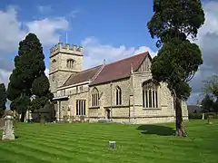
| Church of St Michael and All Angels | Aston Clinton | Church | 13th century | 21 December 1967 | SP8793111948 51°47′57″N 0°43′35″W / 51.799275°N 0.726262°W |
1124228 | 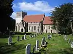 Church of St Michael and All Angels |
| Parish Church of St Michael | Aston Sandford | Church | 13th century | 21 December 1967 | SP7564507876 51°45′52″N 0°54′19″W / 51.764465°N 0.905277°W |
1118340 | 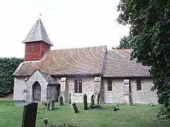 Parish Church of St Michael |
| Ceely House | Aylesbury | House | Early 18th century | 7 April 1952 | SP8177413846 51°49′02″N 0°48′54″W / 51.817269°N 0.81508°W |
1160059 | |
| Greenend House | Aylesbury | House | Late 18th century | 7 April 1952 | SP8176513705 51°48′58″N 0°48′55″W / 51.816003°N 0.815244°W |
1117950 |  Upload Photo |
| Prebendal House School | Aylesbury | Clergy house | 18th century | 7 April 1952 | SP8165913882 51°49′03″N 0°49′00″W / 51.81761°N 0.816739°W |
1117941 | Upload Photo |
| The County Hall, including the former Town Hall, the former County Constabulary Headquarters and the Judge's Lodgings | Aylesbury | County hall | 1722–40 | 7 April 1952 | SP8198613675 51°48′57″N 0°48′43″W / 51.815701°N 0.812045°W |
1117935 | 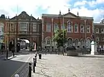 The County Hall, including the former Town Hall, the former County Constabulary Headquarters and the Judge's Lodgings |
| The Derby Arms Public House | Aylesbury | Former public house | 18th century | 7 April 1952 | SP8173313949 51°49′06″N 0°48′56″W / 51.818201°N 0.81565°W |
1319191 | 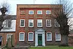 The Derby Arms Public House |
| The Kings Head Hotel | Aylesbury | Public house | 15th–16th century | 7 April 1952 | SP8188413773 51°49′00″N 0°48′49″W / 51.816597°N 0.813502°W |
1160205 | |
| The Museum | Aylesbury | Grammar school | 1719 | 7 April 1952 | SP8176413861 51°49′03″N 0°48′55″W / 51.817406°N 0.815221°W |
1117970 | 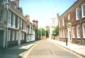 The Museum |
| 26 Temple Street | Aylesbury | House | 17th century | 7 April 1952 | SP8182313763 51°48′59″N 0°48′52″W / 51.816516°N 0.814389°W |
1310418 | 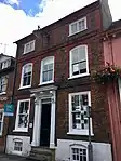 26 Temple Street |
| 28 Temple Street | Aylesbury | House | Early 18th century | 7 April 1952 | SP8181913769 51°49′00″N 0°48′52″W / 51.816571°N 0.814445°W |
1117925 | 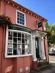 28 Temple Street |
| 1 Church Street | Aylesbury | House | 1739 | 7 April 1952 | SP8180313809 51°49′01″N 0°48′53″W / 51.816933°N 0.814668°W |
1117968 | Upload Photo |
| 10 Church Street | Aylesbury | House | 15th century or 16th century | 7 April 1952 | SP8174313837 51°49′02″N 0°48′56″W / 51.817193°N 0.815532°W |
1160097 | 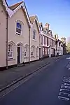 10 Church Street |
| Church of St Mary | Beachampton | Church | 14th century | 13 July 1966 | SP7705337069 52°01′36″N 0°52′42″W / 52.026693°N 0.878365°W |
1288408 | 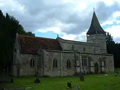 Church of St Mary |
| Hall Farmhouse | Beachampton | Country house | Late 15th century | 25 September 1951 | SP7705237356 52°01′45″N 0°52′42″W / 52.029273°N 0.878315°W |
1214834 | Upload Photo |
| Biddlesden Park House | Biddlesden | Country house | 1731 | 25 September 1951 | SP6324339902 52°03′14″N 1°04′45″W / 52.053904°N 1.079091°W |
1211458 | Upload Photo |
| Church of St Margaret and linking wing to Biddlesden Park House | Biddlesden | Chapel | 1735 | 13 July 1966 | SP6329539862 52°03′13″N 1°04′42″W / 52.053538°N 1.07834°W |
1211493 | Upload Photo |
| Barn at New Manor Farm | Broughton, Bierton with Broughton | Aisled barn | c.1174 | 25 October 1951 | SP8456413728 51°48′57″N 0°46′29″W / 51.815794°N 0.774643°W |
1310584 | Upload Photo |
| Church of St James | Boarstall | Church | 1818 | 21 December 1967 | SP6248214164 51°49′21″N 1°05′41″W / 51.822614°N 1.094855°W |
1124282 | 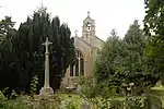 Church of St James |
| Church of All Saints | Brill | Church | 12th century | 21 December 1967 | SP6562813854 51°49′10″N 1°02′57″W / 51.819467°N 1.049275°W |
1124287 | 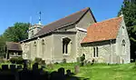 Church of All Saints |
| Flats, the Manor House | Brill | House | Early 17th century | 25 October 1951 | SP6533013718 51°49′06″N 1°03′13″W / 51.81828°N 1.053623°W |
1332781 | Upload Photo |
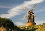
| Brill Windmill | Brill | Windmill | Late 17th century | 25 October 1951 | SP6519814146 51°49′20″N 1°03′20″W / 51.822143°N 1.055458°W |
1124265 | |
| Old Latin School | Buckingham | School | Late 18th century | 13 October 1952 | SP6957234024 52°00′01″N 0°59′17″W / 52.000308°N 0.987998°W |
1201391 | 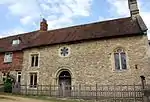 Old Latin School |
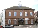
| Old Town Hall | Buckingham | Town hall | 1748 | 13 October 1952 | SP6956933960 51°59′59″N 0°59′17″W / 51.999733°N 0.988055°W |
1282685 | |
| The Manor House, Twisted Chimneys | Buckingham | Clergy house | Early 16th century | 13 October 1952 | SP6942333631 51°59′48″N 0°59′25″W / 51.996794°N 0.990248°W |
1282715 | 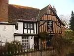 The Manor House, Twisted Chimneys |
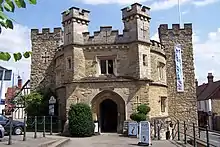
| The Old Gaol | Buckingham | Former gaol | 1748 | 13 October 1952 | SP6967534092 52°00′03″N 0°59′11″W / 52.000906°N 0.986484°W |
1201392 | |
| The Vicarage | Buckingham | Open hall house | c.1445 | 3 April 1973 | SP6943033652 51°59′49″N 0°59′25″W / 51.996982°N 0.990142°W |
1282716 | 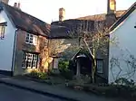 The Vicarage |
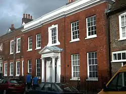
| Trinity House | Buckingham | House | 16th century | 13 October 1952 | SP6943133670 51°59′50″N 0°59′24″W / 51.997143°N 0.990123°W |
1201373 | 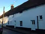 Trinity House |
| Trolly Hall | Buckingham | House | 1670 | 13 October 1952 | SP6953233888 51°59′57″N 0°59′19″W / 51.99909°N 0.988608°W |
1204476 | 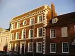 Trolly Hall |
| 29 and 30 West Street | Buckingham | Town house | Early 19th century | 3 April 1973 | SP6954433984 52°00′00″N 0°59′18″W / 51.999952°N 0.988414°W |
1201425 | 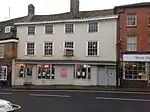 29 and 30 West Street |
| Church of All Saints | Buckland | Church | 13th–19th century | 21 December 1967 | SP8879012446 51°48′13″N 0°42′49″W / 51.803616°N 0.713681°W |
1160591 | 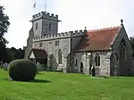 Church of All Saints |
| Parish Church of St Nicholas | Chearsley | Church | 12th century | 21 December 1967 | SP7202510313 51°47′13″N 0°57′26″W / 51.786849°N 0.957218°W |
1118344 | 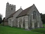 Parish Church of St Nicholas |
| Church of St Giles | Cheddington | Church | 12th century | 18 October 1966 | SP9222118007 51°51′11″N 0°39′45″W / 51.853047°N 0.662456°W |
1310457 | 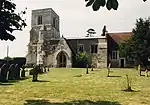 Church of St Giles |
| Chilton House including forecourt walls, gates, railings and pavilions (Clock Tower) | Chilton | House | c.1740 | 25 October 1951 | SP6872911624 51°47′57″N 1°00′17″W / 51.799048°N 1.004734°W |
1118316 | 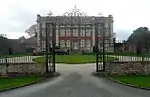 Chilton House including forecourt walls, gates, railings and pavilions (Clock Tower) |
| The Gatehouse | Chilton | House | 1683 | 26 October 1951 | SP6883611558 51°47′54″N 1°00′12″W / 51.798442°N 1.003196°W |
1118320 | 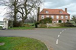 The Gatehouse |
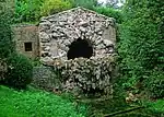
| Chapel at Manor House | Creslow | Chapel | 13th–14th century | 25 October 1951 | SP8110621867 51°53′22″N 0°49′22″W / 51.889468°N 0.822889°W |
1034375 | 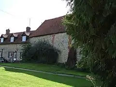 Chapel at Manor House |
| Church of St Nicholas | Cublington | Church | Early 15th century | 18 October 1966 | SP8387622202 51°53′31″N 0°46′57″W / 51.89207°N 0.782568°W |
1320123 | 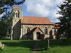 Church of St Nicholas |
| Parish Church of St Nicholas | Cuddington | Church | 13th century | 21 December 1967 | SP7373711209 51°47′41″N 0°55′56″W / 51.794681°N 0.932212°W |
1118334 | 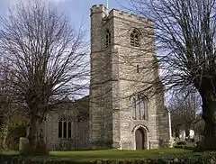 Parish Church of St Nicholas |
| Tyringham Hall | Cuddington | Country house | 16th century | 25 October 1951 | SP7368811228 51°47′41″N 0°55′59″W / 51.794858°N 0.932919°W |
1118328 | 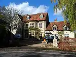 Tyringham Hall |
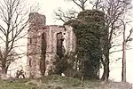
| Dinton Castle | Dinton-with-Ford and Upton | Folly | 1769 | 25 October 1951 | SP7654011548 51°47′50″N 0°53′29″W / 51.797352°N 0.891502°W |
1118308 | |
| Dinton Hall | Dinton, Dinton-with-Ford and Upton | Country house | c.1500 | 25 October 1951 | SP7664111038 51°47′34″N 0°53′25″W / 51.792754°N 0.89015°W |
1158977 | 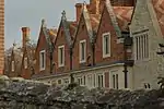 Dinton Hall |
| Waldridge Manor | Meadle, Dinton-with-Ford and Upton | House | 1925 | 25 October 1951 | SP7817507273 51°45′31″N 0°52′08″W / 51.758697°N 0.868759°W |
1118307 | 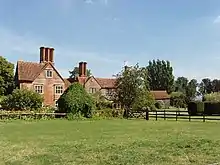 Waldridge Manor |
| Church of St John the Baptist | Dorton | Church | Mid-17th century | 21 December 1967 | SP6788713944 51°49′12″N 1°00′59″W / 51.820007°N 1.016489°W |
1158465 | Mar2006.jpg.webp) Church of St John the Baptist |
| Church of Holy Trinity | Drayton Parslow | Church | 12th century | 19 August 1959 | SP8373228412 51°56′52″N 0°46′59″W / 51.947912°N 0.783152°W |
1289256 | 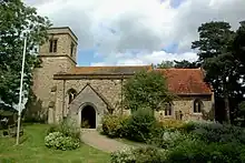 Church of Holy Trinity |
| The Old Rectory | Drayton Parslow | House | 1753 | 19 August 1959 | SP8375828352 51°56′51″N 0°46′58″W / 51.947368°N 0.782788°W |
1289258 | Upload Photo |
| Church of St Martin | Dunton | Church | 12th century | 19 August 1959 | SP8237824372 51°54′42″N 0°48′14″W / 51.911799°N 0.803813°W |
1211972 | 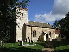 Church of St Martin |
| Botolph House | Botolph Claydon, East Claydon | House | c.1712 | 19 August 1959 | SP7341924828 51°55′02″N 0°56′02″W / 51.917149°N 0.933934°W |
1212143 | Upload Photo |
| Church of St Mary | East Claydon | Church | 14th century | 19 August 1959 | SP7400325534 51°55′24″N 0°55′31″W / 51.923418°N 0.925293°W |
1289625 | 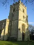 Church of St Mary |
| Church of St Michael | Edgcott | Church | 12th century | 13 July 1966 | SP6800022796 51°53′58″N 1°00′47″W / 51.899569°N 1.013111°W |
1214280 | 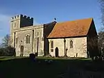 Church of St Michael |
| Barn at Church Farm | Edlesborough | Barn | 15th–16th century | 26 September 1951 | SP9719919265 51°51′49″N 0°35′23″W / 51.86351°N 0.58985°W |
1319209 | 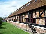 Barn at Church Farm |
| House adjacent to west boundary of Whipsnade Zoo to east of B4506, about 0.25 kilometres to north of Dagnall | Dagnall, Edlesborough | Detached house | 1933–36 | 1 September 1988 | SP9971416887 51°50′30″N 0°33′14″W / 51.841693°N 0.554024°W |
1300803 | Upload Photo |
| Church of St Mary | Fleet Marston | Church | 12th century | 21 December 1967 | SP7796715966 51°50′13″N 0°52′11″W / 51.83687°N 0.869821°W |
1117838 | |
| St Leonard's | Foscott | House | 12th century | 13 July 1966 | SP7168135761 52°00′56″N 0°57′25″W / 52.015654°N 0.95692°W |
1214918 |  St Leonard's |
| Church of Holy Trinity, attached walls and railings | Gawcott, Gawcott with Lenborough | Church | 1827 | 13 October 1952 | SP6799431829 51°58′51″N 1°00′41″W / 51.980772°N 1.011415°W |
1205788 | 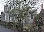 Church of Holy Trinity, attached walls and railings |
| Church of St John the Baptist | Green End, Granborough | Church | 14th century | 19 August 1959 | SP7678025000 51°55′06″N 0°53′06″W / 51.918242°N 0.885038°W |
1212350 | 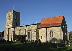 Church of St John the Baptist |
| Church of St Mary | Great Brickhill | Church | Mid-13th century | 18 October 1966 | SP9011430786 51°58′06″N 0°41′23″W / 51.968254°N 0.6897°W |
1115994 | |
| Church of St James | Great Horwood | Church | 14th century | 19 August 1959 | SP7707331206 51°58′26″N 0°52′46″W / 51.973988°N 0.87939°W |
1213275 |  Church of St James |
| Manor Farmhouse | Great Horwood | House | 17th century | 4 June 1952 | SP7729631557 51°58′38″N 0°52′34″W / 51.977112°N 0.876065°W |
1213486 | Upload Photo |
| Church of St Leonard | Grendon Underwood | Church | 15th century | 21 December 1967 | SP6772020985 51°53′00″N 1°01′03″W / 51.883323°N 1.017534°W |
1332808 | 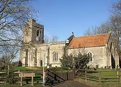 Church of St Leonard |
| Shakespeare Farmhouse | Grendon Underwood | Farmhouse | Late 16th century and 17th century | 25 October 1951 | SP6784620856 51°52′56″N 1°00′57″W / 51.882148°N 1.015729°W |
1124272 | Upload Photo |
| Barn to south west of Manor Farmhouse | Church End, Haddenham | Barn | 15th century | 25 October 1951 | SP7406307892 51°45′53″N 0°55′41″W / 51.76482°N 0.928193°W |
1159107 | Upload Photo |
| Church Farmhouse | Haddenham | Farmhouse | 15th century | 25 October 1951 | SP7419608025 51°45′58″N 0°55′34″W / 51.765998°N 0.926238°W |
1233925 | Upload Photo |
| Grenville Manor | Haddenham | House | 18th century | 25 October 1951 | SP7428008045 51°45′58″N 0°55′30″W / 51.766167°N 0.925016°W |
1118281 | Upload Photo |
| Middle Turn, The Turn, Turn End and retaining walls and pool | Haddenham | House | 1964–67 | 15 July 1998 | SP7395408666 51°46′18″N 0°55′47″W / 51.771792°N 0.929608°W |
1375663 | Upload Photo |
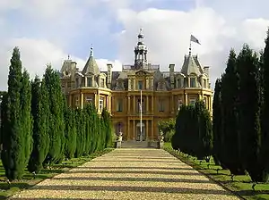
| Halton House | Halton | Country house | 1881–83 | 11 October 1985 | SP8803310108 51°46′58″N 0°43′31″W / 51.78272°N 0.72525°W |
1332843 | |
| Church of St Mary | Hardwick | Church | Late Pre-Conquest | 21 December 1967 | SP8065418982 51°51′49″N 0°49′48″W / 51.8636°N 0.830129°W |
1319256 | 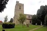 Church of St Mary |
| Hardwick Place | Hardwick | Vicarage | 16th–17th century | 25 October 1951 | SP8048819154 51°51′55″N 0°49′57″W / 51.86517°N 0.832499°W |
1319255 | Upload Photo |
| Church of the Holy Cross | Hoggeston | Church | 12th century | 19 August 1959 | SP8084025027 51°55′04″N 0°49′34″W / 51.917911°N 0.826013°W |
1213255 | 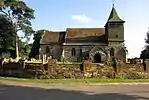 Church of the Holy Cross |
| Manor Farmhouse | Hoggeston | Farmhouse | Early 17th century | 4 June 1952 | SP8083824970 51°55′03″N 0°49′34″W / 51.917399°N 0.826056°W |
1213256 | _and_family_continuity_-_geograph.org.uk_-_891049.jpg.webp) Manor Farmhouse |
| The Old Rectory | Hoggeston | House | 1784 | 19 August 1959 | SP8089125024 51°55′04″N 0°49′31″W / 51.917877°N 0.825272°W |
1213178 | 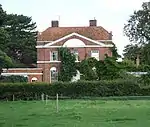 The Old Rectory |
| Church of All Saints | The Green, Hulcott | Church | 14th century | 21 December 1967 | SP8532916684 51°50′32″N 0°45′46″W / 51.842249°N 0.76282°W |
1281503 | 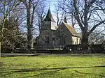 Church of All Saints |
| New Manor House | Little Ickford, Ickford | House | 1675 | 25 October 1951 | SP6529707147 51°45′33″N 1°03′19″W / 51.759212°N 1.055336°W |
1319080 | Upload Photo |
| 12 and 14 Station Road | Ivinghoe | House | Later 13th to early 14th century | 15 October 1984 | SP9446716225 51°50′12″N 0°37′49″W / 51.836654°N 0.630343°W |
1352692 | Upload Photo |
| Church of St Nicholas | Little Horwood | Church | Early 13th century | 19 August 1959 | SP7904630845 51°58′14″N 0°51′03″W / 51.970466°N 0.850756°W |
1213693 | 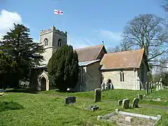 Church of St Nicholas |
| Barn at Notley Farm | Long Crendon | Barn | Medieval | 19 June 1981 | SP7134609232 51°46′38″N 0°58′02″W / 51.777218°N 0.967282°W |
1289035 |  Barn at Notley Farm |
| Long Crendon Courthouse | Church End, Long Crendon | Courthouse | 15th century | 25 October 1951 | SP6978309063 51°46′33″N 0°59′24″W / 51.775896°N 0.989967°W |
1214040 | |
| Warwick Farmhouse | Long Crendon | Farmhouse | 18th century and 19th century | 19 June 1981 | SP6918908844 51°46′26″N 0°59′55″W / 51.774001°N 0.998618°W |
1213243 | Upload Photo |
| Church of St Mary | Marsh Gibbon | Church | 13th century | 13 July 1966 | SP6476123228 51°54′14″N 1°03′36″W / 51.903838°N 1.060097°W |
1214446 | 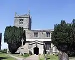 Church of St Mary |
| Manor House | Marsh Gibbon | House | 17th century | 25 September 1951 | SP6473823170 51°54′12″N 1°03′38″W / 51.903319°N 1.060443°W |
1214444 | Upload Photo |
| Church of All Saints | Marsworth | Church | Late 12th century | 18 October 1966 | SP9199114603 51°49′21″N 0°40′00″W / 51.822488°N 0.666698°W |
1161002 |  Church of All Saints |
| Church of Saint Mary | Mentmore | Church | Early 13th century | 18 October 1966 | SP9038519776 51°52′09″N 0°41′19″W / 51.869247°N 0.688643°W |
1319266 | 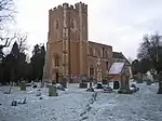 Church of Saint Mary |
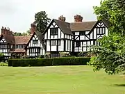
| Manor House | Mentmore | House | Mid-18th century | 18 October 1966 | SP9068819656 51°52′05″N 0°41′03″W / 51.86812°N 0.684275°W |
1161133 | Upload Photo |
| Church of St Mary | Mursley | Church | 14th century | 19 August 1959 | SP8171128554 51°56′58″N 0°48′45″W / 51.949488°N 0.812515°W |
1288706 | 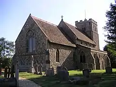 Church of St Mary |
| Salden House Farmhouse | Salden, Mursley | House | Late 16th century | 4 June 1952 | SP8245629767 51°57′37″N 0°48′05″W / 51.960282°N 0.801388°W |
1214311 | Upload Photo |
| Manor Farmhouse | Nether Winchendon | Farmhouse | 16th century | 25 October 1985 | SP7320912246 51°48′15″N 0°56′23″W / 51.804072°N 0.939648°W |
1159881 | Upload Photo |
| Church of St Mary | Oakley | Church | 12th century | 21 December 1967 | SP6419412285 51°48′20″N 1°04′13″W / 51.805529°N 1.070367°W |
1158749 | 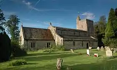 Church of St Mary |
| Church of All Saints | Oving | Church | Early 13th century | 21 December 1967 | SP7824621373 51°53′08″N 0°51′52″W / 51.885435°N 0.864549°W |
1117846 | 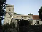 Church of All Saints |
| Oving House | The Village, Oving | Country house | 17th century | 25 October 1951 | SP7828421206 51°53′02″N 0°51′51″W / 51.883929°N 0.864035°W |
1117811 |  Oving House |
| Church of St Mary the Virgin | Padbury | Church | 13th century | 13 July 1966 | SP7214130921 51°58′20″N 0°57′04″W / 51.972087°N 0.951236°W |
1231852 | 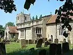 Church of St Mary the Virgin |
| Church of St. Giles | Pitchcott | Church, now house | 12th century | 21 December 1967 | SP7753320419 51°52′37″N 0°52′30″W / 51.876959°N 0.875121°W |
1117813 | 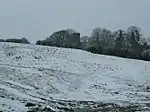 Church of St. Giles |
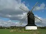
| Pitstone Windmill | Pitstone | Post mill | 1627 | 26 September 1951 | SP9451015677 51°49′54″N 0°37′48″W / 51.831721°N 0.629868°W |
1310208 | |
| Church of St John the Baptist | Preston Bissett | Church | 12th century | 13 July 1966 | SP6578129903 51°57′49″N 1°02′38″W / 51.963724°N 1.044°W |
1214823 |  Church of St John the Baptist |
| Brudenell House | Quainton | House | 16th century | 25 October 1951 | SP7492720208 51°52′32″N 0°54′47″W / 51.875418°N 0.913015°W |
1158483 | Upload Photo |
| Cross Farmhouse | Quainton | Farmhouse | 1723 | 25 October 1951 | SP7464620171 51°52′30″N 0°55′02″W / 51.875123°N 0.917104°W |
1319249 | 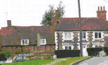 Cross Farmhouse |
| Denham Lodge | Denham, Quainton | House | Mid–Late 17th century | 25 October 1951 | SP7538320530 51°52′42″N 0°54′23″W / 51.878251°N 0.906322°W |
1158606 | .jpg.webp) Denham Lodge |
| Doddershall House | Doddershall, Quainton | House | 1689 | 25 October 1951 | SP7201920143 51°52′31″N 0°57′19″W / 51.875216°N 0.955263°W |
1117820 |  Doddershall House |
| Gatehouse at Denham Lodge | Denham, Quainton | Gatehouse | 16th–17th century | 21 December 1967 | SP7537020504 51°52′41″N 0°54′23″W / 51.878019°N 0.906517°W |
1117819 | Upload Photo |
| Market Cross | Quainton | Cross | 15th century | 21 December 1967 | SP7465720151 51°52′30″N 0°55′01″W / 51.874942°N 0.916949°W |
1117825 |  Market Cross |
| Numbers 40 to 54 and flanking outbuildings | Quainton | Almshouses | 1687 | 25 October 1951 | SP7494320170 51°52′30″N 0°54′46″W / 51.875074°N 0.912791°W |
1311462 |  Numbers 40 to 54 and flanking outbuildings |
| Townsend Farmhouse | Quainton | House | c.1730s | 25 October 1951 | SP7420920194 51°52′31″N 0°55′24″W / 51.875388°N 0.923446°W |
1319273 | Upload Photo |
| Radclive Manor | Radclive, Radclive-cum-Chackmore | Manor house | 16th century | 25 September 1951 | SP6753833871 51°59′57″N 1°01′04″W / 51.999183°N 1.017652°W |
1211601 |  Radclive Manor |
| Parish Church of St Mary Magdalene | Shabbington | Church | c.1100 | 21 December 1967 | SP6666206745 51°45′20″N 1°02′08″W / 51.755437°N 1.035639°W |
1332552 | May2006.jpg.webp) Parish Church of St Mary Magdalene |
| Church of St Edward | Shalstone | Church | 1828 | 13 July 1966 | SP6414036435 52°01′21″N 1°04′00″W / 52.022635°N 1.06666°W |
1289865 |  Church of St Edward |
| Church of the Holy Cross | Slapton | Church | Late 13th–early 14th century | 18 October 1966 | SP9371520690 51°52′37″N 0°38′24″W / 51.876914°N 0.640044°W |
1117831 | 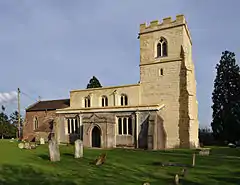 Church of the Holy Cross |
| Church of All Saints | Soulbury | Church | 1770 | 18 October 1966 | SP8821227028 51°56′05″N 0°43′06″W / 51.93478°N 0.718342°W |
1320152 | 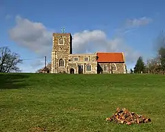 Church of All Saints |
| Liscombe House and wall with pavilion to south of west wing | Liscombe Park, Soulbury | Country house | Mid-17th century | 26 September 1951 | SP8859525734 51°55′23″N 0°42′47″W / 51.923088°N 0.713105°W |
1219372 | Upload Photo |
| Lovett House and wall attached to rear | Soulbury | House | 1724 | 26 September 1951 | SP8828427108 51°56′08″N 0°43′02″W / 51.935488°N 0.717274°W |
1219292 |  Lovett House and wall attached to rear |
| Church of St Michael | Steeple Claydon | Church | 14th century | 13 July 1966 | SP7052126743 51°56′05″N 0°58′32″W / 51.934737°N 0.97567°W |
1214937 | 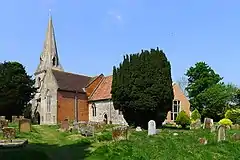 Church of St Michael |
| Church of St Luke | Stoke Hammond | Church | 14th century | 18 October 1966 | SP8794029772 51°57′34″N 0°43′18″W / 51.959487°N 0.721596°W |
1115981 | 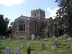 Church of St Luke |
| Church of St John the Baptist | Stone, Stone with Bishopstone and Hartwell | Church | Norman | 21 December 1967 | SP7841012247 51°48′12″N 0°51′51″W / 51.803377°N 0.864233°W |
1118457 | 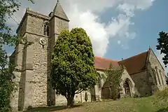 Church of St John the Baptist |
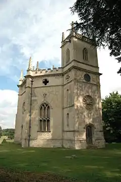
| Church of St Mary | Hartwell, Stone with Bishopstone and Hartwell | Former church | 1753–55 | 21 December 1967 | SP7948612464 51°48′19″N 0°50′55″W / 51.805176°N 0.848582°W |
1160658 | |
| Pavilion (the Cot) south-east of Hartwell House | Hartwell, Stone with Bishopstone and Hartwell | House | c.1730 | 25 October 1951 | SP7976212316 51°48′14″N 0°50′41″W / 51.803806°N 0.844614°W |
1160723 | Upload Photo |
| Stable block and coachhouse south-west of Hartwell House | Hartwell, Stone with Bishopstone and Hartwell | House | 18th century | 29 October 1951 | SP7951912390 51°48′16″N 0°50′53″W / 51.804506°N 0.84812°W |
1332845 | Upload Photo |
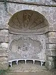
| Statue of Frederick, Prince of Wales, south-west of Hartwell House | Hartwell, Stone with Bishopstone and Hartwell | Statue | 1757 | 29 October 1951 | SP7957812342 51°48′15″N 0°50′50″W / 51.804066°N 0.847276°W |
1118472 | Upload Photo |
| New Inn Farmhouse with outbuildings behind | Stowe | Farmhouse | 1717–19 | 21 April 1983 | SP6817636435 52°01′20″N 1°00′28″W / 52.022154°N 1.00785°W |
1211787 | 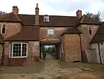 New Inn Farmhouse with outbuildings behind |
| Church of St Mary | Stowe Gardens, Stowe | Church | 14th century | 13 July 1966 | SP6761337352 52°01′50″N 1°00′57″W / 52.030466°N 1.015873°W |
1211870 | |
| The Grotto | Stowe Gardens, Stowe | Grotto | c.1740 | 21 April 1983 | SP6764737501 52°01′54″N 1°00′55″W / 52.031801°N 1.015348°W |
1211941 | |
| The Pebble Alcove | Stowe Gardens, Stowe | Pavilion | c.1737 | 21 April 1983 | SP6787037016 52°01′39″N 1°00′44″W / 52.027414°N 1.012194°W |
1211948 | |
| Church of St Swithun | Swanbourne | Church | 13th century | 19 August 1959 | SP8010527287 51°56′18″N 0°50′10″W / 51.938332°N 0.836172°W |
1214161 | 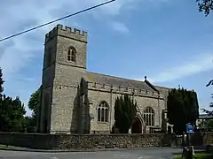 Church of St Swithun |
| Church of St Mary | Thornborough | Church | 11th–12th century | 13 July 1966 | SP7431633658 51°59′47″N 0°55′08″W / 51.996404°N 0.918987°W |
1232681 | 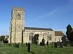 Church of St Mary |
| Church of St Mary Magdalen | Tingewick | Church | Norman arcade | 13 July 1966 | SP6579633043 51°59′31″N 1°02′35″W / 51.991949°N 1.04318°W |
1212274 |  Church of St Mary Magdalen |
| Church of St Mary | Turweston | Church | Norman | 13 July 1966 | SP6003637730 52°02′05″N 1°07′34″W / 52.034735°N 1.126236°W |
1289451 | 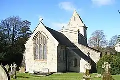 Church of St Mary |
| Turweston House | Turweston | Country house | Early 18th century | 31 October 1973 | SP6000337758 52°02′06″N 1°07′36″W / 52.03499°N 1.126712°W |
1212658 | Upload Photo |
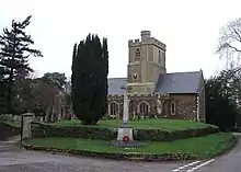
| Church of St Michael | Waddesdon | Church | Late 12th century | 21 December 1967 | SP7402316977 51°50′47″N 0°55′37″W / 51.846494°N 0.926835°W |
1117800 | |
| Manor Farmhouse | Weedon | Farmhouse | Early 17th century | 25 October 1951 | SP8140018330 51°51′27″N 0°49′10″W / 51.857631°N 0.819451°W |
1124301 | Upload Photo |
| Bank Farmhouse | Wendover | Farmhouse | 15th century | 25 October 1951 | SP8705507918 51°45′47″N 0°44′24″W / 51.763187°N 0.739972°W |
1204284 | 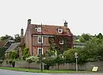 Bank Farmhouse |
| Lychgate and churchyard wall to St Mary's Church | Wendover | Lych gate | 1871 | 11 October 1985 | SP8710407359 51°45′29″N 0°44′22″W / 51.758155°N 0.739402°W |
1232487 | 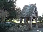 Lychgate and churchyard wall to St Mary's Church |
| Parish Church of St Mary | Wendover | Church | 14th century | 21 December 1967 | SP8713307331 51°45′28″N 0°44′20″W / 51.757898°N 0.738989°W |
1118398 | 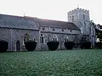 Parish Church of St Mary |
| The Hale | Wendover | House | Before c.1435 | 25 October 1951 | SP8926807344 51°45′28″N 0°42′29″W / 51.75768°N 0.708061°W |
1118403 | Upload Photo |
| The Red House | Wendover | House | Early 18th century | 25 October 1951 | SP8694307981 51°45′50″N 0°44′30″W / 51.763771°N 0.741578°W |
1118430 | 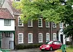 The Red House |
| Church of St Augustine | Westbury | Church | 13th century | 13 July 1966 | SP6224135612 52°00′56″N 1°05′40″W / 52.015452°N 1.094481°W |
1212959 | 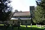 Church of St Augustine |
| A–B Test-stands and support structures, former Royal Ordnance Establishment, Westcott | Westcott | Workshop | 1947 | 23 May 2013 | SP7136316472 51°50′32″N 0°57′56″W / 51.8423°N 0.965547°W |
1403959 | Upload Photo |
| C–D Test-stands and support structures, former Royal Ordnance Establishment, Westcott | Westcott | Workshop | 1947 | 23 May 2013 | SP7110016607 51°50′37″N 0°58′10″W / 51.843547°N 0.969336°W |
1403962 | Upload Photo |
| Church of St Mary | Westcott | Church | 1867 | 26 February 1985 | SP7167417141 51°50′54″N 0°57′39″W / 51.848274°N 0.960895°W |
1332800 | Mar2006.jpg.webp) Church of St Mary |
| K2 Test Stand, Former Royal Ordnance Establishment, Westcott | Westcott | Control room | 1957–60 | 23 May 2013 | SP7047016944 51°50′48″N 0°58′42″W / 51.846656°N 0.978411°W |
1403971 | 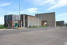 K2 Test Stand, Former Royal Ordnance Establishment, Westcott |
| Manor Farmhouse | Weston Turville | Farmhouse | Late 15th century | 25 October 1951 | SP8533210700 51°47′18″N 0°45′51″W / 51.788459°N 0.764249°W |
1281120 | Upload Photo |
| Manor House | Weston Turville | House | Early 18th century | 25 October 1951 | SP8588410405 51°47′09″N 0°45′23″W / 51.785723°N 0.756321°W |
1332909 | Upload Photo |
| Church of St John | Whitchurch | Church | Late 13th–mid-14th century | 21 December 1967 | SP8027820871 51°52′50″N 0°50′07″W / 51.880634°N 0.835149°W |
1124307 | 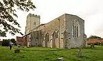 Church of St John |
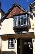
| Priory Hotel | Whitchurch | Mid-16th century | 25 October 1951 | SP8019220822 51°52′49″N 0°50′11″W / 51.880206°N 0.83641°W |
1159973 | 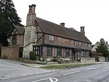 Priory Hotel | |
| The Old House and attached garden walls | Whitchurch | House | 17th century | 25 October 1951 | SP8017020888 51°52′51″N 0°50′12″W / 51.880803°N 0.836714°W |
1332786 | 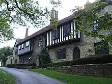 The Old House and attached garden walls |
| Ascott House | Ascott, Wing | Country house | 1874 | 26 September 1951 | SP8914522680 51°53′44″N 0°42′21″W / 51.895549°N 0.705899°W |
1291467 | |
| Church of St Peter and St Paul | Wingrave, Wingrave with Rowsham | Church | Late 12th century | 18 October 1966 | SP8691419059 51°51′48″N 0°44′21″W / 51.863353°N 0.739223°W |
1115952 | 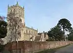 Church of St Peter and St Paul |
| Church of St Laurence | Winslow | Church | 14th century | 19 August 1959 | SP7693227653 51°56′31″N 0°52′56″W / 51.942069°N 0.882236°W |
1287430 | |
| Keach's Meeting House and graveyard walls | Winslow | Baptist chapel | 17th century | 19 August 1959 | SP7695227483 51°56′26″N 0°52′55″W / 51.940539°N 0.881983°W |
1227954 | 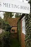 Keach's Meeting House and graveyard walls |
| Church of St Peter and St Paul | Worminghall | Church | 14th century | 21 December 1967 | SP6425208031 51°46′02″N 1°04′13″W / 51.767279°N 1.070312°W |
1158914 | 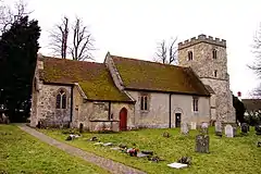 Church of St Peter and St Paul |
| The Almshouses | Worminghall | Almshouse | 1675 | 25 October 1951 | SP6411908428 51°46′15″N 1°04′20″W / 51.770863°N 1.072166°W |
1124253 | 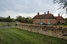 The Almshouses |
| Church of All Saints | Wotton Underwood | Church | 14th century | 21 December 1967 | SP6883715942 51°50′16″N 1°00′08″W / 51.837852°N 1.002312°W |
1124216 | 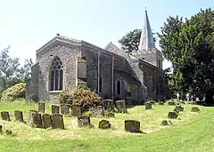 Church of All Saints |

Aug2005.jpg.webp)
Notes
- ↑ The date given is the date used by Historic England as significant for the initial building or that of an important part in the structure's description.
- ↑ Sometimes known as OSGB36, the grid reference is based on the British national grid reference system used by the Ordnance Survey.
- ↑ The "List Entry Number" is a unique number assigned to each listed building and scheduled monument by Historic England.
External links
This article is issued from Wikipedia. The text is licensed under Creative Commons - Attribution - Sharealike. Additional terms may apply for the media files.