This is a list of properties and districts in Clarke County, Georgia that are listed on the National Register of Historic Places (NRHP).
This National Park Service list is complete through NPS recent listings posted January 12, 2024.[1]

Current listings
| [2] | Name on the Register | Image | Date listed[3] | Location | City or town | Description |
|---|---|---|---|---|---|---|
| 1 | Athens Factory |  Athens Factory |
July 31, 1980 (#80000989) |
Baldwin and Williams Sts. 33°57′10″N 83°22′10″W / 33.952778°N 83.369444°W |
Athens | |
| 2 | Athens Manufacturing Company | 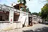 Athens Manufacturing Company |
December 31, 2002 (#02001634) |
585 While Circle 33°54′20″N 83°21′28″W / 33.905556°N 83.357778°W |
Athens | |
| 3 | Athens Warehouse Historic District | 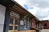 Athens Warehouse Historic District |
October 20, 1988 (#88002021) |
Roughly bounded by Hancock and Thomas Sts., and the RR tracks 33°57′32″N 83°22′17″W / 33.958889°N 83.371389°W |
Athens | |
| 4 | Bishop House | 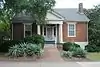 Bishop House |
March 16, 1972 (#72000375) |
Jackson St., University of Georgia campus 33°57′21″N 83°22′23″W / 33.955833°N 83.373056°W |
Athens | |
| 5 | Bloomfield Street Historic District | 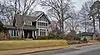 Bloomfield Street Historic District |
April 18, 1985 (#85000850) |
Roughly bounded by Bloomfield and Peabody Sts., U of G campus, Rutherford St and Milledge Ave. 33°56′44″N 83°23′06″W / 33.945556°N 83.385°W |
Athens | |
| 6 | Boulevard Historic District |  Boulevard Historic District |
April 18, 1985 (#85000851) |
Roughly bounded by the Seaboard Coastline RR tracks, Pulaski St., Prince Ave., and Hiawassee St. 33°57′54″N 83°23′23″W / 33.965°N 83.389722°W |
Athens | |
| 7 | Brightwell Shotgun Row |  Brightwell Shotgun Row |
June 14, 2001 (#01000642) |
366-376 Barber St. 33°57′59″N 83°23′08″W / 33.966389°N 83.385556°W |
Athens | |
| 8 | Buena Vista Heights Historic District |  Buena Vista Heights Historic District |
August 27, 1999 (#99001029) |
Roughly bounded by Park Ave., Prince Ave., Pound St., and Nantahala Extension 33°57′58″N 83°24′06″W / 33.966111°N 83.401667°W |
Athens | |
| 9 | Camak House | .jpg.webp) Camak House |
July 7, 1975 (#75000576) |
279 Meigs St. 33°57′34″N 83°23′00″W / 33.95937°N 83.383324°W |
Athens | |
| 10 | Carnegie Library Building |  Carnegie Library Building |
November 11, 1975 (#75000577) |
1401 Prince Ave. 33°57′50″N 83°24′16″W / 33.963889°N 83.404444°W |
Athens | |
| 11 | Albon Chase House |  Albon Chase House |
August 19, 1974 (#74002255) |
185 N. Hull St. 33°57′27″N 83°22′45″W / 33.9575°N 83.379167°W |
Athens | |
| 12 | Chestnut Grove School | 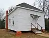 Chestnut Grove School |
June 28, 1984 (#84003873) |
610 Epps Bridge Rd. 33°55′59″N 83°26′18″W / 33.933056°N 83.438333°W |
Athens | |
| 13 | Chi Omega House | Chi Omega House |
July 11, 2019 (#100003491) |
324 S. Milledge Ave. 33°57′09″N 83°23′16″W / 33.95237°N 83.38791°W |
Athens | |
| 14 | Church-Waddel-Brumby House |  Church-Waddel-Brumby House |
February 20, 1975 (#75000578) |
280 E. Dougherty St. 33°57′43″N 83°22′33″W / 33.961944°N 83.375833°W |
Athens | |
| 15 | Clarke County Jail |  Clarke County Jail |
May 29, 1980 (#80000990) |
Courthouse Sq. 33°57′34″N 83°23′06″W / 33.959444°N 83.385°W |
Athens | |
| 16 | T. R. R. Cobb House | .jpg.webp) T. R. R. Cobb House |
June 30, 1975 (#75000579) |
194 Prince Ave. 33°57′40″N 83°22′54″W / 33.961111°N 83.381667°W |
Athens | De-listed in 1985, but re-listed on July 23, 2013[4] |
| 17 | Cobb-Treanor House |  Cobb-Treanor House |
May 8, 1979 (#79000705) |
1234 S. Lumpkin St. 33°56′42″N 83°22′46″W / 33.945°N 83.379444°W |
Athens | |
| 18 | Cobbham Historic District |  Cobbham Historic District |
August 24, 1978 (#78000973) |
Roughly bounded by Prince Ave., Hill, Reese, and Pope Sts. 33°57′32″N 83°23′31″W / 33.958889°N 83.391944°W |
Athens | |
| 19 | Coca-Cola Bottling Plant-Athens |  Coca-Cola Bottling Plant-Athens |
February 1, 2006 (#05001594) |
297 Prince Ave. 33°57′35″N 83°23′00″W / 33.959722°N 83.383333°W |
Athens | |
| 20 | Ross Crane House | 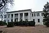 Ross Crane House |
June 18, 1979 (#79000706) |
247 Pulaski St. 33°57′30″N 83°22′51″W / 33.958333°N 83.380833°W |
Athens | |
| 21 | Dearing Street Historic District | _197_Dearing_Street_1859.JPG.webp) Dearing Street Historic District |
September 5, 1975 (#75000580) |
Roughly bounded by Broad and Baxter Sts., Milledge Ave., and includes both sides of Finley St. and Henderson Ave. 33°57′11″N 83°23′07″W / 33.953056°N 83.385278°W |
Athens | includes the Tree That Owns Itself |
| 22 | Albin P. Dearing House | .jpg.webp) Albin P. Dearing House |
May 8, 1979 (#79000707) |
338 S. Milledge Ave. 33°57′07″N 83°23′16″W / 33.95196°N 83.38785°W |
Athens | Now Kappa Alpha Theata house |
| 23 | Downtown Athens Historic District | 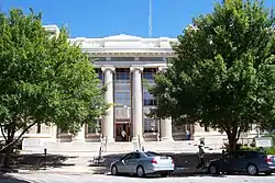 Downtown Athens Historic District |
August 10, 1978 (#78000974) |
Roughly bounded by Hancock Ave., Foundry, Mitchell 33°57′30″N 83°22′25″W / 33.958333°N 83.373611°W |
Athens | There was a boundary increase on May 31, 1984 (refnum 84000965), and a boundary increase and decrease on August 18, 2006 (refnum 06000737) |
| 24 | First African Methodist Episcopal Church | 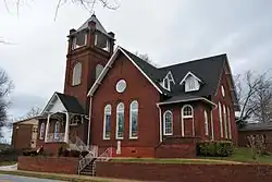 First African Methodist Episcopal Church |
March 10, 1980 (#80000991) |
521 N. Hull St. 33°57′39″N 83°22′46″W / 33.960833°N 83.379444°W |
Athens | |
| 25 | Franklin House | _1936_Historic_American_Buildings_Survey.jpg.webp) Franklin House |
December 11, 1974 (#74000667) |
464-480 E. Broad St. 33°57′28″N 83°22′35″W / 33.957778°N 83.376389°W |
Athens | |
| 26 | Garden Club of Georgia Museum-Headquarters House, Founder's Memorial Garden |  Garden Club of Georgia Museum-Headquarters House, Founder's Memorial Garden |
April 26, 1972 (#72000376) |
Lumpkin St., University of Georgia campus 33°57′15″N 83°22′33″W / 33.954167°N 83.375833°W |
Athens | |
| 27 | Gospel Pilgrim Cemetery | 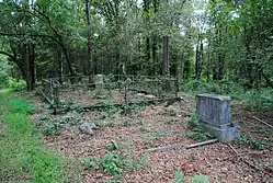 Gospel Pilgrim Cemetery |
April 19, 2006 (#06000285) |
530 Fourth St. 33°58′09″N 83°21′41″W / 33.969167°N 83.361389°W |
Athens | |
| 28 | Henry W. Grady House | .jpg.webp) Henry W. Grady House |
May 11, 1976 (#76000613) |
634 Prince Ave. 33°57′42″N 83°23′18″W / 33.96167°N 83.38827°W |
Athens | National Historic Landmark |
| 29 | Dr. James S. Hamilton House | .JPG.webp) Dr. James S. Hamilton House |
April 24, 1979 (#79000708) |
150 S. Milledge Ave. 33°57′16″N 83°23′19″W / 33.954444°N 83.388611°W |
Athens | |
| 30 | Jackson Street Cemetery | 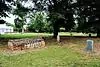 Jackson Street Cemetery |
October 2, 2009 (#09000779) |
S. Jackson St., University of Georgia campus 33°57′21″N 83°22′25″W / 33.955833°N 83.373611°W |
Athens | |
| 31 | Lucy Cobb Institute Campus | 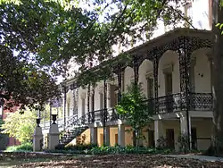 Lucy Cobb Institute Campus |
March 16, 1972 (#72000377) |
200 N. Milledge Ave., University of Georgia campus 33°57′22″N 83°23′23″W / 33.956111°N 83.389722°W |
Athens | |
| 32 | Gov. Wilson Lumpkin House |  Gov. Wilson Lumpkin House |
March 16, 1972 (#72000378) |
Cedar St., University of Georgia campus 33°56′51″N 83°22′26″W / 33.9475°N 83.373889°W |
Athens | |
| 33 | Joseph Henry Lumpkin House | .jpg.webp) Joseph Henry Lumpkin House |
June 27, 1975 (#75000581) |
248 Prince Ave. 33°57′38″N 83°22′57″W / 33.960556°N 83.3825°W |
Athens | |
| 34 | Milledge Avenue Historic District | 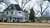 Milledge Avenue Historic District |
April 18, 1985 (#85000852) |
Milledge Ave. from Broad St. to Five Points 33°56′52″N 83°23′16″W / 33.947778°N 83.387778°W |
Athens | Boundary increase (listed September 24, 2009): 295 W. Rutherford St. |
| 35 | Milledge Circle Historic District | .JPG.webp) Milledge Circle Historic District |
April 18, 1985 (#85000859) |
Milledge Park, Lumpkin St., Milledge Circle and Milledge Ave. 33°56′15″N 83°23′22″W / 33.9375°N 83.389444°W |
Athens | |
| 36 | Morton Building |  Morton Building |
October 22, 1979 (#79000709) |
199 W. Washington St. 33°57′31″N 83°22′43″W / 33.958611°N 83.378611°W |
Athens | |
| 37 | Newton House | 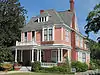 Newton House |
July 11, 2002 (#02000759) |
892 Prince Ave. 33°57′43″N 83°23′34″W / 33.961944°N 83.392778°W |
Athens | |
| 38 | Oconee Hill Cemetery | 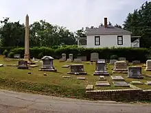 Oconee Hill Cemetery |
May 22, 2013 (#13000291) |
297 Cemetery St. 33°57′04″N 83°22′06″W / 33.951067°N 83.368335°W |
Athens | |
| 39 | Oconee Street School | December 31, 2018 (#100003284) |
594 Oconee St. 33°57′09″N 83°21′59″W / 33.952453°N 83.366365°W |
Athens | ||
| 40 | Oglethorpe Avenue Historic District | 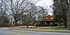 Oglethorpe Avenue Historic District |
November 5, 1987 (#87001360) |
Oglethorpe Ave. 33°57′58″N 83°24′15″W / 33.966111°N 83.404167°W |
Athens | |
| 41 | Old North Campus, University of Georgia | 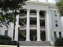 Old North Campus, University of Georgia |
March 16, 1972 (#72000379) |
Bounded by Broad, Lumpkin, and Jackson Sts. 33°58′01″N 83°22′30″W / 33.966944°N 83.375°W |
Athens | |
| 42 | Hubert Bond Owens House | .JPG.webp) Hubert Bond Owens House |
May 14, 2008 (#08000442) |
215 W. Rutherford St. 33°56′34″N 83°23′10″W / 33.9427°N 83.386°W |
Athens | |
| 43 | Calvin W. Parr House | .JPG.webp) Calvin W. Parr House |
September 9, 1982 (#82002394) |
227 Bloomfield St. 33°56′53″N 83°23′09″W / 33.948056°N 83.385833°W |
Athens | |
| 44 | Parrott Insurance Building | 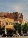 Parrott Insurance Building |
October 7, 1977 (#77000416) |
283 E. Broad St. 33°57′28″N 83°22′30″W / 33.957778°N 83.375°W |
Athens | |
| 45 | President's House | 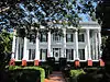 President's House |
March 16, 1972 (#72000380) |
570 Prince Ave. 33°57′41″N 83°23′11″W / 33.961389°N 83.386389°W |
Athens | |
| 46 | Reese Street Historic District | 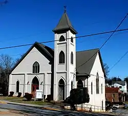 Reese Street Historic District |
November 10, 1987 (#87001990) |
Roughly bounded by Meigs, Finley, Broad, & Harris Sts. 33°57′26″N 83°23′06″W / 33.957222°N 83.385°W |
Athens | Includes the Hill First Baptist Church. |
| 47 | Rocksprings Shotgun Row Historic District | .JPG.webp) Rocksprings Shotgun Row Historic District |
August 23, 1996 (#96000875) |
433-447 Rocksprings St. 33°56′50″N 83°23′29″W / 33.947222°N 83.391389°W |
Athens | |
| 48 | James A. Sledge House | .jpg.webp) James A. Sledge House |
February 12, 1974 (#74000668) |
749 Cobb St. 33°57′37″N 83°23′49″W / 33.960278°N 83.396944°W |
Athens | |
| 49 | R. P. Sorrells House | 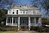 R. P. Sorrells House |
January 22, 1992 (#91002003) |
220 Prince Ave. 33°57′38″N 83°22′56″W / 33.960556°N 83.382222°W |
Athens | |
| 50 | Thomas-Carithers House | 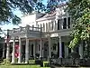 Thomas-Carithers House |
May 8, 1979 (#79000710) |
530 S. Milledge Ave. 33°56′56″N 83°23′16″W / 33.948889°N 83.387778°W |
Athens | |
| 51 | Upson House | 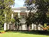 Upson House |
November 15, 1973 (#73000616) |
1022 Prince Ave. 33°57′14″N 83°23′40″W / 33.953889°N 83.394444°W |
Athens | |
| 52 | United States Post Office and Courthouse | 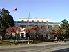 United States Post Office and Courthouse |
September 10, 2014 (#14000554) |
115 E. Hancock St. 33°57′36″N 83°22′38″W / 33.9599°N 83.3773°W |
Athens | |
| 53 | Ware-Lyndon House | 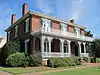 Ware-Lyndon House |
March 15, 1976 (#76000614) |
293 Hoyt St. 33°57′50″N 83°22′35″W / 33.963889°N 83.376389°W |
Athens | |
| 54 | West Cloverhurst Avenue Historic District | 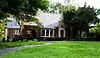 West Cloverhurst Avenue Historic District |
September 27, 2007 (#07001000) |
W. Cloverhurst Ave. vet. Springdale St. and S. Milledge Ave. 33°56′39″N 83°23′30″W / 33.944261°N 83.391631°W |
Athens | |
| 55 | West Hancock Avenue Historic District |  West Hancock Avenue Historic District |
March 30, 1988 (#88000227) |
Roughly bounded by Hill, Franklin, Broad Sts. and the Plaza 33°57′20″N 83°23′38″W / 33.955556°N 83.393889°W |
Athens | |
| 56 | White Hall | .JPG.webp) White Hall |
June 18, 1979 (#79000711) |
Whitehall and Simonton Bridge Rds. 33°53′48″N 83°21′50″W / 33.896667°N 83.363889°W |
Whitehall | |
| 57 | Wilkins House |  Wilkins House |
May 19, 1970 (#70000202) |
387 S. Milledge Ave. 33°57′04″N 83°23′12″W / 33.951111°N 83.386667°W |
Athens | |
| 58 | Winterville Historic District |  Winterville Historic District |
October 11, 2001 (#01000742) |
Roughly center on Main St. and on the abandoned Georgia RR line within the city limits of Winterville 33°58′03″N 83°16′40″W / 33.9675°N 83.277778°W |
Winterville | |
| 59 | Woodlawn Historic District |  Woodlawn Historic District |
October 23, 1987 (#87001390) |
Woodlawn Ave. 33°56′31″N 83°22′53″W / 33.941944°N 83.381389°W |
Athens | |
| 60 | Young Women's Christian Association Complex |  Young Women's Christian Association Complex |
May 12, 1987 (#87000696) |
345-347 W. Hancock St. 33°57′31″N 83°22′51″W / 33.958611°N 83.380833°W |
Athens |
References
- ↑ National Park Service, United States Department of the Interior, "National Register of Historic Places: Weekly List Actions", retrieved January 12, 2024.
- ↑ Numbers represent an alphabetical ordering by significant words. Various colorings, defined here, differentiate National Historic Landmarks and historic districts from other NRHP buildings, structures, sites or objects.
- ↑ The eight-digit number below each date is the number assigned to each location in the National Register Information System database, which can be viewed by clicking the number.
- ↑ "Cobb, T. R. R., House". National Register of Historic Places Program. National Park Service. Retrieved August 26, 2013.
Wikimedia Commons has media related to National Register of Historic Places in Clarke County, Georgia.
| Topics | |
|---|---|
| Lists by state |
|
| Lists by insular areas | |
| Lists by associated state | |
| Other areas | |
| Related | |
This article is issued from Wikipedia. The text is licensed under Creative Commons - Attribution - Sharealike. Additional terms may apply for the media files.