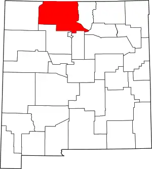
Location of Rio Arriba County in New Mexico
This is a list of the National Register of Historic Places listings in Rio Arriba County, New Mexico.
This is intended to be a complete list of the properties and districts on the National Register of Historic Places in Rio Arriba County, New Mexico, United States. Latitude and longitude coordinates are provided for many National Register properties and districts; these locations may be seen together in a map.[1]
There are 116 properties and districts listed on the National Register in the county, including 3 National Historic Landmarks. One former site on the Register is located within the county.
This National Park Service list is complete through NPS recent listings posted January 12, 2024.[2]
| Bernalillo – Catron – Chaves – Cibola – Colfax – Curry – De Baca – Doña Ana – Eddy – Grant – Guadalupe – Harding – Hidalgo – Lea – Lincoln – Los Alamos – Luna – McKinley – Mora – Otero – Quay – Rio Arriba – Roosevelt – San Juan – San Miguel – Sandoval – Santa Fe – Sierra – Socorro – Taos – Torrance – Union – Valencia |
Current listings
| [3] | Name on the Register[4] | Image | Date listed[5] | Location | City or town | Description |
|---|---|---|---|---|---|---|
| 1 | Abiquiu Mesa Grid Gardens | December 7, 1982 (#82001051) |
Address Restricted |
Abiquiú | State Register of Cultural Properties (SRCP) | |
| 2 | Adams Canyon Site (LA 55824) | January 21, 1987 (#86003631) |
Address Restricted |
Tierra Amarilla | SRCP | |
| 3 | Adolfo Canyon Site (LA 5665) | 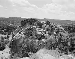 Adolfo Canyon Site (LA 5665) |
January 21, 1987 (#86003605) |
Address Restricted |
Tierra Amarilla | SRCP |
| 4 | Martin Apodaca Homestead | July 17, 2017 (#100001324) |
Address Restricted |
Counselor | ||
| 5 | Archeological Site No. AR-03-10-02-357 | May 14, 1989 (#89000345) |
Address Restricted |
Llaves | ||
| 6 | George Becker House | April 4, 1985 (#85000777) |
East of La Puente Rd. and south of Hatchery Rd. 36°43′13″N 106°34′48″W / 36.720278°N 106.58°W |
Los Ojos | SRCP | |
| 7 | Blanton Log House | April 4, 1985 (#85000778) |
East of La Puente Rd. and south of Hatchery Rd. 36°43′11″N 106°34′51″W / 36.719722°N 106.580833°W |
Los Ojos | SRCP | |
| 8 | Frank Bond House | 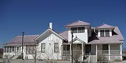 Frank Bond House |
March 6, 1980 (#80002564) |
Bond St. 35°59′28″N 106°04′57″W / 35.991111°N 106.0825°W |
Espanola | SRCP |
| 9 | Boulder Fortress (LA 55828) | January 21, 1987 (#86003630) |
Address Restricted |
Tierra Amarilla | SRCP | |
| 10 | Burns Lake Bungalow | April 4, 1985 (#85000780) |
½ mile south of the eastern end of Hatchery Rd. 36°42′52″N 106°34′55″W / 36.714444°N 106.581944°W |
Los Ojos | SRCP | |
| 11 | Cabresto Mesa Tower Complex (LA 2138) | January 21, 1987 (#86003611) |
Address Restricted |
Tierra Amarilla | SRCP | |
| 12 | Cagle's Site (LA 55826) | January 21, 1987 (#86003629) |
Address Restricted |
Tierra Amarilla | SRCP | |
| 13 | Canyon View Ruin (LA 55827) | January 21, 1987 (#86003628) |
Address Restricted |
Tierra Amarilla | SRCP | |
| 14 | Casa Mesa Diablo (LA 11100) | January 21, 1987 (#86003641) |
Address Restricted |
Tierra Amarilla | SRCP | |
| 15 | Casados House | April 4, 1985 (#85000825) |
Off the junction of U.S. Route 84 and State Road 95 36°44′20″N 106°34′10″W / 36.738889°N 106.569444°W |
Los Ojos | SRCP | |
| 16 | Castles of the Chama (AR-03-10-01-216) | May 14, 1989 (#89000344) |
Address Restricted |
Llaves | SRCP | |
| 17 | E.D. Chimayo Trading Post and Trujillo House | 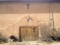 E.D. Chimayo Trading Post and Trujillo House |
May 13, 1999 (#99000500) |
110 Sandia Dr. 35°59′28″N 106°04′04″W / 35.991111°N 106.067778°W |
Espanola | SRCP |
| 18 | The Citadel (LA 55828) | January 21, 1987 (#86003627) |
Address Restricted |
Tierra Amarilla | SRCP | |
| 19 | Compressor Station Ruin (LA 5658) | January 21, 1987 (#86003592) |
Address Restricted |
Tierra Amarilla | SRCP | |
| 20 | Corral Canyon Pueblo Site | November 7, 1990 (#90001581) |
Address Restricted |
Espanola | ||
| 21 | Corral Mesa Cavate Pueblo Site | November 7, 1990 (#90001584) |
Address Restricted |
Espanola | ||
| 22 | Crevice Ruin (LA 13218) | January 21, 1987 (#86003639) |
Address Restricted |
Tierra Amarilla | SRCP | |
| 23 | Crow Canyon Archaeological District | 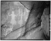 Crow Canyon Archaeological District |
July 15, 1974 (#74001200) |
Address Restricted |
Farmington | SRCP; extends into San Juan County |
| 24 | Crow Canyon Site (LA 20219) | 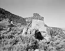 Crow Canyon Site (LA 20219) |
January 21, 1987 (#86003638) |
Address Restricted |
Tierra Amarilla | SRCP |
| 25 | Delgadito Pueblito (LA 5649) | January 21, 1987 (#86003590) |
Address Restricted |
Tierra Amarilla | SRCP | |
| 26 | Denver & Rio Grande Railroad San Juan Extension |  Denver & Rio Grande Railroad San Juan Extension |
February 16, 1973 (#73000462) |
Between Antonito, Colorado and Chama, New Mexico via Cumbres Pass 36°51′56″N 106°23′56″W / 36.865556°N 106.398889°W |
Chama | SRCP |
| 27 | Dogie Canyon School | July 17, 2017 (#100001325) |
Address Restricted |
Counselor | ||
| 28 | El Barranco Community Ditch | September 29, 1986 (#86002296) |
Extending from the Chama River at Chama Division to Upper Brazos Ditch 36°46′35″N 106°33′51″W / 36.776389°N 106.564167°W |
Los Brazos | SRCP | |
| 29 | El Buen Pastor Cemetery | July 17, 2017 (#100001326) |
Address Restricted |
Counselor | ||
| 30 | El Porvenir Community Ditch | September 29, 1986 (#86002300) |
Extending from 4.5 miles east of Encenada to 0.5 miles north of Encenada 36°43′57″N 106°30′36″W / 36.7325°N 106.51°W |
Encenada | SRCP | |
| 31 | Embudo Historic District | 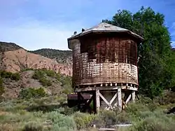 Embudo Historic District |
March 12, 1979 (#79001547) |
State Road 68 36°12′25″N 105°57′41″W / 36.206944°N 105.961389°W |
Embudo | SRCP |
| 32 | Encenada Community Ditch | September 29, 1986 (#86002303) |
Extending from 4.5 miles east of Encenada to 0.3 miles west of U.S. Route 85, 0.5 miles northeast of State Fish Hatchery 36°43′29″N 106°31′49″W / 36.724722°N 106.530278°W |
Encenada | SRCP | |
| 33 | Foothold Ruin (LA 9073) | 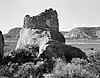 Foothold Ruin (LA 9073) |
January 21, 1987 (#86003602) |
Address Restricted |
Tierra Amarilla | SRCP |
| 34 | Forest Service Site No. AR-03-10-01-374 | December 20, 1993 (#93001421) |
Address Restricted |
Coyote | ||
| 35 | Forest Service Site No. AR-03-10-01-390 | December 20, 1993 (#93001424) |
Address Restricted |
Coyote | ||
| 36 | Foster Hotel | 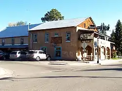 Foster Hotel |
February 13, 1986 (#86000225) |
4th and Terrace 36°54′15″N 106°34′42″W / 36.904167°N 106.578333°W |
Chama | SRCP |
| 37 | Frances Canyon Ruin | 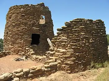 Frances Canyon Ruin |
September 4, 1970 (#70000404) |
Address Restricted 36°45′54″N 107°29′53″W / 36.764873°N 107.497937°W |
Blanco | SRCP |
| 38 | Garcia Canyon Pueblito (LA 36608) | January 21, 1987 (#86003636) |
Address Restricted |
Tierra Amarilla | SRCP | |
| 39 | Gomez Canyon Ruin (LA 55831) | 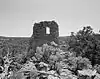 Gomez Canyon Ruin (LA 55831) |
January 21, 1987 (#86003626) |
Address Restricted |
Tierra Amarilla | SRCP |
| 40 | Gomez Point Site (LA 58832) | January 21, 1987 (#86003625) |
Address Restricted |
Tierra Amarilla | SRCP | |
| 41 | Tomas Gonzales House | March 14, 1996 (#96000258) |
County Road 155, 2 miles east of its junction with U.S. Route 84 36°13′18″N 106°18′16″W / 36.221667°N 106.304444°W |
Abiquiú | SRCP | |
| 42 | Gould Pass Ruin (LA 5659) | 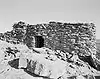 Gould Pass Ruin (LA 5659) |
January 21, 1987 (#86003594) |
Address Restricted |
Tierra Amarilla | SRCP |
| 43 | Haynes Trading Post Site | April 9, 2018 (#100002301) |
Address Restricted |
Counselor | ||
| 44 | Hill Road Ruin (LA 55833) | 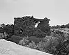 Hill Road Ruin (LA 55833) |
January 21, 1987 (#86003624) |
Address Restricted |
Tierra Amarilla | SRCP |
| 45 | Hooded Fireplace Ruin (LA 5662) | 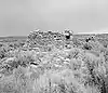 Hooded Fireplace Ruin (LA 5662) |
January 21, 1987 (#86003607) |
Address Restricted |
Tierra Amarilla | SRCP |
| 46 | Hupobi-ouinge | January 18, 1985 (#85000111) |
Address Restricted |
Ojo Caliente | SRCP | |
| 47 | Ramon Jaramillo House and Barn | September 29, 1986 (#86002309) |
Encenada Rd. 36°44′01″N 106°31′58″W / 36.733611°N 106.532778°W |
Encenada | SRCP | |
| 48 | Jicarilla Apache Historic District | March 1, 1984 (#84002956) |
Main St., State Road 17, Apache, Keliiaa, and Sand Hill Drs. 36°56′02″N 107°00′01″W / 36.933889°N 107.000278°W |
Dulce | A residential historic district including 30 houses. SRCP. | |
| 49 | Kin Naa daa (Maize House) (LA 1872) | 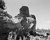 Kin Naa daa (Maize House) (LA 1872) |
January 21, 1987 (#86003612) |
Address Restricted |
Tierra Amarilla | SRCP |
| 50 | Ku-ouinge | August 5, 1993 (#93000674) |
Address Restricted |
Espanola | SRCP | |
| 51 | La Puente Community Ditch | September 29, 1986 (#86002294) |
Extending from Parkview discharge point to 0.7 miles southwest of La Puente on the Chama River 36°42′06″N 106°35′52″W / 36.701667°N 106.597778°W |
La Puente | SRCP | |
| 52 | La Puente Historic District | April 4, 1985 (#85000826) |
Roughly bounded by Main Rd. in La Puente from drop-off of 2nd to 1st plateau east to the church on the west 36°42′01″N 106°36′03″W / 36.700278°N 106.600833°W |
Los Ojos | SRCP | |
| 53 | Largo School Ruin (LA 5657) | 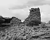 Largo School Ruin (LA 5657) |
January 21, 1987 (#86003621) |
Address Restricted |
Tierra Amarilla | SRCP |
| 54 | Leaf Water Pueblo (LA 300) | December 1, 1983 (#83004155) |
Address Restricted |
Hernandez | SRCP | |
| 55 | Los Brazos Historic District | April 4, 1985 (#85000827) |
Roughly bounded by U.S. Route 84, North Rd., fence line and drop-off to Rio Brazos 36°45′06″N 106°33′38″W / 36.751667°N 106.560556°W |
Los Ojos | SRCP | |
| 56 | Los Luceros Hacienda | .tif.jpg.webp) Los Luceros Hacienda |
October 20, 1983 (#83004157) |
Off State Road 389 36°07′06″N 106°02′22″W / 36.118333°N 106.039444°W |
Los Luceros | SRCP |
| 57 | Los Ojos (Parkview) Fish Hatchery | April 4, 1985 (#85000779) |
Eastern end of Hatchery Rd. 36°43′10″N 106°34′24″W / 36.719444°N 106.573333°W |
Los Ojos | SRCP | |
| 58 | Los Ojos (Parkview) Historic District | April 4, 1985 (#85000828) |
Roughly bounded by the U.S. Route 84 junction with the old highway, drop-off from the first plateau to the Chama River valley and E.-W. Hatchery Rd. 36°43′49″N 106°34′14″W / 36.730278°N 106.570556°W |
Los Ojos | SRCP | |
| 59 | Tony Manzanares House | April 4, 1985 (#85000829) |
East of Los Ojos Rd. and north of La Puente Church 36°42′25″N 106°35′50″W / 36.706944°N 106.597222°W |
Los Ojos | SRCP | |
| 60 | Gilbert Martinez Barn | April 4, 1985 (#85000781) |
East of La Puente Rd and south of Hatchery Rd. 36°43′17″N 106°34′44″W / 36.721389°N 106.578889°W |
Los Ojos | SRCP | |
| 61 | Margarita Martinez Homestead | July 17, 2017 (#100001328) |
Address Restricted |
Counselor | ||
| 62 | Teodoro Martinez House | April 4, 1985 (#85000782) |
East of La Puente Rd and north of Hatchery Rd. 36°43′22″N 106°34′42″W / 36.7228°N 106.5783°W |
Los Ojos | SRCP | |
| 63 | Mesa Prieta Petroglyphs | September 24, 1998 (#98001159) |
Address Restricted |
Velarde | SRCP | |
| 64 | Luciano Miera Store–Homestead | July 17, 2017 (#100001329) |
Address Restricted |
Counselor | ||
| 65 | Nogales Cliff House (AR-03-10-02-124) | May 14, 1989 (#89000346) |
Address Restricted |
Llaves | SRCP | |
| 66 | Georgia O'Keeffe Ghost Ranch House | December 14, 2020 (#100005933) |
US-84, 280 Private Dr. 1708, House 115 northwest of the Ghost Ranch Education and Retreat Center 36°19′56″N 106°28′14″W / 36.3322°N 106.4705°W |
Abiquiú vicinity | ||
| 67 | Georgia O'Keeffe Home and Studio | 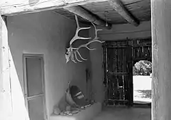 Georgia O'Keeffe Home and Studio |
August 5, 1998 (#98001197) |
County Road 164, House No. 13 36°12′29″N 106°19′01″W / 36.2081°N 106.3169°W |
Abiquiú | SRCP |
| 68 | Old Fort (LA 1869) | January 21, 1987 (#86003614) |
Address Restricted |
Tierra Amarilla | SRCP | |
| 69 | Victor Ortega Cabin | January 28, 1988 (#87002456) |
Carson National Forest 36°34′05″N 106°21′02″W / 36.5681°N 106.3506°W |
Cebolla | SRCP | |
| 70 | Our Lady of Lourdes Grotto | March 27, 1987 (#86002318) |
Old Highway 36°43′34″N 106°33′57″W / 36.7261°N 106.5658°W |
Los Ojos | SRCP | |
| 71 | Overlook Site (LA 10732) | January 21, 1987 (#86003601) |
Address Restricted |
Tierra Amarilla | SRCP | |
| 72 | Parkview Community Ditch | September 29, 1986 (#86002305) |
Extending from 4.5 miles east of Encenada to 1 mile southwest of the State Fish Hatchery 36°43′53″N 106°32′04″W / 36.7314°N 106.5344°W |
Los Ojos | SRCP | |
| 73 | Plaza Blanca Community Ditch | September 29, 1986 (#86002298) |
Extending from 2 miles west-southwest of the State Fish Hatchery to 1 mile south-southwest of Plaza Blanca 36°42′19″N 106°36′20″W / 36.7053°N 106.6056°W |
Plaza Blanca | SRCP | |
| 74 | Plaza Blanca Historic District | September 29, 1986 (#86002322) |
Roughly Plaza Blanca and Old Puente Ford Rds. adjacent to Plaza Blanca Ditch 36°42′15″N 106°36′32″W / 36.7042°N 106.6089°W |
Plaza Blanca | SRCP | |
| 75 | Pointed Butte Ruin (LA 10733) | 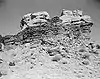 Pointed Butte Ruin (LA 10733) |
January 21, 1987 (#86003600) |
Address Restricted |
Tierra Amarilla | SRCP |
| 76 | Ponsipa'Akeri | August 5, 1993 (#93000673) |
Address Restricted |
Ojo Caliente | SRCP | |
| 77 | Pork Chop Pass Site (LA 5661) | January 21, 1987 (#86003597) |
Address Restricted |
Tierra Amarilla | SRCP | |
| 78 | Posi-ouinge | 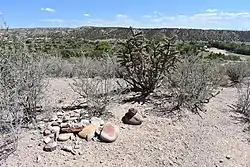 Posi-ouinge |
August 5, 1993 (#93000675) |
On a bluff southwest of Ojo Caliente[6] 36°17′58″N 106°03′22″W / 36.2994°N 106.0561°W |
Ojo Caliente | SRCP; extends into Taos County |
| 79 | Pueblito Canyon Ruin (LA 1684) | January 21, 1987 (#86003615) |
Address Restricted |
Tierra Amarilla | SRCP | |
| 80 | Pueblito East Ruin (LA 55834) | January 21, 1987 (#86003623) |
Address Restricted |
Tierra Amarilla | SRCP | |
| 81 | Puye Ruins | 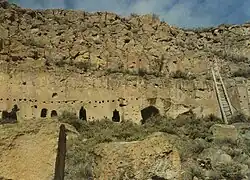 Puye Ruins |
October 15, 1966 (#66000481) |
Santa Clara Pueblo 5°58′32″N 106°13′39″W / 5.9756°N 106.2275°W |
Espanola | Extends into Sandoval County |
| 82 | Rattlesnake Ridge Site | October 27, 1992 (#92001405) |
Address Restricted 36°29′01″N 106°49′23″W / 36.483611°N 106.823056°W |
Llaves | ||
| 83 | Ridge Top House (LA 6287) | January 21, 1987 (#86003603) |
Address Restricted |
Tierra Amarilla | SRCP | |
| 84 | Rincon Largo Ruin (LA 2436 and LA 2435) | January 21, 1987 (#86003589) |
Address Restricted |
Tierra Amarilla | SRCP | |
| 85 | Rincon Rockshelter (LA 55835) | January 21, 1987 (#86003622) |
Address Restricted |
Tierra Amarilla | SRCP | |
| 86 | Rio Grande Bridge at San Juan Pueblo | 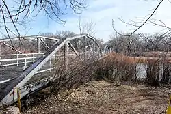 Rio Grande Bridge at San Juan Pueblo |
August 14, 1997 (#97000738) |
Old alignment of State Road 74 over the Rio Grande 36°03′22″N 106°04′57″W / 36.056241°N 106.082516°W |
Alcalde | Parker truss bridge |
| 87 | Romine Canyon Ruin (LA 55836) | January 21, 1987 (#86003620) |
Address Restricted |
Tierra Amarilla | SRCP | |
| 88 | Romine Ranch Site (LA 55837) | January 21, 1987 (#86003619) |
Address Restricted |
Tierra Amarilla | SRCP | |
| 89 | San Antonio de Padua del Quemado Chapel | November 2, 1978 (#78001821) |
Off State Road 76 36°00′27″N 105°51′35″W / 36.0075°N 105.859722°W |
Cordova | SRCP | |
| 90 | San Gabriel de Yungue-Ouinge | .jpg.webp) San Gabriel de Yungue-Ouinge |
October 15, 1966 (#66000482) |
Near the confluence of the Rio Chama and Rio Grande 36°03′02″N 106°03′37″W / 36.050459°N 106.060210°W |
Ohkay Owingeh | Archaeological site of first Spanish New Mexico capital; historical marker nearby |
| 91 | San Joaquin Church | September 29, 1986 (#86002310) |
State Road 162 36°43′34″N 106°32′01″W / 36.726111°N 106.533611°W |
Encenada | SRCP | |
| 92 | San Juan Pueblo |  San Juan Pueblo |
July 30, 1974 (#74001201) |
North of Santa Fe 36°03′15″N 106°04′13″W / 36.054167°N 106.070278°W |
Ohkay Owingeh Pueblo | SRCP |
| 93 | Samuel Sanchez Barns | September 29, 1986 (#86002317) |
Off U.S. Route 64 36°45′55″N 106°33′35″W / 36.765278°N 106.559722°W |
Los Brazos | SRCP | |
| 94 | Samuel Sanchez House |  Samuel Sanchez House |
September 29, 1986 (#86002315) |
Off U.S. Route 64 36°45′59″N 106°33′34″W / 36.766273°N 106.559414°W |
Los Brazos | SRCP |
| 95 | Sanchez-March House | 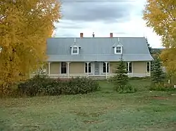 Sanchez-March House |
April 4, 1985 (#85000830) |
West of U.S. Route 84 and north of State Road 95 36°44′23″N 106°34′09″W / 36.739722°N 106.569167°W |
Los Ojos | SRCP |
| 96 | Santa Clara Pueblo |  Santa Clara Pueblo |
November 5, 1974 (#74001199) |
South of Espanola off State Road 30 35°58′05″N 106°05′19″W / 35.968056°N 106.088611°W |
Santa Clara Pueblo | SRCP |
| 97 | Santa Rosa de Lima de Abiquiu | 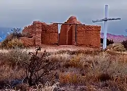 Santa Rosa de Lima de Abiquiu |
April 14, 1978 (#78001820) |
Address Restricted |
Abiquiú | SRCP |
| 98 | Shaft House (LA 5660) | 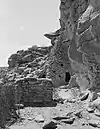 Shaft House (LA 5660) |
January 21, 1987 (#86003595) |
Address Restricted |
Tierra Amarilla | SRCP |
| 99 | Split Rock Ruin (LA 5664) | 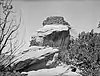 Split Rock Ruin (LA 5664) |
January 21, 1987 (#86003606) |
Address Restricted |
Tierra Amarilla | SRCP |
| 100 | Tapicito Ruin (LA 2298) | 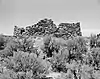 Tapicito Ruin (LA 2298) |
January 21, 1987 (#86003610) |
Address Restricted |
Tierra Amarilla | SRCP |
| 101 | Three Corn Ruin (LA 1871) | January 21, 1987 (#86003613) |
Address Restricted |
Tierra Amarilla | ||
| 102 | Tierra Amarilla AFS P-8 Historic District |  Tierra Amarilla AFS P-8 Historic District |
February 26, 2001 (#00000342) |
9.0 miles southeast of Tierra Amarilla on State Road 112 36°37′25″N 106°39′44″W / 36.623611°N 106.662222°W |
Tierra Amarilla | SRCP |
| 103 | Tierra Amarilla Community Ditch | September 29, 1986 (#86002307) |
Extending from 2 miles east-southeast of Tierra Amarilla to 0.2 miles north of La Corridera Rd. 36°41′36″N 106°33′05″W / 36.693333°N 106.551389°W |
Tierra Amarilla | SRCP | |
| 104 | Tierra Amarilla Historic District | September 29, 1986 (#86002327) |
Roughly along La Puente Rd. on both sides of U.S. Route 84 and along Old Highway and Creek Rd. 36°42′01″N 106°33′24″W / 36.700278°N 106.556667°W |
Tierra Amarilla | SRCP | |
| 105 | Tower of the Standing God (LA 55839) | January 21, 1987 (#86003618) |
Address Restricted |
Tierra Amarilla | SRCP | |
| 106 | Truby's Tower (LA 2434) | January 21, 1987 (#86003608) |
Address Restricted |
Tierra Amarilla | SRCP | |
| 107 | Manuelita Trujillo House | April 4, 1985 (#85000831) |
Off U.S. Route 84 south of the Los Brazos River 36°44′46″N 106°34′04″W / 36.746111°N 106.567778°W |
Los Ojos | SRCP | |
| 108 | Fernando Trujillo Sr. House | April 4, 1985 (#85000832) |
West of U.S. Route 84 and north of State Road 95 36°44′32″N 106°34′09″W / 36.742222°N 106.569167°W |
Los Ojos | SRCP | |
| 109 | Tsama Pueblo |  Tsama Pueblo |
November 17, 1983 (#83004158) |
Address Restricted |
Abiquiú | SRCP |
| 110 | Tsiping | September 4, 1970 (#70000405) |
Address Restricted |
Canones | SRCP | |
| 111 | Unreachable Rockshelter (LA 55841) | January 21, 1987 (#86003616) |
Address Restricted |
Tierra Amarilla | SRCP | |
| 112 | Miguel Valdez Barn | September 29, 1986 (#86002314) |
San Joaquin Church Loop Rd. 36°43′31″N 106°31′45″W / 36.725278°N 106.529167°W |
Encenada | SRCP | |
| 113 | Vicenti Site | May 14, 1979 (#79001546) |
Address Restricted |
Dulce | SRCP | |
| 114 | Senon S. Vigil Homestead | July 17, 2017 (#100001331) |
Address Restricted |
Counselor | ||
| 115 | The Wall (LA 55840) | January 21, 1987 (#86003617) |
Address Restricted |
Tierra Amarilla | SRCP | |
| 116 | Whitaker Dinosaur Quarry | October 19, 2018 (#100003030) |
1708 U.S. Route 84 36°19′51″N 106°28′21″W / 36.3309°N 106.4726°W |
Abiquiu | Apparently on the Ghost Ranch. |
Former listing
| [3] | Name on the Register | Image | Date listed | Date removed | Location | City or town | Description |
|---|---|---|---|---|---|---|---|
| 1 | Officer's House | April 4, 1985 (#85003624) | E of La Puente Rd. |
Los Ojos | Former SRCP |
See also
Wikimedia Commons has media related to National Register of Historic Places in Rio Arriba County, New Mexico.
References
- ↑ The latitude and longitude information provided in this table was derived originally from the National Register Information System, which has been found to be fairly accurate for about 99% of listings. Some locations in this table may have been corrected to current GPS standards.
- ↑ National Park Service, United States Department of the Interior, "National Register of Historic Places: Weekly List Actions", retrieved January 12, 2024.
- 1 2 Numbers represent an alphabetical ordering by significant words. Various colorings, defined here, differentiate National Historic Landmarks and historic districts from other NRHP buildings, structures, sites or objects.
- ↑ "National Register Information System". National Register of Historic Places. National Park Service. July 9, 2010.
- ↑ The eight-digit number below each date is the number assigned to each location in the National Register Information System database, which can be viewed by clicking the number.
- ↑ Location derived from this Bureau of Land Management webpage; the NRIS lists the site as "Address Restricted"
Municipalities and communities of Rio Arriba County, New Mexico, United States | ||
|---|---|---|
| City | Map of New Mexico highlighting Rio Arriba County | |
| Village | ||
| CDPs |
| |
| Other communities | ||
| Ghost towns and former settlements | ||
| Indian reservations | ||
| Footnotes | ‡This populated place also has portions in an adjacent county or counties | |
| Topics | |
|---|---|
| Lists by state |
|
| Lists by insular areas | |
| Lists by associated state | |
| Other areas | |
| Related | |
This article is issued from Wikipedia. The text is licensed under Creative Commons - Attribution - Sharealike. Additional terms may apply for the media files.