There are over 9,000 Grade I listed buildings in England. This page is a list of these buildings in the district of South Kesteven in Lincolnshire.
South Kesteven
.jpg.webp)

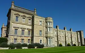
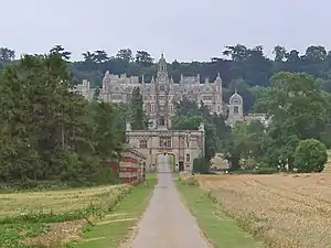
_Belton_House_-_geograph.org.uk_-_967020.jpg.webp)


.jpg.webp)


.png.webp)


.jpg.webp)
.jpg.webp)


.jpg.webp)


.jpg.webp)

.jpg.webp)


.jpg.webp)


.jpg.webp)


.jpg.webp)


References
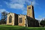
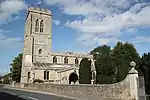
- ↑ Historic England. "Church of St James, Aslackby (Grade I) (1062757)". National Heritage List for England. Retrieved 30 August 2013.
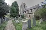
- ↑ Historic England. "St. Guthlac's Church, Little Ponton (325757)". Research records (formerly PastScape). Retrieved 1 September 2013.
- ↑ Historic England. "DMV at Casewick (347796)". Research records (formerly PastScape). Retrieved 1 September 2013.
Notes
- ↑ The date given is the date used by Historic England as significant for the initial building or that of an important part in the structure's description.
- ↑ Sometimes known as OSGB36, the grid reference is based on the British national grid reference system used by the Ordnance Survey.
- ↑ The "List Entry Number" is a unique number assigned to each listed building and scheduled monument by Historic England.
External links
This article is issued from Wikipedia. The text is licensed under Creative Commons - Attribution - Sharealike. Additional terms may apply for the media files.