
Merseyside shown in England
There are over 9,000 Grade I listed buildings in England. This page is a list of these buildings in the county of Merseyside.
Knowsley
| Name | Location | Type | Completed [note 1] | Date designated | Grid ref.[note 2] Geo-coordinates |
Entry number [note 3] | Image |
|---|---|---|---|---|---|---|---|
| Church of St Mary | Prescot, Knowsley | Church | 14th century | 19 March 1951 | SJ4653192704 53°25′42″N 2°48′22″W / 53.4284°N 2.80617°W |
1199139 |

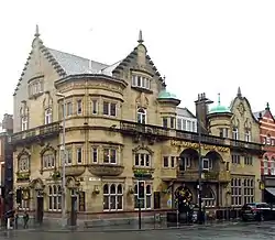
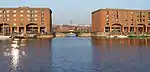
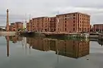
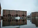
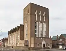
Liverpool
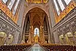
.jpg.webp)


.JPG.webp)


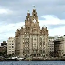

.jpg.webp)
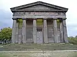


.JPG.webp)

Sefton
| Name | Location | Type | Completed [note 1] | Date designated | Grid ref.[note 2] Geo-coordinates |
Entry number [note 3] | Image |
|---|---|---|---|---|---|---|---|
| Church of St Helen | Sefton, Sefton | Church | Early 14th century | 11 October 1968 | SD3568301295 53°30′16″N 2°58′16″W / 53.504395°N 2.971169°W |
1075852 | |
| Church of St Monica | Bootle | Church | 1936 | 19 March 1981 | SJ3503495685 53°27′14″N 2°58′47″W / 53.453897°N 2.9797901°W |
1283647 |

St. Helens
| Name | Location | Type | Completed [note 1] | Date designated | Grid ref.[note 2] Geo-coordinates |
Entry number [note 3] | Image |
|---|---|---|---|---|---|---|---|
| Sankey Viaduct over Sankey Brook (that Part in St Helens District) | St Helens | Railway Viaduct | 1830 | 3 February 1966 | SJ5688294719 53°26′51″N 2°39′02″W / 53.44746°N 2.650677°W |
1075927 | 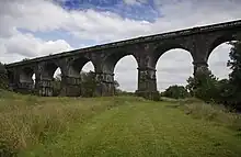 Sankey Viaduct over Sankey Brook (that Part in St Helens District) |
Wirral
| Name | Location | Type | Completed [note 1] | Date designated | Grid ref.[note 2] Geo-coordinates |
Entry number [note 3] | Image |
|---|---|---|---|---|---|---|---|
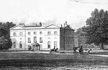
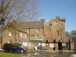
| Brimstage Hall and Tower | Brimstage, Wirral | House | c. 1398 | 27 December 1962 | SJ3042482699 53°20′12″N 3°02′47″W / 53.336602°N 3.046332°W |
1183702 | |
| Church of St. Andrew | Lower Bebington, Wirral | Church | 12th century | 27 December 1962 | SJ3330183908 53°20′52″N 3°00′12″W / 53.347838°N 3.003389°W |
1075462 | |
| Numbers 1 to 18 (consecutive), Hamilton Square - with Railings to Front | Birkenhead, Wirral | Model Dwelling | c. 1825 | 29 July 1950 | SJ3258789088 53°23′39″N 3°00′55″W / 53.394301°N 3.015219°W |
1201580 | 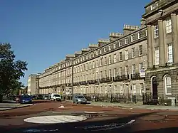 Numbers 1 to 18 (consecutive), Hamilton Square - with Railings to Front |
| Numbers 19 to 34 (consecutive), Hamilton Square - with Railings to Front | Birkenhead, Wirral | Model Dwelling | 1839-44 | 29 July 1950 | SJ3245089045 53°23′38″N 3°01′02″W / 53.393897°N 3.01727°W |
1292180 | .jpg.webp) Numbers 19 to 34 (consecutive), Hamilton Square - with Railings to Front |
| Numbers 35 to 51 (consecutive), Hamilton Square - with Railings to Front | Birkenhead, Wirral | Model Dwelling | 1839-44 | 29 July 1950 | SJ3250088927 53°23′34″N 3°00′59″W / 53.392843°N 3.016493°W |
1292148 | 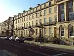 Numbers 35 to 51 (consecutive), Hamilton Square - with Railings to Front |
| Numbers 52 to 57 (consecutive), Hamilton Square - with Railings to Front | Birkenhead, Wirral | Model Dwelling | c. 1844 | 29 July 1950 | SJ3260488927 53°23′34″N 3°00′54″W / 53.392856°N 3.014929°W |
1282616 |  Numbers 52 to 57 (consecutive), Hamilton Square - with Railings to Front |
| Numbers 58 to 63 (consecutive), Hamilton Square - with Railings to Front, Flanking Wall and Gatepiers to East | Birkenhead, Wirral | Model Dwelling | c. 1825 | 29 July 1950 | SJ3268189036 53°23′38″N 3°00′50″W / 53.393846°N 3.013795°W |
1218048 | .jpg.webp) Numbers 58 to 63 (consecutive), Hamilton Square - with Railings to Front, Flanking Wall and Gatepiers to East |
| Remains of Birkenhead Priory | Birkenhead, Wirral | Church | 1150-1400 | 29 July 1950 | SJ3280788542 53°23′22″N 3°00′42″W / 53.389422°N 3.011795°W |
1201757 | |
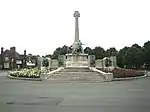
| Port Sunlight War Memorial | Port Sunlight, Wirral | War memorial | 1919-21 | 28 October 2014 | SJ3367484480 53°21′11″N 2°59′52″W / 53.35303°N 2.99791°W |
1343491 |


See also
Notes
- 1 2 3 4 5 The date given is the date used by Historic England as significant for the initial building or that of an important part in the structure's description.
- 1 2 3 4 5 Sometimes known as OSGB36, the grid reference is based on the British national grid reference system used by the Ordnance Survey.
- 1 2 3 4 5 The "List Entry Number" is a unique number assigned to each listed building and scheduled monument by Historic England.
References
External links
![]() Media related to Grade I listed buildings in Merseyside at Wikimedia Commons
Media related to Grade I listed buildings in Merseyside at Wikimedia Commons
This article is issued from Wikipedia. The text is licensed under Creative Commons - Attribution - Sharealike. Additional terms may apply for the media files.