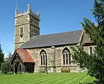
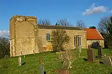
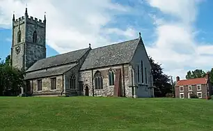
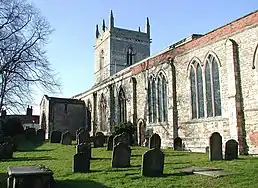
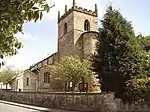
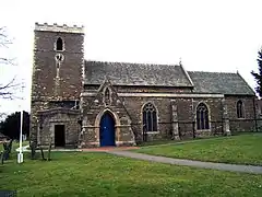
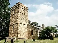
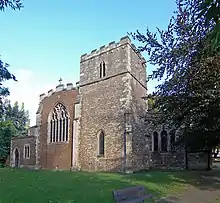
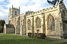
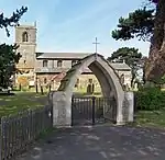
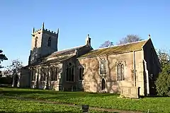
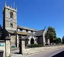
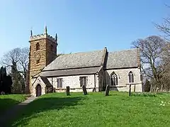
There are over 9,000 Grade I listed buildings in England. This page is a list of these buildings in the district of North Lincolnshire in Lincolnshire.

North Lincolnshire

Name Location Type Completed [note 1]Date designated Grid ref.[note 2]
Geo-coordinates
Entry number [note 3]Image
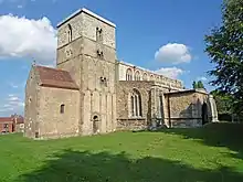
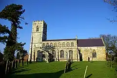
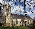
Church of Saint John the Baptist AlkboroughChurchMid 11th century6 November 1967SE8820121891
53°41′10″N 0°39′57″W / 53.686038°N 0.665947°W / 53.686038; -0.665947 (Church of Saint John the Baptist)
1241758
Church of Saint John the Baptist
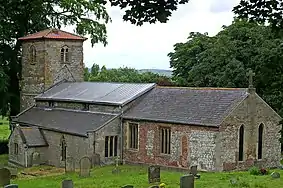
Church of St Mary Barnetby le WoldParish ChurchC11-C126 November 1967TA0615209074
53°34′03″N 0°23′55″W / 53.567546°N 0.398608°W / 53.567546; -0.398608 (Church of St Mary)
1103677
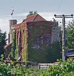
Barrow Hall Barrow upon HumberHouse18th century6 November 1967TA0663420551
53°40′14″N 0°23′15″W / 53.670566°N 0.387408°W / 53.670566; -0.387408 (Barrow Hall)
1288451
Upload Photo
Church of Holy Trinity Barrow upon HumberParish Church13th century6 November 1967TA0721421433
53°40′42″N 0°22′42″W / 53.678372°N 0.378328°W / 53.678372; -0.378328 (Church of Holy Trinity)
1346864
Church of St Mary Barton-upon-HumberChurchNorman21 September 1966TA0334522021
53°41′04″N 0°26′12″W / 53.684433°N 0.436682°W / 53.684433; -0.436682 (Church of St Mary)
1346773
Church of St Peter Barton-upon-HumberChurchC921 September 1966TA0347821949
53°41′02″N 0°26′05″W / 53.68376°N 0.434693°W / 53.68376; -0.434693 (Church of St Peter)
1083103
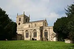
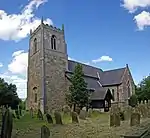
Church of All Saints Church Town, BeltonParish ChurchC14-C151 March 1967SE7829006336
53°32′52″N 0°49′12″W / 53.547832°N 0.819885°W / 53.547832; -0.819885 (Church of All Saints)
1083293
Church of All Saints
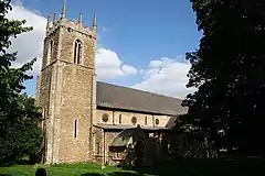
Church of St Peter Ad Vincula BottesfordChurch13th century6 November 1967SE8994507021
53°33′08″N 0°38′38″W / 53.552123°N 0.643837°W / 53.552123; -0.643837 (Church of St Peter Ad Vincula)
1083014
Church of St Peter Ad Vincula
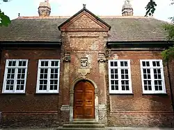
Grammar School (original Portion) BriggGrammar School167410 October 1952TA0015707452
53°33′15″N 0°29′23″W / 53.55415°N 0.489614°W / 53.55415; -0.489614 (Grammar School (original Portion))
1083127
Grammar School (original Portion)
Church of St Mary BroughtonChurch17816 November 1967SE9603608625
53°33′56″N 0°33′05″W / 53.565459°N 0.551438°W / 53.565459; -0.551438 (Church of St Mary)
1161801
Church of St Mary
Church of St Mary
Church of St Andrew Burton upon StatherStatue17766 November 1967SE8701617875
53°39′01″N 0°41′06″W / 53.650149°N 0.685009°W / 53.650149; -0.685009 (Church of St Andrew)
1103747
Church of St Andrew
Church of St Andrew
Normanby Hall Normanby Park, Burton upon StatherCountry House1825-183019 October 1951SE8873016534
53°38′16″N 0°39′34″W / 53.637812°N 0.659468°W / 53.637812; -0.659468 (Normanby Hall)
1103752
Church of All Saints CadneyParish ChurchMid 12th century6 November 1967TA0169503354
53°31′01″N 0°28′04″W / 53.517033°N 0.467737°W / 53.517033; -0.467737 (Church of All Saints)
1083706
Church of All Saints
Newstead Priory Farmhouse and Screen Wall Adjoining to Left CadneyFarmhouseEarly 19th century19 October 1951TA0000804457
53°31′38″N 0°29′34″W / 53.527267°N 0.492819°W / 53.527267; -0.492819 (Newstead Priory Farmhouse and Screen Wall Adjoining to Left)
1346518
Upload Photo
Church of St Oswald CrowleCrossAnglo-Scandinavian1 March 1967SE7715312985
53°36′28″N 0°50′07″W / 53.607751°N 0.835401°W / 53.607751; -0.835401 (Church of St Oswald)
1346672
Church of St Oswald
Church of St Oswald
Church of Saint Peter East HaltonParish Church13th century6 November 1967TA1414618452
53°39′00″N 0°16′28″W / 53.650124°N 0.274527°W / 53.650124; -0.274527 (Church of Saint Peter)
1103729
Church of Saint Peter
Chest Tomb to Samuel Wesley Approximately 3 Metres South of Chancel of Church of St Andrew EpworthGrave Slab173510 September 1987SE7838604001
53°31′37″N 0°49′08″W / 53.526835°N 0.819021°W / 53.526835; -0.819021 (Chest Tomb to Samuel Wesley Approximately 3 Metres South of Chancel of Church of St Andrew)
1083273
Upload Photo
Church of St Andrew EpworthManor HouseLate C12-early 13th century1 March 1967SE7837804010
53°31′37″N 0°49′09″W / 53.526917°N 0.819139°W / 53.526917; -0.819139 (Church of St Andrew)
1068692
Church of St Andrew
Church of St Andrew
The Old Rectory EpworthHouse1956-727 September 1951SE7851503578
53°31′23″N 0°49′02″W / 53.523014°N 0.817181°W / 53.523014; -0.817181 (The Old Rectory)
1068805
The Old Rectory
The Old Rectory
Church of St Lawrence FrodinghamChurch12th century7 November 1966SE8910910841
53°35′12″N 0°39′19″W / 53.586592°N 0.655363°W / 53.586592; -0.655363 (Church of St Lawrence)
1083610
Church of St Lawrence
Church of All Saints GoxhillParish Church13th century6 November 1967TA1022421236
53°40′34″N 0°19′58″W / 53.675976°N 0.332849°W / 53.675976; -0.332849 (Church of All Saints)
1288450
Medieval Hall Adjoining North East Corner of Goxhill Hall GoxhillHouseLate C14-early 15th century19 October 1951TA1095220517
53°40′10″N 0°19′20″W / 53.669363°N 0.32209°W / 53.669363; -0.32209 (Medieval Hall Adjoining North East Corner of Goxhill Hall)
1288428
Medieval Hall Adjoining North East Corner of Goxhill Hall
Church of St Nicholas HaxeyGate18271 March 1967SK7647199834
53°29′23″N 0°50′56″W / 53.489669°N 0.848917°W / 53.489669; -0.848917 (Church of St Nicholas)
1241103
Church of St Nicholas
Church of Saint Maurice HorkstowParish Church13th century6 November 1967SE9872118225
53°39′04″N 0°30′28″W / 53.651219°N 0.507875°W / 53.651219; -0.507875 (Church of Saint Maurice)
1103736
Church of St Oswald Althorpe, Keadby with AlthorpeParish Church14831 March 1967SE8347809625
53°34′36″N 0°44′27″W / 53.57659°N 0.740728°W / 53.57659; -0.740728 (Church of St Oswald)
1083258
Church of St Oswald
Church of St Oswald
Church of St Andrew Kirton in LindseyChurchC11-C126 November 1967SK9341598559
53°28′32″N 0°35′38″W / 53.475481°N 0.593997°W / 53.475481; -0.593997 (Church of St Andrew)
1083025
Church of St Andrew
Church of St Andrew
Church of Saint Denys North KillingholmeParish Church12th century6 November 1967TA1448117357
53°38′25″N 0°16′12″W / 53.640213°N 0.269864°W / 53.640213; -0.269864 (Church of Saint Denys)
1103701
Church of Saint Denys
Church of St Martin Owston FerryBaileyLate 13th century1 March 1967SE8047800293
53°29′36″N 0°47′18″W / 53.493198°N 0.788421°W / 53.493198; -0.788421 (Church of St Martin)
1083261
Church of St Martin
Church of St Martin
Church of St Andrew RedbourneParish ChurchC14-C156 January 1987SK9734099944
53°29′14″N 0°32′04″W / 53.487216°N 0.534451°W / 53.487216; -0.534451 (Church of St Andrew)
1346524
Church of St Mary Roxby cum RisbyChurchC11-C126 November 1967SE9206517019
53°38′30″N 0°36′32″W / 53.641595°N 0.6089°W / 53.641595; -0.6089 (Church of St Mary)
1260342
Church of St Mary
Church of St Mary
Scawby Hall ScawbyCountry Housec.16036 November 1967SE9688005718
53°32′21″N 0°32′23″W / 53.539183°N 0.539599°W / 53.539183; -0.539599 (Scawby Hall)
1083683
Scawby Hall
Scawby Hall
Abbot's Lodge Thornton CurtisAbbey/Farmhouse17th century6 November 1967TA1178718854
53°39′15″N 0°18′36″W / 53.654244°N 0.310056°W / 53.654244; -0.310056 (Abbot's Lodge)
1103713
Church of Saint Lawrence Thornton CurtisParish ChurchLate C12-early 13th century6 November 1967TA0879617874
53°38′46″N 0°21′20″W / 53.64607°N 0.355633°W / 53.64607; -0.355633 (Church of Saint Lawrence)
1227786
Church of Saint Lawrence
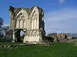
Remains of Thornton Abbey Church and Adjoining Monastic Ranges Thornton CurtisAbbey11486 November 1967TA1180418932
53°39′18″N 0°18′35″W / 53.654942°N 0.30977°W / 53.654942; -0.30977 (Remains of Thornton Abbey Church and Adjoining Monastic Ranges)
1215139
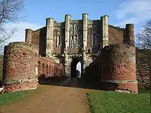
Thornton Abbey Gatehouse and Wing Walls, Precinct Walls and Barbican Thornton CurtisAbbeyC15-C166 November 1967TA1151018967
53°39′19″N 0°18′51″W / 53.655319°N 0.314204°W / 53.655319; -0.314204 (Thornton Abbey Gatehouse and Wing Walls, Precinct Walls and Barbican)
1346859
Church of Saint Nicholas UlcebyParish ChurchC13-C146 November 1967TA1034014606
53°36′59″N 0°20′00″W / 53.616386°N 0.333444°W / 53.616386; -0.333444 (Church of Saint Nicholas)
1227927
Church of Saint Nicholas
Church of All Saints WinteringhamChurchC11-126 November 1967SE9248522458
53°41′25″N 0°36′03″W / 53.690393°N 0.600931°W / 53.690393; -0.600931 (Church of All Saints)
1117040
Church of All Saints
Church of All Saints WintertonChurchMid 11th century6 November 1967SE9283118590
53°39′20″N 0°35′49″W / 53.655576°N 0.596848°W / 53.655576; -0.596848 (Church of All Saints)
1117004
Church of St Andrew WoottonParish Church13th century6 November 1967TA0890416172
53°37′51″N 0°21′17″W / 53.630755°N 0.354596°W / 53.630755; -0.354596 (Church of St Andrew)
1204699
Church of St Andrew
Church of St Andrew
Church of Saint Mary WrawbyParish ChurchLate C12-early 13th century6 November 1967TA0202808612
53°33′51″N 0°27′40″W / 53.564212°N 0.461005°W / 53.564212; -0.461005 (Church of Saint Mary)
1281035
Church of Saint Mary
Humber Bridge Barton-upon-HumberSuspension bridge198112 July 2017TA0241224487
53°42′24″N 0°27′00″W / 53.706773°N 0.44998943°W / 53.706773; -0.44998943 (Humber Bridge)
1447321

Notes

  1. The date given is the date used by Historic England as significant for the initial building or that of an important part in the structure's description.
  2. Sometimes known as OSGB36, the grid reference is based on the British national grid reference system used by the Ordnance Survey.
  3. The "List Entry Number" is a unique number assigned to each listed building and scheduled monument by Historic England.
This article is issued from Wikipedia. The text is licensed under Creative Commons - Attribution - Sharealike. Additional terms may apply for the media files.