Saint-Bardoux | |
|---|---|
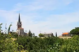 A general view of Saint-Bardoux | |
Location of Saint-Bardoux | |
 Saint-Bardoux 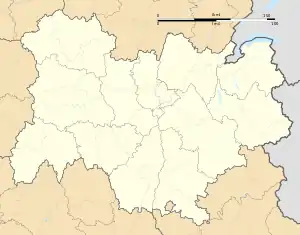 Saint-Bardoux | |
| Coordinates: 45°05′11″N 4°58′24″E / 45.0864°N 4.9733°E | |
| Country | France |
| Region | Auvergne-Rhône-Alpes |
| Department | Drôme |
| Arrondissement | Valence |
| Canton | Romans-sur-Isère |
| Intercommunality | CA Valence Romans Agglo |
| Government | |
| • Mayor (2020–2026) | Etienne Larat[1] |
| Area 1 | 10.63 km2 (4.10 sq mi) |
| Population | 590 |
| • Density | 56/km2 (140/sq mi) |
| Time zone | UTC+01:00 (CET) |
| • Summer (DST) | UTC+02:00 (CEST) |
| INSEE/Postal code | 26294 /26260 |
| Elevation | 159–310 m (522–1,017 ft) (avg. 229 m or 751 ft) |
| 1 French Land Register data, which excludes lakes, ponds, glaciers > 1 km2 (0.386 sq mi or 247 acres) and river estuaries. | |
Saint-Bardoux (French pronunciation: [sɛ̃ baʁdu]; Occitan: Sent Bardol) is a commune in the Drôme department in southeastern France.
Location
Saint-Bardoux is located 8 km north-west of Romans-sur-Isère (capital of the canton) and 11 km east of Tain-l'Hermitage. The surrounding communities are Clérieux, Saint-Donat-sur-l'Herbasse and Granges-les-Beaumont.
Population
| Year | Pop. | ±% p.a. |
|---|---|---|
| 1968 | 318 | — |
| 1975 | 340 | +0.96% |
| 1982 | 403 | +2.46% |
| 1990 | 532 | +3.53% |
| 1999 | 541 | +0.19% |
| 2009 | 596 | +0.97% |
| 2014 | 590 | −0.20% |
| 2020 | 594 | +0.11% |
| Source: INSEE[3] | ||
See also
References
- ↑ "Répertoire national des élus: les maires". data.gouv.fr, Plateforme ouverte des données publiques françaises (in French). 9 August 2021.
- ↑ "Populations légales 2021". The National Institute of Statistics and Economic Studies. 28 December 2023.
- ↑ Population en historique depuis 1968, INSEE
Wikimedia Commons has media related to Saint-Bardoux.
This article is issued from Wikipedia. The text is licensed under Creative Commons - Attribution - Sharealike. Additional terms may apply for the media files.