Gervans | |
|---|---|
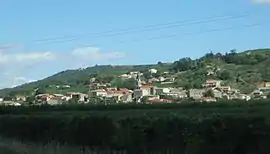 A general view of Gervans | |
Location of Gervans | |
 Gervans 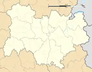 Gervans | |
| Coordinates: 45°06′31″N 4°49′55″E / 45.1086°N 4.8319°E | |
| Country | France |
| Region | Auvergne-Rhône-Alpes |
| Department | Drôme |
| Arrondissement | Valence |
| Canton | Tain-l'Hermitage |
| Intercommunality | CA Arche Agglo |
| Government | |
| • Mayor (2020–2026) | Pascal Claudel[1] |
| Area 1 | 3.28 km2 (1.27 sq mi) |
| Population | 545 |
| • Density | 170/km2 (430/sq mi) |
| Time zone | UTC+01:00 (CET) |
| • Summer (DST) | UTC+02:00 (CEST) |
| INSEE/Postal code | 26380 /26600 |
| Elevation | 109–350 m (358–1,148 ft) (avg. 134 m or 440 ft) |
| 1 French Land Register data, which excludes lakes, ponds, glaciers > 1 km2 (0.386 sq mi or 247 acres) and river estuaries. | |
Gervans (French pronunciation: [ʒɛʁvɑ̃]) is a commune in the Drôme department in southeastern France.
Population
| Year | Pop. | ±% p.a. |
|---|---|---|
| 1968 | 268 | — |
| 1975 | 274 | +0.32% |
| 1982 | 315 | +2.01% |
| 1990 | 341 | +1.00% |
| 1999 | 436 | +2.77% |
| 2009 | 551 | +2.37% |
| 2014 | 570 | +0.68% |
| 2020 | 546 | −0.71% |
| Source: INSEE[3] | ||
See also
References
- ↑ "Répertoire national des élus: les maires". data.gouv.fr, Plateforme ouverte des données publiques françaises (in French). 9 August 2021.
- ↑ "Populations légales 2021". The National Institute of Statistics and Economic Studies. 28 December 2023.
- ↑ Population en historique depuis 1968, INSEE
Wikimedia Commons has media related to Gervans.
This article is issued from Wikipedia. The text is licensed under Creative Commons - Attribution - Sharealike. Additional terms may apply for the media files.