This is a list of the National Register of Historic Places listings in Redwood National and State Parks.
This is intended to be a complete list of the properties and districts on the National Register of Historic Places in Redwood National and State Parks, California, United States. The locations of National Register properties and districts for which the latitude and longitude coordinates are included below, may be seen in a map.[1]
There are eight properties and districts listed on the National Register in the parks.
This National Park Service list is complete through NPS recent listings posted January 12, 2024.[2]
Current listings
| [3] | Name on the Register | Image | Date listed[4] | Location | City or town | Description |
|---|---|---|---|---|---|---|
| 1 | Bald Hills Archaeological District | July 9, 1982 (#82001723) |
Address Restricted |
Orick | c. 500 B.C. to 1000 A.D. Chilula cultural site | |
| 2 | Endert's Beach Archeological Sites | 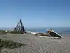 Endert's Beach Archeological Sites |
June 30, 1977 (#77000121) |
Address Restricted |
Crescent City | |
| 3 | Lyons Ranches Historic District | March 19, 2018 (#100002212) |
Bald Hills Rd., Redwoods National Park 41°08′53″N 123°53′36″W / 41.148130°N 123.893215°W |
Orick vicinity | ||
| 4 | O'Men Village Site | June 30, 1977 (#77000120) |
Address Restricted |
Klamath | ||
| 5 | Old Requa | December 16, 1974 (#74000509) |
Address Restricted |
Redwood National Park | ||
| 6 | Prairie Creek Fish Hatchery | .jpg.webp) Prairie Creek Fish Hatchery |
February 4, 2000 (#00000034) |
Milepost 124.83 on US 101, north of Orick 41°19′59″N 124°01′45″W / 41.333056°N 124.029167°W |
Orick | In use 1925 to 1949. |
| 7 | Radar Station B-71 | 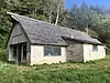 Radar Station B-71 |
April 19, 1978 (#78000282) |
W of Klamath 41°31′20″N 124°04′45″W / 41.522222°N 124.079167°W |
Klamath | |
| 8 | Redwood Highway | .jpg.webp) Redwood Highway |
December 17, 1979 (#79000253) |
West of Klamath 41°36′36″N 124°06′26″W / 41.61°N 124.107222°W |
Klamath vicinity | This segment of U.S. 101 in Redwood National and State Parks was abandoned in the 1930s, around a decade after it was opened. Because of its early abandonment, it has preserved evidence of the road construction techniques of the 1920s without subsequent modification. It was part of the first state highway in Humboldt and Del Norte counties, which transformed transportation and the economy in the region.[5] |
See also
References
- ↑ The latitude and longitude information provided in this table was derived originally from the National Register Information System, which has been found to be fairly accurate for about 99% of listings. Some locations in this table may have been corrected to current GPS standards.
- ↑ National Park Service, United States Department of the Interior, "National Register of Historic Places: Weekly List Actions", retrieved January 12, 2024.
- ↑ Numbers represent an alphabetical ordering by significant words. Various colorings, defined here, differentiate National Historic Landmarks and historic districts from other NRHP buildings, structures, sites or objects.
- ↑ The eight-digit number below each date is the number assigned to each location in the National Register Information System database, which can be viewed by clicking the number.
- ↑ Delgado, James; Chappell, Gordon (June 30, 1978), National Register of Historic Places Inventory — Nomination Form for Federal Properties: Redwood Highway (California State Highway #1) (PDF), retrieved February 3, 2018.
Wikimedia Commons has media related to National Register of Historic Places in Redwood National Park.
| Topics | |
|---|---|
| Lists by state |
|
| Lists by insular areas | |
| Lists by associated state | |
| Other areas | |
| Related | |
This article is issued from Wikipedia. The text is licensed under Creative Commons - Attribution - Sharealike. Additional terms may apply for the media files.