Montcet | |
|---|---|
Commune | |
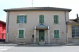 Town hall | |
Location of Montcet | |
 Montcet 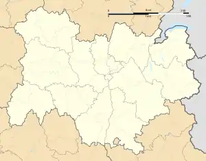 Montcet | |
| Coordinates: 46°12′48″N 5°06′47″E / 46.2133°N 5.1131°E | |
| Country | France |
| Region | Auvergne-Rhône-Alpes |
| Department | Ain |
| Arrondissement | Bourg-en-Bresse |
| Canton | Attignat |
| Intercommunality | CA Bassin de Bourg-en-Bresse |
| Government | |
| • Mayor (2020–2026) | Franck Tarpin[1] |
| Area 1 | 6.68 km2 (2.58 sq mi) |
| Population | 704 |
| • Density | 110/km2 (270/sq mi) |
| Time zone | UTC+01:00 (CET) |
| • Summer (DST) | UTC+02:00 (CEST) |
| INSEE/Postal code | 01259 /01310 |
| Elevation | 200–247 m (656–810 ft) (avg. 250 m or 820 ft) |
| 1 French Land Register data, which excludes lakes, ponds, glaciers > 1 km2 (0.386 sq mi or 247 acres) and river estuaries. | |
Montcet (French pronunciation: [mɔ̃sɛ]) is a commune in the Ain department in eastern France.
Population
| Year | Pop. | ±% p.a. |
|---|---|---|
| 1968 | 311 | — |
| 1975 | 282 | −1.39% |
| 1982 | 290 | +0.40% |
| 1990 | 420 | +4.74% |
| 1999 | 489 | +1.70% |
| 2009 | 664 | +3.11% |
| 2014 | 663 | −0.03% |
| 2020 | 708 | +1.10% |
| Source: INSEE[3] | ||
See also
References
- ↑ "Répertoire national des élus: les maires". data.gouv.fr, Plateforme ouverte des données publiques françaises (in French). 2 December 2020.
- ↑ "Populations légales 2021". The National Institute of Statistics and Economic Studies. 28 December 2023.
- ↑ Population en historique depuis 1968, INSEE
Wikimedia Commons has media related to Montcet.
This article is issued from Wikipedia. The text is licensed under Creative Commons - Attribution - Sharealike. Additional terms may apply for the media files.