Attignat | |
|---|---|
Commune | |
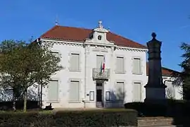 Town hall | |
 Coat of arms | |
Location of Attignat | |
 Attignat 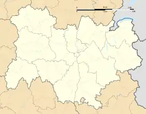 Attignat | |
| Coordinates: 46°17′17″N 5°09′38″E / 46.2881°N 5.1606°E | |
| Country | France |
| Region | Auvergne-Rhône-Alpes |
| Department | Ain |
| Arrondissement | Bourg-en-Bresse |
| Canton | Attignat |
| Intercommunality | CA Bassin de Bourg-en-Bresse |
| Government | |
| • Mayor (2020–2026) | Walter Martin[1] |
| Area 1 | 18.69 km2 (7.22 sq mi) |
| Population | 3,336 |
| • Density | 180/km2 (460/sq mi) |
| Time zone | UTC+01:00 (CET) |
| • Summer (DST) | UTC+02:00 (CEST) |
| INSEE/Postal code | 01024 /01340 |
| Elevation | 199–233 m (653–764 ft) |
| 1 French Land Register data, which excludes lakes, ponds, glaciers > 1 km2 (0.386 sq mi or 247 acres) and river estuaries. | |
Attignat (French pronunciation: [atiɲa]; Arpitan: Ategnat) is a commune in the Ain department in eastern France.
Administration
Since 2014, Walter Martin has been the mayor of Attignat. He was re-elected in the 2020 municipal elections.[3][1]
Geography
The commune is 12 km northwest of Bourg-en-Bresse, 4 km north of the A40. The Reyssouze runs through the commune.
Population
| Year | Pop. | ±% p.a. |
|---|---|---|
| 1968 | 1,236 | — |
| 1975 | 1,279 | +0.49% |
| 1982 | 1,682 | +3.99% |
| 1990 | 1,776 | +0.68% |
| 1999 | 1,924 | +0.89% |
| 2007 | 2,567 | +3.67% |
| 2012 | 3,110 | +3.91% |
| 2017 | 3,211 | +0.64% |
| Source: INSEE[4] | ||
See also
References
- 1 2 "Répertoire national des élus: les maires". data.gouv.fr, Plateforme ouverte des données publiques françaises (in French). 2 December 2020.
- ↑ "Populations légales 2021". The National Institute of Statistics and Economic Studies. 28 December 2023.
- ↑ Ville d'Attignat, annuaire-mairie.fr
- ↑ Population en historique depuis 1968, INSEE
External links
Wikimedia Commons has media related to Attignat.
This article is issued from Wikipedia. The text is licensed under Creative Commons - Attribution - Sharealike. Additional terms may apply for the media files.