Longevelle-sur-Doubs | |
|---|---|
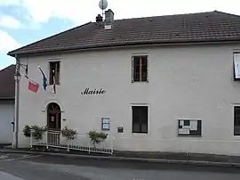 The town hall in Longevelle-sur-Doubs | |
 Coat of arms | |
Location of Longevelle-sur-Doubs | |
 Longevelle-sur-Doubs 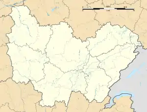 Longevelle-sur-Doubs | |
| Coordinates: 47°27′12″N 6°39′07″E / 47.4533°N 6.6519°E | |
| Country | France |
| Region | Bourgogne-Franche-Comté |
| Department | Doubs |
| Arrondissement | Montbéliard |
| Canton | Bavans |
| Intercommunality | Pays de Montbéliard Agglomération |
| Government | |
| • Mayor (2020–2026) | Pierre-Aimé Girardot[1] |
| Area 1 | 8.31 km2 (3.21 sq mi) |
| Population | 661 |
| • Density | 80/km2 (210/sq mi) |
| Time zone | UTC+01:00 (CET) |
| • Summer (DST) | UTC+02:00 (CEST) |
| INSEE/Postal code | 25345 /25260 |
| Elevation | 295–432 m (968–1,417 ft) |
| 1 French Land Register data, which excludes lakes, ponds, glaciers > 1 km2 (0.386 sq mi or 247 acres) and river estuaries. | |
Longevelle-sur-Doubs (French pronunciation: [lɔ̃ʒvɛl syʁ du], literally Longevelle on Doubs) is a commune in the Doubs department in the Bourgogne-Franche-Comté region in eastern France.
Population
| Year | Pop. | ±% |
|---|---|---|
| 1962 | 412 | — |
| 1968 | 448 | +8.7% |
| 1975 | 493 | +10.0% |
| 1982 | 493 | +0.0% |
| 1990 | 657 | +33.3% |
| 1999 | 604 | −8.1% |
| 2008 | 635 | +5.1% |
| 2012 | 662 | +4.3% |
See also
References
- ↑ "Répertoire national des élus: les maires". data.gouv.fr, Plateforme ouverte des données publiques françaises (in French). 2 December 2020.
- ↑ "Populations légales 2021". The National Institute of Statistics and Economic Studies. 28 December 2023.
External links
Wikimedia Commons has media related to Longevelle-sur-Doubs.
This article is issued from Wikipedia. The text is licensed under Creative Commons - Attribution - Sharealike. Additional terms may apply for the media files.