La Longeville | |
|---|---|
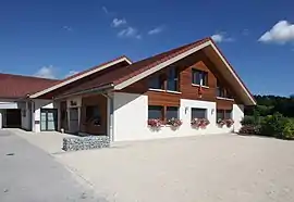 The town hall in La Longeville | |
Location of La Longeville | |
 La Longeville 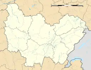 La Longeville | |
| Coordinates: 47°00′30″N 6°27′29″E / 47.0083°N 6.4581°E | |
| Country | France |
| Region | Bourgogne-Franche-Comté |
| Department | Doubs |
| Arrondissement | Pontarlier |
| Canton | Ornans |
| Intercommunality | Montbenoît |
| Government | |
| • Mayor (2020–2026) | Adrien Pellegrini[1] |
| Area 1 | 15.66 km2 (6.05 sq mi) |
| Population | 836 |
| • Density | 53/km2 (140/sq mi) |
| Time zone | UTC+01:00 (CET) |
| • Summer (DST) | UTC+02:00 (CEST) |
| INSEE/Postal code | 25347 /25650 |
| Elevation | 756–991 m (2,480–3,251 ft) |
| 1 French Land Register data, which excludes lakes, ponds, glaciers > 1 km2 (0.386 sq mi or 247 acres) and river estuaries. | |
La Longeville (French pronunciation: [la lɔ̃ʒvil]) is a commune in the Doubs department in the Bourgogne-Franche-Comté region in eastern France.
Geography
The commune lies 5 km (3.1 mi) from Montbenoît, halfway between Pontarlier and Morteau in the Jura mountains near the Swiss border.
Population
| Year | Pop. | ±% |
|---|---|---|
| 1962 | 344 | — |
| 1968 | 363 | +5.5% |
| 1975 | 321 | −11.6% |
| 1982 | 352 | +9.7% |
| 1990 | 384 | +9.1% |
| 1999 | 488 | +27.1% |
| 2008 | 610 | +25.0% |
| 2012 | 717 | +17.5% |
See also
References
- ↑ "Répertoire national des élus: les maires". data.gouv.fr, Plateforme ouverte des données publiques françaises (in French). 9 August 2021.
- ↑ "Populations légales 2021". The National Institute of Statistics and Economic Studies. 28 December 2023.
External links
Wikimedia Commons has media related to La Longeville.
This article is issued from Wikipedia. The text is licensed under Creative Commons - Attribution - Sharealike. Additional terms may apply for the media files.