Záchlumí | |
|---|---|
 Centre of Záchlumí | |
_vlajka.jpg.webp) Flag _znak.jpg.webp) Coat of arms | |
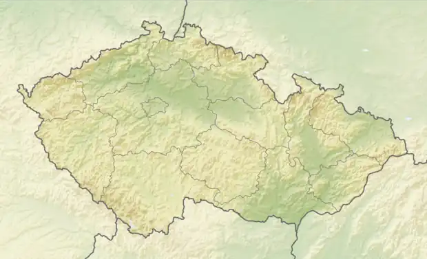 Záchlumí Location in the Czech Republic | |
| Coordinates: 49°48′0″N 12°57′54″E / 49.80000°N 12.96500°E | |
| Country | |
| Region | Plzeň |
| District | Tachov |
| First mentioned | 1359 |
| Area | |
| • Total | 4.42 km2 (1.71 sq mi) |
| Elevation | 497 m (1,631 ft) |
| Population (2023-01-01)[1] | |
| • Total | 450 |
| • Density | 100/km2 (260/sq mi) |
| Time zone | UTC+1 (CET) |
| • Summer (DST) | UTC+2 (CEST) |
| Postal code | 349 01 |
| Website | www |
Záchlumí (German: Eisenhuttel) is a municipality and village in Tachov District in the Plzeň Region of the Czech Republic. It has about 500 inhabitants.
Záchlumí lies approximately 25 kilometres (16 mi) east of Tachov, 31 km (19 mi) west of Plzeň, and 110 km (68 mi) west of Prague.
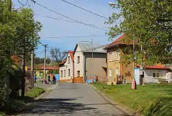
Gallery
 Middle part
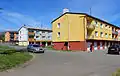 Tenement houses
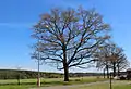 Old oak – protected tree
References
Wikimedia Commons has media related to Záchlumí (Tachov District).
This article is issued from Wikipedia. The text is licensed under Creative Commons - Attribution - Sharealike. Additional terms may apply for the media files.