Walkerville Township | |
|---|---|
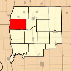 Location in Greene County | |
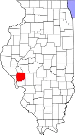 Greene County's location in Illinois | |
| Coordinates: 39°23′30″N 90°33′01″W / 39.39167°N 90.55028°W | |
| Country | United States |
| State | Illinois |
| County | Greene |
| Established | November 4, 1884 |
| Area | |
| • Total | 39.62 sq mi (102.6 km2) |
| • Land | 39 sq mi (100 km2) |
| • Water | 0.62 sq mi (1.6 km2) 1.56% |
| Elevation | 479 ft (146 m) |
| Population (2010) | |
| • Estimate (2016)[1] | 220 |
| • Density | 6/sq mi (2/km2) |
| Time zone | UTC-6 (CST) |
| • Summer (DST) | UTC-5 (CDT) |
| ZIP codes | 62016, 62050, 62092 |
| FIPS code | 17-061-78461 |
Walkerville Township is one of thirteen townships in Greene County, Illinois, USA. As of the 2010 census, its population was 233 and it contained 111 housing units.[2]
Geography
According to the 2010 census, the township has a total area of 39.62 square miles (102.6 km2), of which 39 square miles (100 km2) (or 98.44%) is land and 0.62 square miles (1.6 km2) (or 1.56%) is water.[2]
Unincorporated towns
- Haypress at 39°21′41″N 90°32′05″W / 39.361437°N 90.534845°W
- Walkerville at 39°23′13″N 90°29′43″W / 39.386992°N 90.495400°W
(This list is based on USGS data and may include former settlements.)
Cemeteries
The township contains these eight cemeteries: Bridgewater, Kinser, Likely, Parr, Rollins, Sweeten, Walkerville and William Wood.
Airports and landing strips
- Martin Airport
- Orton Landing Field
Rivers
Lakes
- Brushy Lake
Demographics
| Census | Pop. | Note | %± |
|---|---|---|---|
| 2016 (est.) | 220 | [1] | |
| U.S. Decennial Census[3] | |||
School districts
- Carrollton Community Unit School District 1
- North Greene Unit School District 3
Political districts
- Illinois' 17th congressional district
- State House District 97
- State Senate District 49
References
- "Walkerville Township, Greene County, Illinois". Geographic Names Information System. United States Geological Survey, United States Department of the Interior. Retrieved January 17, 2010.
- United States Census Bureau 2007 TIGER/Line Shapefiles
- United States National Atlas
- 1 2 "Population and Housing Unit Estimates". Retrieved June 9, 2017.
- 1 2 "Population, Housing Units, Area, and Density: 2010 - County -- County Subdivision and Place -- 2010 Census Summary File 1". United States Census. Archived from the original on February 12, 2020. Retrieved May 28, 2013.
- ↑ "Census of Population and Housing". Census.gov. Retrieved June 4, 2016.
External links
Places adjacent to Walkerville Township, Greene County, Illinois | |
|---|---|
Municipalities and communities of Greene County, Illinois, United States | ||
|---|---|---|
| Cities | Map of Illinois highlighting Greene County | |
| Villages | ||
| Townships | ||
| Unincorporated communities | ||
This article is issued from Wikipedia. The text is licensed under Creative Commons - Attribution - Sharealike. Additional terms may apply for the media files.