Waikuku Beach | |
|---|---|
Rural settlement | |
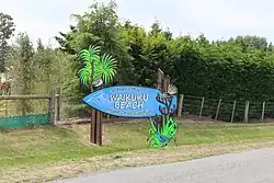 Waikuku beach sign | |
| Coordinates: 43°17′13″S 172°42′58″E / 43.287°S 172.716°E | |
| Country | New Zealand |
| Region | Canterbury |
| Territorial authority | Waimakariri District |
| Ward | Kaiapoi-Woodend Ward |
| Community | Woodend-Sefton Community |
| Electorates |
|
| Government | |
| • Territorial Authority | Waimakariri District Council |
| • Regional council | Environment Canterbury |
| • Mayor of Waimakariri | Dan Gordon |
| • Waimakariri MP | Matthew Doocey |
| • Te Tai Tonga MP | Tākuta Ferris |
| Area | |
| • Total | 1.30 km2 (0.50 sq mi) |
| Population (June 2023)[2] | |
| • Total | 1,130 |
| • Density | 870/km2 (2,300/sq mi) |
| Time zone | UTC+12 (NZST) |
| • Summer (DST) | UTC+13 (NZDT) |
| Postcode | 7402 |
| Area code | 03 |
Waikuku Beach is a small settlement on the coast of the Canterbury region of New Zealand, about 3 km (1.9 mi) east of the settlement of Waikuku.
The sandy beach is popular with surfers and swimmers, and the large estuary of the Ashley River hosts many species of birds.[3] The Waikuku beach has been rated as one of the ten best to learn to surf at.[4]
Demographics
Waikuku Beach is described by Statistics New Zealand as a rural settlement and covers 1.30 km2 (0.50 sq mi).[1] It had an estimated population of 1,130 as of June 2023,[2] with a population density of 869 people per km2. Waikuku Beach is part of the larger Waikuku statistical area.[5]
| Year | Pop. | ±% p.a. |
|---|---|---|
| 2006 | 858 | — |
| 2013 | 900 | +0.69% |
| 2018 | 912 | +0.27% |
| Source: [6] | ||

Waikuku Beach had a population of 912 at the 2018 New Zealand census, an increase of 12 people (1.3%) since the 2013 census, and an increase of 54 people (6.3%) since the 2006 census. There were 342 households, comprising 468 males and 444 females, giving a sex ratio of 1.05 males per female, with 168 people (18.4%) aged under 15 years, 141 (15.5%) aged 15 to 29, 477 (52.3%) aged 30 to 64, and 126 (13.8%) aged 65 or older.
Ethnicities were 95.4% European/Pākehā, 13.2% Māori, 1.3% Pasifika, 1.0% Asian, and 1.6% other ethnicities. People may identify with more than one ethnicity.
Although some people chose not to answer the census's question about religious affiliation, 62.2% had no religion, 28.3% were Christian, 0.3% had Māori religious beliefs, 0.3% were Muslim and 1.0% had other religions.
Of those at least 15 years old, 147 (19.8%) people had a bachelor's or higher degree, and 144 (19.4%) people had no formal qualifications. 141 people (19.0%) earned over $70,000 compared to 17.2% nationally. The employment status of those at least 15 was that 402 (54.0%) people were employed full-time, 132 (17.7%) were part-time, and 18 (2.4%) were unemployed.[6]
References
- 1 2 "ArcGIS Web Application". statsnz.maps.arcgis.com. Retrieved 20 August 2023.
- 1 2 "Subnational population estimates (RC, SA2), by age and sex, at 30 June 1996-2023 (2023 boundaries)". Statistics New Zealand. Retrieved 25 October 2023. (regional councils); "Subnational population estimates (TA, SA2), by age and sex, at 30 June 1996-2023 (2023 boundaries)". Statistics New Zealand. Retrieved 25 October 2023. (territorial authorities); "Subnational population estimates (urban rural), by age and sex, at 30 June 1996-2023 (2023 boundaries)". Statistics New Zealand. Retrieved 25 October 2023. (urban areas)
- ↑ "Ashley-Rakahuri". Ashley-Rakahuri Rivercare Group. Archived from the original on 3 July 2013. Retrieved 12 April 2023.
- ↑ "GO NZ: 10 of the best places to learn to surf in New Zealand". NZ Herald. Retrieved 21 December 2020.
- ↑ 2018 Census place summary: Waikuku
- 1 2 "Statistical area 1 dataset for 2018 Census". Statistics New Zealand. March 2020. 7024080–7024082 and 7024085–7024087.