Verrières-en-Anjou | |
|---|---|
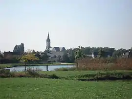 A general view of Saint-Sylvain-d'Anjou | |
Location of Verrières-en-Anjou | |
 Verrières-en-Anjou  Verrières-en-Anjou | |
| Coordinates: 47°31′12″N 0°28′16″W / 47.520°N 0.471°W | |
| Country | France |
| Region | Pays de la Loire |
| Department | Maine-et-Loire |
| Arrondissement | Angers |
| Canton | Angers-6 |
| Intercommunality | CU Angers Loire Métropole |
| Government | |
| • Mayor (2022–2026) | Geneviève Stall[1] |
| Area 1 | 24.83 km2 (9.59 sq mi) |
| Population | 7,775 |
| • Density | 310/km2 (810/sq mi) |
| Time zone | UTC+01:00 (CET) |
| • Summer (DST) | UTC+02:00 (CEST) |
| INSEE/Postal code | 49323 /49480, 49112 |
| 1 French Land Register data, which excludes lakes, ponds, glaciers > 1 km2 (0.386 sq mi or 247 acres) and river estuaries. | |
Verrières-en-Anjou (French pronunciation: [vɛʁjɛʁ ɑ̃.n‿ɑ̃ʒu] ⓘ) is a commune in the Maine-et-Loire department of western France. The municipality was established on 1 January 2016 and consists of the former communes of Saint-Sylvain-d'Anjou and Pellouailles-les-Vignes.[3]
Population
The population data given in the table below refer to the commune in its geography as of January 2020.
| Year | Pop. | ±% p.a. |
|---|---|---|
| 1968 | 2,114 | — |
| 1975 | 2,991 | +5.08% |
| 1982 | 3,547 | +2.47% |
| 1990 | 5,184 | +4.86% |
| 1999 | 6,707 | +2.90% |
| 2007 | 6,825 | +0.22% |
| 2012 | 6,957 | +0.38% |
| 2017 | 7,153 | +0.56% |
| Source: INSEE[4] | ||
See also
References
Wikimedia Commons has media related to Verrières-en-Anjou.
- ↑ "Répertoire national des élus: les maires" (in French). data.gouv.fr, Plateforme ouverte des données publiques françaises. 13 September 2022.
- ↑ "Populations légales 2021". The National Institute of Statistics and Economic Studies. 28 December 2023.
- ↑ Arrêté préfectoral 1 December 2015 (in French)
- ↑ Population en historique depuis 1968, INSEE
This article is issued from Wikipedia. The text is licensed under Creative Commons - Attribution - Sharealike. Additional terms may apply for the media files.