Union Township | |
|---|---|
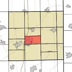 Location of Union Township in DeKalb County | |
| Coordinates: 41°22′24″N 85°01′22″W / 41.37333°N 85.02278°W | |
| Country | United States |
| State | Indiana |
| County | DeKalb |
| Government | |
| • Type | Indiana township |
| Area | |
| • Total | 17.75 sq mi (46.0 km2) |
| • Land | 17.74 sq mi (45.9 km2) |
| • Water | 0.01 sq mi (0.03 km2) |
| Elevation | 879 ft (268 m) |
| Population (2010) | |
| • Total | 13,220 |
| • Density | 745.1/sq mi (287.7/km2) |
| FIPS code | 18-77228[2] |
| GNIS feature ID | 453912 |
Union Township is one of fifteen townships in DeKalb County, Indiana. As of the 2010 census, its population was 13,220 and it contained 5,886 housing units.[3]
History
Union Township was organized in 1837.[4]
Geography
According to the 2010 census, the township has a total area of 17.75 square miles (46.0 km2), of which 17.74 square miles (45.9 km2) (or 99.94%) is land and 0.01 square miles (0.026 km2) (or 0.06%) is water.[3]
Cities and towns
- Auburn (northeast three-quarters)
Adjacent townships
- Grant Township (north)
- Concord Township (east)
- Wilmington Township (east)
- Jackson Township (south)
- Keyser Township (west)
- Richland Township (west)
Major highways
Cemeteries
The township contains seven cemeteries: Cosper, Catholic, Evergreen, Mott, Old Auburn, Roselawn and Woodlawn.
References
- ↑ "US Board on Geographic Names". United States Geological Survey. October 25, 2007. Retrieved January 31, 2008.
- ↑ "U.S. Census website". United States Census Bureau. Retrieved January 31, 2008.
- 1 2 "Population, Housing Units, Area, and Density: 2010 - County -- County Subdivision and Place -- 2010 Census Summary File 1". United States Census. Archived from the original on February 12, 2020. Retrieved May 10, 2013.
- ↑ History of DeKalb County, Indiana: Together with Sketches of Its Cities, Villages and Towns. Inter-State Publishing Company. 1885. pp. 813.
External links
Wikimedia Commons has media related to Union Township, DeKalb County, Indiana.
Municipalities and communities of DeKalb County, Indiana, United States | ||
|---|---|---|
| Cities | Map of Indiana highlighting DeKalb County | |
| Towns | ||
| Townships | ||
| CDP | ||
| Other communities | ||
| Footnotes | ‡This populated place also has portions in an adjacent county or counties | |
This article is issued from Wikipedia. The text is licensed under Creative Commons - Attribution - Sharealike. Additional terms may apply for the media files.