Tsihombe
Tsiombe | |
|---|---|
 | |
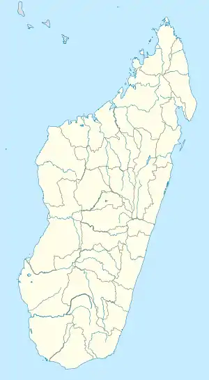 Tsihombe Location in Madagascar | |
| Coordinates: 25°18′S 45°29′E / 25.300°S 45.483°E | |
| Country | |
| Region | Androy |
| District | Tsihombe |
| Area | |
| • Total | 3,316 km2 (1,280 sq mi) |
| Elevation | 150 m (490 ft) |
| Population (2018)[2] | |
| • Total | 122,547 |
| Time zone | UTC3 (EAT) |
| Postal code | 621 |
Tsihombe is a municipality and a district of Androy in Madagascar.[3][4]
Geography
This district is crossed by the Route nationale 10 and the Manambovo river. Tsihombe is located at 65 km west of Ambovombe and 45 km East of Beloha.[5]
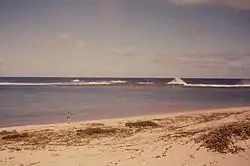
The district of Tsihombe includes the Cape Sainte Marie, the southernmost point of Madagascar. At Cape Sainte Marie there is also a wildlife reserve.
This is the semi-arid region of Madagascar and the population uses to eat cactus fruit and crickets to survive.[6][7][8]
A water-pipeline of 225 km is presently under construction if the tubes will not be embezzled.[9]
Municipalities
- Anjapaly
- Antaritarika
- Faux Cap
- Imongy
- Marovato
- Nikoly
- Tsiombe
References
- ↑ Estimated based on DEM data from Shuttle Radar Topography Mission
- ↑ DIFFICULTES ALIMENTAIRES DANS LES DISTRICTS DE BELOHA ET DE TSIHOMBE.
- ↑ REPOBLIKAN’I MADAGASIKARA:Tanindrazana – Fahafahana – Fandrosoana (PDF). MINISTERE DE L’AGRICULTURE, DE L’ELEVAGE ET DE LA PECHE. October 2007. pp. 42–44.
- ↑ "Madagascar: Administrative Division". citypopulation. Retrieved 10 June 2018.
- ↑ DIFFICULTES ALIMENTAIRES DANS LES DISTRICTS DE BELOHA ET DE TSIHOMBE.
- ↑ Crickets to the rescue
- ↑ Shield-backed katydids in Madagascar with the description of a new genus and three new species (Orthoptera: Ensifera: Tettigoniidae: Tettigoniinae: Arytropteridini)
- ↑ [https://entomofarms.com/wp-content/uploads/2019/11/Cricket_powder_madagascar_nov_2019.pdf Cricket Powder Provides Valuable Nutrients for Vulnerable Populations]
- ↑ www.presidence.gov.mg
Capital: Ambovombe-Androy | ||
| Ambovombe (21) (604) |  | |
| Bekily (20) (607) |
| |
| Beloha (8) (609) | ||
| Tsiombe (7) (621) |
| |
| proposed Antanimora Sud (9) (604) |
| |
4 districts; 56 communes | ||
This article is issued from Wikipedia. The text is licensed under Creative Commons - Attribution - Sharealike. Additional terms may apply for the media files.