Tierra Verde, Texas | |
|---|---|
| Coordinates: 27°45′42″N 97°43′3″W / 27.76167°N 97.71750°W | |
| Country | United States |
| State | Texas |
| County | Nueces |
| Area | |
| • Total | 2.0 sq mi (5.2 km2) |
| • Land | 2.0 sq mi (5.2 km2) |
| • Water | 0.0 sq mi (0.0 km2) |
| Population (2010) | |
| • Total | 277 |
| • Density | 140/sq mi (53/km2) |
| Time zone | UTC-6 (Central (CST)) |
| • Summer (DST) | UTC-5 (CDT) |
| Zip Code | 78380 |
Tierra Verde is a census-designated place (CDP) in Nueces County, Texas, United States. Its population was 277 at the 2010 census. Prior to the census, it was part of the Spring Garden-Terra Verde CDP.[1]
Geography
Tierra Verde is located at 27°45′42″N 97°43′3″W / 27.76167°N 97.71750°W (27.761571, -97.717384). The CDP has a total area of 2.0 square miles (5.2 km2), all land.[2]
References
Municipalities and communities of Nueces County, Texas, United States | ||
|---|---|---|
| Cities | 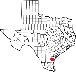 Nueces County map | |
| CDPs | ||
| Other communities | ||
| Footnotes | ‡This populated place also has portions in an adjacent county or counties | |
This article is issued from Wikipedia. The text is licensed under Creative Commons - Attribution - Sharealike. Additional terms may apply for the media files.