Tellières-le-Plessis | |
|---|---|
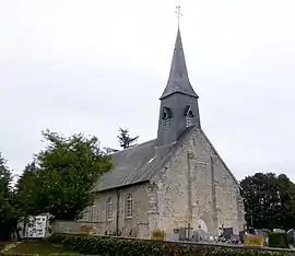 The church in Tellières-le-Plessis | |
Location of Tellières-le-Plessis | |
 Tellières-le-Plessis  Tellières-le-Plessis | |
| Coordinates: 48°37′38″N 0°23′33″E / 48.6272°N 0.3925°E | |
| Country | France |
| Region | Normandy |
| Department | Orne |
| Arrondissement | Alençon |
| Canton | Écouves |
| Intercommunality | Vallée de la Haute Sarthe |
| Government | |
| • Mayor (2020–2026) | Emmanuel Gouello[1] |
| Area 1 | 5.41 km2 (2.09 sq mi) |
| Population | 78 |
| • Density | 14/km2 (37/sq mi) |
| Demonym | Telliériens |
| Time zone | UTC+01:00 (CET) |
| • Summer (DST) | UTC+02:00 (CEST) |
| INSEE/Postal code | 61481 /61390 |
| Elevation | 169–244 m (554–801 ft) (avg. 250 m or 820 ft) |
| 1 French Land Register data, which excludes lakes, ponds, glaciers > 1 km2 (0.386 sq mi or 247 acres) and river estuaries. | |
Tellières-le-Plessis (French pronunciation: [tɛljɛʁ lə plɛsi] ⓘ) is a commune in the Orne department in north-western France.
See also
References
- ↑ "Répertoire national des élus: les maires" (in French). data.gouv.fr, Plateforme ouverte des données publiques françaises. 13 September 2022.
- ↑ "Populations légales 2021". The National Institute of Statistics and Economic Studies. 28 December 2023.
Wikimedia Commons has media related to Tellières-le-Plessis.
This article is issued from Wikipedia. The text is licensed under Creative Commons - Attribution - Sharealike. Additional terms may apply for the media files.