Světlá pod Ještědem | |
|---|---|
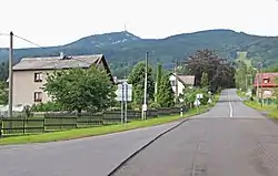 Main road in the municipality | |
 Flag  Coat of arms | |
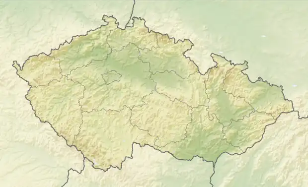 Světlá pod Ještědem Location in the Czech Republic | |
| Coordinates: 50°42′41″N 14°59′10″E / 50.71139°N 14.98611°E | |
| Country | |
| Region | Liberec |
| District | Liberec |
| First mentioned | 1291 |
| Area | |
| • Total | 13.20 km2 (5.10 sq mi) |
| Elevation | 545 m (1,788 ft) |
| Population (2023-01-01)[1] | |
| • Total | 979 |
| • Density | 74/km2 (190/sq mi) |
| Time zone | UTC+1 (CET) |
| • Summer (DST) | UTC+2 (CEST) |
| Postal code | 463 43 |
| Website | www |
Světlá pod Ještědem is a municipality and village in Liberec District in the Liberec Region of the Czech Republic. It has about 1,000 inhabitants.
Administrative parts
Villages of Dolení Paseky, Hodky, Hoření Paseky, Jiříčkov, Křižany, Rozstání and Vesec are administrative parts of Světlá pod Ještědem.
History

Church of Saint Nicholas
The first written mention of Světlá pod Ještědem is from 1291. The Church of Saint Nicholas was built in 1643.[2]
References
- ↑ "Population of Municipalities – 1 January 2023". Czech Statistical Office. 2023-05-23.
- ↑ "Světlá pod Ještědem" (in Czech). Obec Světlá pod Ještědem. Retrieved 2021-08-16.
External links
Wikimedia Commons has media related to Světlá pod Ještědem.
This article is issued from Wikipedia. The text is licensed under Creative Commons - Attribution - Sharealike. Additional terms may apply for the media files.