Senftenberg | |
|---|---|
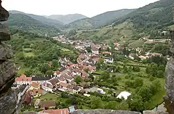 Senftenberg seen from Burgruine Senftenberg | |
 Coat of arms | |
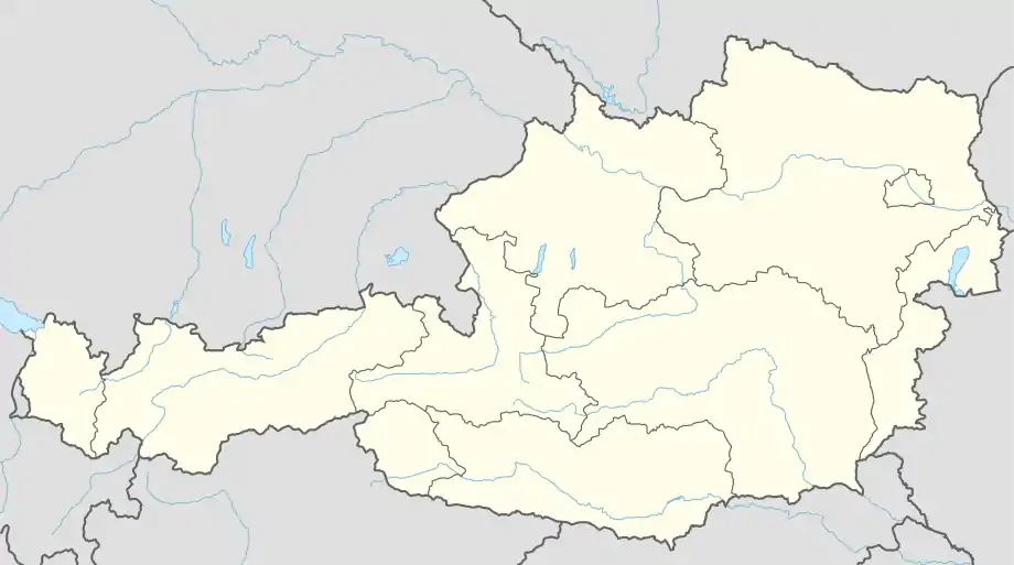 Senftenberg Location within Austria | |
| Coordinates: 48°26′N 15°33′E / 48.433°N 15.550°E | |
| Country | Austria |
| State | Lower Austria |
| District | Krems-Land |
| Government | |
| • Mayor | Josef Ott (ÖVP) |
| Area | |
| • Total | 34.77 km2 (13.42 sq mi) |
| Elevation | 254 m (833 ft) |
| Population (2018-01-01)[2] | |
| • Total | 1,977 |
| • Density | 57/km2 (150/sq mi) |
| Time zone | UTC+1 (CET) |
| • Summer (DST) | UTC+2 (CEST) |
| Postal code | 3541 |
| Area code | 02719 |
| Website | www.senftenberg.at |
Senftenberg is a town in the district of Krems-Land in the Austrian state of Lower Austria.
Geography
The municipality consists of six subdivisions:[3]
- Imbach (population: 580)
- Meislingeramt (population: 55)
- Priel (population: 123)
- Reichaueramt (population: 60)
- Senftenberg (population: 1046)
- Senftenbergeramt (population: 107)
Population
| Year | Pop. | ±% |
|---|---|---|
| 1869 | 1,694 | — |
| 1880 | 1,634 | −3.5% |
| 1890 | 1,654 | +1.2% |
| 1900 | 1,776 | +7.4% |
| 1910 | 2,015 | +13.5% |
| 1923 | 1,965 | −2.5% |
| 1934 | 1,907 | −3.0% |
| 1939 | 1,922 | +0.8% |
| 1951 | 2,017 | +4.9% |
| 1961 | 1,875 | −7.0% |
| 1971 | 1,937 | +3.3% |
| 1981 | 1,986 | +2.5% |
| 1991 | 2,067 | +4.1% |
| 2001 | 1,971 | −4.6% |
| 2011 | 1,937 | −1.7% |
_-_Kirche_und_Pfarrhof.JPG.webp)
Parish church and rectory
Sights
References
- ↑ "Dauersiedlungsraum der Gemeinden Politischen Bezirke und Bundesländer - Gebietsstand 1.1.2018". Statistics Austria. Retrieved 10 March 2019.
- ↑ "Einwohnerzahl 1.1.2018 nach Gemeinden mit Status, Gebietsstand 1.1.2018". Statistics Austria. Retrieved 9 March 2019.
- ↑ Statistik Austria, Bevölkerung am 1.1.2015 nach Ortschaften
- ↑ Statistik Austria, Ein Blick auf die Gemeinde Senftenberg
External links
Wikimedia Commons has media related to Senftenberg, Lower Austria.

This article is issued from Wikipedia. The text is licensed under Creative Commons - Attribution - Sharealike. Additional terms may apply for the media files.