Sainte-Fauste | |
|---|---|
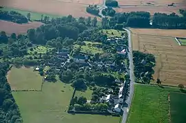 An aerial view of Sainte-Fauste | |
Location of Sainte-Fauste | |
 Sainte-Fauste 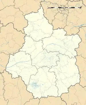 Sainte-Fauste | |
| Coordinates: 46°51′29″N 1°51′58″E / 46.8581°N 1.8661°E | |
| Country | France |
| Region | Centre-Val de Loire |
| Department | Indre |
| Arrondissement | Issoudun |
| Canton | Ardentes |
| Intercommunality | Champagne Boischauts |
| Government | |
| • Mayor (2020–2026) | Jean-Marc Brunaud[1] |
| Area 1 | 23.07 km2 (8.91 sq mi) |
| Population | 262 |
| • Density | 11/km2 (29/sq mi) |
| Time zone | UTC+01:00 (CET) |
| • Summer (DST) | UTC+02:00 (CEST) |
| INSEE/Postal code | 36190 /36100 |
| Elevation | 142–168 m (466–551 ft) (avg. 141 m or 463 ft) |
| 1 French Land Register data, which excludes lakes, ponds, glaciers > 1 km2 (0.386 sq mi or 247 acres) and river estuaries. | |
Sainte-Fauste (French pronunciation: [sɛ̃t fost]) is a commune in the Indre department in central France.
Population
| Year | Pop. | ±% p.a. |
|---|---|---|
| 1968 | 256 | — |
| 1975 | 218 | −2.27% |
| 1982 | 230 | +0.77% |
| 1990 | 229 | −0.05% |
| 1999 | 254 | +1.16% |
| 2009 | 293 | +1.44% |
| 2014 | 278 | −1.05% |
| 2020 | 266 | −0.73% |
| Source: INSEE[3] | ||
See also
References
- ↑ "Répertoire national des élus: les maires". data.gouv.fr, Plateforme ouverte des données publiques françaises (in French). 2 December 2020.
- ↑ "Populations légales 2021". The National Institute of Statistics and Economic Studies. 28 December 2023.
- ↑ Population en historique depuis 1968, INSEE
Wikimedia Commons has media related to Sainte-Fauste.
This article is issued from Wikipedia. The text is licensed under Creative Commons - Attribution - Sharealike. Additional terms may apply for the media files.