Saint-Julien-de-la-Nef | |
|---|---|
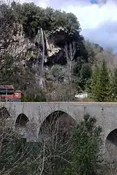 The Aigues Folles waterfall in Saint-Julien-de-la-Nef | |
.svg.png.webp) Coat of arms | |
Location of Saint-Julien-de-la-Nef | |
 Saint-Julien-de-la-Nef 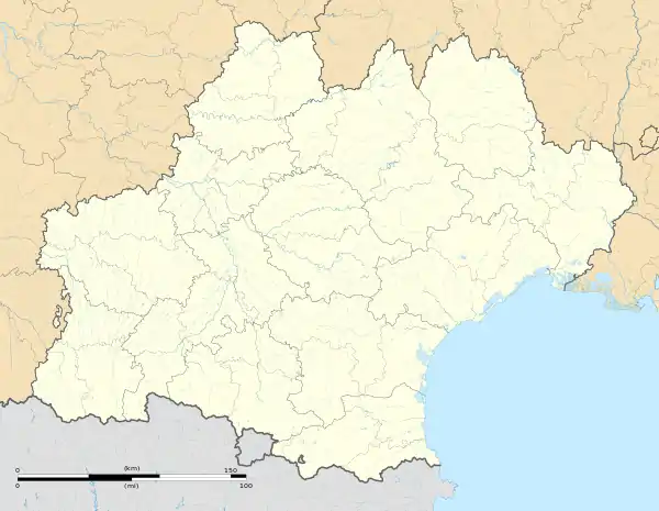 Saint-Julien-de-la-Nef | |
| Coordinates: 43°57′57″N 3°41′21″E / 43.9658°N 3.6892°E | |
| Country | France |
| Region | Occitania |
| Department | Gard |
| Arrondissement | Le Vigan |
| Canton | Le Vigan |
| Intercommunality | Cévennes Gangeoises et Suménoises |
| Government | |
| • Mayor (2020–2026) | Lucas Faidherbe[1] |
| Area 1 | 8.83 km2 (3.41 sq mi) |
| Population | 144 |
| • Density | 16/km2 (42/sq mi) |
| Time zone | UTC+01:00 (CET) |
| • Summer (DST) | UTC+02:00 (CEST) |
| INSEE/Postal code | 30272 /30440 |
| Elevation | 149–529 m (489–1,736 ft) (avg. 167 m or 548 ft) |
| 1 French Land Register data, which excludes lakes, ponds, glaciers > 1 km2 (0.386 sq mi or 247 acres) and river estuaries. | |
Saint-Julien-de-la-Nef (French pronunciation: [sɛ̃ ʒyljɛ̃ də la nɛf]; Languedocien: Sent Julian de la Nau) is a commune in the Gard department in southern France.
Population
| Year | Pop. | ±% p.a. |
|---|---|---|
| 1968 | 86 | — |
| 1975 | 100 | +2.18% |
| 1982 | 99 | −0.14% |
| 1990 | 140 | +4.43% |
| 1999 | 119 | −1.79% |
| 2009 | 124 | +0.41% |
| 2014 | 129 | +0.79% |
| 2020 | 144 | +1.85% |
| Source: INSEE[3] | ||
See also
References
- ↑ "Répertoire national des élus: les maires". data.gouv.fr, Plateforme ouverte des données publiques françaises (in French). 2 December 2020.
- ↑ "Populations légales 2021". The National Institute of Statistics and Economic Studies. 28 December 2023.
- ↑ Population en historique depuis 1968, INSEE
Wikimedia Commons has media related to Saint-Julien-de-la-Nef.
This article is issued from Wikipedia. The text is licensed under Creative Commons - Attribution - Sharealike. Additional terms may apply for the media files.