Súľov-Hradná | |
|---|---|
Village | |
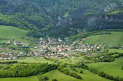 Aerial view on Sulov | |
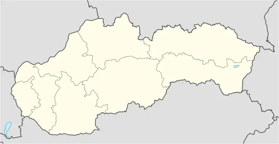 Súľov-Hradná Location of Súľov-Hradná in Slovakia | |
| Coordinates: 49°10′N 18°36′E / 49.167°N 18.600°E | |
| Country | Slovakia |
| Region | Žilina |
| District | Bytča |
| First mentioned | 1193 |
| Area | |
| • Total | 22.93[1] km2 (8.85[1] sq mi) |
| Elevation | 418[2] m (1,371[2] ft) |
| Population (2021) | |
| • Total | 985[3] |
| Postal code | 013 52[2] |
| Area code | +421 41[2] |
| Car plate | BY |
Súľov-Hradná (Hungarian: Szulyóváralja) is a village and municipality in Bytča District in the Žilina Region of northern Slovakia.
History
In historical records the village was first mentioned in 1193.
Geography
The municipality lies at an altitude of 400 metres and covers an area of 22.953 km². It has a population of about 929 people.[4]
The village is situated within the Súľov Mountains, and the highest mountain of the picturesque Súľov Rocks, Zibrid (867 m), is part of Súľov-Hradná's territory.
Gallery
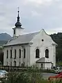 Church in Sulov
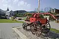 Square with a church and a historical fire truck
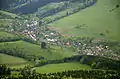 The municipality Súľov-Hradná - Hradná part
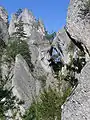 Súľov Rocks
References
- 1 2 "Hustota obyvateľstva - obce [om7014rr_ukaz: Rozloha (Štvorcový meter)]". www.statistics.sk (in Slovak). Statistical Office of the Slovak Republic. 2022-03-31. Retrieved 2022-03-31.
- 1 2 3 4 "Základná charakteristika". www.statistics.sk (in Slovak). Statistical Office of the Slovak Republic. 2015-04-17. Retrieved 2022-03-31.
- ↑ "Počet obyvateľov podľa pohlavia - obce (ročne)". www.statistics.sk (in Slovak). Statistical Office of the Slovak Republic. 2022-03-31. Retrieved 2022-03-31.
- ↑ Mestská a obecná štatistika SR
External links
- Municipal website (in Slovak)
This article is issued from Wikipedia. The text is licensed under Creative Commons - Attribution - Sharealike. Additional terms may apply for the media files.