Pueblo East, Texas | |
|---|---|
| Coordinates: 27°40′29″N 99°11′23″W / 27.67472°N 99.18972°W | |
| Country | United States |
| State | Texas |
| County | Webb |
| Area | |
| • Total | 0.1 sq mi (0.3 km2) |
| • Land | 0.1 sq mi (0.3 km2) |
| • Water | 0.0 sq mi (0 km2) |
| Elevation | 568 ft (173 m) |
| Population (2020) | |
| • Total | 1 |
| • Density | 10/sq mi (3.9/km2) |
| Time zone | UTC-6 (Central (CST)) |
| • Summer (DST) | UTC-5 (CDT) |
| Zip Code | 78044 |
| GNIS feature ID | 2584716[1] |
Pueblo East is a census-designated place (CDP) in Webb County, Texas, United States. This was a new CDP formed from parts of the Ranchitos Las Lomas CDP prior to the 2010 census. Despite being a new CDP, the population was listed as zero.[2]
Geography
Pueblo East is located at 27°40′29″N 99°11′23″W / 27.67472°N 99.18972°W (27.674829, -99.189648). The CDP has a total area of 0.1 square miles (0.26 km2), all land.[3]
Education
Residents are in the United Independent School District.[4] Zoned schools include: Dr. Henry Cuellar Elementary School,[5] Antonio Gonzalez Middle School,[6] and United South High School.[7]
The designated community college for Webb County is Laredo Community College.[8]
Demographics
| Census | Pop. | Note | %± |
|---|---|---|---|
| 2010 | 0 | — | |
| 2020 | 1 | — | |
| U.S. Decennial Census[9] 2010[10] 2020[11] | |||
2020 census
| Race / Ethnicity | Pop 2010[10] | Pop 2020[11] | % 2010 | % 2020 |
|---|---|---|---|---|
| White alone (NH) | 0 | 1 | 0.00% | 100.00% |
| Black or African American alone (NH) | 0 | 0 | 0.00% | 0.00% |
| Native American or Alaska Native alone (NH) | 0 | 0 | 0.00% | 0.00% |
| Asian alone (NH) | 0 | 0 | 0.00% | 0.00% |
| Pacific Islander alone (NH) | 0 | 0 | 0.00% | 0.00% |
| Some Other Race alone (NH) | 0 | 0 | 0.00% | 0.00% |
| Mixed Race/Multi-Racial (NH) | 0 | 0 | 0.00% | 0.00% |
| Hispanic or Latino (any race) | 0 | 0 | 0.00% | 0.00% |
| Total | 0 | 1 | 100.00% | 100.00% |
References
- 1 2 "Pueblo East Census Designated Place". Geographic Names Information System. United States Geological Survey, United States Department of the Interior.
- ↑ "Population and Housing Unit Counts, 2010 Census of Population and Housing" (PDF). Texas: 2010. Retrieved January 3, 2017.
- ↑ "Boundary Map of Pueblo East, Texas". MapTechnica. Retrieved January 3, 2017.
- ↑ "SCHOOL DISTRICT REFERENCE MAP (2020 CENSUS): Webb County, TX" (PDF). U.S. Census Bureau. Retrieved April 19, 2021. - 2010 map
- ↑ "School Boundary Map". Dr. Henry Cuellar Elementary School. Retrieved August 30, 2022. - PDF map
- ↑ "School Boundary Map". Gonzalez Middle School. Retrieved August 30, 2022. - PDF
- ↑ "Boundary Map". United South High School. Retrieved August 29, 2022. - PDF map - See interactive school district map
- ↑ Texas Education Code Sec. 130.185. LAREDO COMMUNITY COLLEGE DISTRICT SERVICE AREA.
- ↑ "Decennial Census by Decade". US Census Bureau.
- 1 2 "P2 HISPANIC OR LATINO, AND NOT HISPANIC OR LATINO BY RACE – 2010: DEC Redistricting Data (PL 94-171) – Pueblo East CDP, Texas". United States Census Bureau.
- 1 2 "P2 HISPANIC OR LATINO, AND NOT HISPANIC OR LATINO BY RACE - 2020: DEC Redistricting Data (PL 94-171) – Pueblo East CDP, Texas". United States Census Bureau.
Municipalities and communities of Webb County, Texas, United States | ||
|---|---|---|
| Cities | 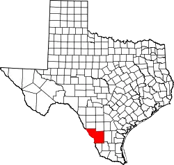 Webb County map | |
| CDPs |
| |
| Other communities |
| |
| Ghost towns | ||
This article is issued from Wikipedia. The text is licensed under Creative Commons - Attribution - Sharealike. Additional terms may apply for the media files.