This is a list of the National Register of Historic Places listings in Texas' High Plains.
The High Plains region is an area of 41 counties defined by the Texas Comptroller for economic reporting in 2022, as mapped here. It includes all of the Texas Panhandle by most definitions of that term. The region included 2020 population of 866,000, or three percent of Texas' population, with Lubbock and Amarillo MSAs together having 68 percent of the High Plains' population.[1]
To see all locations together in a map, click on "Map all coordinates using OpenSourceMap" at right.
Armstrong County
| [2] | Name on the Register | Image | Date listed[3] | Location | City or town | Description |
|---|---|---|---|---|---|---|
| 1 | Charles and Mary Ann (Molly) Goodnight Ranch House | 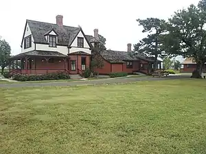 Charles and Mary Ann (Molly) Goodnight Ranch House |
September 20, 2007 (#07000988) |
US 287 and 5000 Block County Road 25 35°01′50″N 101°10′59″W / 35.030516°N 101.183067°W |
Goodnight | Now houses the Charles Goodnight Historical Center |
| 2 | J A Ranch | 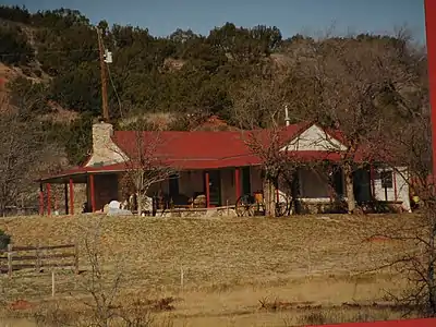 J A Ranch |
October 15, 1966 (#66000807) |
Palo Duro Canyon 34°49′00″N 101°11′17″W / 34.816667°N 101.188056°W |
Palo Duro | aka Goodnight Ranch |
| 3 | Palo Duro Pen | July 12, 1984 (#84001568) |
Address restricted[4] |
Claude | Smithsonian trinomial 41AM5 | |
| 4 | Palo Duro Shelter |  Palo Duro Shelter |
July 12, 1984 (#84001569) |
Address restricted[4] |
Claude | Smithsonian trinomial 41AM6 |
Bailey County
(has no NRHP listings)
Briscoe County
| [2] | Name on the Register | Image | Date listed[3] | Location | City or town | Description |
|---|---|---|---|---|---|---|
| 1 | Lake Theo Folsom site complex |  Lake Theo Folsom site complex |
April 28, 1975 (#75001960) |
Caprock Canyons State Park 34°24′48″N 101°04′00″W / 34.413333°N 101.066667°W |
Quitaque | Primarily located on the southern side of Lake Theo[5] |
| 2 | Mayfield Dugout | June 18, 1973 (#73001960) |
7 mi. NW of Silverton 34°30′29″N 101°25′26″W / 34.508056°N 101.423889°W |
Silverton |
Carson County
| [2] | Name on the Register | Image | Date listed[3] | Location | City or town | Description |
|---|---|---|---|---|---|---|
| 1 | Atchison, Topeka and Santa Fe Railway Depot, Panhandle | 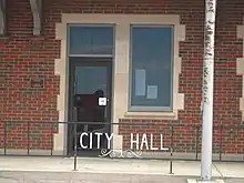 Atchison, Topeka and Santa Fe Railway Depot, Panhandle |
April 25, 2003 (#03000326) |
One Main St. 35°20′28″N 101°22′39″W / 35.341111°N 101.3775°W |
Panhandle | Recorded Texas Historic Landmark, now the Panhandle City Hall |
| 2 | Carson County Square House Museum | 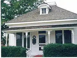 Carson County Square House Museum |
March 7, 1973 (#73001961) |
5th and Elsie Sts. 35°20′46″N 101°22′49″W / 35.346111°N 101.380278°W |
Panhandle | Recorded Texas Historic Landmark |
| 3 | Panhandle Inn | February 28, 2017 (#100000693) |
301 Main St. 35°20′37″N 101°22′48″W / 35.343722°N 101.379943°W |
Panhandle | ||
| 4 | Route 66, Texas 207 to I-40 | 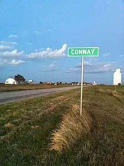 Route 66, Texas 207 to I-40 |
April 3, 2007 (#06000924) |
Texas Farm Rd. 2161, from I-40 to TX 207 35°13′21″N 101°30′02″W / 35.2225°N 101.500556°W |
Conway |
Castro County
(has no NRHP listings)
Childress County
| [2] | Name on the Register | Image | Date listed[3] | Location | City or town | Description |
|---|---|---|---|---|---|---|
| 1 | Childress Commercial and Civic Historic District | Childress Commercial and Civic Historic District |
June 7, 2016 (#16000349) |
Roughly bounded by 3rd St., NW., Aves. A & I, 2nd St., NE., Fair Park & 810 Ave. I NE. 34°25′24″N 100°12′24″W / 34.423353°N 100.206753°W |
Childress | Includes Recorded Texas Historic Landmarks |
Cochran County
(has no NRHP listings)
Collingsworth County
| [2] | Name on the Register | Image | Date listed[3] | Location | City or town | Description |
|---|---|---|---|---|---|---|
| 1 | State Highway 203 (Old TX 52) Bridge at Salt Fork of the Red River | April 14, 2015 (#15000152) |
TX 203 at Salt Fork of Red River 34°53′15″N 100°03′04″W / 34.887541°N 100.051235°W |
Wellington vicinity | ||
| 2 | US 83 Bridge at the Salt Fork of the Red River | October 10, 1996 (#96001117) |
US 83, 16 mi. S of Wheeler Cnty. line 34°57′27″N 100°13′16″W / 34.9575°N 100.221111°W |
Wellington | Demolished |
Crosby County
(has no NRHP listings)
Dallam County
| [2] | Name on the Register[6] | Image | Date listed[3] | Location | City or town | Description |
|---|---|---|---|---|---|---|
| 1 | Dallam County Courthouse | 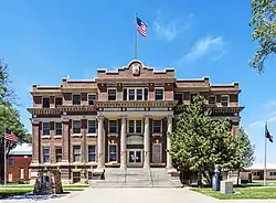 Dallam County Courthouse |
October 15, 1992 (#92001375) |
Jct. of Fifth and Denrock Sts. 36°03′42″N 102°31′21″W / 36.061667°N 102.5225°W |
Dalhart | Recorded Texas Historic Landmark |
Deaf Smith County
| [2] | Name on the Register | Image | Date listed[3] | Location | City or town | Description |
|---|---|---|---|---|---|---|
| 1 | E. B. Black House | _from_SW_3.JPG.webp) E. B. Black House |
July 17, 1978 (#78002923) |
508 W. 3rd St. 34°48′52″N 102°24′17″W / 34.814543°N 102.404605°W |
Hereford | State Antiquities Landmark, Recorded Texas Historic Landmark; houses Deaf Smith County Historical Museum |
| 2 | Glenrio Historic District | 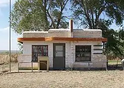 Glenrio Historic District |
January 17, 2007 (#06001258) |
Loop 504 35°10′44″N 103°02′32″W / 35.178889°N 103.042222°W |
Glenrio | Extends into Quay County, New Mexico |
Dickens County
| [2] | Name on the Register | Image | Date listed[3] | Location | City or town | Description |
|---|---|---|---|---|---|---|
| 1 | Dickens County Courthouse and Jail | 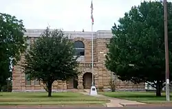 Dickens County Courthouse and Jail |
September 4, 1980 (#80004098) |
Bounded by 4th, 5th, Montgomery and Crow Sts. 33°37′16″N 100°50′10″W / 33.621111°N 100.836111°W |
Dickens | State Antiquities Landmark, Recorded Texas Historic Landmark |
Donley County
| [2] | Name on the Register | Image | Date listed[3] | Location | City or town | Description |
|---|---|---|---|---|---|---|
| 1 | Clarendon Motor Company Building |  Clarendon Motor Company Building |
November 10, 1994 (#94001309) |
221 S. Sully St. 34°56′16″N 100°53′20″W / 34.937778°N 100.888889°W |
Clarendon | |
| 2 | Donley County Courthouse and Jail | 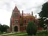 Donley County Courthouse and Jail |
February 17, 1978 (#78002924) |
Public Sq. 34°56′14″N 100°53′26″W / 34.937222°N 100.890556°W |
Clarendon | State Antiquities Landmark, Recorded Texas Historic Landmark |
| 3 | Martin-Lowe House | 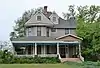 Martin-Lowe House |
November 21, 1985 (#85002911) |
507 W. Fifth 34°56′13″N 100°53′38″W / 34.936944°N 100.893889°W |
Clarendon | Recorded Texas Historic Landmark |
Floyd County
| [2] | Name on the Register | Image | Date listed[3] | Location | City or town | Description |
|---|---|---|---|---|---|---|
| 1 | Floyd County Stone Corral |  Floyd County Stone Corral |
September 27, 1984 (#84001666) |
Address restricted[4] |
Floydada | |
| 2 | Floydada Country Club Site | Floydada Country Club Site |
November 7, 1979 (#79002939) |
Address restricted[4] |
Floydada | |
| 3 | Quitaque Railway Tunnel | September 13, 1977 (#77001442) |
10 mi (16 km). SW of Quitaque 34°14′34″N 101°07′17″W / 34.242778°N 101.121389°W |
Quitaque | Now known as the Clarity Tunnel; State Antiquities Landmark |
Garza County
| [2] | Name on the Register | Image | Date listed[3] | Location | City or town | Description |
|---|---|---|---|---|---|---|
| 1 | Cooper's Canyon Site 41 GR 25 | Cooper's Canyon Site 41 GR 25 |
November 7, 1978 (#78002933) |
Address restricted[4] |
Post | |
| 2 | Garza County Courthouse | 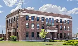 Garza County Courthouse |
November 21, 2001 (#01001266) |
300 W. Main St. 33°11′27″N 101°22′53″W / 33.190833°N 101.381389°W |
Post | Recorded Texas Historic Landmark |
| 3 | O.S. Ranch Petroglyphs 41 GR 57 | O.S. Ranch Petroglyphs 41 GR 57 |
January 31, 1978 (#78002934) |
Address restricted[4] |
Post | |
| 4 | Old Post Sanitarium | 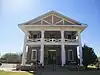 Old Post Sanitarium |
May 21, 1975 (#75001984) |
117 North Ave. N 33°11′31″N 101°23′01″W / 33.191944°N 101.383611°W |
Post | Recorded Texas Historic Landmark |
| 5 | Post West Dugout | Post West Dugout |
May 22, 1978 (#78002935) |
Address restricted[4] |
Post | |
| 6 | Post-Montgomery Site 41 GR 188 | Post-Montgomery Site 41 GR 188 |
November 7, 1978 (#78002936) |
Address restricted[4] |
Post |
Gray County
| [2] | Name on the Register | Image | Date listed[3] | Location | City or town | Description |
|---|---|---|---|---|---|---|
| 1 | Central Fire Station | .JPG.webp) Central Fire Station |
December 30, 1999 (#99001623) |
203 W. Foster 35°32′06″N 100°57′44″W / 35.535°N 100.962222°W |
Pampa | |
| 2 | Combs-Worley Building | 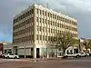 Combs-Worley Building |
December 30, 1999 (#99001625) |
120 W. Kingsmille 35°32′12″N 100°57′46″W / 35.536667°N 100.962778°W |
Pampa | Recorded Texas Historic Landmark |
| 3 | Gray County Courthouse | .JPG.webp) Gray County Courthouse |
February 20, 1998 (#98000142) |
205 N. Russell 35°32′12″N 100°57′50″W / 35.536667°N 100.963889°W |
Pampa | Recorded Texas Historic Landmark |
| 4 | McLean Commercial Historic District | 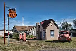 McLean Commercial Historic District |
December 20, 2006 (#06001153) |
Roughly bounded by Railroad, Rowe, Second and Gray Sts. 35°13′58″N 100°36′09″W / 35.232673°N 100.602508°W |
McLean | |
| 5 | Pampa City Hall | 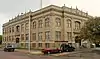 Pampa City Hall |
December 30, 1999 (#99001622) |
200 W. Foster 35°32′08″N 100°57′46″W / 35.535556°N 100.962778°W |
Pampa | Recorded Texas Historic Landmark |
| 6 | Schneider Hotel | 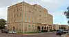 Schneider Hotel |
December 19, 1985 (#85003215) |
120 S. Russell 35°32′04″N 100°57′42″W / 35.534444°N 100.961667°W |
Pampa | |
| 7 | US Post Office-Pampa Main | 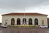 US Post Office-Pampa Main |
November 17, 1986 (#86003236) |
120 E. Foster 35°32′10″N 100°57′36″W / 35.536111°N 100.96°W |
Pampa | Recorded Texas Historic Landmark |
| 8 | White Deer Land Company Building | 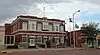 White Deer Land Company Building |
January 14, 2000 (#99001701) |
116 S. Cuyler 35°32′05″N 100°57′38″W / 35.534722°N 100.960556°W |
Pampa |
Hale County
| [2] | Name on the Register[6] | Image | Date listed[3] | Location | City or town | Description |
|---|---|---|---|---|---|---|
| 1 | Plainview Commercial Historic District | .jpg.webp) Plainview Commercial Historic District |
December 2, 1982 (#82004855) |
Roughly bounded by E. 4th, Austin, E. 9th, and Ash Sts. (both sides) 34°11′08″N 101°42′11″W / 34.185556°N 101.703056°W |
Plainview | Includes one Recorded Texas Historic Landmark |
| 2 | Plainview Site | Plainview Site |
October 15, 1966 (#66000814) |
Address restricted[4] |
Plainview |
Hall County
| [2] | Name on the Register | Image | Date listed[3] | Location | City or town | Description |
|---|---|---|---|---|---|---|
| 1 | Hall County Courthouse | 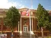 Hall County Courthouse |
October 1, 2008 (#08000961) |
512 W. Main 34°43′31″N 100°32′06″W / 34.725286°N 100.535097°W |
Memphis | State Antiquities Landmark, Recorded Texas Historic Landmark |
| 2 | Hotel Turkey | .jpg.webp) Hotel Turkey |
October 24, 1991 (#91001521) |
Jct. of 3rd and Alexander Sts. 34°23′38″N 100°53′51″W / 34.393889°N 100.8975°W |
Turkey | Recorded Texas Historic Landmark |
Hansford County
| [2] | Name on the Register | Image | Date listed[3] | Location | City or town | Description |
|---|---|---|---|---|---|---|
| 1 | Hansford County Courthouse | 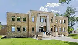 Hansford County Courthouse |
March 22, 2019 (#100003537) |
15 NW Court St. 36°11′54″N 101°11′32″W / 36.198229°N 101.192190°W |
Spearman |
Hartley County
| [2] | Name on the Register | Image | Date listed[3] | Location | City or town | Description |
|---|---|---|---|---|---|---|
| 1 | Hartley County Courthouse and Jail | _Channing%252C_Texas.jpg.webp) Hartley County Courthouse and Jail |
December 31, 1987 (#87002237) |
Railroad Ave. 35°40′54″N 102°19′57″W / 35.681667°N 102.3325°W |
Channing | State Antiquities Landmark, Recorded Texas Historic Landmarks |
| 2 | Proctor Pen I | Proctor Pen I |
July 12, 1984 (#84001852) |
Address restricted[4] |
Amarillo | |
| 3 | Miguel Tafoya Place | Miguel Tafoya Place |
July 12, 1984 (#84001854) |
Address restricted[4] |
Amarillo | |
| 4 | XIT General Office | 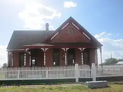 XIT General Office |
May 6, 1985 (#85000960) |
Railroad Ave. and 5th St. 35°41′09″N 102°19′52″W / 35.685833°N 102.331111°W |
Channing | Recorded Texas Historic Landmarks |
Hemphill County
| [2] | Name on the Register | Image | Date listed[3] | Location | City or town | Description |
|---|---|---|---|---|---|---|
| 1 | Battle of Lyman's Wagon Train | Battle of Lyman's Wagon Train |
August 13, 2001 (#01000875) |
Address restricted[4] |
Canadian |
Hockley County
(has no NRHP listings)
Hutchinson County
| [2] | Name on the Register | Image | Date listed[3] | Location | City or town | Description |
|---|---|---|---|---|---|---|
| 1 | Adobe Walls | May 22, 1978 (#78002958) |
Address restricted[4] |
Stinnett | ||
| 2 | Antelope Creek Archeological District | Antelope Creek Archeological District |
September 22, 1972 (#72001366) |
Address restricted[4] |
Fritch | |
| 3 | Hutchinson County Courthouse | Hutchinson County Courthouse |
August 28, 2012 (#12000587) |
500 North Main Street 35°49′39″N 101°26′32″W / 35.827504°N 101.442348°W |
Stinnett | Recorded Texas Historic Landmark |
King County
(has no NRHP listings)
Lamb County
(has no NRHP listings)
Lipscomb County
| [2] | Name on the Register | Image | Date listed[3] | Location | City or town | Description |
|---|---|---|---|---|---|---|
| 1 | Lipscomb County Courthouse | 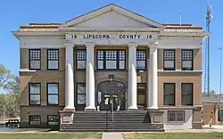 Lipscomb County Courthouse |
July 9, 2008 (#08000730) |
Courthouse Square 36°14′02″N 100°16′14″W / 36.233800°N 100.270550°W |
Lipscomb | State Antiquities Landmark, Recorded Texas Historic Landmark |
Lubbock County
| [2] | Name on the Register[6] | Image | Date listed[3] | Location | City or town | Description |
|---|---|---|---|---|---|---|
| 1 | Warren and Myrta Bacon House | .jpg.webp) Warren and Myrta Bacon House |
July 15, 1982 (#82004512) |
1802 Broadway 33°35′06″N 101°51′23″W / 33.585°N 101.856389°W |
Lubbock | Recorded Texas Historic Landmark |
| 2 | Cactus Theater | .jpg.webp) Cactus Theater |
May 8, 1998 (#98000447) |
1812 Buddy Holly Ave. 33°34′42″N 101°50′39″W / 33.578333°N 101.844167°W |
Lubbock | |
| 3 | Canyon Lakes Archeological District | Canyon Lakes Archeological District |
March 26, 1976 (#76002049) |
Address restricted[4] |
Lubbock | |
| 4 | Carlock Building | .jpg.webp) Carlock Building |
July 28, 2004 (#04000767) |
1001-1013 13th St. 33°35′00″N 101°50′45″W / 33.583333°N 101.845833°W |
Lubbock | |
| 5 | Fort Worth and Denver South Plains Railway Depot | 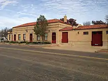 Fort Worth and Denver South Plains Railway Depot |
July 26, 1990 (#90001120) |
1801 Ave. G 33°34′43″N 101°50′32″W / 33.578611°N 101.842222°W |
Lubbock | |
| 6 | Great Plains Life Insurance Company Building | 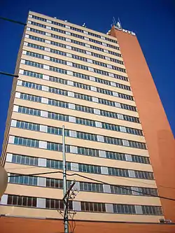 Great Plains Life Insurance Company Building |
March 17, 2021 (#100006318) |
1220 Broadway 33°35′05″N 101°50′56″W / 33.5848°N 101.8488°W |
Lubbock | AKA Metro Tower or NTS Tower. |
| 7 | Holden Properties Historic District | Holden Properties Historic District |
May 29, 1998 (#98000602) |
3103, 3105, 3105A, 3105B, 3107, 3109, and 3111 20th St. 33°34′34″N 101°52′56″W / 33.576111°N 101.882222°W |
Lubbock | |
| 8 | William Curry and Olive Price Holden House | William Curry and Olive Price Holden House |
August 5, 1994 (#94000834) |
3109 20th St. 33°34′34″N 101°52′54″W / 33.576111°N 101.881667°W |
Lubbock | Part of Holden Properties Historic District |
| 9 | In Town Inn | September 1, 2022 (#100008171) |
1212 Main St. 33°35′08″N 101°50′54″W / 33.5856°N 101.8482°W |
Lubbock | ||
| 10 | Kress Building | 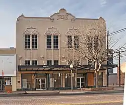 Kress Building |
October 2, 1992 (#92001305) |
1109 Broadway 33°35′05″N 101°50′50″W / 33.584722°N 101.847268°W |
Lubbock | |
| 11 | Lubbock County Jail | 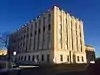 Lubbock County Jail |
February 13, 2018 (#100002130) |
811 Main St. 33°35′08″N 101°50′38″W / 33.585541°N 101.843783°W |
Lubbock | |
| 12 | Lubbock High School | .jpg.webp) Lubbock High School |
May 1, 1985 (#85000924) |
2004 19th St. 33°34′41″N 101°51′35″W / 33.578056°N 101.859722°W |
Lubbock | Recorded Texas Historic Landmark |
| 13 | Lubbock Lake Site | 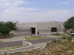 Lubbock Lake Site |
June 21, 1971 (#71000948) |
Landmark Dr off US 84 33°37′19″N 101°53′23″W / 33.621944°N 101.889722°W |
Lubbock | |
| 14 | Lubbock Post Office and Federal Building |  Lubbock Post Office and Federal Building |
February 17, 1995 (#95000101) |
800 Broadway 33°35′06″N 101°50′35″W / 33.585°N 101.843056°W |
Lubbock | |
| 15 | Fred and Annie Snyder House | 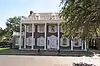 Fred and Annie Snyder House |
January 28, 1992 (#91002019) |
2701 19th St. 33°34′38″N 101°52′30″W / 33.577222°N 101.875°W |
Lubbock | |
| 16 | South Overton Residential Historic District | 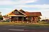 South Overton Residential Historic District |
March 14, 1996 (#96000276) |
Roughly bounded by Broadway, Ave. Q., 19th St. and University Ave. 33°34′51″N 101°51′47″W / 33.580833°N 101.863056°W |
Lubbock | |
| 17 | Texas Technological College Dairy Barn | .jpg.webp) Texas Technological College Dairy Barn |
April 2, 1992 (#92000336) |
Texas Tech University campus 33°34′53″N 101°52′40″W / 33.581389°N 101.877778°W |
Lubbock | Recorded Texas Historic Landmark; part of Texas Technological College Historic District |
| 18 | Texas Technological College Historic District |  Texas Technological College Historic District |
May 10, 1996 (#96000523) |
Roughly bounded by 6th St., University Ave., 19th St., and Flint St. 33°35′02″N 101°52′28″W / 33.583889°N 101.874444°W |
Lubbock | |
| 19 | Tubbs-Carlisle House | 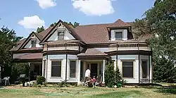 Tubbs-Carlisle House |
November 2, 1990 (#90001719) |
602 Fulton Ave. 33°35′23″N 101°56′35″W / 33.589722°N 101.943056°W |
Lubbock | Recorded Texas Historic Landmark |
Lynn County
| [2] | Name on the Register | Image | Date listed[3] | Location | City or town | Description |
|---|---|---|---|---|---|---|
| 1 | Lynn County Courthouse | 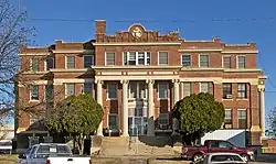 Lynn County Courthouse |
July 8, 1982 (#82004513) |
Bounded by 1st St., 2nd St., Ave. H, and Ave. J 33°09′53″N 101°47′46″W / 33.16461°N 101.79614°W |
Tahoka | Courthouse built in 1916, still in use as that in 2023; also a State Antiquities Landmark, Recorded Texas Historic Landmark |
Moore County
(has no NRHP listings)
Motley County
| [2] | Name on the Register | Image | Date listed[3] | Location | City or town | Description |
|---|---|---|---|---|---|---|
| 1 | Traweek House | .jpg.webp) Traweek House |
May 2, 1991 (#91000486) |
927 Lariat St. 34°00′41″N 100°49′29″W / 34.011389°N 100.824722°W |
Matador | Recorded Texas Historic Landmark |
Ochiltree County
| [2] | Name on the Register | Image | Date listed[3] | Location | City or town | Description |
|---|---|---|---|---|---|---|
| 1 | Buried City Site (41OC1) | Buried City Site (41OC1) |
September 13, 1984 (#84001923) |
Address restricted[4] |
Perryton | |
| 2 | Plainview Hardware Company Building | June 14, 1990 (#90000904) |
210 S. Main St. 36°23′53″N 100°48′10″W / 36.398056°N 100.802778°W |
Perryton |
Oldham County
| [2] | Name on the Register[6] | Image | Date listed[3] | Location | City or town | Description |
|---|---|---|---|---|---|---|
| 1 | Chavez City Ruins (41OL253) | Chavez City Ruins (41OL253) |
July 12, 1984 (#84001925) |
Address restricted[4] |
Amarillo | |
| 2 | Chavez Suburbs East and West (41OL254) | Chavez Suburbs East and West (41OL254) |
July 12, 1984 (#84001928) |
Address restricted[4] |
Amarillo | |
| 3 | Green No. 5 (41OL257) | Green No. 5 (41OL257) |
July 12, 1984 (#84001936) |
Address restricted[4] |
Amarillo | |
| 4 | Griffin Site (41OL246) | Griffin Site (41OL246) |
July 12, 1984 (#84001938) |
Address restricted[4] |
Amarillo | |
| 5 | Landergin Mesa | Landergin Mesa |
October 15, 1966 (#66000821) |
Address restricted[4] |
Vega | |
| 6 | Mansfield I (41OL50) | Mansfield I (41OL50) |
July 12, 1984 (#84001940) |
Address restricted[4] |
Amarillo | |
| 7 | Maston I (41OL256) | Maston I (41OL256) |
July 12, 1984 (#84001942) |
Address restricted[4] |
Amarillo | |
| 8 | Maston No. 13 Stone Wall (41OL249) | Maston No. 13 Stone Wall (41OL249) |
September 10, 1984 (#84001945) |
Address restricted[4] |
Adrian | |
| 9 | Maston No. 52 (41OL235) | Maston No. 52 (41OL235) |
July 12, 1984 (#84001948) |
Address restricted[4] |
Amarillo | |
| 10 | Rocky Dell | Rocky Dell |
February 23, 1972 (#72001370) |
Address restricted[4] |
Adrian | |
| 11 | Stone Corrals No. 1-6 (41OL250) | Stone Corrals No. 1-6 (41OL250) |
July 12, 1984 (#84001951) |
Address restricted[4] |
Amarillo | |
| 12 | Vega Motel | .jpg.webp) Vega Motel |
October 5, 2006 (#06000926) |
1005 Vega Blvd. 35°14′33″N 102°25′46″W / 35.242544°N 102.429357°W |
Vega |
Parmer County
| [2] | Name on the Register | Image | Date listed[3] | Location | City or town | Description |
|---|---|---|---|---|---|---|
| 1 | Parmer County Courthouse | 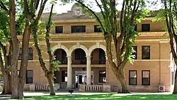 Parmer County Courthouse |
March 6, 2019 (#100003490) |
401 3rd St. 34°23′05″N 103°02′22″W / 34.384807°N 103.039506°W |
Farwell |
Potter County
| [2] | Name on the Register | Image | Date listed[3] | Location | City or town | Description |
|---|---|---|---|---|---|---|
| 1 | Alibates Flint Quarries National Monument | 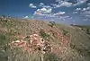 Alibates Flint Quarries National Monument |
October 15, 1966 (#66000822) |
SW of Fritch on the Canadian River 35°34′56″N 101°40′19″W / 35.582092°N 101.672078°W |
Fritch | |
| 2 | Amarillo Building |  Amarillo Building |
February 23, 2018 (#100002131) |
301 S Polk 35°12′38″N 101°50′11″W / 35.210624°N 101.836449°W |
Amarillo | |
| 3 | Amarillo College Administration Building and Gymnasium | .jpg.webp) Amarillo College Administration Building and Gymnasium |
January 28, 1992 (#91002023) |
2201 S. Washington St. and 2221 S. Washington St. 35°11′18″N 101°50′53″W / 35.188335°N 101.848164°W |
Amarillo | Recorded Texas Historic Landmarks |
| 4 | Amarillo US Post Office and Courthouse | .jpg.webp) Amarillo US Post Office and Courthouse |
September 29, 2000 (#00001175) |
205 E. Fifth St. 35°12′31″N 101°50′03″W / 35.208611°N 101.834167°W |
Amarillo | |
| 5 | American National Bank of Amarillo and SPS Tower |  American National Bank of Amarillo and SPS Tower |
March 6, 2019 (#100003493) |
600 S. Tyler St. 35°12′26″N 101°50′19″W / 35.207353°N 101.838623°W |
Amarillo | |
| 6 | Atchison, Topeka and Santa Fe Railway Company Depot and Locomotive No. 5000 |  Atchison, Topeka and Santa Fe Railway Company Depot and Locomotive No. 5000 |
September 18, 1986 (#86002189) |
Corner of 2nd and Lincoln 35°12′31″N 101°49′36″W / 35.208611°N 101.826667°W |
Amarillo | Moved from original location at 307 S Grant in 2005[7] |
| 7 | Bivins House | .jpg.webp) Bivins House |
December 31, 1974 (#74002088) |
1000 Polk St. 35°12′11″N 101°50′17″W / 35.203056°N 101.838056°W |
Amarillo | Recorded Texas Historic Landmark |
| 8 | Miles and Myda Bivins House |  Miles and Myda Bivins House |
October 2, 1992 (#92001306) |
2311 W. 16th Ave. 35°11′49″N 101°51′47″W / 35.196944°N 101.863056°W |
Amarillo | |
| 9 | Central Presbyterian Church | .jpg.webp) Central Presbyterian Church |
November 13, 1991 (#91001649) |
1100 S Harrison St 35°12′10″N 101°50′26″W / 35.202778°N 101.840556°W |
Amarillo | |
| 10 | Alice Ghormley Curtis House | 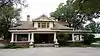 Alice Ghormley Curtis House |
August 14, 1992 (#92000980) |
1626 S. Washington St. 35°11′48″N 101°50′54″W / 35.196667°N 101.848333°W |
Amarillo | Recorded Texas Historic Landmark |
| 11 | Douglas DC-3 Airplane, N34 |  Douglas DC-3 Airplane, N34 |
May 29, 1997 (#97000443) |
Texas Air & Space Museum, 10001 American Drive 35°12′48″N 101°42′53″W / 35.2133°N 101.7148°W |
Amarillo | relocated from Oklahoma City in 2014[8] |
| 12 | First Baptist Church | 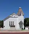 First Baptist Church |
June 21, 1983 (#83003158) |
218 W. 13th St. 35°12′04″N 101°50′22″W / 35.201111°N 101.839444°W |
Amarillo | |
| 13 | Fisk Medical Arts Building | 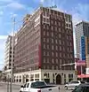 Fisk Medical Arts Building |
December 4, 2012 (#12001003) |
724 S. Polk St. 35°12′21″N 101°50′16″W / 35.20584°N 101.83774°W |
Amarillo | Recorded Texas Historic Landmark, now a Courtyard by Marriott hotel |
| 14 | Jons-Gilvin House | 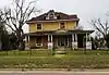 Jons-Gilvin House |
August 14, 1992 (#92000983) |
1500 S. Buchanan St. 35°11′51″N 101°50′01″W / 35.1975°N 101.833611°W |
Amarillo | |
| 15 | Kouns-Jackson House | 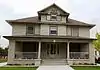 Kouns-Jackson House |
August 14, 1992 (#92000981) |
1118 S. Harrison St. 35°12′07″N 101°50′26″W / 35.201944°N 101.840556°W |
Amarillo | |
| 16 | Landergin-Harrington House | 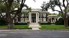 Landergin-Harrington House |
December 16, 1977 (#77001466) |
1600 Polk St. 35°11′49″N 101°50′20″W / 35.196944°N 101.838889°W |
Amarillo | |
| 17 | Levine's Department Store | .jpg.webp) Levine's Department Store |
December 27, 2016 (#16000917) |
800 S. Polk St. 35°12′19″N 101°50′16″W / 35.205408°N 101.837868°W |
Amarillo | |
| 18 | McBride Canyon Ruin | McBride Canyon Ruin |
July 5, 1985 (#85001483) |
Address restricted[4] |
Fritch | |
| 19 | McBride Ranch House | 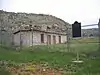 McBride Ranch House |
April 23, 1975 (#75000152) |
North of Amarillo in Lake Meredith National Recreation Area 35°32′29″N 101°43′44″W / 35.541389°N 101.728889°W |
Amarillo | Recorded Texas Historic Landmark |
| 20 | McMillen Apartments | _Apartments_1320_S._Fillmore_Amarillo_20140916.jpg.webp) McMillen Apartments |
April 2, 2010 (#10000145) |
1320 S. Fillmore 35°11′58″N 101°50′11″W / 35.199444°N 101.836389°W |
Amarillo | |
| 21 | Northwest Texas Hospital School of Nursing | 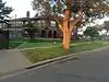 Northwest Texas Hospital School of Nursing |
November 7, 1996 (#96001234) |
2209 W. 6th Ave. 35°12′32″N 101°55′39″W / 35.208889°N 101.9275°W |
Amarillo | Recorded Texas Historic Landmark |
| 22 | Oliver-Eakle-Barfield Building | January 11, 2019 (#100003302) |
600 S. Polk St. 35°12′27″N 101°50′19″W / 35.207477°N 101.838626°W |
Amarillo | ||
| 23 | Plemons-Mrs. M. D. Oliver-Eakle Additions Historic District | .jpg.webp) Plemons-Mrs. M. D. Oliver-Eakle Additions Historic District |
April 21, 1992 (#92000370) |
Roughly bounded by 16th Ave., Taylor St., 26th Ave., Van Buren St., I-40 and Madison St. 35°11′29″N 101°50′33″W / 35.191389°N 101.8425°W |
Amarillo | |
| 24 | Polk Street Methodist Church | 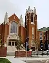 Polk Street Methodist Church |
January 28, 1992 (#91002021) |
1401 S. Polk St. 35°11′56″N 101°50′17″W / 35.198889°N 101.838056°W |
Amarillo | Recorded Texas Historic Landmark |
| 25 | Potter County Courthouse and Library | 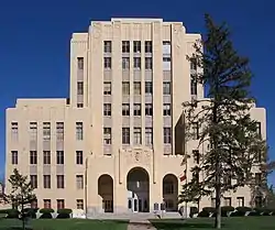 Potter County Courthouse and Library |
August 22, 1996 (#96000938) |
501 S. Taylor St. 35°12′29″N 101°50′06″W / 35.208056°N 101.835°W |
Amarillo | Recorded Texas Historic Landmarks |
| 26 | Ranchotel | Ranchotel |
April 14, 1995 (#95000411) |
2501 W. Sixth Ave. 35°12′40″N 101°51′54″W / 35.211154°N 101.865125°W |
Amarillo | |
| 27 | St. Anthony's Hospital | January 14, 2021 (#100006047) |
200 NW 7th Ave. 35°13′13″N 101°50′09″W / 35.2203°N 101.8358°W |
Amarillo | ||
| 28 | Henry B. and Ellen M. Sanborn House | 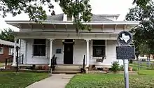 Henry B. and Ellen M. Sanborn House |
August 14, 1992 (#92000982) |
1311 S. Madison St. 35°11′59″N 101°50′25″W / 35.199722°N 101.840278°W |
Amarillo | Recorded Texas Historic Landmark |
| 29 | Santa Fe Building | .jpg.webp) Santa Fe Building |
August 22, 1996 (#96000939) |
900 S. Polk St. 35°12′16″N 101°50′15″W / 35.204444°N 101.8375°W |
Amarillo | Recorded Texas Historic Landmark |
| 30 | Shelton-Houghton House | 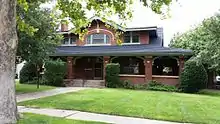 Shelton-Houghton House |
August 29, 1980 (#80004145) |
1700 S Polk St 35°11′42″N 101°50′22″W / 35.195°N 101.839444°W |
Amarillo | Recorded Texas Historic Landmark |
| 31 | Louis H. Smith Inc. Firestone Store | Louis H. Smith Inc. Firestone Store |
July 21, 2015 (#15000451) |
1004 South Tyler Street 35°12′12″N 101°50′22″W / 35.203464°N 101.839572°W |
Amarillo | |
| 32 | Triangle Motel | .jpg.webp) Triangle Motel |
December 7, 2010 (#10000982) |
7804, 7808, 7954, and 8024 E. Amarillo Blvd. 35°13′20″N 101°44′52″W / 35.222222°N 101.747778°W |
Amarillo | Route 66 in Texas MPS |
| 33 | US Route 66-Sixth Street Historic District | .jpg.webp) US Route 66-Sixth Street Historic District |
August 23, 1994 (#94000982) |
Sixth Ave. between Georgia and Forrest Aves. 35°12′40″N 101°52′24″W / 35.211111°N 101.873333°W |
Amarillo | |
| 34 | Vineyard Manor | _from_NW_1.JPG.webp) Vineyard Manor |
November 26, 2014 (#14000965) |
1201 S. Polk Street 35°12′04″N 101°50′17″W / 35.201222°N 101.838074°W |
Amarillo | |
| 35 | Wolflin Historic District | May 21, 1992 (#92000581) |
Roughly bounded by Wolflin Ave., Washington St., SW. 34th Ave., Parker St., SW. 30th Ave. and Lipscomb St. 35°11′07″N 101°51′07″W / 35.185278°N 101.851944°W |
Amarillo |
Randall County
| [2] | Name on the Register | Image | Date listed[3] | Location | City or town | Description |
|---|---|---|---|---|---|---|
| 1 | Amarillo Globe Dream House | 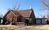 Amarillo Globe Dream House |
December 8, 1997 (#97001532) |
3104 S. Harrison 35°10′49″N 101°50′36″W / 35.180278°N 101.843333°W |
Amarillo | Recorded Texas Historic Landmark |
| 2 | L. T. Lester House | 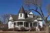 L. T. Lester House |
September 13, 1978 (#78002975) |
310 8th St. 34°58′49″N 101°56′13″W / 34.980278°N 101.936944°W |
Canyon | Recorded Texas Historic Landmark |
| 3 | Llano Cemetery Historic District | 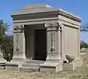 Llano Cemetery Historic District |
May 21, 1992 (#92000584) |
2900 South Hayes 35°10′50″N 101°49′45″W / 35.180556°N 101.829167°W |
Amarillo | |
| 4 | St. Mary's Catholic Church | _from_SE_1.JPG.webp) St. Mary's Catholic Church |
June 21, 1983 (#83003159) |
22830 Pondesetta Rd[9] 34°57′24″N 102°06′29″W / 34.956575°N 102.108106°W |
Umbarger |
Roberts County
| [2] | Name on the Register | Image | Date listed[3] | Location | City or town | Description |
|---|---|---|---|---|---|---|
| 1 | Roberts County Courthouse | 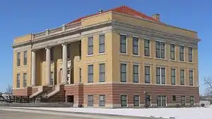 Roberts County Courthouse |
March 22, 2004 (#04000228) |
301 E. Commercial St. 35°41′34″N 100°38′07″W / 35.692679°N 100.635377°W |
Miami | State Antiquities Landmark, Recorded Texas Historic Landmark |
Sherman County
(has no NRHP listings)
Swisher County
(has no NRHP listings)
Terry County
(has no NRHP listings)
Wheeler County
| [2] | Name on the Register | Image | Date listed[3] | Location | City or town | Description |
|---|---|---|---|---|---|---|
| 1 | Battle of Sweetwater Creek | August 13, 2001 (#01000876) |
Address restricted[4] |
Mobeetie | ||
| 2 | Route 66 Bridge over the Chicago, Rock Island and Gulf Railroad | .jpg.webp) Route 66 Bridge over the Chicago, Rock Island and Gulf Railroad |
April 3, 2007 (#06000925) |
I-40 south frontage road over the former CRI&G RR ROW 35°13′35″N 100°06′20″W / 35.2264°N 100.1056°W |
Shamrock | |
| 3 | Route 66 in Wheeler County, Texas | 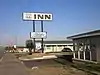 Route 66 in Wheeler County, Texas |
September 22, 2020 (#100005601) |
South side frontage road of I 40 between Gray Co. (TX) and Beckham Co. (OK) lines. 35°13′35″N 100°17′24″W / 35.2264°N 100.2900°W |
Shamrock vicinity | |
| 4 | Tower Station | 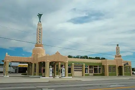 Tower Station |
September 18, 1997 (#97001160) |
101 E. 12th St. 35°13′36″N 100°14′55″W / 35.2267°N 100.2486°W |
Shamrock | Recorded Texas Historic Landmark, also called Tower Station |
Yoakum County
(has no NRHP listings)
References
- ↑ "The High Plains Region 2022 Regional Report". Texas Comptroller of Public Accounts. Retrieved April 3, 2023.
- 1 2 3 4 5 6 7 8 9 10 11 12 13 14 15 16 17 18 19 20 21 22 23 24 25 26 27 28 29 Numbers represent an alphabetical ordering by significant words. Various colorings, defined here, differentiate National Historic Landmarks and historic districts from other NRHP buildings, structures, sites or objects.
- 1 2 3 4 5 6 7 8 9 10 11 12 13 14 15 16 17 18 19 20 21 22 23 24 25 26 27 28 29 The eight-digit number below each date is the number assigned to each location in the National Register Information System database, which can be viewed by clicking the number.
- 1 2 3 4 5 6 7 8 9 10 11 12 13 14 15 16 17 18 19 20 21 22 23 24 25 26 27 28 29 Federal and state laws and practices restrict general public access to information regarding the specific location of this resource. In some cases, this is to protect archeological sites from vandalism, while in other cases it is restricted at the request of the owner. See: Knoerl, John; Miller, Diane; Shrimpton, Rebecca H. (1990), Guidelines for Restricting Information about Historic and Prehistoric Resources, National Register Bulletin, National Park Service, U.S. Department of the Interior, OCLC 20706997.
- ↑ Buchanan, Briggs. "Folsom Lithic Procurement, Tool Use, and Replacement at the Lake Theo Site, Texas". Plains Anthropologist 47.181 (2002): 121-146: 122.
- 1 2 3 4 "National Register Information System". National Register of Historic Places. National Park Service. July 9, 2010.
- ↑ Santa Fe Preserved Locomotives
- ↑ Texas Air and Space Museum
- ↑ "Contact Us". St. Mary's. Retrieved 2016-04-02.