
This is a list of the National Register of Historic Places listings in Kansas City, Missouri outside downtown.
This is intended to be a complete list of the properties and districts on the National Register of Historic Places in the Jackson County portions of Kansas City, Missouri, United States, outside downtown. Downtown Kansas City is defined as being roughly bounded by the Missouri River to the north, 31st Street to the south, Troost Avenue to the east, and State Line Road to the west. The locations of National Register properties and districts may be seen in an online map.[1]
There are 347 properties and districts listed on the National Register in Kansas City. The Jackson County portions outside downtown includes 182 of these properties and districts; the city's remaining properties and districts are listed elsewhere. One historic district overlaps both the downtown area and the area outside downtown.
This National Park Service list is complete through NPS recent listings posted January 5, 2024.[2]
Current listings
| [3] | Name on the Register | Image | Date listed[4] | Location | Neighborhood | Description |
|---|---|---|---|---|---|---|
| 1 | 18th and Vine Historic District |  18th and Vine Historic District |
September 9, 1991 (#84004142) |
Roughly bounded by 18th St., Woodland Ave., 19th St., and The Paseo 39°05′20″N 94°33′40″W / 39.088889°N 94.561111°W |
18th and Vine-Downtown East | part of the 18th and Vine Area of Kansas City Multiple Property Submission (MPS) |
| 2 | 85th and Manchester "Three Trails" Trail Segment |  85th and Manchester "Three Trails" Trail Segment |
August 22, 2012 (#12000525) |
Northwestern corner of the junction of 85th and Manchester 38°58′13″N 94°29′55″W / 38.970242°N 94.498606°W |
Park Farms | part of the Santa Fe Trail MPS |
| 3 | A.B.C. Storage and Van Company Building |  A.B.C. Storage and Van Company Building |
February 1, 2007 (#06001334) |
1015 E. 8th St. 39°06′14″N 94°34′13″W / 39.103923°N 94.570180°W |
Paseo West | |
| 4 | ABC Storage & Van Company Warehouse B | December 12, 2022 (#100008448) |
3244 Main St. 39°04′03″N 94°35′08″W / 39.0675°N 94.5856°W |
|||
| 5 | ACME Cleansing Company Building |  ACME Cleansing Company Building |
July 16, 2017 (#100001346) |
3200 Gillham Rd. 39°04′07″N 94°34′41″W / 39.068569°N 94.578074°W |
North Hyde Park | |
| 6 | Agee Apartments Historic District | 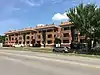 Agee Apartments Historic District |
July 16, 2017 (#100001347) |
3200-3218 Linwood Blvd. 39°04′05″N 94°32′44″W / 39.068087°N 94.545593°W |
Santa Fe | |
| 7 | Aines Farm Dairy Building | 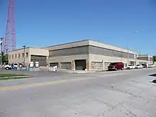 Aines Farm Dairy Building |
October 1, 2008 (#08000960) |
3110-30 Gillham Rd. 39°04′11″N 94°34′36″W / 39.069768°N 94.576761°W |
Hyde Park | |
| 8 | Ambassador Hotel Historic District | February 17, 1983 (#83000995) |
3527 and 3600 Broadway and 435 and 441 Knickerbocker Pl.; also 336 W. 36th St. and 3543 Broadway 39°03′45″N 94°35′25″W / 39.0625°N 94.590278°W |
Hanover Place, Valentine | Second set of addresses represents a boundary increase of April 10, 2008 | |
| 9 | Anderson Electric Car Company Building | December 12, 2022 (#100008447) |
3240 Main St. 39°04′04″N 94°35′08″W / 39.0677°N 94.5856°W |
|||
| 10 | Archbishop O'Hara High School | 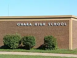 Archbishop O'Hara High School |
February 1, 2021 (#100006074) |
9001 James A. Reed Rd. 38°57′40″N 94°29′35″W / 38.9611°N 94.4931°W |
||
| 11 | Armour Boulevard Post-World War II Apartment Building Historic District | November 7, 2007 (#07001155) |
640 and 701 E. Armour Boulevard and 3457 Holmes St. 39°03′49″N 94°34′34″W / 39.063611°N 94.576111°W |
Hyde Park | part of the Working-Class and Middle-Income Apartment Buildings in Kansas City, Missouri MPS | |
| 12 | Attucks School | .jpg.webp) Attucks School |
September 9, 1991 (#91001150) |
1815 Woodland Ave. 39°05′25″N 94°33′37″W / 39.090198°N 94.560381°W |
Wendell Phillips | part of the 18th and Vine Area of Kansas City MPS |
| 13 | Aurora Apartments |  Aurora Apartments |
October 23, 2017 (#100001758) |
3012-3014 Linwood Blvd. 39°04′04″N 94°32′52″W / 39.067865°N 94.547679°W |
||
| 14 | Bancroft School | .jpg.webp) Bancroft School |
January 12, 2012 (#11001017) |
4300 Tracy Ave. 39°02′54″N 94°34′14″W / 39.04835°N 94.570647°W |
Manheim Park | |
| 15 | Barclay Building |  Barclay Building |
February 8, 2007 (#07000042) |
3613-23 Broadway Boulevard 39°03′42″N 94°35′25″W / 39.061610°N 94.590235°W |
Hanover Place | |
| 16 | Bellefontaine Avenue Historic District |  Bellefontaine Avenue Historic District |
February 14, 2011 (#11000010) |
500-24 Bellefontaine Ave. 39°06′27″N 94°32′50″W / 39.1075°N 94.547222°W |
Scarritt Point | |
| 17 | Bellerive Hotel |  Bellerive Hotel |
February 28, 1980 (#80002361) |
214 E. Armour Boulevard 39°03′50″N 94°34′59″W / 39.063889°N 94.583056°W |
Broadway Gillham | |
| 18 | Belmont Hotel | 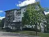 Belmont Hotel |
August 4, 2016 (#16000513) |
911 E. Linwood Blvd. 39°04′07″N 94°34′25″W / 39.068722°N 94.573547°W |
North Hyde Park | |
| 19 | Thomas Hart Benton House and Studio | 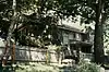 Thomas Hart Benton House and Studio |
November 21, 1980 (#80002362) |
3616 Belleview St. 39°03′44″N 94°35′52″W / 39.062092°N 94.597814°W |
Roanoke | |
| 20 | Beth Shalom Synagogue | 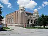 Beth Shalom Synagogue |
September 9, 1982 (#82003142) |
3400 The Paseo 39°03′53″N 94°34′03″W / 39.064684°N 94.567402°W |
Center City | |
| 21 | Walter E. Bixby House |  Walter E. Bixby House |
November 21, 1978 (#78001651) |
6505 State Line Rd. 39°00′37″N 94°36′26″W / 39.010369°N 94.607344°W |
Romanelli West | |
| 22 | Blenheim School | 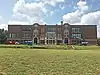 Blenheim School |
July 16, 2017 (#100001348) |
2411 E. 70th Terrace 38°59′55″N 94°33′30″W / 38.998566°N 94.558376°W |
Blenheim Square-Research Hospital | |
| 23 | Bon Air Apartments Building | 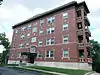 Bon Air Apartments Building |
July 30, 2008 (#08000754) |
4127–4133 Locust St. 39°03′06″N 94°34′49″W / 39.051673°N 94.580398°W |
Southmoreland | part of the Working-Class and Middle-Income Apartment Buildings in Kansas City, Missouri MPS |
| 24 | Charles A. Braley House |  Charles A. Braley House |
October 9, 2013 (#13000821) |
3 Dunford Cir. 39°01′48″N 94°36′25″W / 39.0299°N 94.6069°W |
Kansas City | |
| 25 | Burnette-Berry House |  Burnette-Berry House |
February 18, 2011 (#11000023) |
1030 W. 65th St. 39°00′38″N 94°36′07″W / 39.0106°N 94.6019°W |
Country Club District | |
| 26 | Byram's Ford Historic District |  Byram's Ford Historic District |
October 16, 1989 (#89001629) |
63rd St. and Manchester Trafficway at the Big Blue River 39°00′55″N 94°31′33″W / 39.0154°N 94.5259°W |
Kansas City | |
| 27 | Campbell-Continental Baking Company Building |  Campbell-Continental Baking Company Building |
May 10, 2016 (#16000235) |
1108 E. 30th St. 39°04′21″N 94°34′15″W / 39.0724°N 94.5708°W |
Erroneously listed in Caldwell County. | |
| 28 | Cave Spring | August 10, 1978 (#78001652) |
7100 Blue Ridge Extension 38°59′38″N 94°29′00″W / 38.9940°N 94.4834°W |
Park Farms | ||
| 29 | Philip E. Chappell House |  Philip E. Chappell House |
August 3, 1990 (#90001157) |
1836 Pendleton Ave. 39°06′47″N 94°33′30″W / 39.1131°N 94.5583°W |
Pendleton Heights | |
| 30 | Chatham Hotel |  Chatham Hotel |
June 24, 2008 (#08000564) |
3701 Broadway 39°03′36″N 94°35′25″W / 39.0601°N 94.5903°W |
Hanover Place | |
| 31 | Chicago Apartments |  Chicago Apartments |
September 11, 1980 (#80002363) |
1110–1112 E. Armour Boulevard 39°03′48″N 94°34′16″W / 39.0634°N 94.5710°W |
Center City | |
| 32 | Circle Apartments |  Circle Apartments |
October 22, 2002 (#02001199) |
1200 Paseo Boulevard 39°05′57″N 94°33′53″W / 39.0991°N 94.5646°W |
Paseo West | part of the Apartment Buildings on the North End of the Paseo Boulevard in Kansas City, Missouri MPS |
| 33 | Colonnade Apartment Building at 4302 Oak Street |  Colonnade Apartment Building at 4302 Oak Street |
September 4, 2008 (#08000857) |
4302 Oak St. 39°02′56″N 94°34′56″W / 39.0488°N 94.5821°W |
Southmoreland | part of the Colonnade Apartment Buildings of Kansas City, MO MPS |
| 34 | Community Church | October 9, 2020 (#100005662) |
4601 Main St. 39°02′36″N 94°35′12″W / 39.0433°N 94.5867°W |
|||
| 35 | Bernard Corrigan House |  Bernard Corrigan House |
January 18, 1978 (#78001653) |
1200 W. 55th St. 39°01′43″N 94°36′17″W / 39.0287°N 94.6046°W |
Sunset Hill | |
| 36 | Crestwood Historic District | October 8, 1998 (#98001239) |
Roughly bounded by Oak St., the junction of Cherry and Locust Sts., Holmes St., and 56th St. 39°01′46″N 94°34′58″W / 39.0294°N 94.5828°W |
Crestwood | ||
| 37 | O.H. Dean Building | 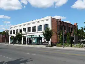 O.H. Dean Building |
September 3, 2009 (#09000682) |
3625–3635 Main Street 39°03′39″N 94°35′09″W / 39.0607°N 94.5857°W |
Hanover Place | |
| 38 | R. J. DeLano School for Crippled Children | September 26, 2022 (#100008203) |
3708 East Linwood Blvd. 39°04′04″N 94°32′24″W / 39.0677°N 94.5399°W |
|||
| 39 | Walt Disney House |  Walt Disney House |
May 22, 1978 (#78001654) |
3028 Bellefontaine Ave. 39°04′12″N 94°32′50″W / 39.07°N 94.5472°W |
Santa Fe | |
| 40 | District I | July 28, 1983 (#83000998) |
Armour Boulevard between Broadway and Baltimore Aves. 39°03′51″N 94°35′18″W / 39.0642°N 94.5883°W |
Broadway Gillham | part of the Armour Boulevard Multiple Resource Area (MRA) | |
| 41 | District II | July 28, 1983 (#83001001) |
Armour Boulevard between Warwick and Kenwood Aves. 39°03′49″N 94°34′47″W / 39.0636°N 94.5797°W |
Broadway Gillham, Hyde Park | part of the Armour Boulevard MRA | |
| 42 | District III | July 28, 1983 (#83000999) |
Armour Boulevard between Charlotte St. and The Paseo; also 3424 and 3426 Harrison Boulevard 39°03′48″N 94°34′12″W / 39.0633°N 94.57°W |
Center City, Hyde Park, Squier Park | Part of the Armour Boulevard MRA. Harrison Boulevard represents a boundary increase of June 13, 2006 | |
| 43 | Dorson Apartment Building |  Dorson Apartment Building |
May 5, 1987 (#87000906) |
912–918 Benton Boulevard 39°06′06″N 94°32′41″W / 39.1016°N 94.5446°W |
Independence Plaza | |
| 44 | East 27th Street Colonnades Historic District |  East 27th Street Colonnades Historic District |
June 28, 2006 (#06000538) |
1300-02, 1312-14, and 1320-22 E. 27th St. 39°04′40″N 94°34′04″W / 39.0777°N 94.5677°W |
Beacon Hill-McFeders | |
| 45 | East Side Apartments Historic District | January 19, 2022 (#100007359) |
5212-5314 East 12th St., 1103-1123 Hardesty Ave., 5308-5315 Williamsburg Ct., 5101-5315 Winner Rd. 39°05′54″N 94°31′14″W / 39.0982°N 94.5205°W |
|||
| 46 | El Torreon Ballroom | January 3, 2022 (#100007262) |
3101 Gillham Plz. 39°04′13″N 94°34′44″W / 39.0704°N 94.5788°W |
|||
| 47 | Ellsworth Apartments | 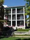 Ellsworth Apartments |
October 22, 2002 (#02001203) |
928 Paseo Boulevard 39°06′08″N 94°33′51″W / 39.1021°N 94.5642°W |
Paseo West | part of the Apartment Buildings on the North End of the Paseo Boulevard in Kansas City, Missouri MPS |
| 48 | Elmwood Cemetery | 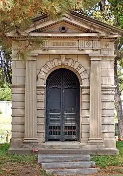 Elmwood Cemetery |
July 28, 1983 (#83001002) |
4900 Truman Rd. 39°05′46″N 94°31′33″W / 39.096111°N 94.525833°W |
Sheffield | |
| 49 | Firestone Tire and Rubber Company Service Station | October 7, 2021 (#100007044) |
1112 East Linwood Blvd. 39°04′07″N 94°34′16″W / 39.0687°N 94.5711°W |
|||
| 50 | First Swedish Baptist Church |  First Swedish Baptist Church |
May 20, 2018 (#100002425) |
3931 Washington St. 39°03′21″N 94°35′30″W / 39.0557°N 94.591552°W |
||
| 51 | Jacobs Floyd House | September 8, 1983 (#83001003) |
5050 Sunset Dr. 39°02′10″N 94°35′55″W / 39.036241°N 94.598609°W |
Sunset Hill | part of the Residential Structures by Mary Rockwell Hook Thematic Resource (TR) | |
| 52 | Four Gates Farm | July 15, 1991 (#83004871) |
13001 Little Blue Rd. 38°59′52″N 94°25′46″W / 38.997726°N 94.429556°W |
Little Blue Valley | part of the Residential Structures by Mary Rockwell Hook TR | |
| 53 | Henry T. Fowler House | July 28, 1983 (#83001004) |
3 E. Armour Boulevard 39°03′49″N 94°35′07″W / 39.063611°N 94.585278°W |
Hanover Place | part of the Armour Boulevard MRA. Demolished. | |
| 54 | Hunter Gary House | 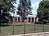 Hunter Gary House |
February 13, 2008 (#08000022) |
1228 W. 56th St. 39°01′37″N 94°36′20″W / 39.026944°N 94.605556°W |
Sunset Hill | |
| 55 | Gillham Court Apartments Building |  Gillham Court Apartments Building |
November 7, 2007 (#07001156) |
3411 Gillham Rd. 39°03′53″N 94°34′50″W / 39.064722°N 94.580556°W |
Hyde Park | part of the Working-Class and Middle-Income Apartment Buildings in Kansas City, Missouri MPS |
| 56 | Gillis Orphans' Home | 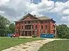 Gillis Orphans' Home |
July 10, 2017 (#100001300) |
2119 Tracy Ave. 39°05′11″N 94°34′04″W / 39.086467°N 94.567869°W |
||
| 57 | Goodenow Textiles Company Building | 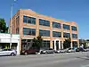 Goodenow Textiles Company Building |
April 18, 2003 (#03000297) |
3710 Main St. 39°03′35″N 94°35′10″W / 39.059674°N 94.586095°W |
Hanover Place | |
| 58 | Gotham Apartments | 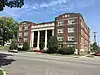 Gotham Apartments |
July 16, 2017 (#100001349) |
2718 Linwood Blvd. 39°04′06″N 94°33′03″W / 39.0682°N 94.5509°W |
Santa Fe | |
| 59 | Col. John Harris House | 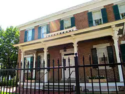 Col. John Harris House |
October 18, 1972 (#72000717) |
4000 Baltimore Ave. 39°03′15″N 94°35′16″W / 39.0541°N 94.5878°W |
Westport | |
| 60 | Hazelle, Inc. Building | February 1, 2021 (#100006075) |
1224 Admiral Blvd. 39°06′20″N 94°34′02″W / 39.1055°N 94.5672°W |
|||
| 61 | Ferd. Heim Brewing Company Bottling Plant |  Ferd. Heim Brewing Company Bottling Plant |
June 7, 2016 (#15001018) |
507 N. Montgall Ave. 39°07′11″N 94°32′57″W / 39.1198°N 94.5492°W |
||
| 62 | Heim Fire Station No. 20 | January 4, 2024 (#100009693) |
2701 Guinotte Ave. 39°07′09″N 94°32′57″W / 39.1192°N 94.5491°W |
|||
| 63 | Dr. Generous Henderson House |  Dr. Generous Henderson House |
February 26, 1979 (#79001368) |
1016 The Paseo 39°06′04″N 94°33′51″W / 39.1011°N 94.5642°W |
Paseo West | |
| 64 | Hiland Telephone Exchange Building |  Hiland Telephone Exchange Building |
May 6, 2005 (#05000373) |
1020 E. 63rd St. 39°00′55″N 94°34′30″W / 39.0153°N 94.575°W |
Holmes Park | |
| 65 | Holy Name Catholic Church | September 25, 2003 (#03000964) |
2800 E. 23rd St. 39°05′05″N 94°32′57″W / 39.0847°N 94.5492°W |
Washington-Wheatley | Demolished about 2011. | |
| 66 | Mary Rockwell Hook House | September 8, 1983 (#83001005) |
4940 Summit St. 39°02′15″N 94°35′48″W / 39.0374°N 94.5968°W |
Sunset Hill | part of the Residential Structures by Mary Rockwell Hook TR | |
| 67 | House at 5011 Sunset Drive | September 8, 1983 (#83001006) |
5011 Sunset Dr. 39°02′13″N 94°35′50″W / 39.0370°N 94.5972°W |
Sunset Hill | part of the Residential Structures by Mary Rockwell Hook TR | |
| 68 | House at 54 E. 53rd Terrace |  House at 54 E. 53rd Terrace |
September 8, 1983 (#83001007) |
54 E. 53rd Terrace 39°01′49″N 94°35′06″W / 39.0302°N 94.5851°W |
Countryside | part of the Residential Structures by Mary Rockwell Hook TR |
| 69 | Hyde Park Historic District | November 21, 1980 (#80002364) |
Roughly bounded by Armour and Harrison Boulevards, 39th St., and Gillham Rd. 39°03′36″N 94°34′38″W / 39.06°N 94.5772°W |
Hyde Park | ||
| 70 | Independence Boulevard Christian Church |  Independence Boulevard Christian Church |
January 14, 2015 (#14001158) |
606 Gladstone Blvd. 39°06′21″N 94°32′47″W / 39.105810°N 94.546322°W |
||
| 71 | Interstate Bakeries Corporation Headquarters |  Interstate Bakeries Corporation Headquarters |
September 1, 2015 (#15000553) |
12 E. Armour Blvd. 39°03′51″N 94°35′06″W / 39.0641°N 94.585°W |
||
| 72 | Ivanhoe Masonic Temple | May 2, 1985 (#85000942) |
2301 E. Linwood Boulevard and 3201 Park Ave. 39°04′05″N 94°33′22″W / 39.068056°N 94.556111°W |
Key Coalition | Demolished 2002. | |
| 73 | Janssen Place Historic District | .jpg.webp) Janssen Place Historic District |
November 7, 1976 (#76001111) |
Janssen Pl. 39°03′36″N 94°34′41″W / 39.06°N 94.578056°W |
Hyde Park | |
| 74 | R. Bryson Jones House | 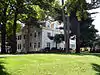 R. Bryson Jones House |
April 15, 2009 (#09000205) |
1045 W. 56th St. 39°01′35″N 94°36′06″W / 39.026443°N 94.601701°W |
Ward Estates | |
| 75 | Kansas City Athenaeum | 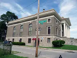 Kansas City Athenaeum |
October 11, 1979 (#79001371) |
900 E. Linwood Boulevard 39°04′09″N 94°34′26″W / 39.069167°N 94.573889°W |
Hyde Park | |
| 76 | Kansas City Masonic Temple |  Kansas City Masonic Temple |
November 14, 1980 (#80002365) |
903 Harrison St. 39°06′11″N 94°34′15″W / 39.102951°N 94.570796°W |
Paseo West | |
| 77 | Kansas City National Guard Armory | February 24, 2020 (#100004986) |
3620 Main St. 39°03′40″N 94°35′09″W / 39.0612°N 94.5859°W |
|||
| 78 | Kansas City Parks and Boulevards Historic District | August 9, 2016 (#14000931) |
Roughly bounded by Missouri R., Hardesty Ave., Armour Blvd. & State Line. 39°04′57″N 94°33′18″W / 39.082598°N 94.555041°W |
|||
| 79 | Michael H. and Rose Katz House | 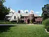 Michael H. and Rose Katz House |
March 22, 2004 (#04000212) |
5930 Ward Parkway 39°01′11″N 94°36′10″W / 39.019750°N 94.602714°W |
Stratford Gardens | |
| 80 | Charles S. Keith House | March 31, 2000 (#00000308) |
1214 W. 55th St. 39°01′44″N 94°36′20″W / 39.029026°N 94.605624°W |
Sunset Hill | ||
| 81 | Kelly's Westport Inn |  Kelly's Westport Inn |
September 7, 1972 (#72000718) |
Westport Rd. and Pennsylvania Ave. 39°03′10″N 94°35′30″W / 39.052866°N 94.591685°W |
Westport | |
| 82 | Kessler Apartments | 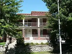 Kessler Apartments |
October 22, 2002 (#02001202) |
924 Paseo Boulevard 39°06′08″N 94°33′51″W / 39.102177°N 94.564129°W |
Paseo West | part of the Apartment Buildings on the North End of the Paseo Boulevard in Kansas City, Missouri MPS |
| 83 | Knickerbocker Apartments | 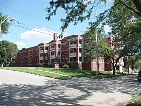 Knickerbocker Apartments |
June 13, 2003 (#03000525) |
501–535 Knickerbocker Place 39°03′45″N 94°35′32″W / 39.062436°N 94.592149°W |
Valentine | |
| 84 | William Baker and Mary Knight House |  William Baker and Mary Knight House |
October 18, 2003 (#03001054) |
3534 Walnut St. 39°03′44″N 94°35′05″W / 39.062207°N 94.584831°W |
Hanover Place | |
| 85 | Kuehne-Schmidt Apartments | 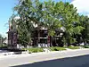 Kuehne-Schmidt Apartments |
February 13, 2007 (#07000040) |
3737-39 and 3741-43 Main Sts. 39°03′32″N 94°35′08″W / 39.058776°N 94.585667°W |
Hanover Place | part of the Colonnade Apartment Buildings of Kansas City, MO MPS |
| 86 | Sanford B. Ladd School | September 20, 2021 (#100006918) |
3640 Benton Bvld. 39°03′33″N 94°32′48″W / 39.0592°N 94.5466°W |
|||
| 87 | Lincoln High School | 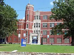 Lincoln High School |
January 15, 2014 (#13001086) |
2111 Woodland Ave. 39°05′13″N 94°33′37″W / 39.086895°N 94.560358°W |
Wendell Phillips | |
| 88 | Linwood Presbyterian Church and Home for Convalescent Employed Women | 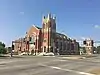 Linwood Presbyterian Church and Home for Convalescent Employed Women |
August 7, 2012 (#12000472) |
1801 Linwood Boulevard and 3212 Michigan Ave. 39°04′05″N 94°33′41″W / 39.067941°N 94.561316°W |
Key Coalition | |
| 89 | Locust Street Apartments | 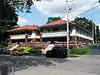 Locust Street Apartments |
April 29, 2011 (#11000249) |
3421 and 3425 Locust St. 39°03′52″N 94°34′46″W / 39.064444°N 94.579444°W |
Hyde Park | part of the Working-Class and Middle-Income Apartment Buildings in Kansas City, Missouri MPS |
| 90 | R.A. Long House |  R.A. Long House |
November 14, 1980 (#80002366) |
3218 Gladstone Boulevard 39°06′57″N 94°32′33″W / 39.115711°N 94.542463°W |
Scarritt Point | |
| 91 | Jacob Loose House |  Jacob Loose House |
July 28, 1983 (#83001008) |
101 E. Armour Boulevard 39°03′49″N 94°35′03″W / 39.063611°N 94.584167°W |
Hanover Place | part of the Armour Boulevard MRA |
| 92 | Loretto Academy | 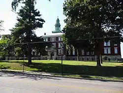 Loretto Academy |
July 28, 1983 (#83001009) |
1111 W. 39th St. 39°03′23″N 94°36′01″W / 39.056451°N 94.600259°W |
Volker | |
| 93 | Emily Rockwell Love House | September 8, 1983 (#83001010) |
5029 Sunset Dr. 39°02′10″N 94°35′51″W / 39.036097°N 94.597505°W |
Sunset Hill | part of the Residential Structures by Mary Rockwell Hook TR | |
| 94 | Luzier Special Formula Laboratories Building |  Luzier Special Formula Laboratories Building |
January 2, 2018 (#100001351) |
3216 Gillham Plaza 39°04′05″N 94°34′45″W / 39.068184°N 94.579065°W |
||
| 95 | Maine Apartments | 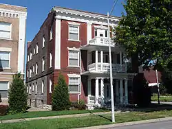 Maine Apartments |
October 22, 2002 (#02001198) |
1300 Paseo Boulevard 39°05′52″N 94°33′53″W / 39.097799°N 94.564704°W |
Paseo West | part of the Apartment Buildings on the North End of the Paseo Boulevard in Kansas City, Missouri MPS |
| 96 | Majestic Apartments | 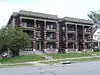 Majestic Apartments |
October 17, 2003 (#03001052) |
701–707 Benton Boulevard 39°06′14″N 94°32′38″W / 39.104016°N 94.543950°W |
Lykins | |
| 97 | Alexander Majors House | 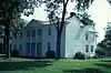 Alexander Majors House |
April 3, 1970 (#70000335) |
8145 State Line Rd. 38°58′47″N 94°36′29″W / 38.979666°N 94.607954°W |
Ward Parkway Plaza | |
| 98 | Maples Apartments |  Maples Apartments |
October 22, 2002 (#02001196) |
1401 E. 10th St. 39°06′06″N 94°33′53″W / 39.101597°N 94.564784°W |
Paseo West | part of the Apartment Buildings on the North End of the Paseo Boulevard in Kansas City, Missouri MPS |
| 99 | Maryland Apartments |  Maryland Apartments |
October 22, 2002 (#02001204) |
930 Paseo Boulevard 39°06′07″N 94°33′51″W / 39.101867°N 94.564172°W |
Paseo West | part of the Apartment Buildings on the North End of the Paseo Boulevard in Kansas City, Missouri MPS |
| 100 | McConahay Building | 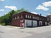 McConahay Building |
May 22, 1978 (#78001655) |
1121–1131 E. 31st St. 39°04′13″N 94°34′13″W / 39.070285°N 94.570206°W |
Center City | |
| 101 | Levi McIntire House | 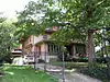 Levi McIntire House |
July 28, 1983 (#83001011) |
710 E. Armour Boulevard 39°03′49″N 94°34′33″W / 39.063712°N 94.575898°W |
Hyde Park | part of the Armour Boulevard MRA |
| 102 | McMahon Apartments | 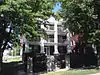 McMahon Apartments |
October 22, 2002 (#02001195) |
1106 Paso Boulevard 39°06′00″N 94°33′51″W / 39.100130°N 94.564197°W |
Paseo West | part of the Apartment Buildings on the North End of the Paseo Boulevard in Kansas City, Missouri MPS |
| 103 | August Meyer House |  August Meyer House |
September 9, 1982 (#82003146) |
4415 Warwick Boulevard 39°02′49″N 94°35′00″W / 39.046829°N 94.583279°W |
Southmoreland | |
| 104 | Michelson Building |  Michelson Building |
January 29, 2018 (#100002033) |
3125-3133 Troost Ave. 39°04′11″N 94°34′17″W / 39.069641°N 94.571400°W |
||
| 105 | Milo Apartments |  Milo Apartments |
October 25, 2011 (#11000763) |
1014–1020 W. 44th St. 39°02′54″N 94°35′57″W / 39.048333°N 94.599167°W |
West Plaza | part of the Working-Class and Middle-Income Apartment Buildings in Kansas City, Missouri MPS |
| 106 | Mineral Hall | Mineral Hall |
July 12, 1976 (#76001112) |
4340 Oak St. 39°02′52″N 94°34′56″W / 39.047709°N 94.582258°W |
Southmoreland | |
| 107 | Missouri Apartments |  Missouri Apartments |
October 22, 2002 (#02001197) |
1304 Paseo Boulevard 39°05′52″N 94°33′53″W / 39.097668°N 94.564652°W |
Paseo West | part of the Apartment Buildings on the North End of the Paseo Boulevard in Kansas City, Missouri MPS |
| 108 | Mutual Ice Company Building | 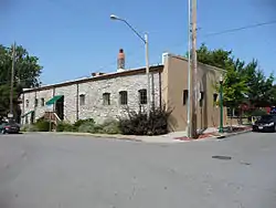 Mutual Ice Company Building |
August 4, 2004 (#04000783) |
4142–4144 Pennsylvania Ave. 39°03′04″N 94°35′26″W / 39.051162°N 94.590506°W |
Westport | |
| 109 | Mutual Musicians' Foundation Building | 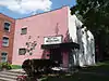 Mutual Musicians' Foundation Building |
February 7, 1979 (#79001372) |
1823 Highland Ave. 39°05′25″N 94°33′43″W / 39.090278°N 94.561944°W |
Wendell Phillips | |
| 110 | George J. Myers House | 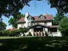 George J. Myers House |
July 28, 1983 (#83001012) |
633 E. Armour Boulevard 39°03′47″N 94°34′36″W / 39.063056°N 94.576667°W |
Hyde Park | part of the Armour Boulevard MRA |
| 111 | National Cloak and Suit Company | January 29, 2018 (#100002034) |
5401 Independence Ave. 39°06′19″N 94°31′06″W / 39.1052°N 94.5182°W |
|||
| 112 | George H. Nettleton Home | 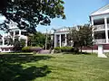 George H. Nettleton Home |
October 14, 1999 (#99001253) |
5125 Swope Parkway 39°01′57″N 94°32′31″W / 39.0324°N 94.5419°W |
Town Fork Creek | |
| 113 | New England Apartments |  New England Apartments |
October 22, 2002 (#02001200) |
1116 Paseo Boulevard 39°05′59″N 94°33′51″W / 39.0997°N 94.5642°W |
Paseo West | part of the Apartment Buildings on the North End of the Paseo Boulevard in Kansas City, Missouri MPS |
| 114 | New Santa Fe "Three Trails" Trail Swales |  New Santa Fe "Three Trails" Trail Swales |
August 22, 2012 (#12000526) |
W. Santa Fe Trail, ½ block west of the junction with Madison Ave. 38°54′23″N 94°36′23″W / 38.9065°N 94.6064°W |
Blue Hills Estates | part of the Santa Fe Trail MPS |
| 115 | Newbern Hotel |  Newbern Hotel |
September 23, 1980 (#80002367) |
525 E. Armour Boulevard 39°03′48″N 94°34′45″W / 39.0633°N 94.5791°W |
Hyde Park | |
| 116 | D.W. Newcomer's Sons Funeral Home |  D.W. Newcomer's Sons Funeral Home |
August 9, 1983 (#83001013) |
1331 Brush Creek 39°02′34″N 94°34′07″W / 39.0428°N 94.5686°W |
Manheim Park | |
| 117 | George E. Nicholson House |  George E. Nicholson House |
November 25, 2005 (#05001325) |
1028 W. 58th St. 39°01′22″N 94°36′04″W / 39.0227°N 94.6011°W |
Country Club District | |
| 118 | Norman School |  Norman School |
January 15, 2014 (#13001087) |
3514 Jefferson St. 39°03′51″N 94°35′40″W / 39.0641°N 94.5944°W |
Valentine | |
| 119 | Oakwood Country Club | February 1, 2021 (#100006076) |
9800 Grandview Rd. 38°56′54″N 94°33′10″W / 38.9483°N 94.5527°W |
|||
| 120 | Old Hyde Park East Historic District | May 27, 2004 (#04000527) |
Roughly bounded by Armour Boulevard, Walnut St., 39th St., and Gillham Rd. 39°03′42″N 94°35′03″W / 39.0617°N 94.5842°W |
Hanover Place | ||
| 121 | Old Hyde Park West Historic District | May 27, 2004 (#04000526) |
Roughly bounded by Linwood Boulevard, Central, 39th St., and Baltimore St. 39°03′49″N 94°35′17″W / 39.0636°N 94.5881°W |
Broadway Gillham | ||
| 122 | Robert Ostertag House | September 8, 1983 (#83001014) |
5030 Summit St. 39°02′10″N 94°35′49″W / 39.0361°N 94.5969°W |
Sunset Hill | part of the Residential Structures by Mary Rockwell Hook TR | |
| 123 | Parade Park Maintenance Building |  Parade Park Maintenance Building |
July 24, 2008 (#08000719) |
1722 Woodland Ave. 39°05′31″N 94°33′40″W / 39.0920°N 94.5610°W |
18th and Vine-Downtown East | |
| 124 | Paris and Weaver Apartment Buildings |  Paris and Weaver Apartment Buildings |
July 5, 2006 (#06000545) |
3944-46 and 3948-50 Walnut St. 39°03′17″N 94°35′07″W / 39.0548°N 94.5854°W |
Southmoreland | part of the Colonnade Apartment Buildings of Kansas City, MO MPS |
| 125 | Park Lane Apartments | 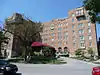 Park Lane Apartments |
May 5, 2004 (#04000387) |
4600–4606 J.C. Nichols Parkway 39°02′38″N 94°35′20″W / 39.0438°N 94.5889°W |
Plaza Westport | |
| 126 | Park Manor Historic District | February 1, 2006 (#05001610) |
910 Ward Parkway, 920 Ward Parkway, and 4826 Roanoke Parkway 39°02′29″N 94°35′54″W / 39.0414°N 94.5983°W |
West Plaza | ||
| 127 | The Parkview | 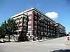 The Parkview |
October 22, 2002 (#02001205) |
1000 Paseo Boulevard 39°06′05″N 94°33′51″W / 39.1015°N 94.5642°W |
Paseo West | part of the Apartment Buildings on the North End of the Paseo Boulevard in Kansas City, Missouri MPS |
| 128 | Paseo YMCA |  Paseo YMCA |
September 9, 1991 (#91001151) |
1824 The Paseo 39°05′25″N 94°33′53″W / 39.0903°N 94.5648°W |
18th and Vine-Downtown East | part of the 18th and Vine Area of Kansas City MPS |
| 129 | Charles and Josephine Peters House | March 15, 2016 (#16000085) |
1228 W. 55th St. 39°01′42″N 94°36′25″W / 39.0283°N 94.6069°W |
|||
| 130 | Pilgrim Lutheran Church for the Deaf of Greater Kansas City and Parsonage | 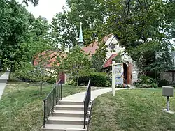 Pilgrim Lutheran Church for the Deaf of Greater Kansas City and Parsonage |
January 25, 2001 (#00000334) |
3801–3807 Gilham Rd. 39°03′29″N 94°34′52″W / 39.0580°N 94.5811°W |
Hyde Park | |
| 131 | Pink House | September 8, 1983 (#83001015) |
5012 Summit St. 39°02′13″N 94°35′48″W / 39.0369°N 94.5968°W |
Sunset Hill | part of the Residential Structures by Mary Rockwell Hook TR | |
| 132 | Plaza House Apartments |  Plaza House Apartments |
October 16, 2013 (#13000837) |
4712 Roanoke Pkwy. 39°02′31″N 94°35′52″W / 39.041886°N 94.597735°W |
Kansas City | Part of the Working-Class and Middle-Income Apartment Buildings in Kansas City, Missouri MPS |
| 133 | Plaza Towers | 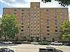 Plaza Towers |
February 23, 2016 (#16000030) |
209 Emanuel Cleaver II Blvd. 39°02′31″N 94°35′04″W / 39.041975°N 94.584409°W |
Kansas City | Part of the Working-Class and Middle-Income Apartment Buildings in Kansas City, Missouri MPS |
| 134 | Pratt and Whitney Plant Complex | .jpg.webp) Pratt and Whitney Plant Complex |
August 28, 2013 (#13000381) |
1500 & 2000 E. Bannister Rd. 38°57′27″N 94°34′15″W / 38.957407°N 94.570861°W |
South Kansas City | |
| 135 | President Gardens Apartments Historic District |  President Gardens Apartments Historic District |
December 10, 1998 (#98001503) |
Roughly along President Ave., 83rd St., and 82nd Terrace between Lydia and Troost Aves. 38°58′40″N 94°34′25″W / 38.977778°N 94.573611°W |
Marlborough Heights | |
| 136 | William D. Repp House |  William D. Repp House |
July 28, 1983 (#83001017) |
721 E. Armour Blvd. 39°03′47″N 94°34′32″W / 39.062929°N 94.575492°W |
Hyde Park | part of the Armour Boulevard MRA |
| 137 | Rockhill Neighborhood | July 21, 1975 (#75001068) |
Both sides of 47th St. from Locust St. (S. Pierce St.) to both sides of Harrison St. (north to Brush Creek Boulevard) 39°02′31″N 94°34′36″W / 39.041944°N 94.576667°W |
Rockhill | ||
| 138 | Bertrand Rockwell House | September 8, 1983 (#83001018) |
1004 W. 52nd St. 39°02′02″N 94°35′59″W / 39.033838°N 94.599699°W |
Sunset Hill | part of the Residential Structures by Mary Rockwell Hook TR | |
| 139 | Row House Buildings |  Row House Buildings |
May 22, 1978 (#78001658) |
1–7 E. 34th St. and 3401 Main St.; also 9–23 E. 34th St. 39°03′56″N 94°35′06″W / 39.065556°N 94.585°W |
Broadway Gillham | Second set of addresses represents a boundary increase of January 15, 1985 |
| 140 | Safeway No. 357 | March 7, 2023 (#100008688) |
3740 Troost Ave. 39°03′30″N 94°34′20″W / 39.0583°N 94.5721°W |
|||
| 141 | St. Francis Xavier Parish Church & Rectory | 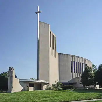 St. Francis Xavier Parish Church & Rectory |
March 28, 2022 (#100007529) |
1001 East 52nd St. 39°01′57″N 94°34′27″W / 39.0326°N 94.5743°W |
||
| 142 | St. Francis Xavier School |  St. Francis Xavier School |
October 23, 2017 (#100001760) |
5220 Troost Ave. 39°01′52″N 94°34′25″W / 39.031160°N 94.573598°W |
||
| 143 | St. John's High School and Seminary | June 3, 2021 (#100006589) |
2015-2131 East 72nd St. 38°59′47″N 94°33′48″W / 38.9964°N 94.5634°W |
|||
| 144 | St. Regis Hotel | .jpg.webp) St. Regis Hotel |
December 3, 2013 (#13000885) |
1400–1402 E. Linwood Blvd. 39°04′08″N 94°33′59″W / 39.068963°N 94.566377°W |
Center City | |
| 145 | St. Teresa's Academy Music and Arts Building |  St. Teresa's Academy Music and Arts Building |
November 15, 2000 (#00001375) |
5600 Main St. 39°01′33″N 94°35′23″W / 39.025749°N 94.589719°W |
Countryside | |
| 146 | Santa Fe Place Historic District | May 30, 1986 (#86001204) |
Roughly bounded by 27th St., Indiana Ave., 30th St., and Prospect Ave. 39°04′31″N 94°33′06″W / 39.075278°N 94.551667°W |
Santa Fe | ||
| 147 | Santa Fe Trail-Minor Park, Kansas City, Trail Segments |  Santa Fe Trail-Minor Park, Kansas City, Trail Segments |
June 30, 1994 (#94000617) |
Red Bridge Rd. east of its junction with Holmes Rd. 38°55′29″N 94°34′31″W / 38.924656°N 94.575334°W |
Mission Lake | part of the Santa Fe Trail MPS |
| 148 | Rev. Nathan Scarritt House |  Rev. Nathan Scarritt House |
May 8, 1978 (#78001660) |
4038 Central St. 39°03′08″N 94°35′18″W / 39.052222°N 94.588333°W |
Westport | |
| 149 | Scarritt Point North Historic District | December 1, 1997 (#97001484) |
Roughly along Gladstone Boulevard and Windor, Bales, Indiana, and Norledge Aves. 39°06′54″N 94°32′30″W / 39.115°N 94.541667°W |
Scarritt Point | ||
| 150 | Scarritt Point South Historic District | December 1, 1997 (#97001483) |
Roughly aling Gladstone and Benton Boulevards and Thompson Ave. 39°06′38″N 94°32′40″W / 39.110556°N 94.544444°W |
Scarritt Point | ||
| 151 | Edward Lucky Scarritt House | 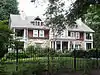 Edward Lucky Scarritt House |
May 23, 1977 (#77000809) |
3500 Gladstone Boulevard 39°06′56″N 94°32′24″W / 39.115623°N 94.540025°W |
Scarritt Point | |
| 152 | William Chick Scarritt House | 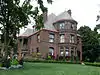 William Chick Scarritt House |
March 21, 1978 (#78001661) |
3240 Norledge Ave. 39°07′02″N 94°32′33″W / 39.117120°N 94.542471°W |
Scarritt Point | Severely damaged by fire September 19, 2016[5] |
| 153 | Seven Oaks School | 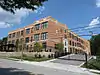 Seven Oaks School |
October 9, 2012 (#12000847) |
3711 Jackson Ave. 39°03′29″N 94°32′05″W / 39.057968°N 94.534644°W |
Knoches Park | Part of the Kansas City, Missouri School District Pre-1970 MPS |
| 154 | Shankman Building | 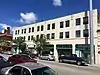 Shankman Building |
January 29, 2018 (#100002035) |
3115-3123 Troost Ave. 39°04′13″N 94°34′17″W / 39.070237°N 94.571310°W |
||
| 155 | William Francis Shelley House | 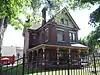 William Francis Shelley House |
March 17, 1978 (#78001662) |
3601 Baltimore Ave. 39°03′42″N 94°35′13″W / 39.061741°N 94.586840°W |
Hanover Place | |
| 156 | Simpson-Yeomans-Country Side Historic District | September 6, 1984 (#84002576) |
Roughly bounded by 51st Terrace, Wornall Rd., and Wyandotte and 54th Sts.; also the general vicinity of W. 51st Terrace, Wornall Rd., W. F7, and W. 57th St.; also E. 52nd St., Brookside Boulevard, Oak St., E. 57th St., and Main St. 39°01′52″N 94°35′27″W / 39.031111°N 94.590833°W |
Countryside | Second and third sets of boundaries represent boundary increases of May 26, 2000 and July 14, 2011 | |
| 157 | Sophian Plaza | 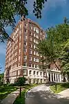 Sophian Plaza |
July 5, 1983 (#83001019) |
4618 Warwick Boulevard 39°03′42″N 94°35′13″W / 39.061741°N 94.586840°W |
Southmoreland | |
| 158 | South Hyde Park Historic District | November 14, 2007 (#07001186) |
Bounded by E. 39th St., the Gillham Parkway, Brush Creek Boulevard, and Troost Ave. 39°03′07″N 94°34′31″W / 39.051858°N 94.575339°W |
Hyde Park | ||
| 159 | South Side Historic District | June 9, 1983 (#83001020) |
Roughly bounded by 38th, 40th, Walnut, and Baltimore Sts. 39°03′23″N 94°35′11″W / 39.056389°N 94.586389°W |
Hanover Place, Southmoreland, Westport | ||
| 160 | Spofford Home for Children | August 23, 2016 (#16000545) |
5501 Cleveland Ave. 39°01′33″N 94°32′28″W / 39.025747°N 94.541066°W |
|||
| 161 | Squier Park Historic District | April 24, 2012 (#12000232) |
Roughly bounded by Armour Boulevard, Troost Avenue, 39th Street and The Paseo 39°03′34″N 94°34′10″W / 39.05958°N 94.56958°W |
Squier Park | Historic Residential Suburbs in the United States, 1830–1960 MPS | |
| 162 | Edward A. Stevens House | 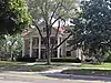 Edward A. Stevens House |
October 24, 2016 (#16000736) |
3223 Gladstone Blvd. 39°06′55″N 94°32′31″W / 39.115222°N 94.541935°W |
Kansas City | |
| 163 | Sunset Tower | December 22, 2021 (#100007263) |
4821 Roanoke Pkwy. 39°02′23″N 94°35′50″W / 39.0398°N 94.5973°W |
Kansas City | ||
| 164 | E.F. Swinney School | 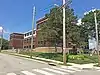 E.F. Swinney School |
October 16, 2013 (#13000838) |
1106 W. 47th St. 39°02′36″N 94°36′01″W / 39.043229°N 94.600231°W |
Kansas City | Part of the Kansas City, Missouri School District Pre-1970 MPS |
| 165 | The Tocoma | 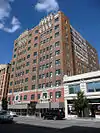 The Tocoma |
November 24, 1979 (#79003782) |
3835 Main St. 39°03′25″N 94°35′08″W / 39.056944°N 94.585556°W |
Hanover Place | |
| 166 | Alfred Toll House | 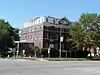 Alfred Toll House |
July 28, 1983 (#83001022) |
3502 Warwick Boulevard 39°03′48″N 94°35′01″W / 39.063387°N 94.583684°W |
Hanover Place | part of the Armour Boulevard MRA |
| 167 | Town of Kansas Site | June 28, 2011 (#11000399) |
Address Restricted |
Kansas City | part of the Railroad Related Historic Commercial and Industrial Resources in Kansas City, Missouri MPS | |
| 168 | Norman Tromanhauser House | 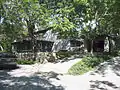 Norman Tromanhauser House |
January 26, 2001 (#01000014) |
3603 W. Roanoke Dr. 39°03′43″N 94°36′05″W / 39.061939°N 94.601513°W |
Volker | |
| 169 | Uptown Building and Theatre |  Uptown Building and Theatre |
June 27, 1979 (#79001374) |
3700–3712 Broadway 39°03′40″N 94°35′27″W / 39.061111°N 94.590833°W |
Valentine | |
| 170 | Valentine on Broadway Hotel | 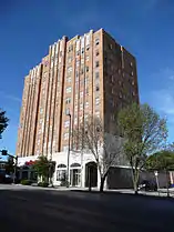 Valentine on Broadway Hotel |
August 1, 2008 (#08000745) |
3724 Broadway Boulevard 39°03′37″N 94°35′27″W / 39.060234°N 94.590823°W |
Valentine | |
| 171 | Ira C. and Charles S. Van Noy Houses | 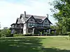 Ira C. and Charles S. Van Noy Houses |
July 8, 1987 (#87000505) |
6700 and 6800 Elmwood 39°00′11″N 94°32′04″W / 39.003038°N 94.534381°W |
Foxtown East | |
| 172 | Villa Serena Apartment Hotel | 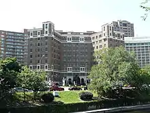 Villa Serena Apartment Hotel |
April 15, 2009 (#09000207) |
325 Ward Parkway 39°02′23″N 94°35′29″W / 39.039672°N 94.591342°W |
South Plaza | |
| 173 | Virginia Apartments | 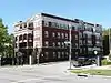 Virginia Apartments |
October 22, 2002 (#02001201) |
1100 Paseo Boulevard 39°06′01″N 94°33′51″W / 39.100293°N 94.564198°W |
Paseo West | part of the Apartment Buildings on the North End of the Paseo Boulevard in Kansas City, Missouri MPS |
| 174 | William Volker House | 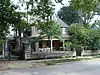 William Volker House |
May 20, 1993 (#93000408) |
3717 Bell St. 39°03′35″N 94°36′21″W / 39.059847°N 94.605874°W |
Volker | |
| 175 | Waldo Water Tower |  Waldo Water Tower |
April 18, 1977 (#77000810) |
75th St. and Holmes Rd., Tower Park 38°59′25″N 94°34′55″W / 38.990278°N 94.581944°W |
Tower Homes | |
| 176 | Seth E. Ward Homestead | 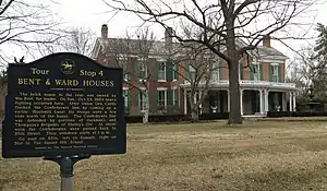 Seth E. Ward Homestead |
February 17, 1978 (#78001664) |
1032 W. 55th St. 39°01′42″N 94°36′06″W / 39.028333°N 94.601667°W |
Sunset Hill | |
| 177 | Westminster Congregational Church |  Westminster Congregational Church |
February 28, 1980 (#80002369) |
3600 Walnut St. 39°03′42″N 94°35′06″W / 39.0617°N 94.585°W |
Hanover Place | |
| 178 | Westport High School | 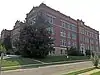 Westport High School |
February 2, 2015 (#14001239) |
315 E. 39th St. 39°03′21″N 94°34′53″W / 39.0557°N 94.5815°W |
Westport | |
| 179 | Westport Junior High School | 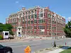 Westport Junior High School |
April 15, 2014 (#14000162) |
300 E. 39th St. 39°03′25″N 94°34′58″W / 39.0570°N 94.5827°W |
Westport | |
| 180 | Wheatley-Provident Hospital | 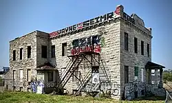 Wheatley-Provident Hospital |
October 8, 2020 (#100005665) |
1826 Forest Ave. 39°05′26″N 94°34′08″W / 39.0906°N 94.5690°W |
||
| 181 | Windsor Hall Apartments | 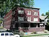 Windsor Hall Apartments |
January 14, 2011 (#10001129) |
3420 Locust St. 39°03′52″N 94°34′48″W / 39.0644°N 94.5800°W |
Hyde Park | part of the Working Class Hotels at 19th and Main Streets, Kansas City, Missouri MPS |
| 182 | F. W. Woolworth Building |  F. W. Woolworth Building |
May 6, 2005 (#05000372) |
3120–3122 Troost Ave. 39°04′11″N 94°34′18″W / 39.0697°N 94.5716°W |
Hyde Park | |
| 183 | Wornall House |  Wornall House |
May 21, 1969 (#69000109) |
146 W. 61st St. 39°01′00″N 94°35′32″W / 39.0167°N 94.5922°W |
Wornall Homestead |
See also
References
- ↑ The latitude and longitude information provided in this table was derived originally from the National Register Information System, which has been found to be fairly accurate for about 99% of listings. Some locations in this table may have been corrected to current GPS standards.
- ↑ National Park Service, United States Department of the Interior, "National Register of Historic Places: Weekly List Actions", retrieved January 5, 2024.
- ↑ Numbers represent an alphabetical ordering by significant words. Various colorings, defined here, differentiate National Historic Landmarks and historic districts from other NRHP buildings, structures, sites or objects.
- ↑ The eight-digit number below each date is the number assigned to each location in the National Register Information System database, which can be viewed by clicking the number.
- ↑ "Neighbors help rebuild historic home after fire". January 12, 2017.
| Topics | |
|---|---|
| Lists by state |
|
| Lists by insular areas | |
| Lists by associated state | |
| Other areas | |
| Related | |