Nakhon Thai
นครไทย | |
|---|---|
 A scenery of Phu Hin Rong Kla National Park in Nakhon Thai | |
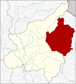 District location in Phitsanulok province | |
| Country | Thailand |
| Province | Phitsanulok |
| Tambon | 11 |
| Muban | 145 |
| Area | |
| • Total | 2,220.374 km2 (857.291 sq mi) |
| Population (2019)[1] | |
| • Total | 87,772 |
| • Density | 40/km2 (100/sq mi) |
| Time zone | UTC+7 (ICT) |
| Postal code | 65120 |
| Geocode | 6502 |
Nakhon Thai (Thai: นครไทย, pronounced [ná(ʔ).kʰɔ̄ːn tʰāj]) is a district (amphoe) in the eastern part of Phitsanulok province, central Thailand.
Geography
Neighboring districts are (from the southwest clockwise), Wang Thong and Chat Trakan of Phitsanulok Province; Na Haeo and Dan Sai of Loei province; and Khao Kho of Phetchabun province.
Phu Hin Rong Kla National Park is in Nakhon Thai District.[2]
Nakhon Thai lies within the Nan Basin, which is part of the Chao Phraya Watershed. The Khwae Noi River flows through the district, as well as the lesser Fia (Thai: ลำน้ำเฟี้ย) and Kaem (Thai: ลำน้ำแขม) Rivers.
Administration
Provincial administration
Nakhon Thai is divided into 11 sub-districts (tambons), which are further subdivided into 145 administrative villages (mubans).
| No. | Name | Thai | Villages | Pop.[1] | Households |
|---|---|---|---|---|---|
| 1. | Nong Kathao | หนองกะท้าว | 27 | 16,384 | 6,058 |
| 2. | Noen Phoem | เนินเพิ่ม | 19 | 13,467 | 4,612 |
| 3. | Ban Yaeng | บ้านแยง | 13 | 10,235 | 4,763 |
| 4. | Nakhon Thai | นครไทย | 13 | 9,278 | 4,155 |
| 5. | Na Bua | นาบัว | 15 | 7,828 | 2,538 |
| 6. | Bo Pho | บ่อโพธิ์ | 13 | 6,976 | 2,301 |
| 7. | Huai Hia | ห้วยเฮี้ย | 10 | 6,855 | 2,453 |
| 8. | Ban Phrao | บ้านพร้าว | 10 | 6,251 | 2,187 |
| 9. | Yang Klon | ยางโกลน | 10 | 4,979 | 1,389 |
| 10. | Nakhon Chum | นครชุม | 8 | 3,072 | 1,002 |
| 11. | Nam Kum | น้ำกุ่ม | 7 | 2,447 | 765 |
Local administration
There are two sub-district municipalities (thesaban tambons) in the district:
- Nakhon Thai (Thai: เทศบาลตำบลนครไทย) consisting of sub-district Nakhon Thai.
- Ban Yaeng (Thai: เทศบาลตำบลบ้านแยง) consisting of sub-district Ban Yaeng.
There are nine sub-district administrative organizations (SAO) in the district:
- Nong Kathao (Thai: องค์การบริหารส่วนตำบลหนองกะท้าว) consisting of sub-district Nong Kathao.
- Noen Phoem (Thai: องค์การบริหารส่วนตำบลเนินเพิ่ม) consisting of sub-district Noen Phoem.
- Na Bua (Thai: องค์การบริหารส่วนตำบลนาบัว) consisting of sub-district Na Bua.
- Bo Pho (Thai: องค์การบริหารส่วนตำบลบ่อโพธิ์) consisting of sub-district Bo Pho.
- Huai Hia (Thai: องค์การบริหารส่วนตำบลห้วยเฮี้ย) consisting of sub-district Huai Hia.
- Ban Phrao (Thai: องค์การบริหารส่วนตำบลบ้านพร้าว) consisting of sub-district Ban Phrao.
- Yang Klon (Thai: องค์การบริหารส่วนตำบลยางโกลน) consisting of sub-district Yang Klon.
- Nakhon Chum (Thai: องค์การบริหารส่วนตำบลนครชุม) consisting of sub-district Nakhon Chum.
- Nam Kum (Thai: องค์การบริหารส่วนตำบลน้ำกุ่ม) consisting of sub-district Nam Kum.
Temples
There are 23 Buddhist temples in Nakhon Thai.
Economy
Nakhon Thai is a district on the outskirts of Phitsanulok province, more than 80% of which is reserved forest area.
Therefore, Nakhon Thai and two neighboring districts, Chat Trakan and Wat Bot, have the lowest prosperity index in Phitsanulok, lowest household income and highest household debt.[3]
References
- 1 2 "Official statistics registration systems". Department of Provincial Administration. Retrieved 7 September 2020.
- ↑ "Phu Hin Rong Kla National Park". Department of National Parks (Thailand). Archived from the original on 18 April 2016. Retrieved 29 May 2017.
- ↑ หน้า 6, ไก่–ศุภกปรณ์ กิตยาธิคุณ พิษณุโลก ก้าวไกล ลุยปลดล็อกปัญหาที่ดิน. Matichon issues 16540 vol.46 Saturday, June 24, 2023 (in Thai)