| Mount Usu | |
|---|---|
| 有珠山 Usu-zan | |
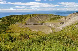
 Viewed from the SE. | |
| Highest point | |
| Elevation | 733 m (2,405 ft)[1][2] |
| Listing | Mountains of Japan |
| Coordinates | 42°32′37″N 140°50′21″E / 42.5435°N 140.8392°E[1] |
| Geography | |
| Parent range | Nasu Volcanic Zone |
| Topo map | Geographical Survey Institute 25,000:1 壮瞥, 50,000:1 虻田 |
| Geology | |
| Mountain type | Stratovolcano |
| Type of rock | Basalt, Andesite, Dacite and Rhyolite[2] |
| Volcanic arc/belt | Northeast Japan Arc |
| Last eruption | March 2000 to September 2001[2] |
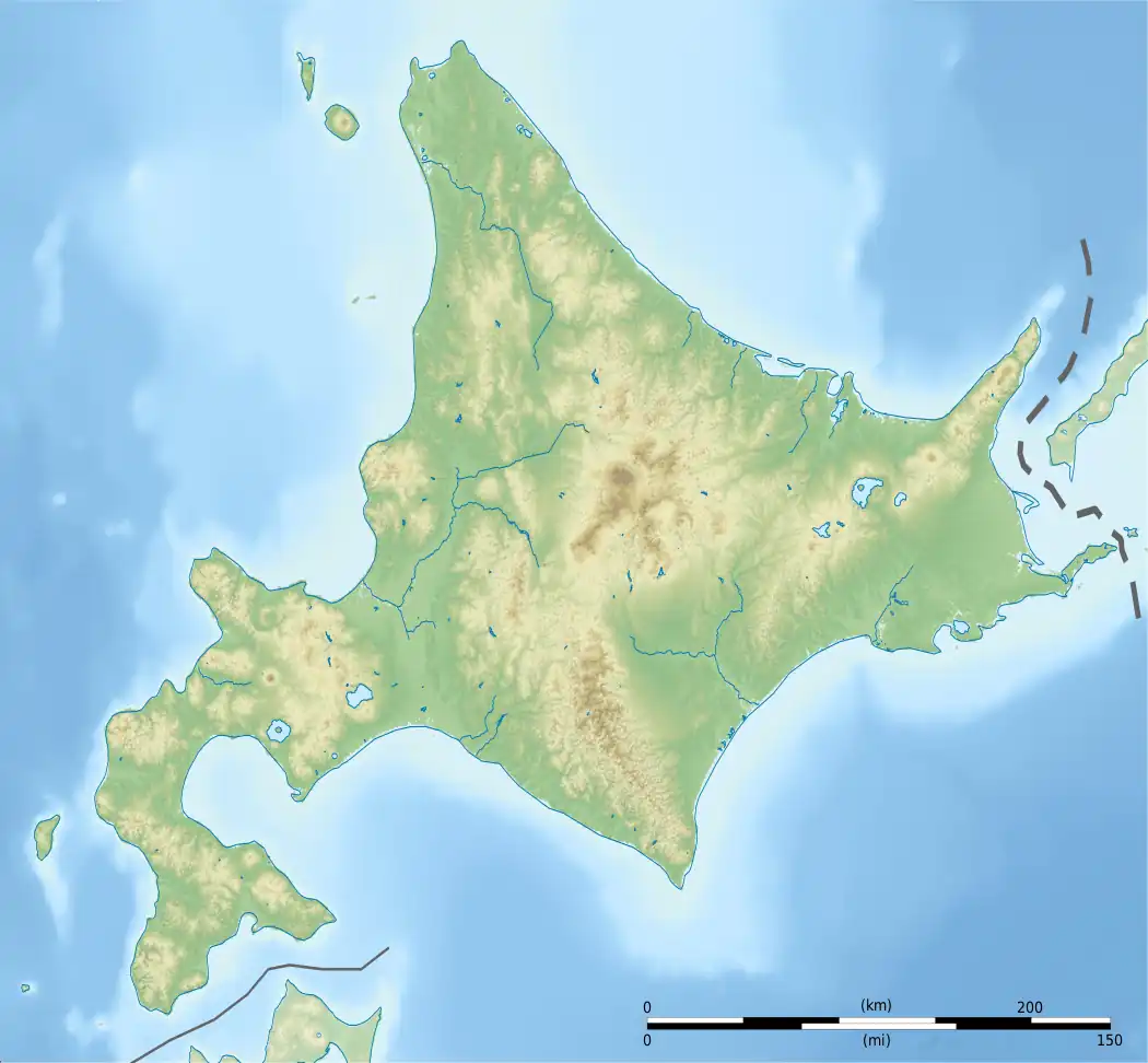
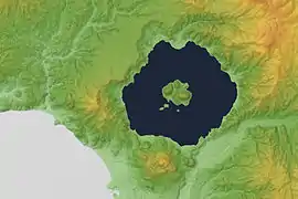
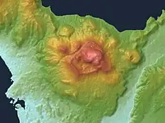
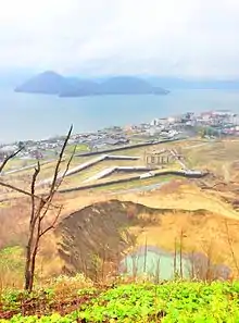
Mount Usu (有珠山, Usu-zan[3]) is an active stratovolcano in the Shikotsu-Tōya National Park, Hokkaido, Japan. It has erupted four times since 1900: in 1910 (which created Meiji-shinzan[4]), 1944–45 (which created Shōwa-shinzan), August 7, 1977,[5] and on March 31, 2000. To the north lies Lake Tōya. Mount Usu formed on the southern rim of the caldera containing the lake.
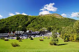
Mount Usu and Shōwa-shinzan are major tourist attractions in the Shikotsu-Tōya National Park. A rope-way on Mount Usu takes visitors to viewing platforms overlooking Shōwa-shinzan. The 1977 eruption is mentioned in passing in Alan Booth's travelogue, The Roads to Sata. The 2008 G8 Summit was held near Mount Usu at Lake Tōya.[6]
|
See also
References
- 1 2 "Topographic map of Mount Usu". opentopomap.org. Retrieved 2023-06-20.
- 1 2 3 "Toya". Global Volcanism Program. Smithsonian Institution. Retrieved 2021-06-25.
- ↑ Teikoku's Complete Atlas of Japan, Teikoku-Shoin Co., Ltd., ISBN 4-8071-0004-1
- ↑ 神沼克伊,小山悦郎 日本の火山を科学する 日本列島津々浦々、あなたの身近にある108の活火山とは? ソフトバンククリエイティブ 2011. ISBN 978-4797361308.
- ↑ "The 1977–78 Eruptions at the Mountain Peak and Ground Deformation". Archived from the original on 2010-10-12. Retrieved 2010-10-28. Last access 28 October 2010.
- ↑ "Japan's Selects Hokkaido for 2008 Summit". University of Toronto. Retrieved 28 May 2008.
External links
Wikimedia Commons has media related to Mount Usu.
- Usuzan—Japan Meteorological Agency (in Japanese)
- "15. Usuzan" (PDF). National Catalogue of the Active Volcanoes in Japan. Japan Meteorological Agency.
- Usu Volcano—Geological Survey of Japan
- Toya-Usu UNESCO Global Geopark
This article is issued from Wikipedia. The text is licensed under Creative Commons - Attribution - Sharealike. Additional terms may apply for the media files.