Maungakotukutuku | |
|---|---|
Rural locality | |
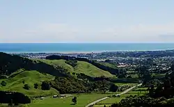 Paraparaumu from Maungakotukutuku Road | |
| Coordinates: 40°57′S 175°1′E / 40.950°S 175.017°E | |
| Country | New Zealand |
| Region | Wellington Region |
| Territorial authority | Kāpiti Coast District |
| Ward |
|
| Community |
|
| Electorates | |
| Government | |
| • Territorial Authority | Kāpiti Coast District Council |
| • Regional council | Greater Wellington Regional Council |
| • Kāpiti Coast Mayor | Janet Holborow |
| • Ōtaki MP/Mana MP | Tim Costley/Barbara Edmonds |
| • Te Tai Hauāuru MP | Debbie Ngarewa-Packer |
| Area | |
| • Total | 112.68 km2 (43.51 sq mi) |
| Population (June 2023)[2] | |
| • Total | 1,450 |
| • Density | 13/km2 (33/sq mi) |
| Postcode(s) | 5032, 5391 |
| Area code | 04 |
Maungakotukutuku is a rural locality on the Kāpiti Coast of New Zealand's North Island. It is located inland, behind Paraparaumu and Raumati.
The Maungakōtukutuku Stream and Wharemauku Stream both have their headwaters in the Maungakotukutuku area. Maungakotukutuku Valley has been considered as a possible site for a dam to boost the Kāpiti Coast's water supply.[3] The hilly areas, often called "the Maungatooks" by locals, have tracks popular with trampers, mountain and dirt bikers, and horse riders.
Demographics
Maungakotukutuku statistical area covers 112.69 km2 (43.51 sq mi).[1] It had an estimated population of 1,450 as of June 2023, with a population density of 13 people per km2.
| Year | Pop. | ±% p.a. |
|---|---|---|
| 2006 | 1,044 | — |
| 2013 | 1,212 | +2.15% |
| 2018 | 1,335 | +1.95% |
| Source: [4] | ||

Maungakotukutuku had a population of 1,335 at the 2018 New Zealand census, an increase of 123 people (10.1%) since the 2013 census, and an increase of 291 people (27.9%) since the 2006 census. There were 486 households, comprising 672 males and 663 females, giving a sex ratio of 1.01 males per female. The median age was 50.3 years (compared with 37.4 years nationally), with 189 people (14.2%) aged under 15 years, 195 (14.6%) aged 15 to 29, 693 (51.9%) aged 30 to 64, and 261 (19.6%) aged 65 or older.
Ethnicities were 93.9% European/Pākehā, 6.7% Māori, 1.3% Pasifika, 2.7% Asian, and 2.9% other ethnicities. People may identify with more than one ethnicity.
The percentage of people born overseas was 30.1, compared with 27.1% nationally.
Although some people chose not to answer the census's question about religious affiliation, 56.6% had no religion, 34.4% were Christian, 0.2% were Muslim, 0.7% were Buddhist and 2.0% had other religions.
Of those at least 15 years old, 342 (29.8%) people had a bachelor's or higher degree, and 138 (12.0%) people had no formal qualifications. The median income was $35,700, compared with $31,800 nationally. 321 people (28.0%) earned over $70,000 compared to 17.2% nationally. The employment status of those at least 15 was that 558 (48.7%) people were employed full-time, 192 (16.8%) were part-time, and 33 (2.9%) were unemployed.[4]
References
- 1 2 "ArcGIS Web Application". statsnz.maps.arcgis.com. Retrieved 30 November 2023.
- ↑ "Population estimate tables - NZ.Stat". Statistics New Zealand. Retrieved 25 October 2023.
- ↑ D. Townsend; D. Heron (April 2004). "Proposed Dam Site, Kapiti Coast District: Prefeasibility Fault Hazard Assessment". Institute of Geological and Nuclear Sciences. Archived from the original on 29 September 2007.
- 1 2 "Statistical area 1 dataset for 2018 Census". Statistics New Zealand. March 2020. Maungakotukutuku (237900). 2018 Census place summary: Maungakotukutuku