Maraial | |
|---|---|
 Flag | |
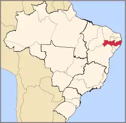
 Maraial Maraial located in Brazil Map | |
| Coordinates: 8°48′10″S 35°49′44″W / 8.80278°S 35.82889°W | |
| Country | |
| State | Pernambuco |
| Region | Zona da mata |
| Area | |
| • Total | 192.25 km2 (74.23 sq mi) |
| Elevation | 212 m (696 ft) |
| Population (2020 [1]) | |
| • Total | 11,220 |
| Time zone | UTC−3 (BRT) |
Maraial is a city in Pernambuco, Brazil. It is located in Zona da mata Pernambucana, 154 km from the state capital, Recife.
Geography
- State - Pernambuco
- Region - Zona da mata Pernambucana
- Boundaries - Jaqueira (N); Alagoas state (S); Xexéu and Catende (E); São Benedito do Sul (W)
- Area - 192.25 km2
- Elevation - 212 m
- Hydrography - Una river
- Vegetation - Subperenifólia forest
- Climate - Hot tropical and humid
- Annual average temperature - 23.6 c
- Distance to Recife - 154 km
Economy
The main economic activities in Maraial are based in food and beverage industry and agribusiness, especially sugarcane, bananas, pineapples, cattle and goats.
Economic Indicators
| Population[2] | GDP x(1000 R$).[3] | GDP pc (R$) | PE |
|---|---|---|---|
| 12.303 | 56.715 | 4.592 | 0.09% |
Economy by Sector (2006)
| Primary sector | Secondary sector | Service sector |
|---|---|---|
| 10.64% | 26.05% | 63.31% |
Health Indicators
| HDI (2000)[4] | Hospitals (2007) | Hospitals beds (2007) | Children's Mortality every 1000 (2005) |
|---|---|---|---|
| 0.564 | 1 | 13 | 30.8 |
References
- ↑ IBGE 2020
- ↑ IBGE Population 2009 Maraial, page 33
- ↑ Maraial 2007 GDP IBGE page 31 Archived 2016-03-04 at the Wayback Machine
- ↑ PE State site - City by city profile
Capital: Recife | ||||||||||||||
| Mesoregion Agreste Pernambucano |
|  | ||||||||||||
| Mesoregion Mata Pernambucana |
| |||||||||||||
| Mesoregion Metropolitana de Recife |
| |||||||||||||
| Mesoregion Sao Francisco Pernambucano |
| |||||||||||||
| Mesoregion Sertão Pernambucano |
| |||||||||||||
This article is issued from Wikipedia. The text is licensed under Creative Commons - Attribution - Sharealike. Additional terms may apply for the media files.