There are at least 121 named trails in Madison County, Montana according to the U.S. Geological Survey, Board of Geographic Names. A trail is defined as: "Route for passage from one point to another; does not include roads or highways (jeep trail, path, ski trail)."[1]
- Ambush Meadows Ski Trail, 45°16′51″N 111°24′24″W / 45.28083°N 111.40667°W, el. 7,759 feet (2,365 m) [2]
- Ambush Ski Trail, 45°16′51″N 111°24′24″W / 45.28083°N 111.40667°W, el. 7,759 feet (2,365 m) [3]
- Arch Rock Ski Trail, 45°16′51″N 111°24′24″W / 45.28083°N 111.40667°W, el. 7,759 feet (2,365 m) [4]
- A-Z Chutes Ski Trail, 45°16′51″N 111°24′24″W / 45.28083°N 111.40667°W, el. 7,759 feet (2,365 m) [5]
- Bacon Rind Ski Trail, 45°16′51″N 111°24′24″W / 45.28083°N 111.40667°W, el. 7,759 feet (2,365 m) [6]
- Bad Dog Ski Trail, 45°16′51″N 111°24′24″W / 45.28083°N 111.40667°W, el. 7,759 feet (2,365 m) [7]
- Bavarian Forest Ski Trail, 45°16′51″N 111°24′24″W / 45.28083°N 111.40667°W, el. 7,759 feet (2,365 m) [8]
- Bert Road Ski Trail, 45°16′51″N 111°24′24″W / 45.28083°N 111.40667°W, el. 7,759 feet (2,365 m) [9]
- Big Couloir Ski Trail, 45°16′51″N 111°24′24″W / 45.28083°N 111.40667°W, el. 7,759 feet (2,365 m) [10]
- Big Horn Ski Trail, 45°16′51″N 111°24′24″W / 45.28083°N 111.40667°W, el. 7,759 feet (2,365 m) [11]
- Big Rock Tongue Ski Trail, 45°16′51″N 111°24′24″W / 45.28083°N 111.40667°W, el. 7,759 feet (2,365 m) [12]
- Billy Johns Trail, 45°42′26″N 112°23′56″W / 45.70722°N 112.39889°W, el. 7,267 feet (2,215 m) [13]
- Black and Blue Ski Trail, 45°16′51″N 111°24′24″W / 45.28083°N 111.40667°W, el. 7,759 feet (2,365 m) [14]
- Black Rock Gully Ski Trail, 45°16′51″N 111°24′24″W / 45.28083°N 111.40667°W, el. 7,759 feet (2,365 m) [15]
- Blue Moon Ski Trail, 45°16′51″N 111°24′24″W / 45.28083°N 111.40667°W, el. 7,759 feet (2,365 m) [16]
- Bone Crusher Ski Trail, 45°16′51″N 111°24′24″W / 45.28083°N 111.40667°W, el. 7,759 feet (2,365 m) [17]
- Bozeman Trail Ski Trail, 45°16′51″N 111°24′24″W / 45.28083°N 111.40667°W, el. 7,759 feet (2,365 m) [18]
- Brazil Pack Trail, 45°41′38″N 112°26′38″W / 45.69389°N 112.44389°W, el. 7,208 feet (2,197 m) [19]
- Broken Arrow Ski Trail, 45°16′51″N 111°24′24″W / 45.28083°N 111.40667°W, el. 7,759 feet (2,365 m) [20]
- Buffalo Jump Ski Trail, 45°16′51″N 111°24′24″W / 45.28083°N 111.40667°W, el. 7,759 feet (2,365 m) [21]
- Cache Trees Ski Trail, 45°16′51″N 111°24′24″W / 45.28083°N 111.40667°W, el. 7,759 feet (2,365 m) [22]
- Calamity Jane Ski Trail, 45°16′51″N 111°24′24″W / 45.28083°N 111.40667°W, el. 7,759 feet (2,365 m) [23]
- Chucks Run Ski Trail, 45°16′51″N 111°24′24″W / 45.28083°N 111.40667°W, el. 7,759 feet (2,365 m) [24]
- Country Club Ski Trail, 45°16′51″N 111°24′24″W / 45.28083°N 111.40667°W, el. 7,759 feet (2,365 m) [25]
- Cow Creek Trail, 45°29′23″N 112°05′11″W / 45.48972°N 112.08639°W, el. 6,968 feet (2,124 m) [26]
- Cow Flats Ski Trail, 45°16′51″N 111°24′24″W / 45.28083°N 111.40667°W, el. 7,759 feet (2,365 m) [27]
- Crazy Horse Ski Trail, 45°16′51″N 111°24′24″W / 45.28083°N 111.40667°W, el. 7,759 feet (2,365 m) [28]
- Crazy Raven Ski Trail, 45°16′51″N 111°24′24″W / 45.28083°N 111.40667°W, el. 7,759 feet (2,365 m) [29]
- Crons Pocket Ski Trail, 45°16′51″N 111°24′24″W / 45.28083°N 111.40667°W, el. 7,759 feet (2,365 m) [30]
- Cue Ball Ski Trail, 45°16′51″N 111°24′24″W / 45.28083°N 111.40667°W, el. 7,759 feet (2,365 m) [31]
- Currant Creek Trail, 45°28′37″N 112°02′16″W / 45.47694°N 112.03778°W, el. 7,388 feet (2,252 m) [32]
- Cutoff Trail, 44°58′03″N 111°22′44″W / 44.96750°N 111.37889°W, el. 8,405 feet (2,562 m) [33]
- Dakota Territory Ski Trail, 45°16′51″N 111°24′24″W / 45.28083°N 111.40667°W, el. 7,759 feet (2,365 m) [34]
- Dead Top Ski Trail, 45°16′51″N 111°24′24″W / 45.28083°N 111.40667°W, el. 7,759 feet (2,365 m) [35]
- Deep South Ski Trail, 45°16′51″N 111°24′24″W / 45.28083°N 111.40667°W, el. 7,759 feet (2,365 m) [36]
- Dictator Chutes Ski Trail, 45°16′51″N 111°24′24″W / 45.28083°N 111.40667°W, el. 7,759 feet (2,365 m) [37]
- Dirt Bag Wall Ski Trail, 45°16′51″N 111°24′24″W / 45.28083°N 111.40667°W, el. 7,759 feet (2,365 m) [38]
- Dry Fork Trail, 45°01′45″N 111°44′04″W / 45.02917°N 111.73444°W, el. 6,722 feet (2,049 m) [39]
- Duck Walk Ski Trail, 45°16′51″N 111°24′24″W / 45.28083°N 111.40667°W, el. 7,759 feet (2,365 m) [40]
- Dude Park Ski Trail, 45°16′51″N 111°24′24″W / 45.28083°N 111.40667°W, el. 7,759 feet (2,365 m) [41]
- El Dorado Ski Trail, 45°16′51″N 111°24′24″W / 45.28083°N 111.40667°W, el. 7,759 feet (2,365 m) [42]
- Elk Park Meadows Ski Trail, 45°16′51″N 111°24′24″W / 45.28083°N 111.40667°W, el. 7,759 feet (2,365 m) [43]
- Elk Park Ridge Ski Trail, 45°16′51″N 111°24′24″W / 45.28083°N 111.40667°W, el. 7,759 feet (2,365 m) [44]
- Exit Chute Ski Trail, 45°16′51″N 111°24′24″W / 45.28083°N 111.40667°W, el. 7,759 feet (2,365 m) [45]
- Fast Lane Ski Trail, 45°16′51″N 111°24′24″W / 45.28083°N 111.40667°W, el. 7,759 feet (2,365 m) [46]
- Fifth Gully Ski Trail, 45°16′51″N 111°24′24″W / 45.28083°N 111.40667°W, el. 7,759 feet (2,365 m) [47]
- First Gully Ski Trail, 45°16′51″N 111°24′24″W / 45.28083°N 111.40667°W, el. 7,759 feet (2,365 m) [48]
- Fourth Gully Ski Trail, 45°16′51″N 111°24′24″W / 45.28083°N 111.40667°W, el. 7,759 feet (2,365 m) [49]
- Gazelle Creek Pack Trail, 44°51′52″N 111°47′16″W / 44.86444°N 111.78778°W, el. 9,055 feet (2,760 m) [50]
- Gilbert Trail, 44°52′02″N 112°01′46″W / 44.86722°N 112.02944°W, el. 7,329 feet (2,234 m) [51]
- Gun Mount Ski Trail, 45°16′51″N 111°24′24″W / 45.28083°N 111.40667°W, el. 7,759 feet (2,365 m) [52]
- Hangmans Ski Trail, 45°16′51″N 111°24′24″W / 45.28083°N 111.40667°W, el. 7,759 feet (2,365 m) [53]
- High Clearing Ski Trail, 45°16′51″N 111°24′24″W / 45.28083°N 111.40667°W, el. 7,759 feet (2,365 m) [54]
- Highway Ski Trail, 45°16′51″N 111°24′24″W / 45.28083°N 111.40667°W, el. 7,759 feet (2,365 m) [55]
- Huntley Hollow Ski Trail, 45°16′51″N 111°24′24″W / 45.28083°N 111.40667°W, el. 7,759 feet (2,365 m) [56]
- Hyde Creek Trail, 44°58′30″N 111°47′12″W / 44.97500°N 111.78667°W, el. 9,219 feet (2,810 m) [57]
- Kurts Glades Ski Trail, 45°16′51″N 111°24′24″W / 45.28083°N 111.40667°W, el. 7,759 feet (2,365 m) [58]
- Larkspur Ski Trail, 45°16′51″N 111°24′24″W / 45.28083°N 111.40667°W, el. 7,759 feet (2,365 m) [59]
- Liberty Bowl Ski Trail, 45°16′51″N 111°24′24″W / 45.28083°N 111.40667°W, el. 7,759 feet (2,365 m) [60]
- Lightning Creek Trail, 44°59′32″N 111°22′43″W / 44.99222°N 111.37861°W, el. 8,399 feet (2,560 m) [61]
- Lightning Ski Trail, 45°16′51″N 111°24′24″W / 45.28083°N 111.40667°W, el. 7,759 feet (2,365 m) [62]
- Little Ewe Ski Trail, 45°16′51″N 111°24′24″W / 45.28083°N 111.40667°W, el. 7,759 feet (2,365 m) [63]
- Little Gullies Ski Trail, 45°16′51″N 111°24′24″W / 45.28083°N 111.40667°W, el. 7,759 feet (2,365 m) [64]
- Little Rock Tongue Ski Trail, 45°16′51″N 111°24′24″W / 45.28083°N 111.40667°W, el. 7,759 feet (2,365 m) [65]
- Little Tree Ski Trail, 45°16′51″N 111°24′24″W / 45.28083°N 111.40667°W, el. 7,759 feet (2,365 m) [66]
- Lobo Mesa Pack Trail, 44°49′09″N 111°48′09″W / 44.81917°N 111.80250°W, el. 9,180 feet (2,800 m) [67]
- Lobo Ski Trail, 45°16′51″N 111°24′24″W / 45.28083°N 111.40667°W, el. 7,759 feet (2,365 m) [68]
- Lone Wolf Ski Trail, 45°16′51″N 111°24′24″W / 45.28083°N 111.40667°W, el. 7,759 feet (2,365 m) [69]
- Lost Cabin Lake Recreation Trail, 45°35′36″N 112°04′10″W / 45.59333°N 112.06944°W, el. 8,284 feet (2,525 m) [70]
- Louise Lake National Recreation Trail, 45°36′24″N 112°02′36″W / 45.60667°N 112.04333°W, el. 8,359 feet (2,548 m) [71]
- Low Bench Ski Trail, 45°16′51″N 111°24′24″W / 45.28083°N 111.40667°W, el. 7,759 feet (2,365 m) [72]
- Low Clearing Ski Trail, 45°16′51″N 111°24′24″W / 45.28083°N 111.40667°W, el. 7,759 feet (2,365 m) [73]
- Lower Bone Crusher Ski Trail, 45°16′51″N 111°24′24″W / 45.28083°N 111.40667°W, el. 7,759 feet (2,365 m) [74]
- Lower Calamity Jane Ski Trail, 45°16′51″N 111°24′24″W / 45.28083°N 111.40667°W, el. 7,759 feet (2,365 m) [75]
- Lower Mister K Ski Trail, 45°16′51″N 111°24′24″W / 45.28083°N 111.40667°W, el. 7,759 feet (2,365 m) [76]
- Lower Morningstar Ski Trail, 45°16′51″N 111°24′24″W / 45.28083°N 111.40667°W, el. 7,759 feet (2,365 m) [77]
- Mad Wolf Ski Trail, 45°16′51″N 111°24′24″W / 45.28083°N 111.40667°W, el. 7,759 feet (2,365 m) [78]
- Madison Avenue Ski Trail, 45°16′51″N 111°24′24″W / 45.28083°N 111.40667°W, el. 7,759 feet (2,365 m) [79]
- Marmot Meadows Ski Trail, 45°16′51″N 111°24′24″W / 45.28083°N 111.40667°W, el. 7,759 feet (2,365 m) [80]
- Midnight Basin Ski Trail, 45°16′51″N 111°24′24″W / 45.28083°N 111.40667°W, el. 7,759 feet (2,365 m) [81]
- Mister K Ski Trail, 45°16′51″N 111°24′24″W / 45.28083°N 111.40667°W, el. 7,759 feet (2,365 m) [82]
- Moonlight Basin Ski Trail, 45°16′51″N 111°24′24″W / 45.28083°N 111.40667°W, el. 7,759 feet (2,365 m) [83]
- Nashville Bowl Ski Trail, 45°16′51″N 111°24′24″W / 45.28083°N 111.40667°W, el. 7,759 feet (2,365 m) [84]
- Never Sweat Ski Trail, 45°16′51″N 111°24′24″W / 45.28083°N 111.40667°W, el. 7,759 feet (2,365 m) [85]
- Old Faithful Glades Ski Trail, 45°16′51″N 111°24′24″W / 45.28083°N 111.40667°W, el. 7,759 feet (2,365 m) [86]
- Onslows Ski Trail, 45°16′51″N 111°24′24″W / 45.28083°N 111.40667°W, el. 7,759 feet (2,365 m) [87]
- Pacifer Ski Trail, 45°16′51″N 111°24′24″W / 45.28083°N 111.40667°W, el. 7,759 feet (2,365 m) [88]
- Pack Saddle Ski Trail, 45°16′51″N 111°24′24″W / 45.28083°N 111.40667°W, el. 7,759 feet (2,365 m) [89]
- Peacock Creek Trail, 45°28′29″N 112°04′37″W / 45.47472°N 112.07694°W, el. 7,198 feet (2,194 m) [90]
- Pedro Trail, 45°29′01″N 112°00′16″W / 45.48361°N 112.00444°W, el. 7,910 feet (2,410 m) [91]
- Ponderosa Ski Trail, 45°16′51″N 111°24′24″W / 45.28083°N 111.40667°W, el. 7,759 feet (2,365 m) [92]
- Powder River Ski Trail, 45°16′51″N 111°24′24″W / 45.28083°N 111.40667°W, el. 7,759 feet (2,365 m) [93]
- Quartz Hill Trail, 45°29′13″N 112°03′34″W / 45.48694°N 112.05944°W, el. 7,730 feet (2,360 m) [94]
- Rice Bowl Ski Trail, 45°16′51″N 111°24′24″W / 45.28083°N 111.40667°W, el. 7,759 feet (2,365 m) [95]
- Sacajawea Ski Trail, 45°16′51″N 111°24′24″W / 45.28083°N 111.40667°W, el. 7,759 feet (2,365 m) [96]
- Screaming Left Ski Trail, 45°16′51″N 111°24′24″W / 45.28083°N 111.40667°W, el. 7,759 feet (2,365 m) [97]
- Second Gully Ski Trail, 45°16′51″N 111°24′24″W / 45.28083°N 111.40667°W, el. 7,759 feet (2,365 m) [98]
- Seventeenth Green Ski Trail, 45°16′51″N 111°24′24″W / 45.28083°N 111.40667°W, el. 7,759 feet (2,365 m) [99]
- Short Shot Ski Trail, 45°16′51″N 111°24′24″W / 45.28083°N 111.40667°W, el. 7,759 feet (2,365 m) [100]
- Silverknife Ski Trail, 45°16′51″N 111°24′24″W / 45.28083°N 111.40667°W, el. 7,759 feet (2,365 m) [101]
- Sixth Gully Ski Trail, 45°16′51″N 111°24′24″W / 45.28083°N 111.40667°W, el. 7,759 feet (2,365 m) [102]
- Snake Bite Ski Trail, 45°16′51″N 111°24′24″W / 45.28083°N 111.40667°W, el. 7,759 feet (2,365 m) [103]
- Snake Pit Ski Trail, 45°16′51″N 111°24′24″W / 45.28083°N 111.40667°W, el. 7,759 feet (2,365 m) [104]
- Stump Farm Ski Trail, 45°16′51″N 111°24′24″W / 45.28083°N 111.40667°W, el. 7,759 feet (2,365 m) [105]
- Stutzmans Rock Ski Trail, 45°16′51″N 111°24′24″W / 45.28083°N 111.40667°W, el. 7,759 feet (2,365 m) [106]
- Sunlight Ski Trail, 45°16′51″N 111°24′24″W / 45.28083°N 111.40667°W, el. 7,759 feet (2,365 m) [107]
- The Bowl Ski Trail, 45°16′51″N 111°24′24″W / 45.28083°N 111.40667°W, el. 7,759 feet (2,365 m) [108]
- The Pinnacles Ski Trail, 45°16′51″N 111°24′24″W / 45.28083°N 111.40667°W, el. 7,759 feet (2,365 m) [109]
- The Wave Ski Trail, 45°16′51″N 111°24′24″W / 45.28083°N 111.40667°W, el. 7,759 feet (2,365 m) [110]
- Third Gully Ski Trail, 45°16′51″N 111°24′24″W / 45.28083°N 111.40667°W, el. 7,759 feet (2,365 m) [111]
- Thunder Ski Trail, 45°16′51″N 111°24′24″W / 45.28083°N 111.40667°W, el. 7,759 feet (2,365 m) [112]
- Tippys Tumble Ski Trail, 45°16′51″N 111°24′24″W / 45.28083°N 111.40667°W, el. 7,759 feet (2,365 m) [113]
- Tohelluride Ski Trail, 45°16′51″N 111°24′24″W / 45.28083°N 111.40667°W, el. 7,759 feet (2,365 m) [114]
- Turkey Traverse Ski Trail, 45°16′51″N 111°24′24″W / 45.28083°N 111.40667°W, el. 7,759 feet (2,365 m) [115]
- Upper Morningstar Ski Trail, 45°16′51″N 111°24′24″W / 45.28083°N 111.40667°W, el. 7,759 feet (2,365 m) [116]
- Upper Sunlight Ski Trail, 45°16′51″N 111°24′24″W / 45.28083°N 111.40667°W, el. 7,759 feet (2,365 m) [117]
- Vertical Reality Ski Trail, 45°16′51″N 111°24′24″W / 45.28083°N 111.40667°W, el. 7,759 feet (2,365 m) [118]
- War Dance Ski Trail, 45°16′51″N 111°24′24″W / 45.28083°N 111.40667°W, el. 7,759 feet (2,365 m) [119]
- White Wing Ski Trail, 45°16′51″N 111°24′24″W / 45.28083°N 111.40667°W, el. 7,759 feet (2,365 m) [120]
- Yellow Mule Ski Trail, 45°16′51″N 111°24′24″W / 45.28083°N 111.40667°W, el. 7,759 feet (2,365 m) [121]
- Zucchini Patch Ski Trail, 45°16′51″N 111°24′24″W / 45.28083°N 111.40667°W, el. 7,759 feet (2,365 m) [122]
Further reading
- Arthur, Jean (2000). Winter Trails Montana: The Best Cross-Country Ski & Snowshoe Trails. Guilford, CT: Globe Pequot. ISBN 0-7627-0730-5.
- Spring, Ira (1974). Wilderness trails Northwest;: A hiker's and climber's overview-guide to national parks and wilderness areas in Wyoming, Montana, Idaho, Northern California, . British Columbia, Canadian Rockies. Touchstone Press. ISBN 0-911518-25-8.
- Willard, John A. (1986). Adventure Trails in Montana. Pruett Publishing Co. ISBN 0-87108-726-X.
- Howard, Lynna and Leland (2000). Along Montana & Idaho's Continental Divide Trail. Westcliff Publishers. ISBN 1-56579-343-9.
- Wolf, John R. (1992). Guide to the Continental Divide Trail: Northern Montana. Continental Divide Trail Society. ISBN 0-934326-01-0.
- Barnett, Carellen (1997). Trail Riding Western Montana. Guilford, CT: Falcon Press Publishing. ISBN 1-56044-336-7.
- Schneider, Bill (1995). Hiking Montana. Guilford, CT: Falcon Press Publishing. ISBN 1-56044-381-2.
See also
Notes
- ↑ "Geographic Names Information System (GNIS) Feature Class Definitions". U.S. Geological Survey. Retrieved 2011-07-26.
- ↑ "Ambush Meadows Ski Trail". Geographic Names Information System. United States Geological Survey, United States Department of the Interior.
- ↑ "Ambush Ski Trail". Geographic Names Information System. United States Geological Survey, United States Department of the Interior.
- ↑ "Arch Rock Ski Trail". Geographic Names Information System. United States Geological Survey, United States Department of the Interior.
- ↑ "A-Z Chutes Ski Trail". Geographic Names Information System. United States Geological Survey, United States Department of the Interior.
- ↑ "Bacon Rind Ski Trail". Geographic Names Information System. United States Geological Survey, United States Department of the Interior.
- ↑ "Bad Dog Ski Trail". Geographic Names Information System. United States Geological Survey, United States Department of the Interior.
- ↑ "Bavarian Forest Ski Trail". Geographic Names Information System. United States Geological Survey, United States Department of the Interior.
- ↑ "Bert Road Ski Trail". Geographic Names Information System. United States Geological Survey, United States Department of the Interior.
- ↑ "Big Couloir Ski Trail". Geographic Names Information System. United States Geological Survey, United States Department of the Interior.
- ↑ "Big Horn Ski Trail". Geographic Names Information System. United States Geological Survey, United States Department of the Interior.
- ↑ "Big Rock Tongue Ski Trail". Geographic Names Information System. United States Geological Survey, United States Department of the Interior.
- ↑ "Billy Johns Trail". Geographic Names Information System. United States Geological Survey, United States Department of the Interior.
- ↑ "Black and Blue Ski Trail". Geographic Names Information System. United States Geological Survey, United States Department of the Interior.
- ↑ "Black Rock Gully Ski Trail". Geographic Names Information System. United States Geological Survey, United States Department of the Interior.
- ↑ "Blue Moon Ski Trail". Geographic Names Information System. United States Geological Survey, United States Department of the Interior.
- ↑ "Bone Crusher Ski Trail". Geographic Names Information System. United States Geological Survey, United States Department of the Interior.
- ↑ "Bozeman Trail Ski Trail". Geographic Names Information System. United States Geological Survey, United States Department of the Interior.
- ↑ "Brazil Pack Trail". Geographic Names Information System. United States Geological Survey, United States Department of the Interior.
- ↑ "Broken Arrow Ski Trail". Geographic Names Information System. United States Geological Survey, United States Department of the Interior.
- ↑ "Buffalo Jump Ski Trail". Geographic Names Information System. United States Geological Survey, United States Department of the Interior.
- ↑ "Cache Trees Ski Trail". Geographic Names Information System. United States Geological Survey, United States Department of the Interior.
- ↑ "Calamity Jane Ski Trail". Geographic Names Information System. United States Geological Survey, United States Department of the Interior.
- ↑ "Chucks Run Ski Trail". Geographic Names Information System. United States Geological Survey, United States Department of the Interior.
- ↑ "Country Club Ski Trail". Geographic Names Information System. United States Geological Survey, United States Department of the Interior.
- ↑ "Cow Creek Trail". Geographic Names Information System. United States Geological Survey, United States Department of the Interior.
- ↑ "Cow Flats Ski Trail". Geographic Names Information System. United States Geological Survey, United States Department of the Interior.
- ↑ "Crazy Horse Ski Trail". Geographic Names Information System. United States Geological Survey, United States Department of the Interior.
- ↑ "Crazy Raven Ski Trail". Geographic Names Information System. United States Geological Survey, United States Department of the Interior.
- ↑ "Crons Pocket Ski Trail". Geographic Names Information System. United States Geological Survey, United States Department of the Interior.
- ↑ "Cue Ball Ski Trail". Geographic Names Information System. United States Geological Survey, United States Department of the Interior.
- ↑ "Currant Creek Trail". Geographic Names Information System. United States Geological Survey, United States Department of the Interior.
- ↑ "Cutoff Trail". Geographic Names Information System. United States Geological Survey, United States Department of the Interior.
- ↑ "Dakota Territory Ski Trail". Geographic Names Information System. United States Geological Survey, United States Department of the Interior.
- ↑ "Dead Top Ski Trail". Geographic Names Information System. United States Geological Survey, United States Department of the Interior.
- ↑ "Deep South Ski Trail". Geographic Names Information System. United States Geological Survey, United States Department of the Interior.
- ↑ "Dictator Chutes Ski Trail". Geographic Names Information System. United States Geological Survey, United States Department of the Interior.
- ↑ "Dirt Bag Wall Ski Trail". Geographic Names Information System. United States Geological Survey, United States Department of the Interior.
- ↑ "Dry Fork Trail". Geographic Names Information System. United States Geological Survey, United States Department of the Interior.
- ↑ "Duck Walk Ski Trail". Geographic Names Information System. United States Geological Survey, United States Department of the Interior.
- ↑ "Dude Park Ski Trail". Geographic Names Information System. United States Geological Survey, United States Department of the Interior.
- ↑ "El Dorado Ski Trail". Geographic Names Information System. United States Geological Survey, United States Department of the Interior.
- ↑ "Elk Park Meadows Ski Trail". Geographic Names Information System. United States Geological Survey, United States Department of the Interior.
- ↑ "Elk Park Ridge Ski Trail". Geographic Names Information System. United States Geological Survey, United States Department of the Interior.
- ↑ "Exit Chute Ski Trail". Geographic Names Information System. United States Geological Survey, United States Department of the Interior.
- ↑ "Fast Lane Ski Trail". Geographic Names Information System. United States Geological Survey, United States Department of the Interior.
- ↑ "Fifth Gully Ski Trail". Geographic Names Information System. United States Geological Survey, United States Department of the Interior.
- ↑ "First Gully Ski Trail". Geographic Names Information System. United States Geological Survey, United States Department of the Interior.
- ↑ "Fourth Gully Ski Trail". Geographic Names Information System. United States Geological Survey, United States Department of the Interior.
- ↑ "Gazelle Creek Pack Trail". Geographic Names Information System. United States Geological Survey, United States Department of the Interior.
- ↑ "Gilbert Trail". Geographic Names Information System. United States Geological Survey, United States Department of the Interior.
- ↑ "Gun Mount Ski Trail". Geographic Names Information System. United States Geological Survey, United States Department of the Interior.
- ↑ "Hangmans Ski Trail". Geographic Names Information System. United States Geological Survey, United States Department of the Interior.
- ↑ "High Clearing Ski Trail". Geographic Names Information System. United States Geological Survey, United States Department of the Interior.
- ↑ "Highway Ski Trail". Geographic Names Information System. United States Geological Survey, United States Department of the Interior.
- ↑ "Huntley Hollow Ski Trail". Geographic Names Information System. United States Geological Survey, United States Department of the Interior.
- ↑ "Hyde Creek Trail". Geographic Names Information System. United States Geological Survey, United States Department of the Interior.
- ↑ "Kurts Glades Ski Trail". Geographic Names Information System. United States Geological Survey, United States Department of the Interior.
- ↑ "Larkspur Ski Trail". Geographic Names Information System. United States Geological Survey, United States Department of the Interior.
- ↑ "Liberty Bowl Ski Trail". Geographic Names Information System. United States Geological Survey, United States Department of the Interior.
- ↑ "Lightning Creek Trail". Geographic Names Information System. United States Geological Survey, United States Department of the Interior.
- ↑ "Lightning Ski Trail". Geographic Names Information System. United States Geological Survey, United States Department of the Interior.
- ↑ "Little Ewe Ski Trail". Geographic Names Information System. United States Geological Survey, United States Department of the Interior.
- ↑ "Little Gullies Ski Trail". Geographic Names Information System. United States Geological Survey, United States Department of the Interior.
- ↑ "Little Rock Tongue Ski Trail". Geographic Names Information System. United States Geological Survey, United States Department of the Interior.
- ↑ "Little Tree Ski Trail". Geographic Names Information System. United States Geological Survey, United States Department of the Interior.
- ↑ "Lobo Mesa Pack Trail". Geographic Names Information System. United States Geological Survey, United States Department of the Interior.
- ↑ "Lobo Ski Trail". Geographic Names Information System. United States Geological Survey, United States Department of the Interior.
- ↑ "Lone Wolf Ski Trail". Geographic Names Information System. United States Geological Survey, United States Department of the Interior.
- ↑ "Lost Cabin Lake Recreation Trail". Geographic Names Information System. United States Geological Survey, United States Department of the Interior.
- ↑ "Louise Lake National Recreation Trail". Geographic Names Information System. United States Geological Survey, United States Department of the Interior.
- ↑ "Low Bench Ski Trail". Geographic Names Information System. United States Geological Survey, United States Department of the Interior.
- ↑ "Low Clearing Ski Trail". Geographic Names Information System. United States Geological Survey, United States Department of the Interior.
- ↑ "Lower Bone Crusher Ski Trail". Geographic Names Information System. United States Geological Survey, United States Department of the Interior.
- ↑ "Lower Calamity Jane Ski Trail". Geographic Names Information System. United States Geological Survey, United States Department of the Interior.
- ↑ "Lower Mister K Ski Trail". Geographic Names Information System. United States Geological Survey, United States Department of the Interior.
- ↑ "Lower Morningstar Ski Trail". Geographic Names Information System. United States Geological Survey, United States Department of the Interior.
- ↑ "Mad Wolf Ski Trail". Geographic Names Information System. United States Geological Survey, United States Department of the Interior.
- ↑ "Madison Avenue Ski Trail". Geographic Names Information System. United States Geological Survey, United States Department of the Interior.
- ↑ "Marmot Meadows Ski Trail". Geographic Names Information System. United States Geological Survey, United States Department of the Interior.
- ↑ "Midnight Basin Ski Trail". Geographic Names Information System. United States Geological Survey, United States Department of the Interior.
- ↑ "Mister K Ski Trail". Geographic Names Information System. United States Geological Survey, United States Department of the Interior.
- ↑ "Moonlight Basin Ski Trail". Geographic Names Information System. United States Geological Survey, United States Department of the Interior.
- ↑ "Nashville Bowl Ski Trail". Geographic Names Information System. United States Geological Survey, United States Department of the Interior.
- ↑ "Never Sweat Ski Trail". Geographic Names Information System. United States Geological Survey, United States Department of the Interior.
- ↑ "Old Faithful Glades Ski Trail". Geographic Names Information System. United States Geological Survey, United States Department of the Interior.
- ↑ "Onslows Ski Trail". Geographic Names Information System. United States Geological Survey, United States Department of the Interior.
- ↑ "Pacifer Ski Trail". Geographic Names Information System. United States Geological Survey, United States Department of the Interior.
- ↑ "Pack Saddle Ski Trail". Geographic Names Information System. United States Geological Survey, United States Department of the Interior.
- ↑ "Peacock Creek Trail". Geographic Names Information System. United States Geological Survey, United States Department of the Interior.
- ↑ "Pedro Trail". Geographic Names Information System. United States Geological Survey, United States Department of the Interior.
- ↑ "Ponderosa Ski Trail". Geographic Names Information System. United States Geological Survey, United States Department of the Interior.
- ↑ "Powder River Ski Trail". Geographic Names Information System. United States Geological Survey, United States Department of the Interior.
- ↑ "Quartz Hill Trail". Geographic Names Information System. United States Geological Survey, United States Department of the Interior.
- ↑ "Rice Bowl Ski Trail". Geographic Names Information System. United States Geological Survey, United States Department of the Interior.
- ↑ "Sacajawea Ski Trail". Geographic Names Information System. United States Geological Survey, United States Department of the Interior.
- ↑ "Screaming Left Ski Trail". Geographic Names Information System. United States Geological Survey, United States Department of the Interior.
- ↑ "Second Gully Ski Trail". Geographic Names Information System. United States Geological Survey, United States Department of the Interior.
- ↑ "Seventeenth Green Ski Trail". Geographic Names Information System. United States Geological Survey, United States Department of the Interior.
- ↑ "Short Shot Ski Trail". Geographic Names Information System. United States Geological Survey, United States Department of the Interior.
- ↑ "Silverknife Ski Trail". Geographic Names Information System. United States Geological Survey, United States Department of the Interior.
- ↑ "Sixth Gully Ski Trail". Geographic Names Information System. United States Geological Survey, United States Department of the Interior.
- ↑ "Snake Bite Ski Trail". Geographic Names Information System. United States Geological Survey, United States Department of the Interior.
- ↑ "Snake Pit Ski Trail". Geographic Names Information System. United States Geological Survey, United States Department of the Interior.
- ↑ "Stump Farm Ski Trail". Geographic Names Information System. United States Geological Survey, United States Department of the Interior.
- ↑ "Stutzmans Rock Ski Trail". Geographic Names Information System. United States Geological Survey, United States Department of the Interior.
- ↑ "Sunlight Ski Trail". Geographic Names Information System. United States Geological Survey, United States Department of the Interior.
- ↑ "The Bowl Ski Trail". Geographic Names Information System. United States Geological Survey, United States Department of the Interior.
- ↑ "The Pinnacles Ski Trail". Geographic Names Information System. United States Geological Survey, United States Department of the Interior.
- ↑ "The Wave Ski Trail". Geographic Names Information System. United States Geological Survey, United States Department of the Interior.
- ↑ "Third Gully Ski Trail". Geographic Names Information System. United States Geological Survey, United States Department of the Interior.
- ↑ "Thunder Ski Trail". Geographic Names Information System. United States Geological Survey, United States Department of the Interior.
- ↑ "Tippys Tumble Ski Trail". Geographic Names Information System. United States Geological Survey, United States Department of the Interior.
- ↑ "Tohelluride Ski Trail". Geographic Names Information System. United States Geological Survey, United States Department of the Interior.
- ↑ "Turkey Traverse Ski Trail". Geographic Names Information System. United States Geological Survey, United States Department of the Interior.
- ↑ "Upper Morningstar Ski Trail". Geographic Names Information System. United States Geological Survey, United States Department of the Interior.
- ↑ "Upper Sunlight Ski Trail". Geographic Names Information System. United States Geological Survey, United States Department of the Interior.
- ↑ "Vertical Reality Ski Trail". Geographic Names Information System. United States Geological Survey, United States Department of the Interior.
- ↑ "War Dance Ski Trail". Geographic Names Information System. United States Geological Survey, United States Department of the Interior.
- ↑ "White Wing Ski Trail". Geographic Names Information System. United States Geological Survey, United States Department of the Interior.
- ↑ "Yellow Mule Ski Trail". Geographic Names Information System. United States Geological Survey, United States Department of the Interior.
- ↑ "Zucchini Patch Ski Trail". Geographic Names Information System. United States Geological Survey, United States Department of the Interior.
Municipalities and communities of Madison County, Montana, United States | ||
|---|---|---|
| Towns | 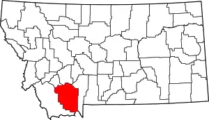 Madison County map | |
| CDPs | ||
| Other communities | ||
| Ghost towns | ||
| Footnotes | ‡This populated place also has portions in an adjacent county or counties | |
This article is issued from Wikipedia. The text is licensed under Creative Commons - Attribution - Sharealike. Additional terms may apply for the media files.