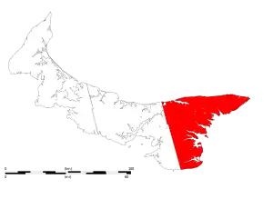
This article is a list of historic places in Kings County, Prince Edward Island entered on the Canadian Register of Historic Places, whether they are federal, provincial, or municipal.
List of historic places
| Name | Address | Coordinates | Government recognition (CRHP №) | Image | |
|---|---|---|---|---|---|
| The A.A. Building | 577 Main Street Montague PE |
46°09′48″N 62°38′43″W / 46.1632°N 62.6453°W | Prince Edward Island (8994) |  Upload Photo | |
| Aitken House | 28 St. Andrews Point Road Lower Montague PE |
46°10′11″N 62°33′33″W / 46.1698°N 62.5592°W | Prince Edward Island (12019) | Upload Photo | |
| All Saints Roman Catholic Church | 4279 Chapel Road - Route 321 Cardigan PE |
46°14′33″N 62°37′20″W / 46.2425°N 62.6221°W | Prince Edward Island (11344) | Upload Photo | |
| Annandale Rear Range Lighthouse | Lighthouse Road Annandale PE |
46°16′00″N 62°26′17″W / 46.2668°N 62.4380°W | Prince Edward Island (22597) | .jpg.webp) | |
| Beck's Furniture and Appliances | 18 Water Street Montague PE |
46°09′52″N 62°38′44″W / 46.1644°N 62.6456°W | Prince Edward Island (9051) | Upload Photo | |
| Edward Blaisdell Home | 591 Main Street Montague PE |
46°09′47″N 62°38′37″W / 46.163°N 62.6437°W | Prince Edward Island (9055) | Upload Photo | |
| Blanchard Cottage | 35 Burkes Lane Fortune PE |
46°20′00″N 62°20′46″W / 46.3334°N 62.3462°W | Prince Edward Island (15126) | Upload Photo | |
| Brehaut-Beck House | 3611 Cape Bear Road - Route 18 Guernsey Cove PE |
45°58′33″N 62°31′13″W / 45.9758°N 62.5203°W | Prince Edward Island (15901) | Upload Photo | |
| John and Jocelyn Brothers Home | 341 Shore Road Cardigan PE |
46°13′51″N 62°37′18″W / 46.2309°N 62.6216°W | Prince Edward Island (10745) | Upload Photo | |
| Bruce Road Pioneer Grave | Bruce Road - Route 349 Glenwilliam PE |
46°02′40″N 62°38′52″W / 46.0445°N 62.6477°W | Prince Edward Island (16061) | Upload Photo | |
| Brudenell Community Centre | 415 Brudenell Point Road - Route 319 Brudenell PE |
46°11′28″N 62°37′46″W / 46.1912°N 62.6294°W | Prince Edward Island (12098) | Upload Photo | |
| Brudenell Island Pioneer Cemetery | Brudenell Island Georgetown Royalty PE |
46°11′48″N 62°34′45″W / 46.1966°N 62.5793°W | Prince Edward Island (11659) | Upload Photo | |
| John Burck House | 580 Main Street Montague PE |
46°09′49″N 62°38′42″W / 46.1635°N 62.645°W | Prince Edward Island (8863) | Upload Photo | |
| Caledonia Presbyterian Church | 2064 Murray Harbour Road, Rte. 24 Caledonia PE |
46°03′41″N 62°42′41″W / 46.0613°N 62.7114°W | Prince Edward Island (18704) | Upload Photo | |
| Anna Campbell Home | 5692 Sparrows Road, Route 320 Victoria Cross PE |
46°09′35″N 62°40′37″W / 46.1597°N 62.6769°W | Prince Edward Island (10742) | Upload Photo | |
| The Cannery at Basin Head Fisheries Museum | 336 Basin Head Road Basin Head PE |
46°22′43″N 62°06′33″W / 46.3786°N 62.1091°W | Prince Edward Island (7436) | Upload Photo | |
| Cape Bear Lighthouse | 42 Black Brook Road Beach Point PE |
46°00′13″N 62°27′28″W / 46.0036°N 62.4579°W | Federal (11034, (21134), Prince Edward Island (19728) |
 | |
| Cardigan Craft Centre | 358 Shore Road Cardigan PE |
46°13′50″N 62°37′14″W / 46.2306°N 62.6206°W | Prince Edward Island (10731) | Upload Photo | |
| Chester's Barber Shop and Laurie's Beauty Salon | 571 Main Street Montague PE |
46°09′48″N 62°38′46″W / 46.1634°N 62.6462°W | Prince Edward Island (9151) | Upload Photo | |
| Church of Christ | 513 Main Street Montague PE |
46°10′16″N 62°39′05″W / 46.1712°N 62.6514°W | Prince Edward Island (8841) | Upload Photo | |
| Clow House | 27 Mink River Road Murray Harbour North PE |
46°02′59″N 62°31′13″W / 46.0498°N 62.5202°W | Prince Edward Island (19409) | Upload Photo | |
| Edgar and Brenda Dewar Home | 135 Dewars Road Roseneath PE |
46°12′04″N 62°38′52″W / 46.2011°N 62.6479°W | Prince Edward Island (11973) | Upload Photo | |
| Gordon Douglas House | 13 Water Street Georgetown PE |
46°10′48″N 62°32′13″W / 46.1801°N 62.5369°W | Prince Edward Island (11514) | Upload Photo | |
| East Point Fog Alarm Building | East Point PE |
46°27′08″N 61°58′18″W / 46.4523°N 61.9717°W | Prince Edward Island (19205) | _(24346416394).jpg.webp) | |
| Mary Elliot Home | 11 Sunset Lane Lower Montague PE |
46°10′08″N 62°33′46″W / 46.169°N 62.5629°W | Prince Edward Island (10729) | Upload Photo | |
| Elmira Railway Station | 457 Elmira Road, Route 16A Elmira PE |
46°26′24″N 62°03′52″W / 46.4399°N 62.0645°W | Prince Edward Island (4604) | .jpg.webp) | |
| English Church Cemetery | Murray Harbour Road - Route 18 Murray Harbour South PE |
46°00′14″N 62°31′14″W / 46.0038°N 62.5205°W | Prince Edward Island (12844) | Upload Photo | |
| Former Murray River United Church | 9328 Main Street North Murray River PE |
46°00′59″N 62°36′54″W / 46.0165°N 62.615°W | Prince Edward Island (16441) | Upload Photo | |
| Garden of the Gulf Museum | 564 Main Street Montague PE |
46°09′50″N 62°38′50″W / 46.1638°N 62.6471°W | Prince Edward Island (9318) |  | |
| Karen and Ron Garrett Home | 13 Parkman Avenue Montague PE |
46°09′45″N 62°38′51″W / 46.1624°N 62.6475°W | Prince Edward Island (11503) | Upload Photo | |
| Georgetown Inn | 62 Richmond Street Georgetown PE |
46°10′53″N 62°31′59″W / 46.1815°N 62.533°W | Prince Edward Island (1662) | Upload Photo | |
| The Goff House | 5127 Launching Road, Route 311 Woodville Mills PE |
46°14′25″N 62°31′02″W / 46.2402°N 62.5173°W | Prince Edward Island (5307) | Upload Photo | |
| Government of Canada Building, Montague | 551 Main Street North Montague PE |
46°09′56″N 62°38′57″W / 46.1656°N 62.6491°W | Federal (11085), Prince Edward Island (19432) |
Upload Photo | |
| The Graphic Office | 567 Main Street Montague PE |
46°09′49″N 62°38′50″W / 46.1635°N 62.6471°W | Prince Edward Island (8910) | Upload Photo | |
| Francis Hebert Machine Shop | 45 Victoria Street Georgetown PE |
46°11′02″N 62°31′50″W / 46.184°N 62.5306°W | Prince Edward Island (11328) | Upload Photo | |
| Holy Trinity Anglican Church | 93 Grafton Street Georgetown PE |
46°10′59″N 62°31′49″W / 46.1830°N 62.5303°W | Prince Edward Island (12046) | .jpg.webp) | |
| Dan and Janet Hughes Home | 615 Main Street Montague PE |
46°09′44″N 62°38′25″W / 46.1622°N 62.6402°W | Prince Edward Island (8958) | Upload Photo | |
| The Hyndman Building | 543 Main Street Montague PE |
46°09′58″N 62°38′58″W / 46.1662°N 62.6495°W | Prince Edward Island (8978) | Upload Photo | |
| The Jackson House | 601 Main Street Montague PE |
46°09′46″N 62°38′34″W / 46.1629°N 62.6427°W | Prince Edward Island (9662) | Upload Photo | |
| Kings County Courthouse | 60 Kent Street Georgetown PE |
46°11′03″N 62°32′00″W / 46.1841°N 62.5333°W | Prince Edward Island (7442) | 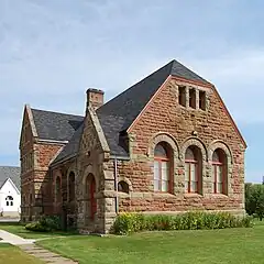 | |
| Knox's Dam | Route 320 Victoria Cross PE |
46°09′31″N 62°40′31″W / 46.1587°N 62.6753°W | Prince Edward Island (12038) | Upload Photo | |
| Knox's Dam Bed and Breakfast | 442 South Montague Road - Route 353 Victoria Cross PE |
46°09′31″N 62°40′27″W / 46.1585°N 62.6743°W | Prince Edward Island (12025) | .jpg.webp) | |
| Launching 1790 Pioneer Cemetery | St. Michael's Lane Launching PE |
46°12′49″N 62°24′44″W / 46.2136°N 62.4122°W | Prince Edward Island (16021) | Upload Photo | |
| Launching Pioneer Cemetery | Primrose Road - Route 311 Launching PE |
46°13′15″N 62°25′52″W / 46.2209°N 62.4312°W | Prince Edward Island (12261) | Upload Photo | |
| Lewis and Clara Ann Lavandier House | 86 Grafton Street Georgetown PE |
46°10′58″N 62°31′52″W / 46.1828°N 62.531°W | Prince Edward Island (11401) | Upload Photo | |
| Fred W. LeLacheur House | 210 Route 18A Murray Harbour PE |
45°59′39″N 62°31′42″W / 45.9943°N 62.5283°W | Prince Edward Island (15906) | Upload Photo | |
| Lime Kiln - Zita Boudreault Property | 651 Route 17 Lower Montague PE |
46°10′24″N 62°36′24″W / 46.1732°N 62.6068°W | Prince Edward Island (11369) | Upload Photo | |
| Lime Kiln - Former Campbell Property | 494 Route 17 Lower Montague PE |
46°09′52″N 62°36′53″W / 46.1644°N 62.6148°W | Prince Edward Island (15921) | Upload Photo | |
| Little Sands United Church | 11352 Shore Road, Route 4 Little Sands PE |
45°57′58″N 62°38′45″W / 45.9662°N 62.6457°W | Prince Edward Island (5255) | Upload Photo | |
| Lubbert and Beaulieu Home | 608 Main Street Montague PE |
46°09′47″N 62°38′30″W / 46.163°N 62.6416°W | Prince Edward Island (9136) | Upload Photo | |
| The Mabon House | 600 Main Street Montague PE |
46°09′47″N 62°38′33″W / 46.1631°N 62.6425°W | Prince Edward Island (8937) | Upload Photo | |
| Peter MacCallum House | 89 Bay Shore Road St. Peter's Bay PE |
46°25′08″N 62°35′01″W / 46.419°N 62.5836°W | Prince Edward Island (1944) | Upload Photo | |
| MacDonald House | 65 Water Street Georgetown PE |
46°10′51″N 62°31′55″W / 46.1809°N 62.5319°W | Prince Edward Island (11441) | Upload Photo | |
| Dr. Gus MacDonald House | 8 Church Avenue Souris PE |
46°21′17″N 62°15′16″W / 46.3546°N 62.2545°W | Prince Edward Island (19661) | Upload Photo | |
| Joe and Nora MacDonald Home | 64 Pleasant Street Cardigan PE |
46°14′02″N 62°37′03″W / 46.2339°N 62.6174°W | Prince Edward Island (11554) | Upload Photo | |
| John A. MacDonald Store | 4557 Wharf Road Cardigan PE |
46°13′51″N 62°37′07″W / 46.2307°N 62.6185°W | Prince Edward Island (19169) | Upload Photo | |
| Dr. Roddie MacDonald House | 5707 St. Peters Road, Rte. 2 St. Peters Bay PE |
46°24′53″N 62°35′07″W / 46.4146°N 62.5854°W | Prince Edward Island (20485) | Upload Photo | |
| MacEachern Barn | 7737 Northside Road Priests Pond PE |
46°28′33″N 62°09′09″W / 46.4757°N 62.1525°W | Prince Edward Island (19744) | Upload Photo | |
| MacKay Pioneer Cemetery | Cemetery Road Murray Harbour PE |
46°00′22″N 62°30′48″W / 46.006°N 62.5134°W | Prince Edward Island (16043) | Upload Photo | |
| The MacLaren Building | 514 Main Street Montague PE |
46°10′11″N 62°39′02″W / 46.1697°N 62.6505°W | Prince Edward Island (9059) | Upload Photo | |
| Shirley MacNeill Home | 117 Chestnut Street Montague PE |
46°09′46″N 62°38′46″W / 46.1627°N 62.646°W | Prince Edward Island (8893) | Upload Photo | |
| Charles and Vicky Mahar Home | 126 Grafton Street Georgetown PE |
46°11′01″N 62°31′39″W / 46.1835°N 62.5274°W | Prince Edward Island (10703) | Upload Photo | |
| Therese Mair House | 20 Kent Street Georgetown PE |
46°10′54″N 62°31′56″W / 46.1816°N 62.5322°W | Prince Edward Island (11204) | Upload Photo | |
| Timothy Mair House | 12 Kent Street Georgetown PE |
46°10′51″N 62°31′55″W / 46.1808°N 62.5319°W | Prince Edward Island (12071) | Upload Photo | |
| Archibald Matheson House | 142 Albion Road, Route 327 Albion Cross PE |
46°19′42″N 62°29′03″W / 46.3283°N 62.4841°W | Prince Edward Island (1661) | Upload Photo | |
| Matthew House | 15 Breakwater Street Souris PE |
46°21′10″N 62°15′05″W / 46.3527°N 62.2513°W | Prince Edward Island (19170) | Upload Photo | |
| Matthew and McLean Heritage Building | 95 Main Street Souris PE |
46°21′17″N 62°15′12″W / 46.3547°N 62.2534°W | Prince Edward Island (5983) | Upload Photo | |
| McLean House Inn | 16 Washington Street Souris PE |
46°21′13″N 62°15′13″W / 46.3535°N 62.2537°W | Prince Edward Island (18476) | Upload Photo | |
| McNichol-Best House | 57 Owens Wharf Road Cardigan PE |
46°13′50″N 62°36′54″W / 46.2306°N 62.6150°W | Prince Edward Island (20525) | Upload Photo | |
| Harvey Moore Wildlife Centre | 7096 Commercial Road - Route 4 Milltown Cross PE |
46°06′42″N 62°37′34″W / 46.1118°N 62.626°W | Prince Edward Island (12361) | Upload Photo | |
| David and Catherine Morrison Home | 610 Main Street Montague PE |
46°09′46″N 62°38′29″W / 46.1629°N 62.6414°W | Prince Edward Island (9103) | Upload Photo | |
| Duncan Munn Property | 11533 Shore Road - Route 4 Little Sands PE |
45°57′55″N 62°39′26″W / 45.9652°N 62.6573°W | Prince Edward Island (15817) | Upload Photo | |
| The Munroe House | 41 Riverside Drive Montague PE |
46°09′46″N 62°39′15″W / 46.1629°N 62.6542°W | Prince Edward Island (9160) | Upload Photo | |
| Kenneth A. Murphy House | 892 Route 17 Lower Montague PE |
46°09′49″N 62°35′28″W / 46.1636°N 62.5912°W | Prince Edward Island (11297) | Upload Photo | |
| Murray River Pioneer Cemetery | Pioneer Cemetery Road Murray River PE |
46°00′37″N 62°35′32″W / 46.0102°N 62.5921°W | Prince Edward Island (12834) | Upload Photo | |
| Kent and Lyda Myers Home | 2654 Route 3 New Perth PE |
46°12′41″N 62°40′36″W / 46.2113°N 62.6767°W | Prince Edward Island (12072) | Upload Photo | |
| Manfred and Christian Ohlandt Property | 58-62 Grafton Street Georgetown PE |
46°10′56″N 62°32′00″W / 46.1823°N 62.5334°W | Prince Edward Island (11284) | Upload Photo | |
| Panmure Island Lighthouse | Lighthouse Road Montague PE |
46°08′41″N 62°28′03″W / 46.1446°N 62.4676°W | Federal (20731), Prince Edward Island (19723) |
 | |
| Panmure Island Pioneer Cemetery | Lot 61 Panmure Island PE |
46°08′17″N 62°30′07″W / 46.138°N 62.502°W | Prince Edward Island (12205) | Upload Photo | |
| Doug and Maureen Panting Home | 625 Main Street Montague PE |
46°09′43″N 62°38′14″W / 46.1619°N 62.6373°W | Prince Edward Island (9697) | Upload Photo | |
| Terry Parker Home | 13 Richmond Street Georgetown PE |
46°10′51″N 62°32′14″W / 46.1809°N 62.5372°W | Prince Edward Island (10732) | Upload Photo | |
| Perreault / Parent House | 598 Main Street Montague PE |
46°09′48″N 62°38′34″W / 46.1633°N 62.6428°W | Prince Edward Island (10736) | Upload Photo | |
| The Pine's Bed and Breakfast | 31 Riverside Drive Montague PE |
46°09′49″N 62°39′08″W / 46.1635°N 62.6522°W | Prince Edward Island (9092) | Upload Photo | |
| George Poole Home | 430 Lower Montague Road Lower Montague PE |
46°10′11″N 62°33′43″W / 46.1696°N 62.562°W | Prince Edward Island (10725) | Upload Photo | |
| Kenny and Annette Power House | 612 Main Street Montague PE |
46°09′46″N 62°38′27″W / 46.1628°N 62.6407°W | Prince Edward Island (9665) | Upload Photo | |
| Samuel Prowse House | 1278 Main Street Murray Harbour PE |
46°00′20″N 62°31′29″W / 46.0055°N 62.5246°W | Prince Edward Island (15809) | Upload Photo | |
| Red Bank Pioneer Cemetery | 195 North Lake Harbour Road North Lake PE |
46°28′00″N 62°04′22″W / 46.4666°N 62.0728°W | Prince Edward Island (16006) | Upload Photo | |
| Silas Sewell Robertson Farm House | 2937 East Point Road - Route 16 Kingsboro PE |
46°23′53″N 62°05′37″W / 46.398°N 62.0935°W | Prince Edward Island (9288) | Upload Photo | |
| Jean-Pierre Roma at Three Rivers National Historic Site of Canada | Brudenell PE |
46°10′54″N 62°33′36″W / 46.1818°N 62.5601°W | Federal (8459) | Upload Photo | |
| Alvin Roy House | 619 Main Street Montague PE |
46°09′44″N 62°38′21″W / 46.1623°N 62.6392°W | Prince Edward Island (9669) | Upload Photo | |
| St. Alexis Mission | Cemetery Road Rollo Bay East PE |
46°21′06″N 62°19′04″W / 46.3517°N 62.3178°W | Prince Edward Island (1884) | Upload Photo | |
| St. Andrew's Point Pioneer Cemetery | St. Andrew's Point Road Lower Montague PE |
46°09′32″N 62°31′37″W / 46.1589°N 62.527°W | Prince Edward Island (11600) | Upload Photo | |
| St. Andrew's Presbyterian Church | 268 Shore Road Cardigan PE |
46°13′57″N 62°37′30″W / 46.2325°N 62.6251°W | Prince Edward Island (10722) | Upload Photo | |
| St. David's United Church | 50 Grafton Street Georgetown PE |
46°10′56″N 62°32′03″W / 46.1821°N 62.5341°W | Prince Edward Island (11965) | Upload Photo | |
| St. Margaret of Scotland Pioneer Cemetery | Bear Shore Road St. Margarets PE |
46°28′01″N 62°23′02″W / 46.467°N 62.384°W | Prince Edward Island (13172) | Upload Photo | |
| St. Mary's Roman Catholic Church | 1 Longworth Street Souris PE |
46°21′34″N 62°15′11″W / 46.3595°N 62.2531°W | Prince Edward Island (19171) |  | |
| St. Paul's Roman Catholic Church | 1133 Cambridge Road - Route 17A Sturgeon PE |
46°06′26″N 62°32′01″W / 46.1072°N 62.5336°W | Prince Edward Island (11275) | Upload Photo | |
| St. Peter's Bay United Church | 5781 St. Peter's Road - Route 2 St. Peter's Bay PE |
46°24′50″N 62°35′25″W / 46.4139°N 62.5902°W | Prince Edward Island (9666) | Upload Photo | |
| St. Peter's Courthouse | 5697 St. Peters Road, Rte 2 St. Peter's Bay PE |
46°24′53″N 62°35′05″W / 46.4146°N 62.5847°W | Prince Edward Island (20877) | Upload Photo | |
| St. Peters Harbour Lighthouse | Lighthouse Road St. Peter's Harbour PE |
46°26′33″N 62°44′51″W / 46.4425°N 62.7476°W | Federal (21013) | .jpg.webp) | |
| Sir Isaac's Restaurant and Mister Gabe's Pub | 576 Main Street Montague PE |
46°09′49″N 62°38′44″W / 46.1635°N 62.6455°W | Prince Edward Island (8877) | Upload Photo | |
| Ruby Smith Home | 2965 Route 3 New Perth PE |
46°12′42″N 62°41′48″W / 46.2118°N 62.6968°W | Prince Edward Island (12092) | Upload Photo | |
| Trent Sorrey House | 599 Main Street Montague PE |
46°09′46″N 62°38′34″W / 46.1629°N 62.6429°W | Prince Edward Island (9146) | Upload Photo | |
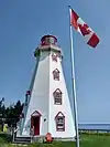
| Souris Historic Lighthouse | 134 Breakwater Street Souris PE |
46°20′47″N 62°14′47″W / 46.3463°N 62.2465°W | Federal (10646), Prince Edward Island (18696) |
.jpg.webp) | |
| Souris Town Hall | 75 Main Street Souris PE |
46°21′18″N 62°15′18″W / 46.355°N 62.2551°W | Prince Edward Island (18705) | Upload Photo | |
| The Station | 1 Station Street Montague PE |
46°09′53″N 62°38′54″W / 46.1646°N 62.6482°W | Prince Edward Island (9374) | Upload Photo | |
| Donald B. Taylor and Arlene Smith Home | 73 Water Street Georgetown PE |
46°10′52″N 62°31′53″W / 46.1812°N 62.5314°W | Prince Edward Island (11492) | Upload Photo | |
| Tír na nÓg Inn | 5749 St. Peters Road St. Peter's Bay PE |
46°24′51″N 62°35′18″W / 46.4142°N 62.5883°W | Prince Edward Island (6275) | Upload Photo | |
| Tower East Point Light Station | East Point PE |
46°27′10″N 61°58′16″W / 46.4529°N 61.9711°W | Federal (11479), Prince Edward Island (19729) |
.jpg.webp) | |
| Underhay House | 1610 Route 310 Eglington PE |
46°18′35″N 62°22′43″W / 46.3096°N 62.3787°W | Prince Edward Island (19147) | Upload Photo | |
| Marc and Janice Vandaele, Maple Lane B&B | 1540 Whim Road - Route 316 Commercial Cross PE |
46°07′30″N 62°38′41″W / 46.1249°N 62.6446°W | Prince Edward Island (11520) | Upload Photo | |
| Elizabeth Watson Home | 20 Wood Islands Road Montague PE |
46°09′42″N 62°38′41″W / 46.1618°N 62.6447°W | Prince Edward Island (8853) | Upload Photo | |
| Joan Watson and Jackie Lavers Home | 614 Main Street Montague PE |
46°09′46″N 62°38′25″W / 46.1629°N 62.6404°W | Prince Edward Island (9375) | Upload Photo | |
| Windows on the Water Restaurant | 558 Main Street Montague PE |
46°09′54″N 62°38′55″W / 46.1649°N 62.6487°W | Prince Edward Island (8949) | Upload Photo | |
| Yeo House | 569 Main Street Montague PE |
46°09′48″N 62°38′44″W / 46.1634°N 62.6456°W | Prince Edward Island (9373) | Upload Photo |
See also
- List of historic places in Prince Edward Island
- List of National Historic Sites of Canada in Prince Edward Island
- Heritage Places Protection Act
| National park |
|
|---|---|
| National historic sites |
|
| Provincial parks | |
| Charlottetown parks | |
| Other | |
| |
This article is issued from Wikipedia. The text is licensed under Creative Commons - Attribution - Sharealike. Additional terms may apply for the media files.