This list of cemeteries in Sonoma County, California includes currently operating, historical (closed for new interments), and defunct (graves abandoned or removed) cemeteries, columbaria, and mausolea in Sonoma County, California. It does not include pet cemeteries. Selected interments are given for notable people.

NumberNameCityImageTypeNotesLocationReferences
1Annapolis Church CemeteryAnnapolisAlso known as Horicon Cemetery and Mt. Carmel Cemetery.[1]38°43′06″N 123°21′37″W / 38.7182399°N 123.3602726°W / 38.7182399; -123.3602726 (Annapolis Church Cemetery)[2]
2B'nai Israel CemeteryPetaluma38°14′44″N 122°38′57″W / 38.2454723°N 122.6491530°W / 38.2454723; -122.6491530 (B'nai Israel Cemetery)[3]
3Beeson CemeteryGeyservilletraditionalAlso known as Alexander Valley Cemetery.[1]38°40′52″N 122°50′00″W / 38.6810215°N 122.8333301°W / 38.6810215; -122.8333301 (Beeson Cemetery)[4]
4Benitz Ranch CemeteryJenner38°31′49″N 123°16′09″W / 38.5301907°N 123.2691747°W / 38.5301907; -123.2691747 (Benitz Ranch Cemetery)[5]
5Bennett Valley CemeterySanta RosaSonoma County Historic Landmarks and Districts #3938°24′57″N 122°39′41″W / 38.4157455°N 122.6613746°W / 38.4157455; -122.6613746 (Bennett Valley Cemetery)[6]
6Beth Ami CemeterySanta RosaHome of the Eternal Peace Interfaith Cemetery. Part of Santa Rosa Memorial Park.38°27′28″N 122°42′25″W / 38.4578600°N 122.7069297°W / 38.4578600; -122.7069297 (Beth Ami Cemetery)[7]
7Bloomfield CemeteryBloomfieldSonoma County Historic Landmarks and Districts #15138°18′49″N 122°51′32″W / 38.3135273°N 122.8588827°W / 38.3135273; -122.8588827 (Bloomfield Cemetery)[8]
8Bodega Bay CemeteryBodega Bay38°19′03″N 123°01′32″W / 38.3174170°N 123.0255565°W / 38.3174170; -123.0255565 (Bodega Bay Cemetery)[9]
9Bodega Calvary CemeteryBodega38°20′31″N 122°58′32″W / 38.3418607°N 122.9755545°W / 38.3418607; -122.9755545 (Bodega Calvary Cemetery)[10]
10Bridgehaven Cemetery38°26′02″N 123°06′28″W / 38.4338404°N 123.1078596°W / 38.4338404; -123.1078596 (Bridgehaven Cemetery)[11]
11Buckeye Creek CemeteryAnnapolis38°43′53″N 123°25′50″W / 38.7314715°N 123.4306473°W / 38.7314715; -123.4306473 (Buckeye Creek Cemetery)
12Calvary Catholic CemeterySanta Rosatraditional + colombarium38°25′52″N 122°41′09″W / 38.4311766°N 122.6857290°W / 38.4311766; -122.6857290 (Calvary Catholic Cemetery)[12][13]
13Canfield CemeterySebastopol38°21′05″N 122°48′55″W / 38.3513039°N 122.8152694°W / 38.3513039; -122.8152694 (Canfield Cemetery)[14]
14Chapel of the ChimesSanta Rosa38°24′50″N 122°42′50″W / 38.4138015°N 122.7138761°W / 38.4138015; -122.7138761 (Chapel of the Chimes)[15]
15Cloverdale CemeteryCloverdale38°48′32″N 123°00′36″W / 38.8087593°N 123.0100939°W / 38.8087593; -123.0100939 (Cloverdale Cemetery)[16]
16Cooper CemeteryStewarts Point38°36′46″N 123°16′36″W / 38.6126850°N 123.2766614°W / 38.6126850; -123.2766614 (Cooper Cemetery)[17]
17County of Sonoma CemeterySanta Rosagraveyard Entrance is located within the Santa Rosa Rural Cemetery. Enter McDonald Gate, stay to your right till it slopes down to a flat area.

Was part of Stanley Cemetery, adjacent to Santa Rosa Rural Cemetery.

38°27′19″N 122°42′10″W / 38.4552780°N 122.70277°W / 38.4552780; -122.70277 (County of Sonoma Cemetery)
18Cypress Hill Memorial ParkPetaluma38°14′50″N 122°39′06″W / 38.2471389°N 122.6516531°W / 38.2471389; -122.6516531 (Cypress Hill Memorial Park)[18][19]
19Cyrus Alexander Family CemeteryHealdsburg38°39′25″N 122°47′11″W / 38.6568515°N 122.7863788°W / 38.6568515; -122.7863788 (Cyrus Alexander Family Cemetery)[20]
20Druids Occidental CemeteryOccidental38°24′36″N 122°56′32″W / 38.4099145°N 122.9422193°W / 38.4099145; -122.9422193 (Druids Occidental Cemetery)[21]
21Duncans Mills CemeteryDuncans Mills38°27′33″N 123°03′18″W / 38.4590807°N 123.0550013°W / 38.4590807; -123.0550013 (Duncans Mills Cemetery)[22]
22Eldridge Cemetery38°20′38″N 122°31′13″W / 38.3437970°N 122.5202467°W / 38.3437970; -122.5202467 (Eldridge Cemetery)[23]
23Evergreen CemeteryKellogg38°38′10″N 122°40′49″W / 38.6360188°N 122.6802649°W / 38.6360188; -122.6802649 (Evergreen Cemetery)[24]
24Faught CemeterySanta Rosa38°31′07″N 122°45′27″W / 38.5186228°N 122.7573708°W / 38.5186228; -122.7573708 (Faught Cemetery)[25]
25Forestview CemeteryForestville38°28′06″N 122°53′00″W / 38.4682459°N 122.8833273°W / 38.4682459; -122.8833273 (Forestview Cemetery)[26]
26Fort Ross State Historic Park CemeteryJenner38°30′53″N 123°14′24″W / 38.5147490°N 123.24001°W / 38.5147490; -123.24001 (Fort Ross State Historic Park Cemetery)
27Fulton CemeteryFulton38°29′20″N 122°46′43″W / 38.4888000°N 122.7786001°W / 38.4888000; -122.7786001 (Fulton Cemetery)[27][28]
28Gilliam CemeterySebastopolSometimes identified as in Graton.38°25′53″N 122°52′52″W / 38.4313024°N 122.8811052°W / 38.4313024; -122.8811052 (Gilliam Cemetery)[29][30]
29Green Valley CemeterySebastopolSometimes identified as in Green Valley. Originally associated with the Green Valley Methodist Church.38°26′32″N 122°53′11″W / 38.4421355°N 122.8863832°W / 38.4421355; -122.8863832 (Green Valley Cemetery)[31][32]
30Hall CemeteryHealdsburg38°39′40″N 122°51′36″W / 38.6610210°N 122.8599949°W / 38.6610210; -122.8599949 (Hall Cemetery)[33]
31Jack London State Historic Park CemeteryGlen Ellen38°21′14″N 122°32′12″W / 38.3538000°N 122.53670°W / 38.3538000; -122.53670 (Jack London State Historic Park Cemetery)
32Jess Stonestreet Jackson Jr. CemeteryHealdsburgPrivate cemetery located north of Stonestreet Winery38°42′56″N 122°48′02″W / 38.715427°N 122.800582°W / 38.715427; -122.800582 Flagpole visible in March 2015 imagery.[34]
33Liberty CemeteryPetalumaSonoma County landmarks #16038°16′43″N 122°42′18″W / 38.2785540°N 122.7049597°W / 38.2785540; -122.7049597 (Liberty Cemetery)[35]
34Long Ranch Family CemeteryHealdsburg38°40′21″N 122°52′54″W / 38.6725528°N 122.8816394°W / 38.6725528; -122.8816394 (Long Ranch Family Cemetery)[36]
35Luther Burbank Memorial Home and Gardens CemeterySanta Rosa38°26′08″N 122°42′42″W / 38.4355810°N 122.71180°W / 38.4355810; -122.71180 (Luther Burbank Memorial Home and Gardens Cemetery)[37]
36Macedonia CemeterySebastopol38°21′34″N 122°46′22″W / 38.3593588°N 122.7727674°W / 38.3593588; -122.7727674 (Macedonia Cemetery)[1][38]
37McPeak CemeteryHaciendatraditional38°30′35″N 122°55′41″W / 38.5098191°N 122.9280933°W / 38.5098191; -122.9280933 (McPeak Cemetery)[39]
38Mission San Francisco Solano CemeterySonoma38°17′42″N 122°27′20″W / 38.29491°N 122.45554°W / 38.29491; -122.45554 (Mission San Francisco Solano)[40][41]
39Oak Mound CemeteryHealdsburg38°36′59″N 122°51′32″W / 38.6162970°N 122.8588806°W / 38.6162970; -122.8588806 (Oak Mound Cemetery)[42]
40Old County CemeterySanta RosaAlso known as Chanate Historic Cemetery38°28′01″N 122°42′30″W / 38.4669991°N 122.70839°W / 38.4669991; -122.70839 (Old County Cemetery)
41Olive Hill CemeteryHealdsburg38°42′30″N 122°55′27″W / 38.7082432°N 122.9241657°W / 38.7082432; -122.9241657 (Olive Hill Cemetery)[43]
42Pleasant Hills Memorial ParkSebastopol38°22′47″N 122°50′07″W / 38.3796366°N 122.8352702°W / 38.3796366; -122.8352702 (Pleasant Hills Memorial Park)[44]
43Pythian Home CemeteryKenwood38°26′36″N 122°34′50″W / 38.4433580°N 122.5806907°W / 38.4433580; -122.5806907 (Pythian Home Cemetery)[45]
44Redwood Memorial GardensGuerneville38°30′29″N 122°59′32″W / 38.5079685°N 122.9922211°W / 38.5079685; -122.9922211 (Redwood Memorial Gardens)[46][47]
45Riverside CemeteryCloverdale[48]
46Rouff–Thomas CemeteryCloverdale38°32′26″N 123°17′10″W / 38.5404637°N 123.2861059°W / 38.5404637; -123.2861059 (Rouff–Thomas Cemetery)[49]
47Saint Catherine's Church CemeteryMonte Rio38°28′09″N 123°00′38″W / 38.4691010°N 123.01049°W / 38.4691010; -123.01049 (Saint Catherine's Church Cemetery)
48Saint Francis Solano Catholic CemeterySonoma38°17′28″N 122°26′46″W / 38.2910259°N 122.4460927°W / 38.2910259; -122.4460927 (Saint Francis Solano Catholic Cemetery)[50]
49Santa Rosa Memorial Park CemeterySanta Rosalawn + mausaleums38°27′35″N 122°42′21″W / 38.4598009°N 122.7058992°W / 38.4598009; -122.7058992 (Santa Rosa Memorial Park)[51][52]
50Santa Rosa Odd Fellows CemeterySanta RosatraditionalNow managed by Santa Rosa Memorial Park.38°27′25″N 122°42′22″W / 38.4570300°N 122.7061787°W / 38.4570300; -122.7061787 (Santa Rosa Odd Fellows Cemetery)[53][54]
51Santa Rosa Rural CemeterySanta Rosa ruralSanta Rosa Rural Cemetery has two entrances: the McDonald Entrance (main entrance) and the Franklin Gate Entrance. The Fulkerson Cemetery[55] and Moke Cemetery are within.[56]38°27′20″N 122°42′17″W / 38.4556233°N 122.7047218°W / 38.4556233; -122.7047218 (Santa Rosa Rural Cemetery)[51][57][58]
52Seaview CemeterySeaview38°32′36″N 123°13′27″W / 38.5432459°N 123.2241736°W / 38.5432459; -123.2241736 (Seaview Cemetery)[59]
53Sebastopol Memorial Lawn CemeterySebastopollawn + traditional38°23′51″N 122°50′13″W / 38.3974140°N 122.8369367°W / 38.3974140; -122.8369367 (Sebastopol Memorial Lawn Cemetery)[60]
54Sharp Creek CemeterySanta RosaAlso known as Oak Knoll Cemetery and Sharp Cemetery[1] 38°33′02″N 122°40′17″W / 38.5505981°N 122.67130°W / 38.5505981; -122.67130 (Sharp Creek Cemetery)
55Shiloh CemeteryWindsor38°31′32″N 122°48′55″W / 38.5254660°N 122.8152716°W / 38.5254660; -122.8152716 (Shiloh Cemetery)[61]
56Sonoma Mountain CemeterySonomaNotable burial:
Mariano Guadalupe Vallejo
38°18′00″N 122°27′22″W / 38.3001163°N 122.4561024°W / 38.3001163; -122.4561024 (Mountain Cemetery)[62][63]
57Sonoma State Home CemeteryEldridgeSonoma County Historic Landmarks and Districts #3838°20′50″N 122°31′07″W / 38.34713°N 122.51859°W / 38.34713; -122.51859 (Sonoma State Home)[64]
58Spring Hill CemeterySebastopol38°23′49″N 122°51′51″W / 38.3968540°N 122.8641466°W / 38.3968540; -122.8641466 (Spring Hill Cemetery)[65]
59Stanley CemeterySanta Rosa38°27′21″N 122°42′18″W / 38.4557724°N 122.7049417°W / 38.4557724; -122.7049417 (Stanley Cemetery)[66]
60Steele Family CemeterySanta Rosa38°27′08″N 122°48′24″W / 38.4522394°N 122.8065339°W / 38.4522394; -122.8065339 (Steele Family Cemetery)[67]
61Stewarts Point CemeteryStewarts Point38°39′00″N 123°23′47″W / 38.6499077°N 123.3963843°W / 38.6499077; -123.3963843 (Stewarts Point Cemetery)[68]
62Sugarloaf CemeteryAnnapolis38°39′14″N 123°15′53″W / 38.6537955°N 123.2647168°W / 38.6537955; -123.2647168 (Sugarloaf Cemetery)[69]
63Two Rock Presbyterian Church CemeteryTwo RockSonoma County Historic Landmarks and Districts #158. Also known as the Presbyterian Church Cemetery.38°15′24″N 122°46′47″W / 38.2566572°N 122.7795849°W / 38.2566572; -122.7795849 (Two Rock Presbyterian Church Cemetery)[70]
64Valley CemeterySonoma38°17′00″N 122°27′02″W / 38.2833492°N 122.4505985°W / 38.2833492; -122.4505985 (Sonoma Valley Cemetery)[71][72]
65Veterans Memorial Park CemeterySonoma38°17′57″N 122°27′24″W / 38.299279°N 122.456639°W / 38.299279; -122.456639 (Veterans Memorial Park Cemetery)[73]

See also

Footnotes

  1. 1 2 3 4 Nichols, Jeremy Dwight (2008) [2002]. Cemeteries of Sonoma County, California: A History and Guide. Bowie, MD: Heritage Books. pp. 4, 57, 60. ISBN 978-0788422690. OCLC 52204884.
  2. U.S. Geological Survey Geographic Names Information System: Annapolis Church Cemetery
  3. U.S. Geological Survey Geographic Names Information System: B'nai Israel Cemetery
  4. U.S. Geological Survey Geographic Names Information System: Beeson Cemetery
  5. U.S. Geological Survey Geographic Names Information System: Benitz Ranch Cemetery
  6. U.S. Geological Survey Geographic Names Information System: Bennett Valley Cemetery
  7. U.S. Geological Survey Geographic Names Information System: Beth Ami Cemetery
  8. U.S. Geological Survey Geographic Names Information System: Bloomfield Cemetery
  9. U.S. Geological Survey Geographic Names Information System: Bodega Bay Cemetery
  10. U.S. Geological Survey Geographic Names Information System: Bodega Calvary Cemetery
  11. U.S. Geological Survey Geographic Names Information System: Bridgehaven Cemetery
  12. U.S. Geological Survey Geographic Names Information System: Calvary Catholic Cemetery
  13. "Calvary Catholic Cemetery in Santa Rosa, California – Diocese of Santa Rosa". www.catholiccemeteries-dsr.org.
  14. U.S. Geological Survey Geographic Names Information System: Canfield Cemetery
  15. U.S. Geological Survey Geographic Names Information System: Chapel of the Chimes Cemetery
  16. U.S. Geological Survey Geographic Names Information System: Cloverdale Cemetery
  17. U.S. Geological Survey Geographic Names Information System: Cooper Cemetery
  18. "Cypress Hill Memorial Park, Petaluma, CA". www.cypresshillmemorialpark.com.
  19. U.S. Geological Survey Geographic Names Information System: Cypress Hill Memorial Park
  20. U.S. Geological Survey Geographic Names Information System: Cyrus Alexander Family. Cemetery
  21. U.S. Geological Survey Geographic Names Information System: Druids Occidental Cemetery
  22. U.S. Geological Survey Geographic Names Information System: Duncans Mills Cemetery
  23. U.S. Geological Survey Geographic Names Information System: Eldridge Cemetery
  24. U.S. Geological Survey Geographic Names Information System: Evergreen Cemetery
  25. U.S. Geological Survey Geographic Names Information System: Faught Cemetery
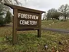
  26. U.S. Geological Survey Geographic Names Information System: Forestview Cemetery
  27. Fulton Cemetery, interment.net
  28. U.S. Geological Survey Geographic Names Information System: Fulton Cemetery
  29. Gilliam Cemetery, interment.net
  30. U.S. Geological Survey Geographic Names Information System: Gilliam Cemetery
  31. "Methodist Church and parsonage at Green Valley built on Sullivan land in 1899". digital.sonomalibrary.org.
  32. U.S. Geological Survey Geographic Names Information System: List of cemeteries in Sonoma County, California
  33. U.S. Geological Survey Geographic Names Information System: Hall Cemetery
  34. Coursey, Chris (March 27, 2013). "Burial laws are easy to break". Santa Rosa Press Democrat. Retrieved 2021-01-02.
  35. U.S. Geological Survey Geographic Names Information System: Liberty Cemetery
  36. U.S. Geological Survey Geographic Names Information System: Long Ranch Family Cemetery
  37. Luther Burbank Home & Gardens, LutherBurbank.org
  38. U.S. Geological Survey Geographic Names Information System: Macedonia Cemetery
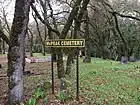
  39. U.S. Geological Survey Geographic Names Information System: McPeak Cemetery
  40. Official Sonoma State Historic Park website
  41. U.S. Geological Survey Geographic Names Information System: Mission San Francisco Solano
  42. U.S. Geological Survey Geographic Names Information System: Oak Mound Cemetery
  43. U.S. Geological Survey Geographic Names Information System: Olive Hill Cemetery
  44. U.S. Geological Survey Geographic Names Information System: Pleasant Hills Memorial Park
  45. U.S. Geological Survey Geographic Names Information System: Pythian Home Cemetery
  46. U.S. Geological Survey Geographic Names Information System: Redwood Memorial Gardens
  47. "Redwood Memorial Gardens". www.uscemeteryproj.com.
  48. "Cloverdale Cemetery". 30 January 2015. Archived from the original on 30 January 2015.
  49. U.S. Geological Survey Geographic Names Information System: Ruoff–Thomas Cemetery
  50. U.S. Geological Survey Geographic Names Information System: Saint Francis Solano Catholic Cemetery
  51. 1 2 U.S. Geological Survey Geographic Names Information System: Santa Rosa Memorial Park
  52. "Santa Rosa Memorial Park". www.srmp.org.
  53. U.S. Geological Survey Geographic Names Information System: Santa Rosa Odd Fellows Cemetery
  54. "Odd Fellows Cemetery Association". Retrieved 2021-01-01.
  55. 38°27′21″N 122°42′18″W / 38.4557979°N 122.7051106°WU.S. Geological Survey Geographic Names Information System: Fulkerson Cemetery
  56. Nichols, Jeremy Dwight (2008). Cemeteries of Sonoma County California: A History and Guide. Heritage Books. p. ix.
  57. srcity.org Archived 2015-03-02 at the Wayback Machine
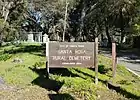
  58. U.S. Geological Survey Geographic Names Information System: Santa Rosa Rural Cemetery
  59. U.S. Geological Survey Geographic Names Information System: Seaview Cemetery
  60. U.S. Geological Survey Geographic Names Information System: Sebastopol Memorial Lawn Cemetery
  61. U.S. Geological Survey Geographic Names Information System: Shiloh Cemetery
  62. U.S. Geological Survey Geographic Names Information System: Mountain Cemetery
  63. "Mountain Cemetery". City of Sonoma.
  64. U.S. Geological Survey Geographic Names Information System: Sonoma State Home
  65. U.S. Geological Survey Geographic Names Information System: Spring Hill Cemetery
  66. U.S. Geological Survey Geographic Names Information System: Stanley Cemetery
  67. U.S. Geological Survey Geographic Names Information System: Steele Family Cemetery
  68. U.S. Geological Survey Geographic Names Information System: Stewarts Point Cemetery
  69. U.S. Geological Survey Geographic Names Information System: Sugarloaf Cemetery
  70. U.S. Geological Survey Geographic Names Information System: Two Rock Presbyterian Church Cemetery
  71. U.S. Geological Survey Geographic Names Information System: Valley Cemetery
  72. "Valley Cemetery". City of Sonoma.
  73. "Veterans' Cemetery". City of Sonoma.

Further reading

  • Sonoma County Genealogical Society, Inc. (2012) [1999]. Sonoma County, California Cemetery Records 1846–1921 (3rd ed.). Santa Rosa, CA & Westminster, MD: Heritage Books. ISBN 978-0788412080. OCLC 144674262.
  • Sonoma County Genealogical Society, Inc. (2015). Burial of Indigents Sonoma County, California, 1937–1967. Santa Rosa, CA & Raleigh, NC: Lulu. ISBN 978-1329530898. OCLC 960238152.
  • Culbertson, Judi; Randall, Tom (1989). Permanent Californians: an illustrated guide to the cemeteries of California. Chelsea, VT: Chelsea Green. ISBN 978-0930031213. OCLC 19322965.
  • Brooks, Patricia; Brooks, Jonathan (2006). Laid to Rest in California: a guide to the cemeteries and grave sites of the rich and famous. Guilford, CT: Globe Pequot Press. ISBN 978-0762741014. OCLC 70284362.
This article is issued from Wikipedia. The text is licensed under Creative Commons - Attribution - Sharealike. Additional terms may apply for the media files.