Map of central London in 1666, showing landmarks related to the Great Fire of London
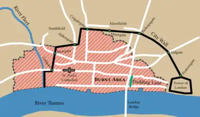
Central London in 1666, with the burnt area shown in pink.

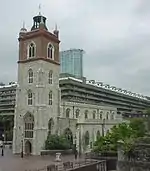
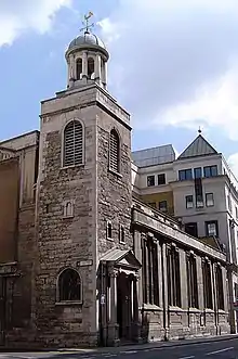
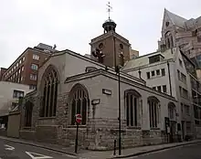
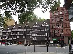
This is a list of buildings that survived the Great Fire of London in 1666 and are still standing.

Grade Criteria[1]
I Buildings of exceptional interest.
II* Particularly important buildings of more than special interest.
II Buildings of national importance and special interest.
Name Location Type Date Grid ref.

Geo-coordinates

Image Grade
41–41 Cloth Fair Cloth Fair House 1597–1614 II*
74–75 Long Lane Long Lane House 1598
229 Strand Strand Townhouse 1625
All Hallows-by-the-Tower Byward Street Church 1658 51°30′34″N 0°04′46″W / 51.5094°N 0.0794°W / 51.5094; -0.0794 I
The Guildhall Gresham Street City Hall 1411 51°30′57″N 0°05′31″W / 51.5159°N 0.092°W / 51.5159; -0.092 I
The Hoop and Grapes Aldgate High Street Public House Late 17th century 51°30′51″N 0°04′27″W / 51.51421°N 0.074177°W / 51.51421; -0.074177 II*
The Old Curiosity Shop Portsmouth Street Shop 1567 II*
The Olde Wine Shades Martin Lane Public House 1663 II
Prince Henry's Room Fleet Street Townhouse 1610 51°30′50″N 0°6′39″W / 51.51389°N 0.11083°W / 51.51389; -0.11083 II*
Saint Andrew Undershaft Saint Mary Axe Church 1532 51°30′49.18″N 0°4′52.72″W / 51.5136611°N 0.0813111°W / 51.5136611; -0.0813111 I
Saint Bartholomew's Gatehouse West Smithfield Gatehouse 1595 II*
Saint Etheldreda's Church Ely Place Church 1290 51°31′07″N 0°06′27″W / 51.5187°N 0.1074°W / 51.5187; -0.1074 I
Saint Giles-without-Cripplegate Fore Street Church 1394, 1545 and 1682 51°31′7.38″N 0°5′38.55″W / 51.5187167°N 0.0940417°W / 51.5187167; -0.0940417 I
Saint Helen's Bishopsgate Great St Helen's Church 12th century 51°30′53″N 0°04′54″W / 51.5148°N 0.0818°W / 51.5148; -0.0818 I
Saint Katharine Cree Leadenhall Street Church 1631 (tower from 1504) 51°30′48.28″N 0°4′44.88″W / 51.5134111°N 0.0791333°W / 51.5134111; -0.0791333 I
Saint Olave Hart Street Church 1450 51°30′39.04″N 0°4′46.88″W / 51.5108444°N 0.0796889°W / 51.5108444; -0.0796889 I
The Staple Inn High Holborn Inn of Chancery 1585 51°31′04.68″N 0°06′40.28″W / 51.5179667°N 0.1111889°W / 51.5179667; -0.1111889 I
The Seven Stars Carey Street Public House 1602 51°30′54″N 0°06′49″W / 51.514950°N 0.11360747°W / 51.514950; -0.11360747 II
The Tower of London St Katharine's & Wapping Castle 1078 51°30′29″N 00°04′34″W / 51.50806°N 0.07611°W / 51.50806; -0.07611 I

See also

References

  1. Listed Buildings, Historic England, retrieved 30 March 2017
This article is issued from Wikipedia. The text is licensed under Creative Commons - Attribution - Sharealike. Additional terms may apply for the media files.