The island country of Barbados has more than 70 miles (110 km) of beaches of both pink and white sands, which are made of coral reefs that have been ground into a very fine powder by the waves of the ocean. Beaches on Barbados can be categorized by region: north and east coast beaches, south coast beaches, and west coast beaches. East and north coast beaches are facing the Atlantic Ocean, while the waters of the southern beaches are a combination of both the Atlantic Ocean and Caribbean Sea. The west coast, or the Platinum Coast, beaches are brimmed by the warm waters of the Caribbean. This is a list of many of the beaches located in Barbados. There are no private beaches on the island.[1][2][3][4][5]
Beaches
There are 61 beaches in Barbados, including the following with the parishes indicated for each beach:
Gallery
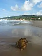 Bathsheba Beach
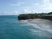 Bel Air Beach
.jpg.webp) Bottom Bay
Bottom Bay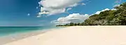 Brandon's Beach
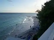 Butterfly Beach
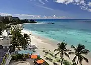 Carllisle Bay
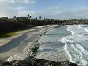 Cave Bay
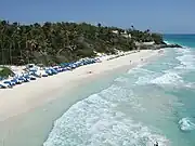 Crane Beach
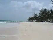 Dovere Beach
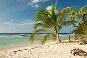 Drill Hall Beach
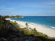 Foul Bay
 Miami Beach
.jpg.webp) Moamo Beach
Moamo Beach Moody Beach
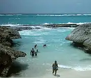 Shark's Hole Beach
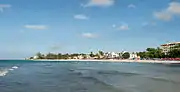 Worthing Beach
See also
References
- 1 2 3 4 5 6 7 8 9 10 11 12 13 14 15 16 17 18 19 20 21 22 23 24 25 26 27 28 "Barbados Beaches". Fun Barbados. Retrieved September 19, 2021.
- 1 2 3 4 5 6 7 8 9 10 11 "Beaches in Barbados". GeoNames. Retrieved September 19, 2021.
- ↑ "All Barbados Beaches". Totally Barbados. Retrieved September 19, 2021.
- ↑ Welch, Nick. "Beaches of Barbados - interactive map". Beaches of Barbados. Retrieved September 19, 2021.
- 1 2 3 4 5 6 7 8 9 10 11 12 13 14 15 16 17 18 19 20 21 22 23 24 25 26 27 28 29 30 31 32 33 34 35 36 37 38 39 "Stroll the beaches of Barbados". Barbados Beaches Plus. Retrieved September 19, 2021.
- 1 2 3 4 5 6 7 8 9 10 11 12 13 14 15 16 17 18 19 20 21 22 23 24 25 Google maps
- ↑ Possibly closed beach, no references
- ↑ "Freshwater Bay". GeoNames. Retrieved September 19, 2021.
- ↑ Moxly, Joseph Henry Sutton (1886). An Account of a West Indian Sanatorium and a Guide to Barbados. S. Low, Marston, Searle, & Rivington. pp. 60-61.
Freshwater Bay Barbados.
- ↑ "Silver Sands Beach". Visit Barbados. Retrieved September 19, 2021.