Lincoln Park, Georgia | |
|---|---|
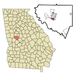 Location in Upson County and the state of Georgia | |
| Coordinates: 32°52′4″N 84°19′55″W / 32.86778°N 84.33194°W | |
| Country | United States |
| State | Georgia |
| County | Upson |
| Area | |
| • Total | 0.86 sq mi (2.24 km2) |
| • Land | 0.86 sq mi (2.22 km2) |
| • Water | 0.01 sq mi (0.02 km2) |
| Elevation | 715 ft (218 m) |
| Population (2020) | |
| • Total | 817 |
| • Density | 953.33/sq mi (368.08/km2) |
| Time zone | UTC-5 (Eastern (EST)) |
| • Summer (DST) | UTC-4 (EDT) |
| ZIP code | 30286[2] |
| Area code | 706 |
| FIPS code | 13-46524[3] |
| GNIS feature ID | 0332218[4] |
Lincoln Park is an unincorporated community and census-designated place (CDP) in Upson County, Georgia, United States. The population was 1,122 at the 2000 census.
Geography
Lincoln Park is located at 32°52′4″N 84°19′55″W / 32.86778°N 84.33194°W (32.867666, -84.332046).[5]
According to the United States Census Bureau, the CDP has a total area of 1.0 square mile (2.6 km2), all land.
Demographics
| Census | Pop. | Note | %± |
|---|---|---|---|
| 1950 | 1,575 | — | |
| 1960 | 1,840 | 16.8% | |
| 1970 | 1,852 | 0.7% | |
| 1980 | 1,755 | −5.2% | |
| 2000 | 1,122 | — | |
| 2010 | 833 | −25.8% | |
| 2020 | 817 | −1.9% | |
| U.S. Decennial Census[6] 1930-1950[7] 1960-1980[8] 1980-2000[9] 2010[10] 2020[11] | |||
Lincoln Park was first listed as an unincorporated place in the 1950 U.S. Census[7] and designated a CDP in the 1980 U.S. Census. It was not listed in the 1990 U.S. Census[9] after a portion of the CDP was annexed to Thomastown.[12] It reappeared as a CDP in the 2000 U.S. Census.
2020
| Race / Ethnicity | Pop 2000[13] | Pop 2010[10] | Pop 2020[11] | % 2000 | % 2010 | % 2020 |
|---|---|---|---|---|---|---|
| White alone (NH) | 50 | 61 | 65 | 4.46% | 7.32% | 7.96% |
| Black or African American alone (NH) | 1,058 | 759 | 720 | 94.30% | 91.12% | 88.13% |
| Native American or Alaska Native alone (NH) | 1 | 2 | 1 | 0.09% | 0.24% | 0.12% |
| Asian alone (NH) | 3 | 4 | 1 | 0.27% | 0.48% | 0.12% |
| Pacific Islander alone (NH) | 0 | 1 | 0 | 0.00% | 0.12% | 0.00% |
| Some Other Race alone (NH) | 0 | 2 | 10 | 0.00% | 0.24% | 1.22% |
| Mixed Race/Multi-Racial (NH) | 1 | 2 | 11 | 0.09% | 0.24% | 1.35% |
| Hispanic or Latino (any race) | 9 | 2 | 9 | 0.80% | 0.24% | 1.10% |
| Total | 1,122 | 833 | 817 | 100.00% | 100.00% | 100.00% |
2000
As of the census[3] of 2000, there were 1,122 people, 450 households, and 298 families residing in the CDP. The population density was 1,094.2 inhabitants per square mile (422.5/km2). There were 520 housing units at an average density of 507.1 per square mile (195.8/km2). The racial makeup of the CDP was 4.55% White, 95.01% African American, 0.09% Native American, 0.27% Asian, and 0.09% from two or more races. Hispanic or Latino of any race were 0.80% of the population.
There were 450 households, out of which 26.0% had children under the age of 18 living with them, 23.6% were married couples living together, 36.2% had a female householder with no husband present, and 33.6% were non-families. 28.7% of all households were made up of individuals, and 9.6% had someone living alone who was 65 years of age or older. The average household size was 2.49 and the average family size was 3.09.
In the CDP, the population was spread out, with 24.9% under the age of 18, 9.9% from 18 to 24, 26.6% from 25 to 44, 24.6% from 45 to 64, and 14.1% who were 65 years of age or older. The median age was 37 years. For every 100 females, there were 90.5 males. For every 100 females age 18 and over, there were 85.3 males.
The median income for a household in the CDP was $20,085, and the median income for a family was $24,150. Males had a median income of $23,472 versus $18,542 for females. The per capita income for the CDP was $15,161. About 20.1% of families and 31.5% of the population were below the poverty line, including 53.4% of those under age 18 and 23.6% of those age 65 or over.
References
- ↑ "2020 U.S. Gazetteer Files". United States Census Bureau. Retrieved December 18, 2021.
- ↑ "Lincoln Park ZIP Code". zipdatamaps.com. 2023. Retrieved January 12, 2023.
- 1 2 "U.S. Census website". United States Census Bureau. Retrieved January 31, 2008.
- ↑ "US Board on Geographic Names". United States Geological Survey. October 25, 2007. Retrieved January 31, 2008.
- ↑ "US Gazetteer files: 2010, 2000, and 1990". United States Census Bureau. February 12, 2011. Retrieved April 23, 2011.
- ↑ "Decennial Census of Population and Housing by Decades". US Census Bureau.
- 1 2 "1950 Census of Population - Georgia" (PDF). US Census Bureau. 1980.
- ↑ "1980 Census of Population - Number of Inhabitants - Georgia" (PDF). US Census Bureau. 1980.
- 1 2 "2000 Census of Population - General Population Characteristics - Georgia" (PDF). US Census Bureau. 2000.
- 1 2 "P2 HISPANIC OR LATINO, AND NOT HISPANIC OR LATINO BY RACE - 2010: DEC Redistricting Data (PL 94-171) - Lincoln Park CDP, Georgia". United States Census Bureau.
- 1 2 "P2 HISPANIC OR LATINO, AND NOT HISPANIC OR LATINO BY RACE - 2020: DEC Redistricting Data (PL 94-171) - Lincoln Park CDP, Georgia". United States Census Bureau.
- ↑ "1990 Census of Population - Population and Housing - Georgia" (PDF). US Census Bureau. 1990. p. III-4.
Upson County—Annexations: Thomaston city, Yatesville town. Deleted CDP's: Hannahs Mill and Lincoln Park (both partially annexed by Thomaston city).
- ↑ "P004 HISPANIC OR LATINO, AND NOT HISPANIC OR LATINO BY RACE – 2000: DEC Summary File 1 – Lincoln Park CDP, Georgia". United States Census Bureau.
Municipalities and communities of Upson County, Georgia, United States | ||
|---|---|---|
| City |  Map of Georgia highlighting Upson County | |
| Town | ||
| CDPs | ||
| Other unincorporated communities | ||