Kotamobagu | |
|---|---|
 Coat of arms | |
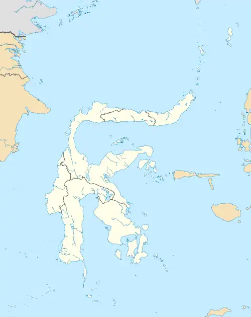
 Location within North Sulawesi | |
OpenStreetMap | |
| Coordinates: 0°44′N 124°19′E / 0.733°N 124.317°E | |
| Country | |
| Province | |
| Government | |
| • Mayor | Tatong Bara |
| • Vice Mayor | Nayodo Koerniawan |
| Area | |
| • Total | 108.89 km2 (42.04 sq mi) |
| Population (mid 2022 estimate) | |
| • Total | 123,146 |
| • Density | 1,100/km2 (2,900/sq mi) |
| [1] | |
| Time zone | UTC+8 (Indonesia Central Time) |
| Area code | (+62) 434 |
| Website | kotamobagukota |
Kotamobagu is a city in North Sulawesi, Indonesia. Having previously been a town within the Bolaang Mongondow Regency, Kotamobagu was separated from that regency on 2 January 2007 to become an autonomous city. It is the principal centre of the southern part of the province, the Bolaang Mongondow region, which is projected by the Indonesian government to be separated from the rest of North Sulawesi and formed into a separate province. The city covers an area of 108.89 km2, and had a population of 107,459 at the 2010 Census,[2] rising to 123,722 at the 2020 Census;[3] the official estimate as at mid 2022 was 123,146 (comprising 63,287 males and 59,859 females).[1]
Administrative districts
The city is divided into four districts (kecamatan) tabulated below with their areas and their population as at the 2010 Census[2] and the 2020 Census,[3] together with the official estimates as at mid 2022.[1] The table also includes the location of the district centres, the number of administrative villages in each district (18 classed as urban kelurahan and 15 as rural desa), and its postal codes.
| Kode Wilayah | Name of District (kecamatan) | Area in km2 | Pop'n Census 2010 | Pop'n Census 2020 | Pop'n Estimate mid 2022 | Admin centre | No. of villages | Post codes |
|---|---|---|---|---|---|---|---|---|
| 71.74.03 | Kotamobagu Selatan (South Kotamobagu) | 62.97 | 28,030 | 33,353 | 33,088 | Poyowa Besar | 9 (a) | 95717 |
| 71.74.02 | Kotamobagu Timur (East Kotamobagu) | 23.69 | 26,355 | 30,904 | 30,603 | Kotobangon | 10 (b) | 95712 - 95719 |
| 71.74.04 | Kotamobagu Barat (West Kotamobagu) | 12.20 | 37,678 | 41,843 | 41,851 | Mongkonai Barat | 6 (c) | 95711 - 95716 |
| 71.74.01 | Kotamobagu Utara (North Kotamobagu) | 10.04 | 15,396 | 17,622 | 17,604 | Bilalang 1 | 8 (d) | 95713 - 95714 |
| Totals | 108.89 | 107,459 | 123,722 | 123,146 | 33 |
Notes: (a) including 3 kelurahan - Mongondow, Motoboi Kecil and Pobundayan. (b) including 6 kelurahan - Kobo Besar, Kotabangun, Matali, Motoboi Besar, Sinindia and Tumbui.
(c) all 6 are kelurahan - Gogagoman, Kotamobagu, Molinow, Mogolaing, Mongkonai and Mongkonai Barat. (d) including 3 kelurahan - Biga, Genggulang and Upai.
Autonomy
As an autonomous city, in 2011 Kotamobagu was judged the best autonomous area from among 57 autonomous areas which have been formed by central government since 2007.[4]
Climate
Kotamobagu has a tropical rainforest climate (Af) with moderate rainfall in August and September and heavy rainfall in the remaining months.
| Climate data for Kotamobagu | |||||||||||||
|---|---|---|---|---|---|---|---|---|---|---|---|---|---|
| Month | Jan | Feb | Mar | Apr | May | Jun | Jul | Aug | Sep | Oct | Nov | Dec | Year |
| Mean daily maximum °C (°F) | 28.8 (83.8) |
28.8 (83.8) |
29.1 (84.4) |
29.8 (85.6) |
29.7 (85.5) |
29.6 (85.3) |
29.4 (84.9) |
30.0 (86.0) |
30.4 (86.7) |
30.5 (86.9) |
30.1 (86.2) |
29.3 (84.7) |
29.6 (85.3) |
| Daily mean °C (°F) | 25.0 (77.0) |
24.9 (76.8) |
25.2 (77.4) |
25.6 (78.1) |
25.7 (78.3) |
25.6 (78.1) |
25.3 (77.5) |
25.5 (77.9) |
25.5 (77.9) |
25.6 (78.1) |
25.7 (78.3) |
25.3 (77.5) |
25.4 (77.7) |
| Mean daily minimum °C (°F) | 21.2 (70.2) |
21.1 (70.0) |
21.4 (70.5) |
21.4 (70.5) |
21.8 (71.2) |
21.6 (70.9) |
21.3 (70.3) |
21.1 (70.0) |
20.7 (69.3) |
20.8 (69.4) |
21.4 (70.5) |
21.4 (70.5) |
21.3 (70.3) |
| Average rainfall mm (inches) | 216 (8.5) |
179 (7.0) |
186 (7.3) |
201 (7.9) |
211 (8.3) |
174 (6.9) |
134 (5.3) |
93 (3.7) |
94 (3.7) |
136 (5.4) |
204 (8.0) |
197 (7.8) |
2,025 (79.8) |
| Source: Climate-Data.org[5] | |||||||||||||
References
- 1 2 3 Badan Pusat Statistik, Jakarta, 2023, Kota Kotamobagu Dalam Angka 2023 (Katalog-BPS 1102001.7174)
- 1 2 Biro Pusat Statistik, Jakarta, 2011.
- 1 2 Badan Pusat Statistik, Jakarta, 2021.
- ↑ "Kotamobagu Daerah Otonom Terbaik". March 22, 2012.
- ↑ "Climate: Kotamobagu". Climate-Data.org. Retrieved 22 November 2020.