Kopani
Копані | |
|---|---|
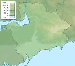 Kopani Location of Kopani in Zaporizhzhia Oblast 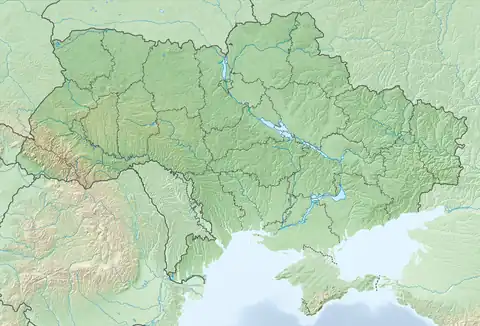 Kopani Kopani (Ukraine) | |
| Coordinates: 47°27′13″N 35°43′59″E / 47.453549°N 35.733062°E | |
| Country | |
| Oblast | |
| Raion | Polohy Raion |
| Founded Status | 1851 |
| Area | |
| • Total | 6.12 km2 (2.36 sq mi) |
| Elevation | 137 m (449 ft) |
| Population | |
| • Total | 616 |
| • Density | 100/km2 (260/sq mi) |
| Time zone | UTC+2 (EET) |
| • Summer (DST) | UTC+3 (EEST) |
| Postal code | 70562 |
| Area code | +380 6141 |
Kopani (Ukrainian: Копані) is a village in Polohy Raion (district) in Zaporizhzhia Oblast of southern Ukraine, at about 62.1 kilometres (38.6 mi) southeast of the centre of Zaporizhzhia city. It belongs to Orikhiv urban hromada, one of the hromadas of Ukraine. Nearby villages are Nesterianka to the north-west and Robotyne to the east.
The village came under occupation by Russian forces in 2022, during the Russian invasion of Ukraine.
References
- ↑ "Офіційна сторінка Всеукраїнського перепису населення | Банк даних" [All-Ukrainian population census | Database]. ukrcensus.gov.ua (in Ukrainian). Retrieved 2 November 2022.
| Cities | Coat of arms of Polohy Raion | |
|---|---|---|
| Urban-type settlements | ||
| Villages | ||
| Hromadas | ||
This article is issued from Wikipedia. The text is licensed under Creative Commons - Attribution - Sharealike. Additional terms may apply for the media files.