Karakoyunlu District | |
|---|---|
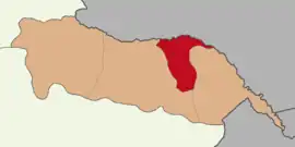 Map showing Karakoyunlu District in Iğdır Province | |
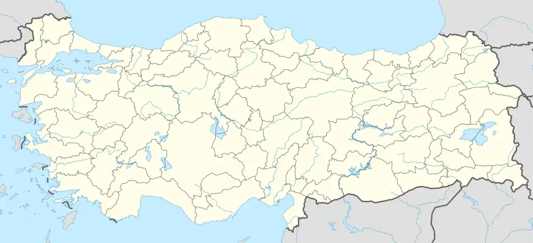 Karakoyunlu District Location in Turkey | |
| Coordinates: 39°58′N 44°10′E / 39.967°N 44.167°E | |
| Country | Turkey |
| Province | Iğdır |
| Seat | Karakoyunlu |
| Government | |
| • Kaymakam | Furkan Atalık |
| Area | 269 km2 (104 sq mi) |
| Population (2022) | 13,565 |
| • Density | 50/km2 (130/sq mi) |
| Time zone | TRT (UTC+3) |
| Website | www |
Karakoyunlu District is a district of the Iğdır Province of Turkey. Its seat is the town of Karakoyunlu.[1] Its area is 269 km2,[2] and its population is 13,565 (2022).[3] The northern portion of the district forms part of the international border between Turkey and Armenia.
Composition
There is one municipality in Karakoyunlu District:[1]
There are 19 villages in Karakoyunlu District:[4]
- Aktaş
- Aşağıalican
- Bayatdoğanşalı
- Bekirhanlı
- Bulakbaşı
- Cennetabat
- Gökçeli
- Gölköy
- İslamköy
- Kaçardoğanşalı
- Kerimbeyli
- Koçkıran
- Mürşitali
- Orta Alican
- Şıracı
- Taşburun
- Yazlık
- Yukarıalican
- Zülfikarköy
References
- 1 2 İlçe Belediyesi, Turkey Civil Administration Departments Inventory. Retrieved 1 March 2023.
- ↑ "İl ve İlçe Yüz ölçümleri". General Directorate of Mapping. Retrieved 1 March 2023.
- ↑ "Address-based population registration system (ADNKS) results dated 31 December 2022, Favorite Reports" (XLS). TÜİK. Retrieved 13 March 2023.
- ↑ Köy, Turkey Civil Administration Departments Inventory. Retrieved 1 March 2023.
Karakoyunlu District in Iğdır Province of Turkey | |||||||||||||||||||||||||||
|---|---|---|---|---|---|---|---|---|---|---|---|---|---|---|---|---|---|---|---|---|---|---|---|---|---|---|---|
| Districts | 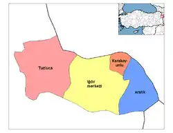 Districts of Iğdır | ||||||||||||||||||||||||||
| |||||||||||||||||||||||||||
Metropolitan municipalities are bolded. | |||||||||||||||||||||||||||
| Municipalities | |
|---|---|
| Villages |
|
This article is issued from Wikipedia. The text is licensed under Creative Commons - Attribution - Sharealike. Additional terms may apply for the media files.