Kamatanda Airport | |||||||||||
|---|---|---|---|---|---|---|---|---|---|---|---|
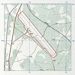 Map of the airport in 1980 | |||||||||||
| Summary | |||||||||||
| Airport type | Closed | ||||||||||
| Serves | Likasi | ||||||||||
| Elevation AMSL | 4,261 ft / 1,299 m | ||||||||||
| Coordinates | 10°53′30″S 26°44′40″E / 10.89167°S 26.74444°E | ||||||||||
| Map | |||||||||||
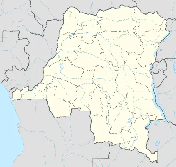 FZQI Location of the airport in Democratic Republic of the Congo | |||||||||||
| Runways | |||||||||||
| |||||||||||
Sources: Google Maps[1] | |||||||||||
Kamatanda Airport (ICAO: FZQI) is an abandoned airport near the town of Likasi in Democratic Republic of the Congo. It used to serve the Kamatanda mining area.
See also
References
This article is issued from Wikipedia. The text is licensed under Creative Commons - Attribution - Sharealike. Additional terms may apply for the media files.