Kalnište | |
|---|---|
Municipality | |
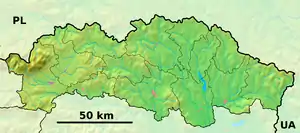 Kalnište Location of Kalnište in the Prešov Region  Kalnište Location of Kalnište in Slovakia | |
| Coordinates: 49°08′N 21°29′E / 49.133°N 21.483°E | |
| Country | |
| Region | Prešov |
| District | Svidník |
| First mentioned | 1363 |
| Area | |
| • Total | 8.66[1] km2 (3.34[1] sq mi) |
| Elevation | 184[2] m (604[2] ft) |
| Population (2021) | |
| • Total | 519[3] |
| Time zone | UTC+1 (CET) |
| • Summer (DST) | UTC+2 (CEST) |
| Postal code | 087 01[2] |
| Area code | +421 54[2] |
| Car plate | SK |
| Website | www |
Kalnište (Hungarian: Kálnás) is a village and municipality in Svidník District in the Prešov Region of north-eastern Slovakia.
History
In historical records the village was first mentioned in 1363.
Geography
The municipality lies at an altitude of 210 metres and covers an area of 5.664 km². It has a population of about 555 people.
Genealogical resources
The records for genealogical research are available at the state archive "Statny Archiv in Presov, Slovakia"
- Roman Catholic church records (births/marriages/deaths): 1776-1897 (parish B)
- Greek Catholic church records (births/marriages/deaths): 1839-1935 (parish B)
- Lutheran church records (births/marriages/deaths): 1742-1897 (parish B)
See also
References
- 1 2 "Hustota obyvateľstva - obce [om7014rr_ukaz: Rozloha (Štvorcový meter)]". www.statistics.sk (in Slovak). Statistical Office of the Slovak Republic. 2022-03-31. Retrieved 2022-03-31.
- 1 2 3 4 "Základná charakteristika". www.statistics.sk (in Slovak). Statistical Office of the Slovak Republic. 2015-04-17. Retrieved 2022-03-31.
- ↑ "Počet obyvateľov podľa pohlavia - obce (ročne)". www.statistics.sk (in Slovak). Statistical Office of the Slovak Republic. 2022-03-31. Retrieved 2022-03-31.
External links
 Media related to Kalnište at Wikimedia Commons
- Official website

- Surnames of living people in Kalniste
This article is issued from Wikipedia. The text is licensed under Creative Commons - Attribution - Sharealike. Additional terms may apply for the media files.