Herbeys | |
|---|---|
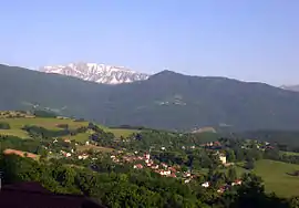 A general view of Herbeys | |
 Coat of arms | |
Location of Herbeys | |
 Herbeys 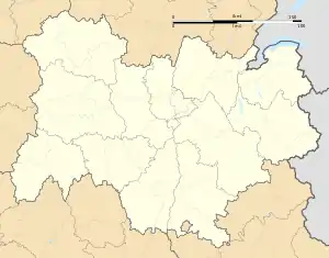 Herbeys | |
| Coordinates: 45°08′20″N 5°47′36″E / 45.1390°N 5.7934°E | |
| Country | France |
| Region | Auvergne-Rhône-Alpes |
| Department | Isère |
| Arrondissement | Grenoble |
| Canton | Le Pont-de-Claix |
| Intercommunality | Grenoble-Alpes Métropole |
| Government | |
| • Mayor (2020–2026) | Françoise Fontana[1] |
| Area 1 | 7.73 km2 (2.98 sq mi) |
| Population | 1,378 |
| • Density | 180/km2 (460/sq mi) |
| Time zone | UTC+01:00 (CET) |
| • Summer (DST) | UTC+02:00 (CEST) |
| INSEE/Postal code | 38188 /38320 |
| Elevation | 417–935 m (1,368–3,068 ft) |
| 1 French Land Register data, which excludes lakes, ponds, glaciers > 1 km2 (0.386 sq mi or 247 acres) and river estuaries. | |
Herbeys (French pronunciation: [ɛʁbɛ] ⓘ; Arpitan: Hèrbês) is a commune in the Isère department in southeastern France.
Population
| Year | Pop. | ±% p.a. |
|---|---|---|
| 1968 | 355 | — |
| 1975 | 765 | +11.59% |
| 1982 | 945 | +3.06% |
| 1990 | 1,086 | +1.75% |
| 1999 | 1,167 | +0.80% |
| 2009 | 1,342 | +1.41% |
| 2014 | 1,358 | +0.24% |
| 2020 | 1,370 | +0.15% |
| Source: INSEE[3] | ||
See also
References
- ↑ "Répertoire national des élus: les maires". data.gouv.fr, Plateforme ouverte des données publiques françaises (in French). 2 December 2020.
- ↑ "Populations légales 2021". The National Institute of Statistics and Economic Studies. 28 December 2023.
- ↑ Population en historique depuis 1968, INSEE
External links
Wikimedia Commons has media related to Herbeys.
This article is issued from Wikipedia. The text is licensed under Creative Commons - Attribution - Sharealike. Additional terms may apply for the media files.